This page currently offers 4 free Niobrara National Scenic River maps for you to view or download: NPS brochure maps, regional maps, vegetation maps, and more. In addition to the free Niobrara maps, I include external affiliate links that help cover my costs and allow me to keep this site ad-free. These links have shaded backgrounds (like this example) so you can easily recognize or skip past them: Browse the best-selling Niobrara maps and books on Amazon.
Niobrara map from the park brochures
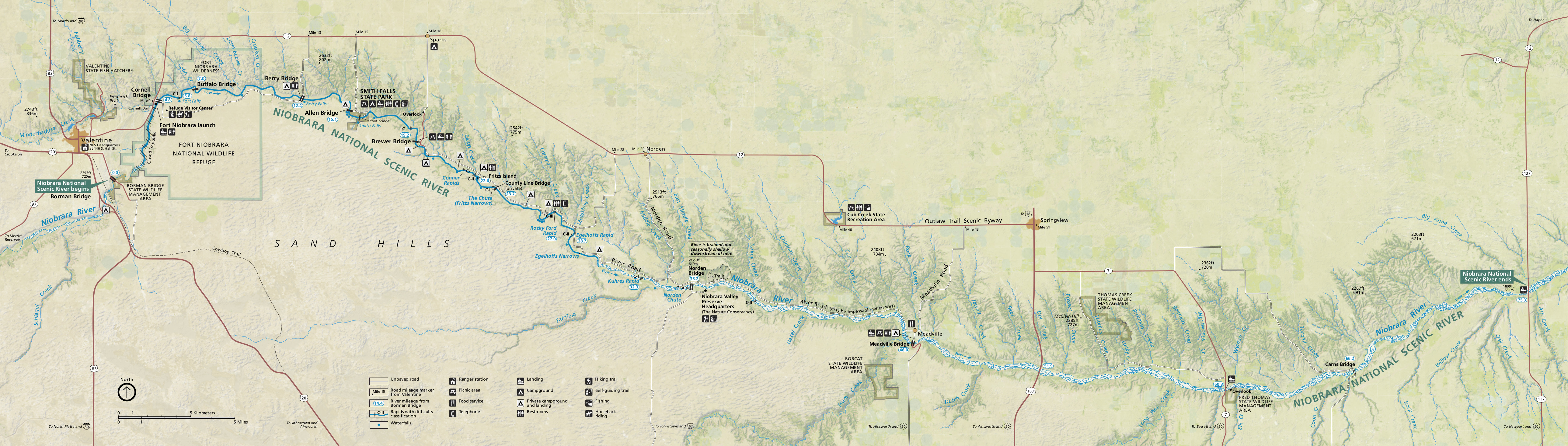 This is the official Niobrara map showing the full 75 miles of river’s length in the park, ending near Valentine. Click the image to view a full size map or download the PDF.
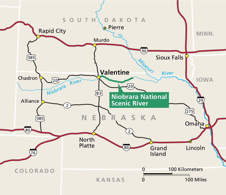 Here’s a regional Niobrara River map, which shows the surrounding highways between I-80 and I-90 and towns nearby the Niobrara River in Nebraska, South Dakota, and other nearby states.
Niobrara vegetation map
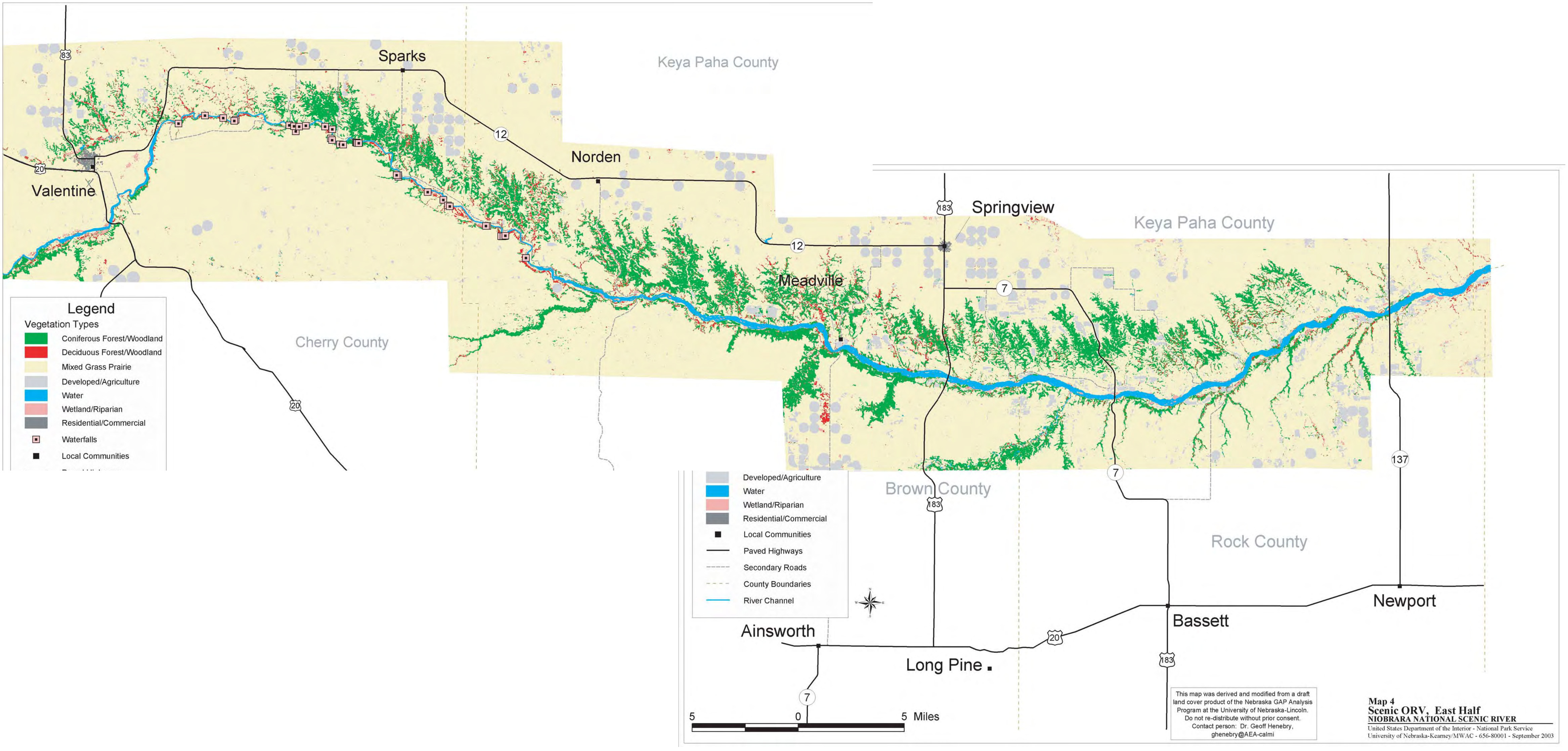 This vegetation map of Niobrara is a composite of two different maps and shows the various types of ecosystems that you’ll find at Niobrara National Scenic River – mostly prairie and coniferous forest.
…and more!
< Return to National Park Maps home
< Return to Park List
< Return to List by State
Need more planning help? Browse Amazon’s best-selling Nebraska maps and guidebooks.