John Day Fossil Beds map from the park brochure
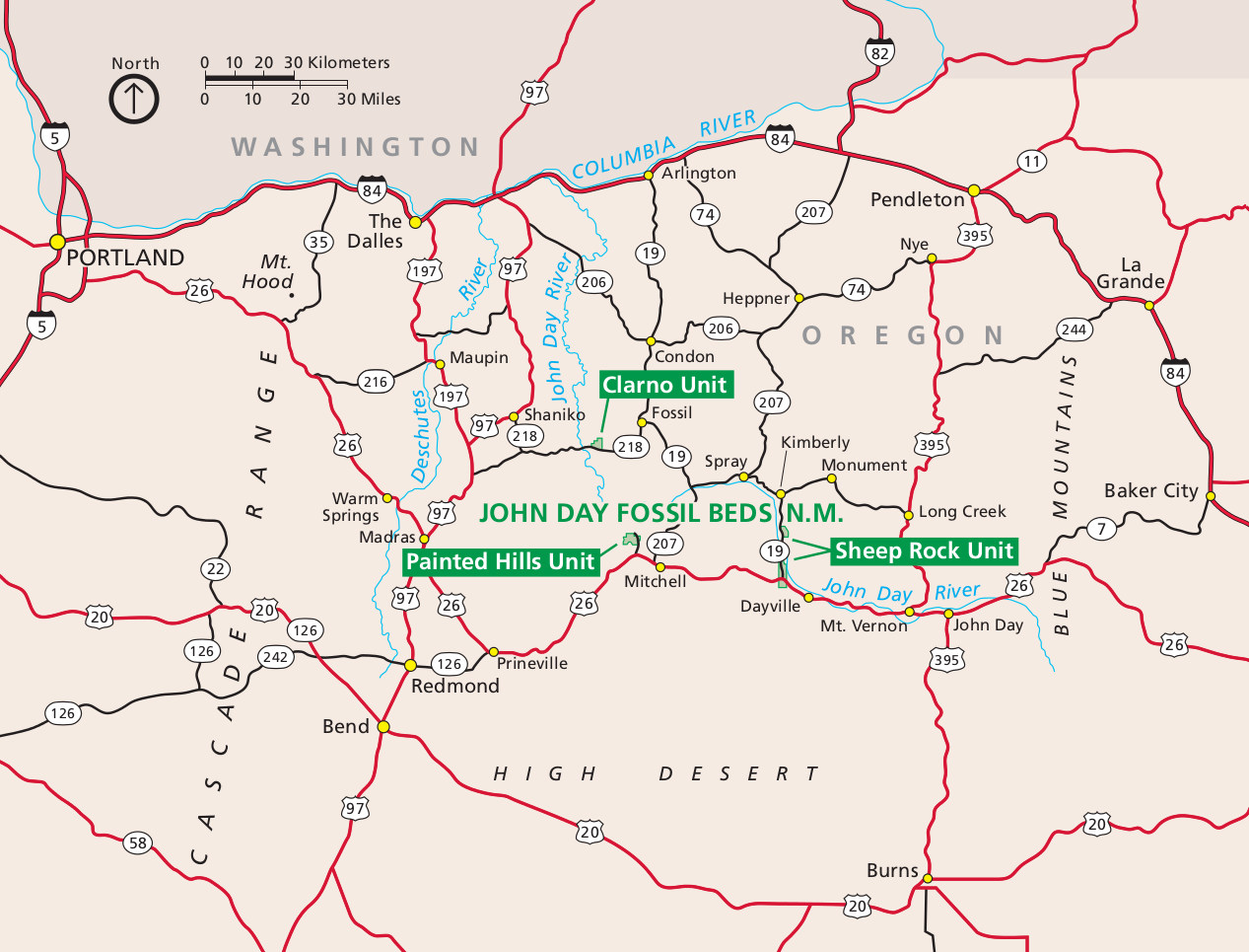
 This is the new official NPS John Day Fossil Beds map, showing the locations of each of the three units of the park. John Day is a bit unique in that the three park units are separated rather than contiguous.
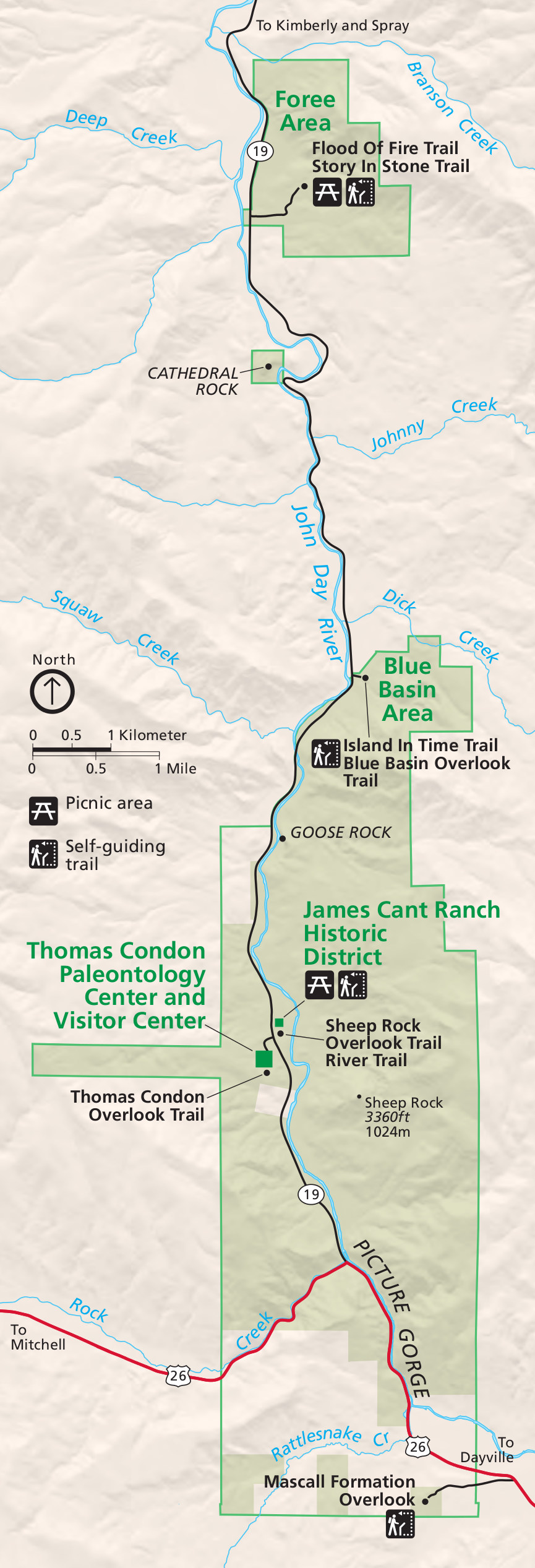
 The Sheep Rock Unit map includes the area with the most park facilities. It’s located along the John Day River and features the Paleontology Center, Cant Ranch, and several trails focusing on fossils, history, and scenic views.
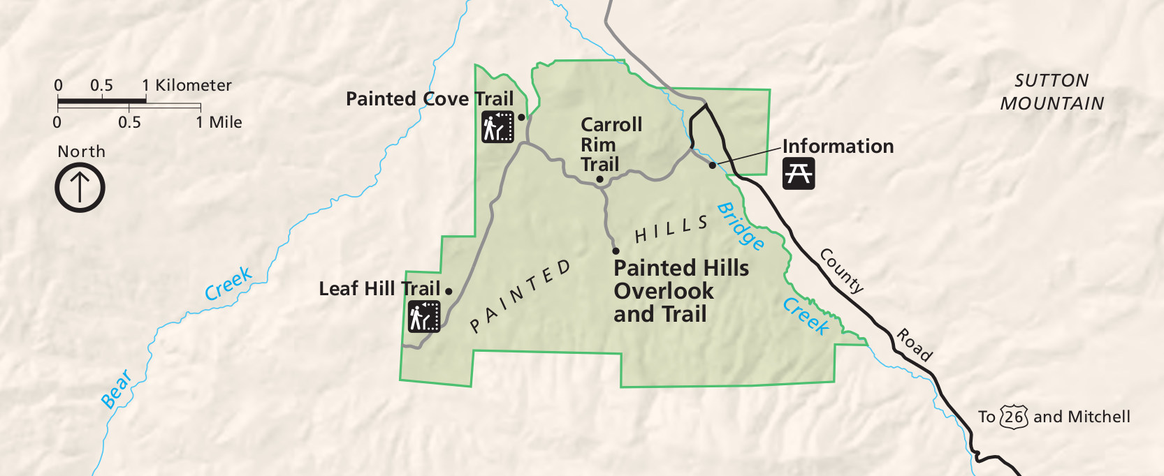
 Here’s a Painted Hills Unit map shows the most visited area of the park, located west of the main Sheep Rock unit. It features the Carroll Rim Trail, Painted Hills Overlook Trail, and Painted Cove Trail.
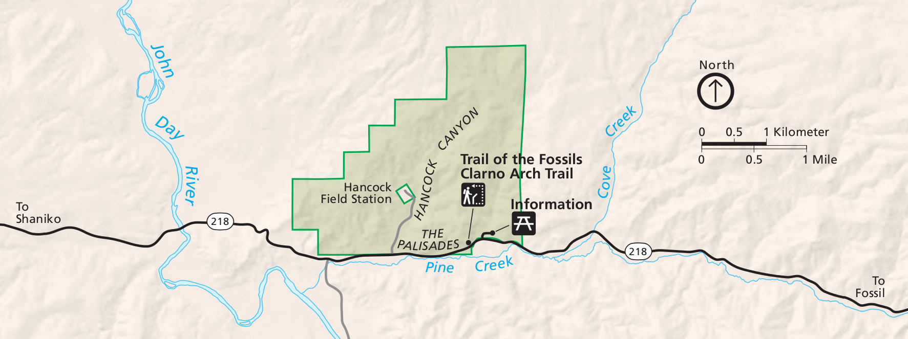
 This is a Clarno Unit map, focusing on the northwesternmost unit of John Day Fossil Beds. It includes the Palisades, along with the Clarno Arch Trail, Trail of Fossils, Geologic Time Trail, and Palisades Picnic Area.
John Day Fossil Beds trail maps
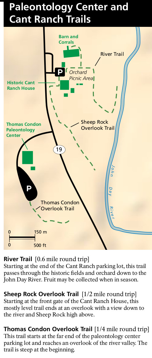 Here’s a Paleontology Center and Cant Ranch trail map, showing the hiking trails in the Sheep Rock Unit of the park, where most visitors stop first to check out the visitor center.
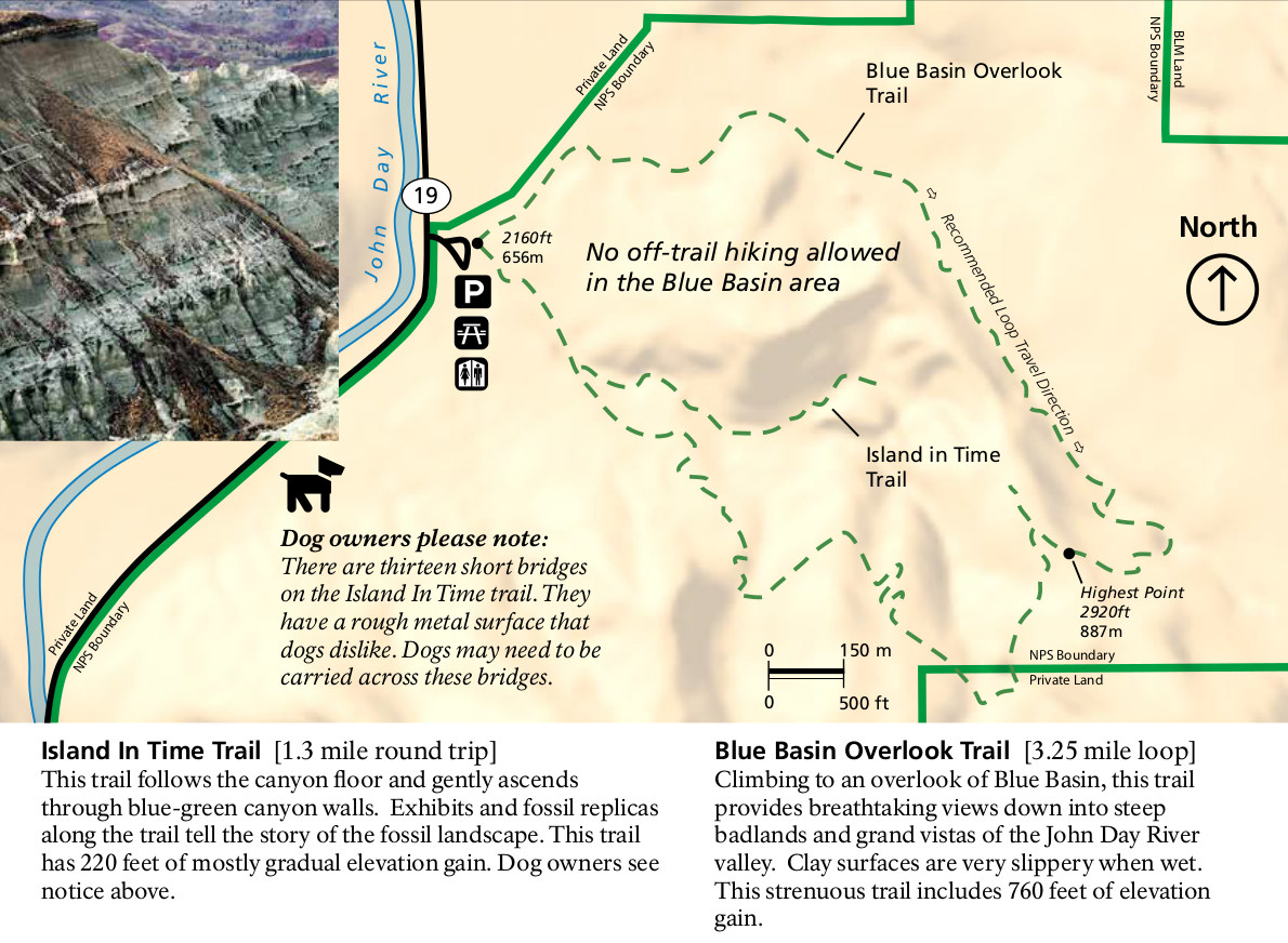 The Blue Basin trail map shows the Blue Basin Overlook trail and Island in Time trail, just north of the main visitor center area in the Sheep Rock unit. Here you can do a one-way or loop hike.
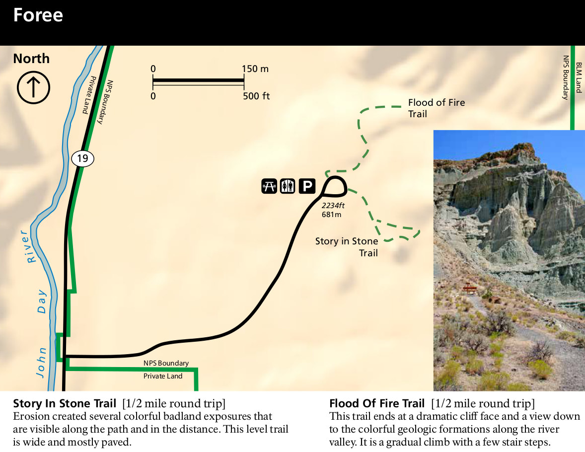 The Foree trail map focuses on the two trails — Story in Stone and Flood of Fire — located a bit north of the visitor center and Blue Basin area (but still located in the Sheep Rock Unit).
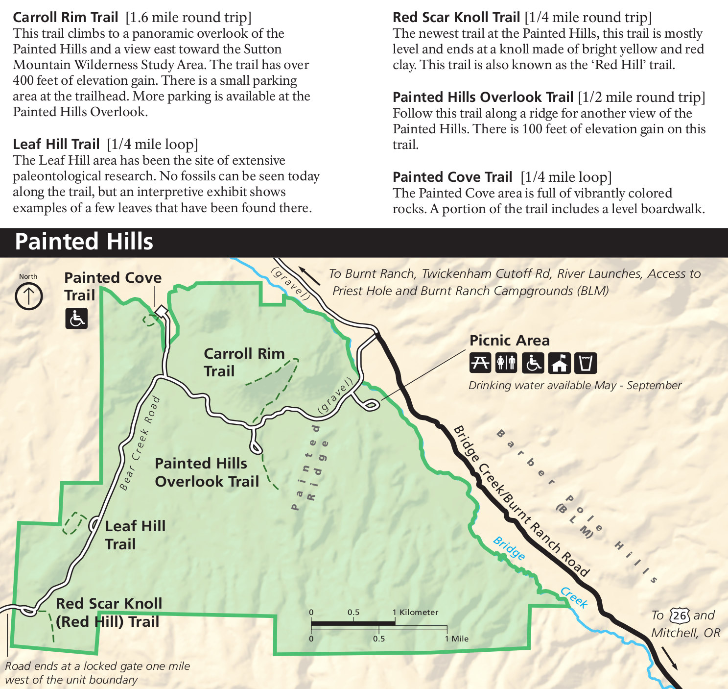 This Painted Hills Unit trail map shows several short trails and includes text descriptions of what you’ll find at each of them. Most of these are short walks that will take less than 30 minutes.
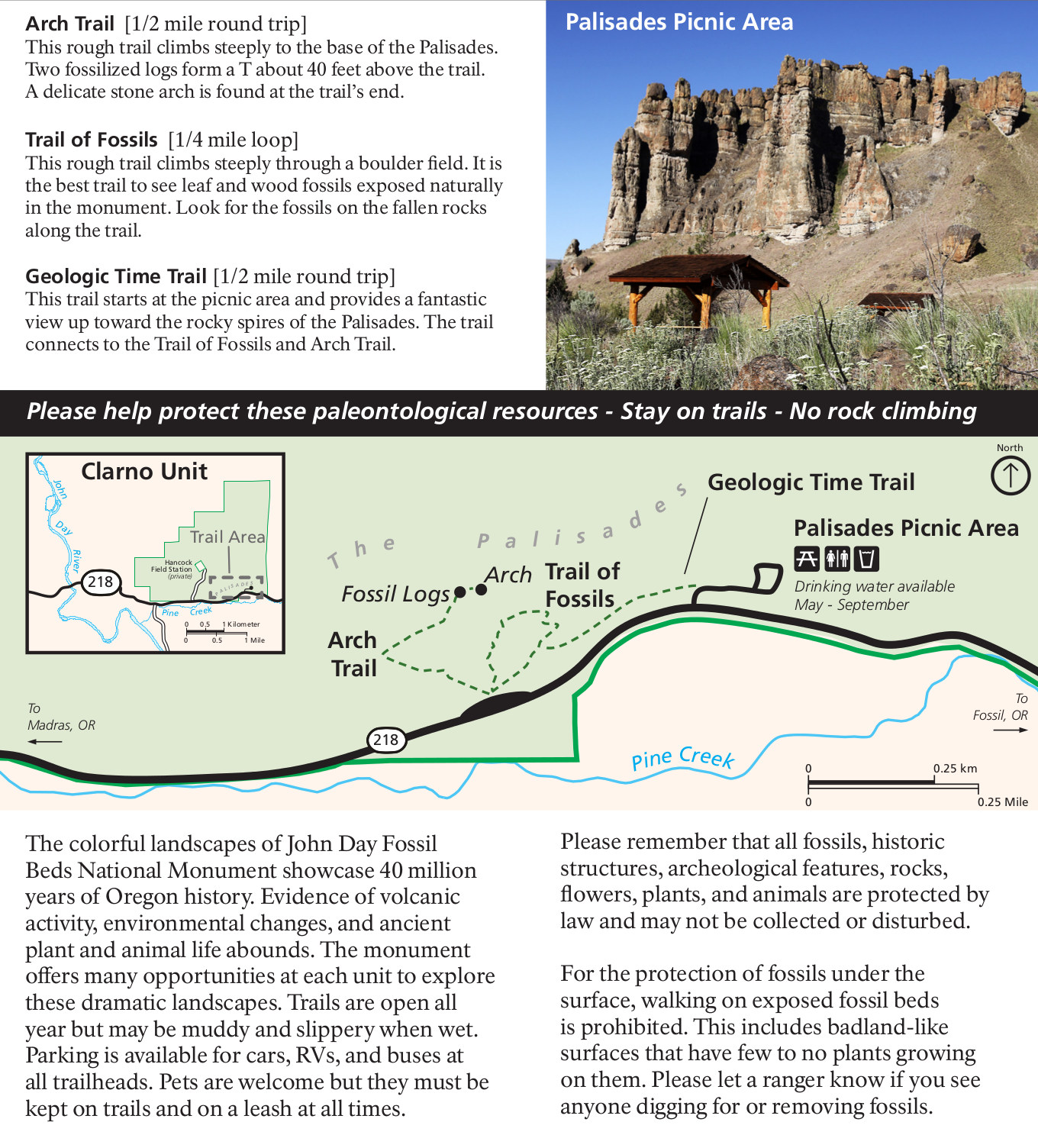 The Clarno Unit trail map includes routes and descriptions for the Arch Trail, Geologic Time Trail, and the Trail of Fossils in the northwest part of the park off Route 218.
Various John Day Fossil Beds maps
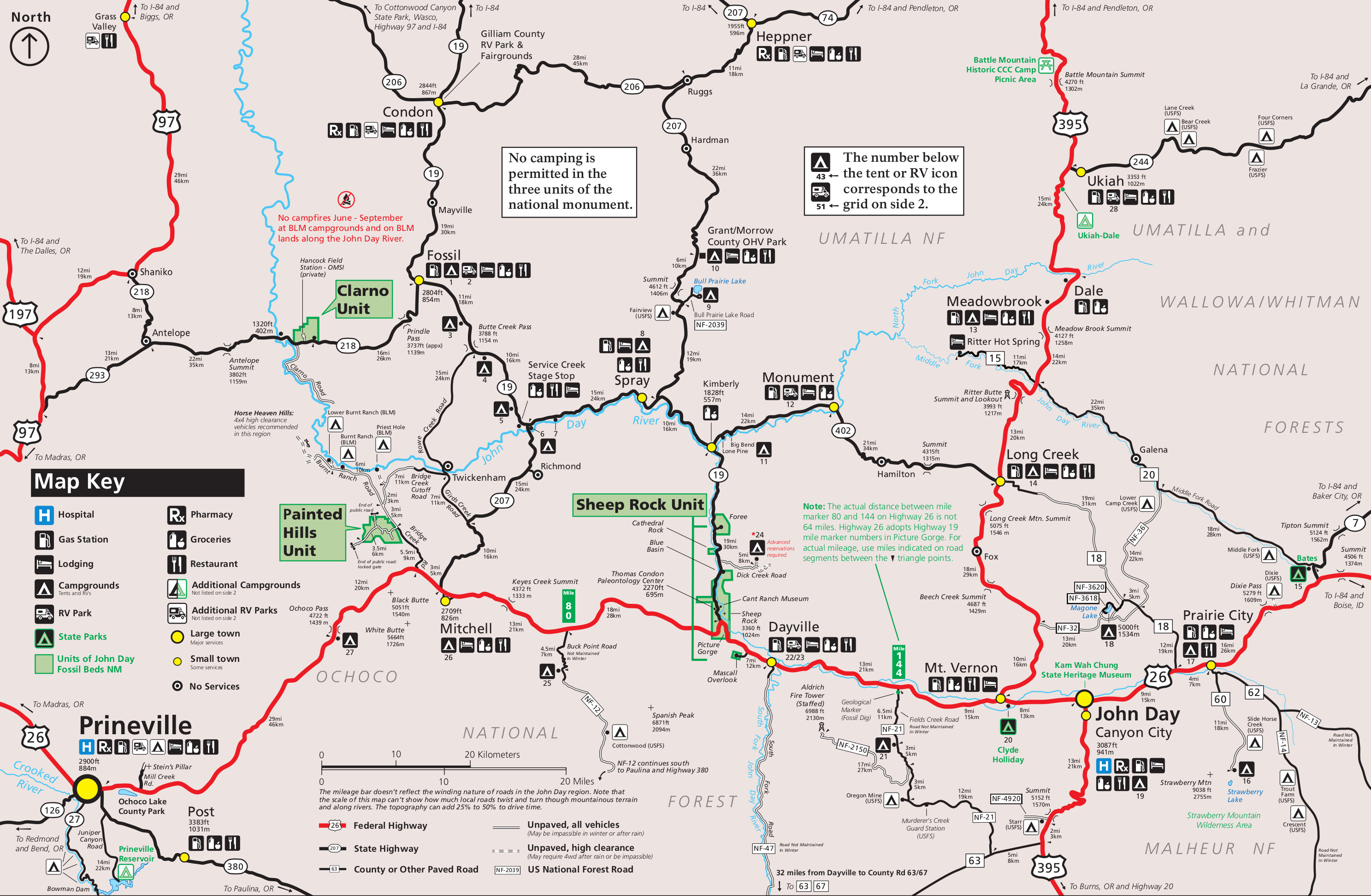 The John Day Fossil Beds regional map shows the nearby campgrounds, services, and towns surrounding the park on nearby eastern Oregon highways in this VERY detailed map.
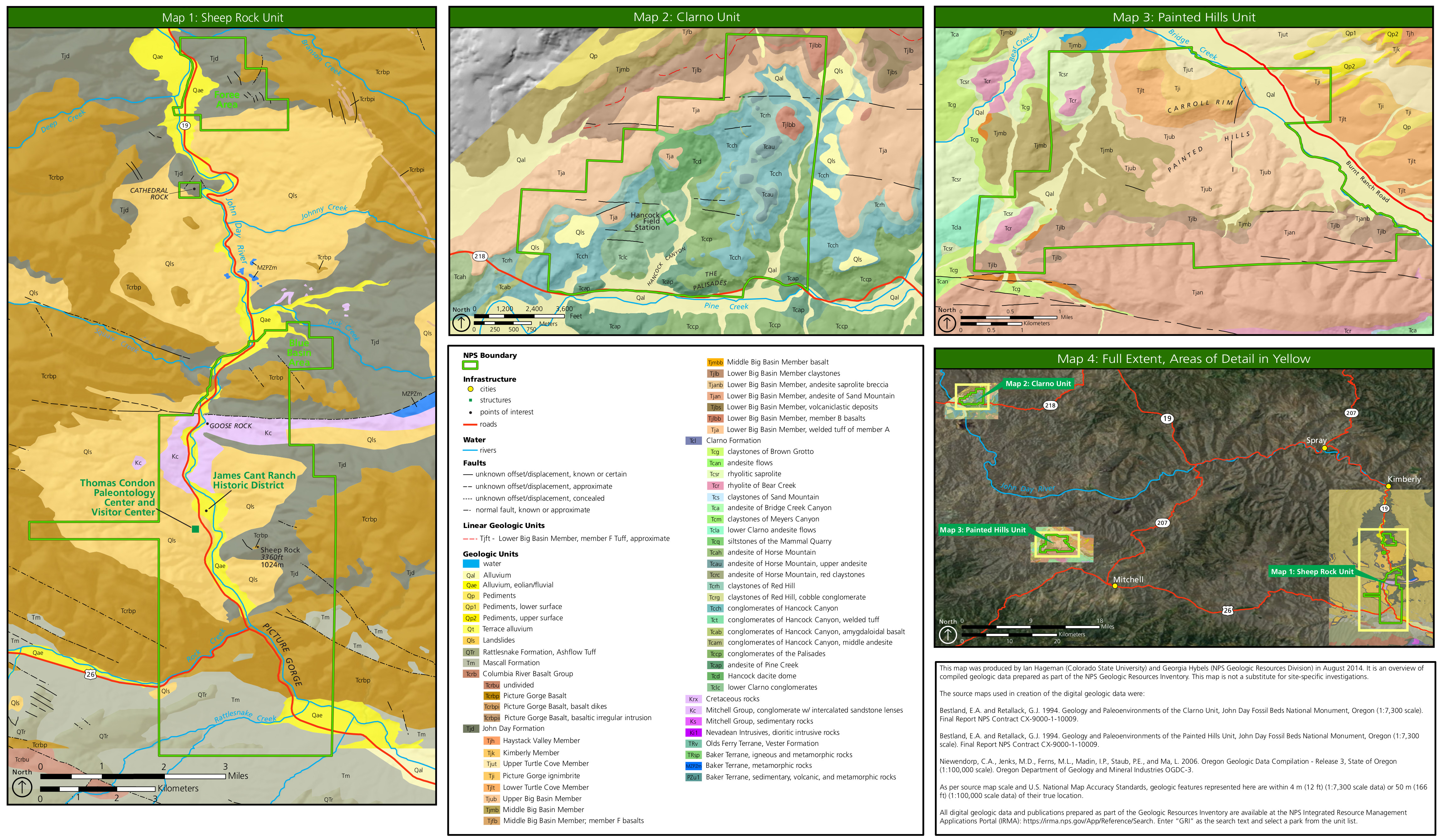 This John Day Fossil Beds geologic map is really three maps in one, showing the rock layers and labeling each one in each of the three units of the park: Sheep Rock, Painted Hills, and Clarno.
 Here’s a vegetation map of John Day Fossil Beds, showing the types of forest, woodlands, shrublands, and other types of ground cover communities throughout the three units of the park.
Archived John Day Fossil Beds maps
 This was the official John Day Fossil Beds map from the park brochure, prior the park map’s major overhaul in 2020. Click the image to view a full size map or download the PDF.
 Here’s the old Sheep Rock Unit map from before 2020, focusing on the main part of the park featuring the Thomas Condon Paleontology and Visitor Center. Click the image to view a full size map or download the PDF.
 This Painted Hills Unit map is from before the 2020 park map update and shows this area of the park west of the main Sheep Rock area. Click the image to view a full size map or download the PDF.
 This was a Clarno Unit map from before 2020, showing the northwesternmost unit of John Day Fossil Beds. Click the image to view a full size map or download the PDF.
…and more!
< Return to National Park Maps home
< Return to Park List
< Return to List by State