Great Basin map from the official brochure
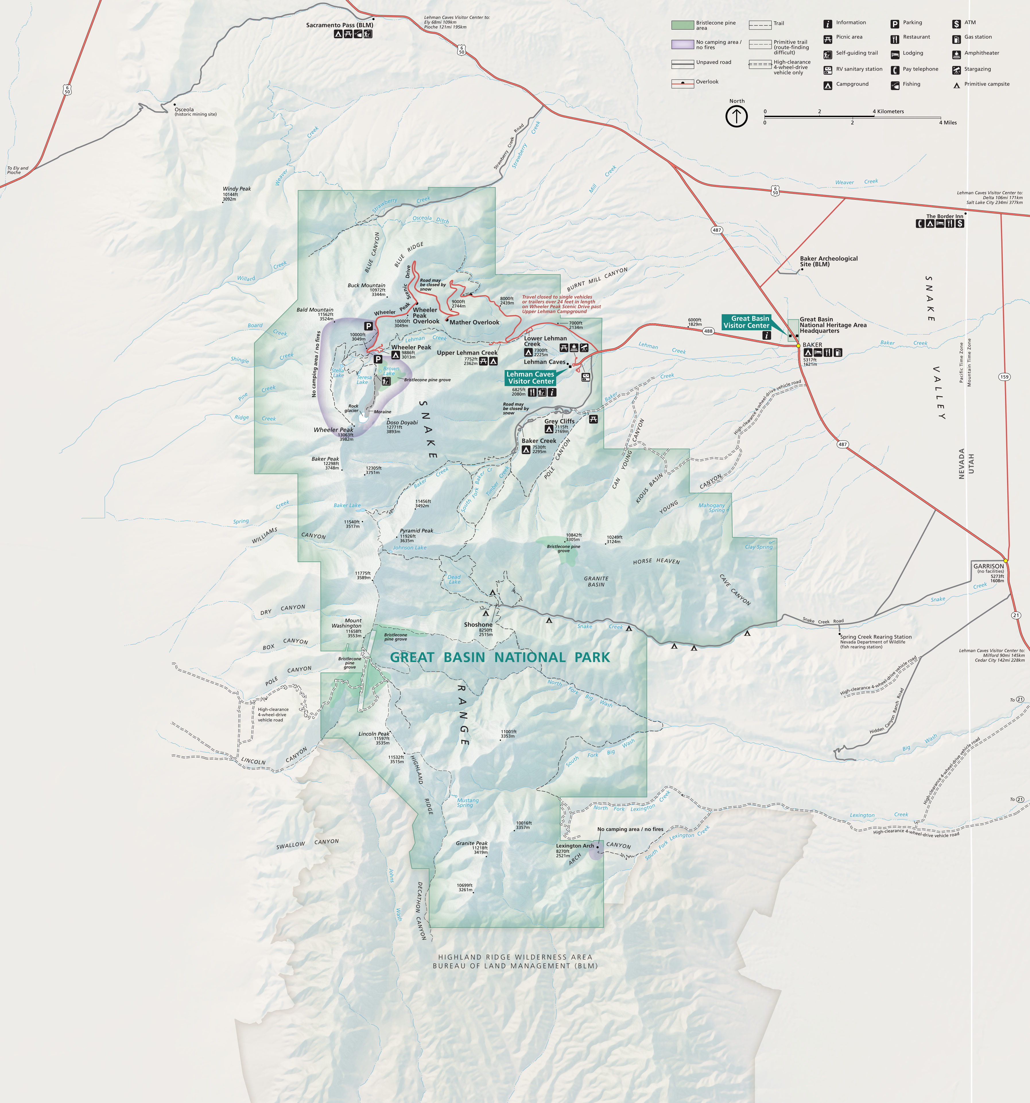 This is the official NPS Great Basin National Park map, last updated in 2024 with new colors and shading. The file here is higher-resolution than the map you’ll find on the official park website.
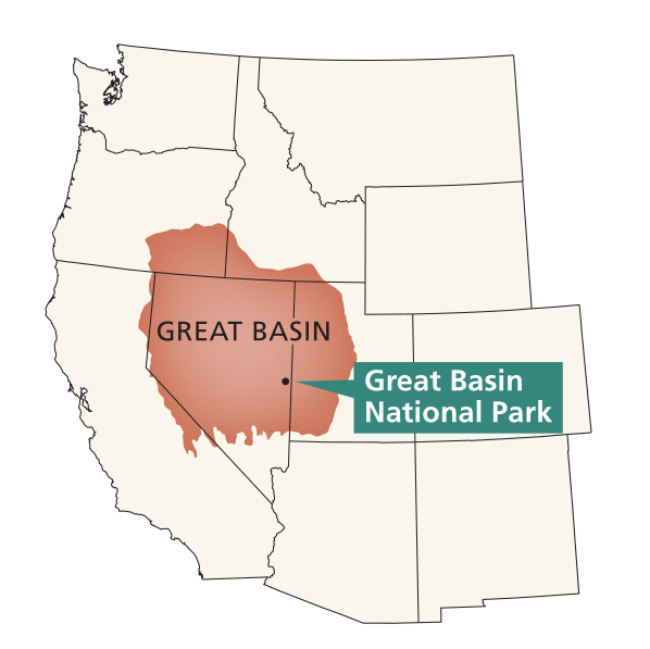 Here’s the Great Basin region map, highlighting the geologic province known as the Great Basin. The park is a great representation of the sort of scenery and biodiversity you’ll find in Great Basin sky islands.
Great Basin trail maps
 There aren’t any super high-quality NPS trail maps for Great Basin, but below I’ve provided maps that zoom in on portions of the full park map above. They’re not really suitable for navigation, but they do highlight trails and show hiking distances. Purchasing the waterproof National Geographic Trails Illustrated map from Amazon is your best bet if you’re looking for a single high-quality trail map suitable for navigation.
Wheeler Peak Scenic Drive trail maps
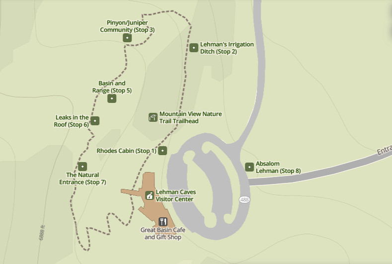 The Mountain View Nature Trail map shows this easy interpretive nature trail accessible from the Lehman Caves Visitor Center. It labels each of the interpretive stops; a printed trail guide is available from the front desk.
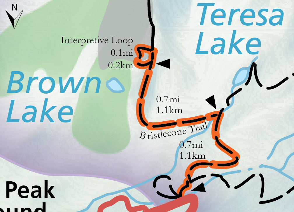 Here’s a Bristlecone Trail map that shows the route into the Wheeler Peak Bristlecone Pine grove. This is likely the most popular trail in all of Great Basin National Park.
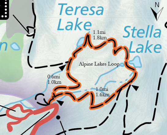 The Alpine Lakes Loop map shows this popular trail that includes both Teresa and Stella lakes in under 3 miles of hiking. It starts from the same trailhead as the Bristlecone Trail above.
 The Sky Island Forest Trail map shows this paved ADA-accessible route accessible from the end of the scenic drive. Note that this map, and many of the others in this section, shows north pointing down.
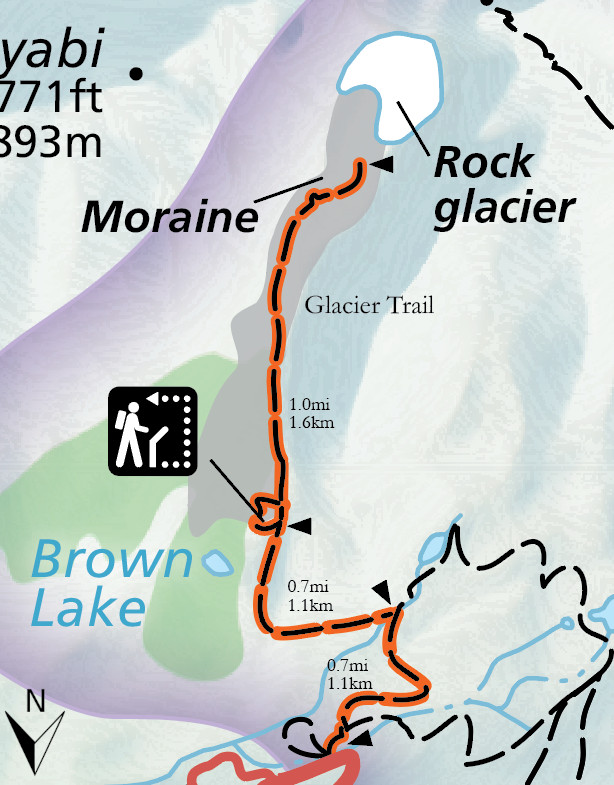 This Wheeler Peak Glacier Trail map shows the route through the Bristlecone pines to visit the last remaining glacier in Nevada (though it’s currently a rock glacier and may not be what you’re exactly picturing).
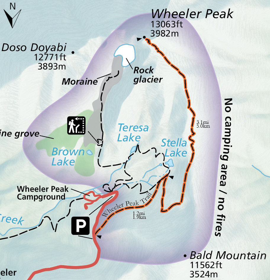 The Wheeler Peak Trail map shows the route to the summit of Wheeler Peak, the second tallest mountain in Nevada (and tallest that lies entirely within the state).
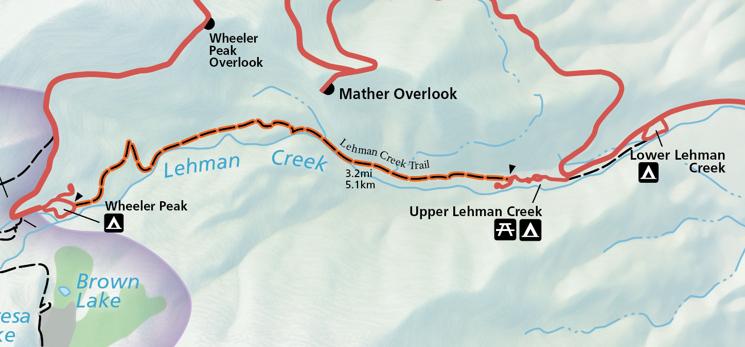 Here’s a Lehman Creek Trail map that shows this route that departs the Upper Lehman Creek Campground and follows the creek upstream to rejoin the Wheeler Peak Scenic Drive near the end.
Baker Creek trail maps
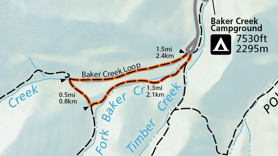 This Baker Creek Loop trail map shows this trail starting from the Baker Creek Trailhead and making a loop of about 3 miles through forest, sagebrush, and meadow.
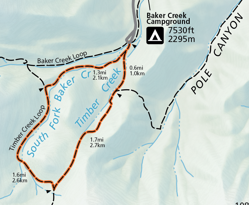 The Timber Creek Loop trail map shows this longer route that starts from the same location at the end of Baker Creek Road. It travels about 5 miles and has some strenuous elevation gain of just over 1500 feet.
Here’s a 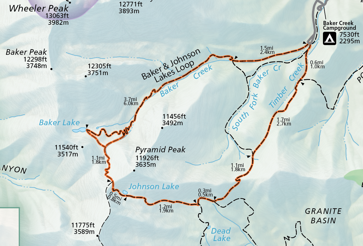 Baker and Johnson Lake Loop trail map that shows this popular backcountry loop route. Over 3000 feet of elevation gain occurs across nearly 12 miles, and you’re rewarded with two beautiful mountain lakes.
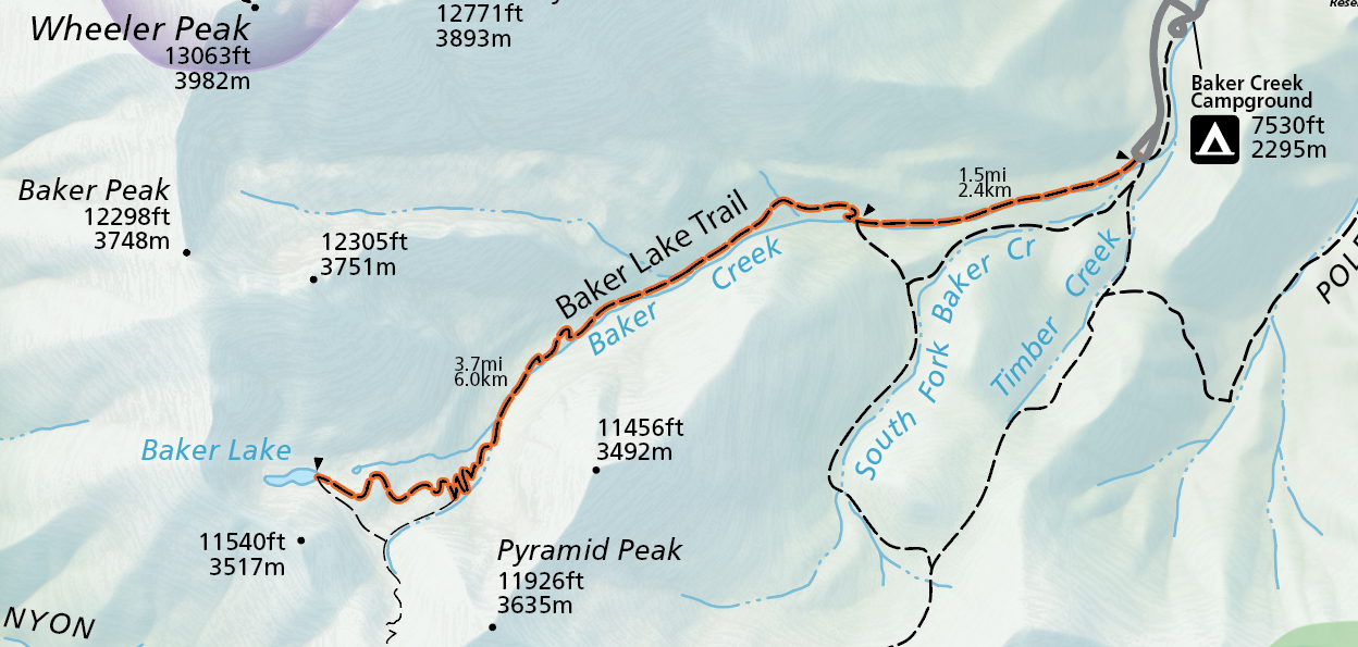 The Baker Lake trail map shows an alternative to the loop described above; instead you can hike out and back just to Baker Lake in about 10 miles (and have less elevation to climb as well).
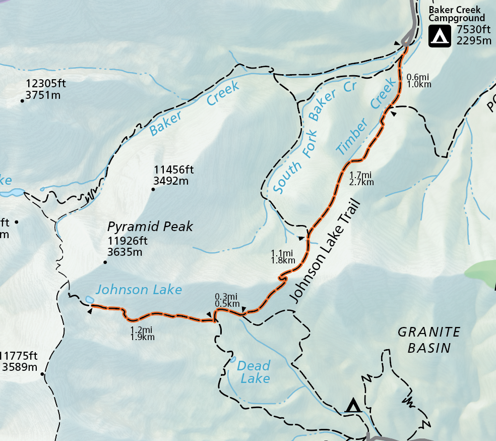 The Johnson Lake trail map shows the way to visit Johnson Lake without doing the loop described above. Johnson Lake, and its associated historic district, can also be accessed from the Snake Creek Road.
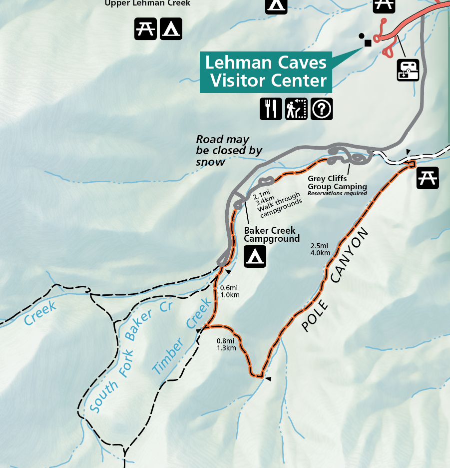 This Pole Canyon trail map shows a trail that can be made a full loop or as a shorter car shuttle, hiking Pole Canyon between the Baker Creek Trailhead and Pole Canyon Trailhead.
Snake Creek trail maps
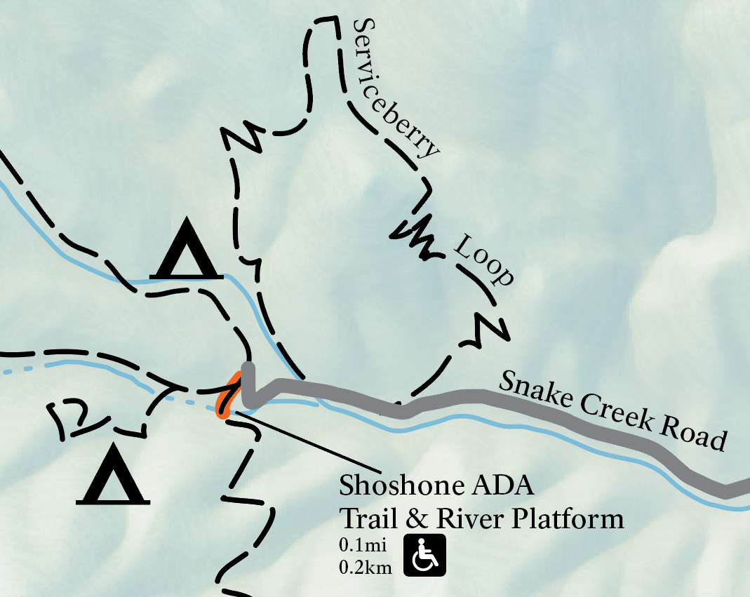 The Shoshone ADA Trail map shows the easy flat trail that leads to an overlook of Snake Creek with wayside exhibits. Fishing is possible from the overlook platform.
 This Snake Creek Overlook trail map shows the route that starts from the same trailhead as the map above and leads to views of the Snake Creek valley below, with a small loop at the end.
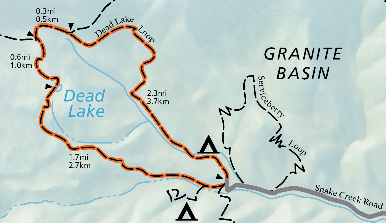 Here’s a Dead Lake Loop trail map that shows the 5-mile loop hike that visits Dead Lake. As the name implies, Dead Lake is ephemeral, and dries up by late summer unless it’s been an exceptionally heavy snow year.
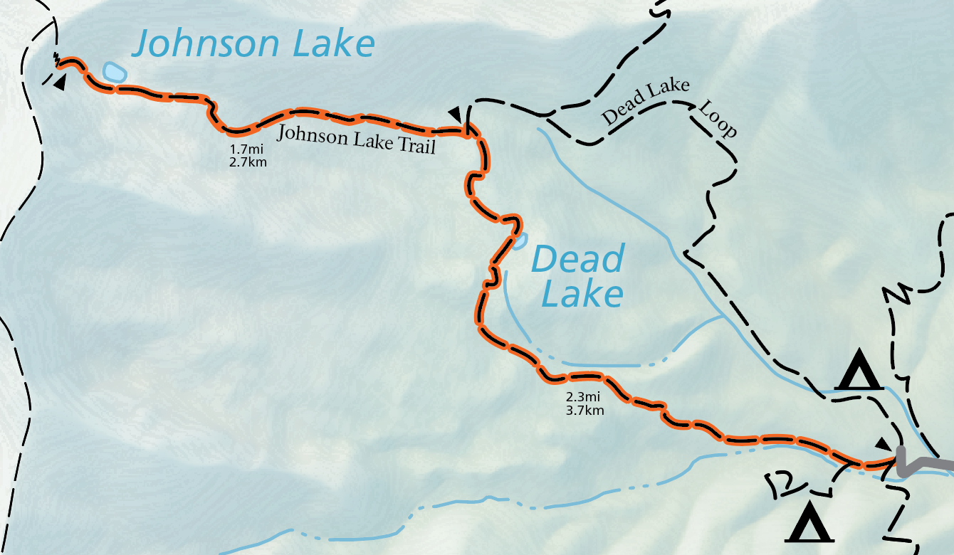 The Johnson Lake Trail map shows the route to the Johnson Lake Mining District. This area includes historic cabins that are still preserved and standing from its days as a tungsten mine.
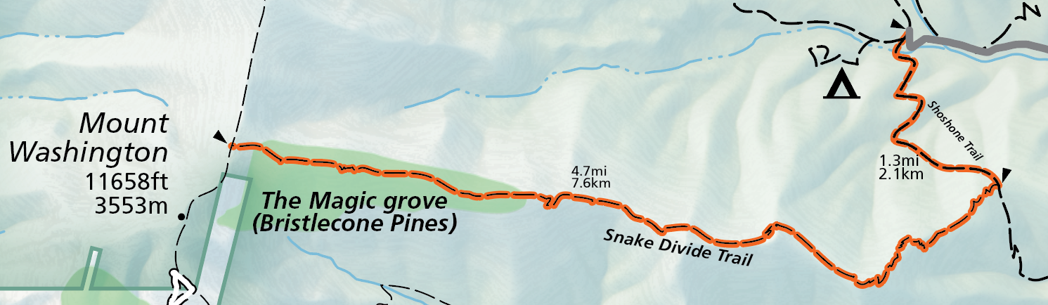 This Snake Divide Trail map shows the high-elevation route that visits multiple Bristlecone pine groves and includes an optional side-visit to the summit of Mt. Washington.
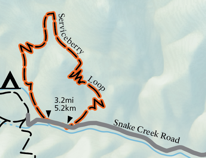 The Serviceberry Trail map shows a three-mile loop that starts at the Serviceberry Trailhead near the end of the Snake Creek Road and has some climbing for views of the valley below.
Strawberry Creek trail maps
 Here’s a map of Upper Strawberry and the Sage Steppe Loop trails. Both of these begin at the end of the Strawberry Creek road and include mountain scenery recovering from the 2016 Strawberry Fire.
Lexington Creek trail maps
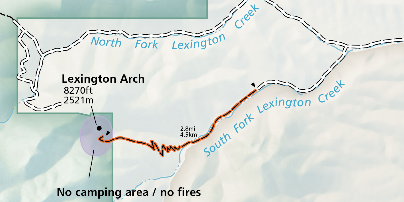 Here’s a Lexington Arch Trail map, showing the route to one of the tallest limestone arches in the world. There is little shade on this trail due to it passing through an area burned by wildfire in the early 2010s.
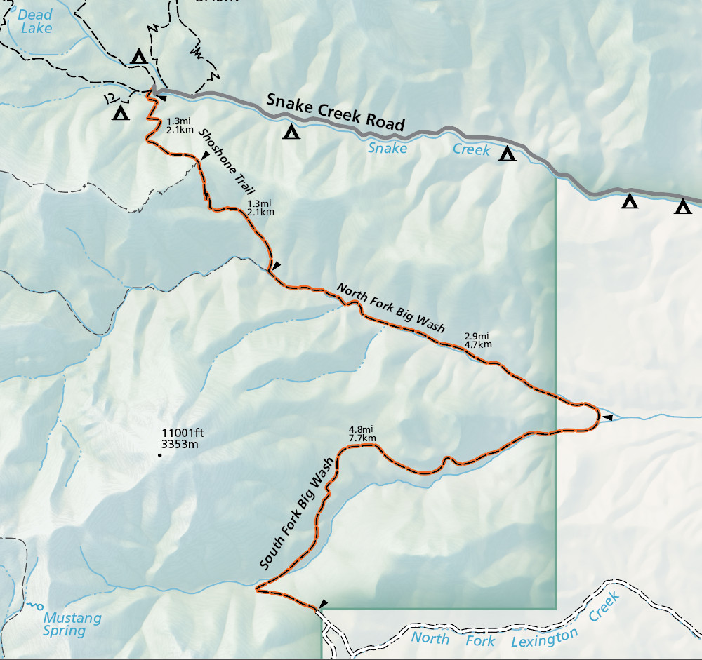 The Big Wash Trail map shows the route of this very desolate route. Some route-finding and bushwhacking may be necessary due to the less-traveled nature of this trail in the southern section of the park.
Great Basin campground maps
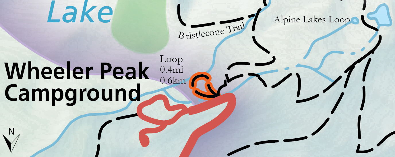
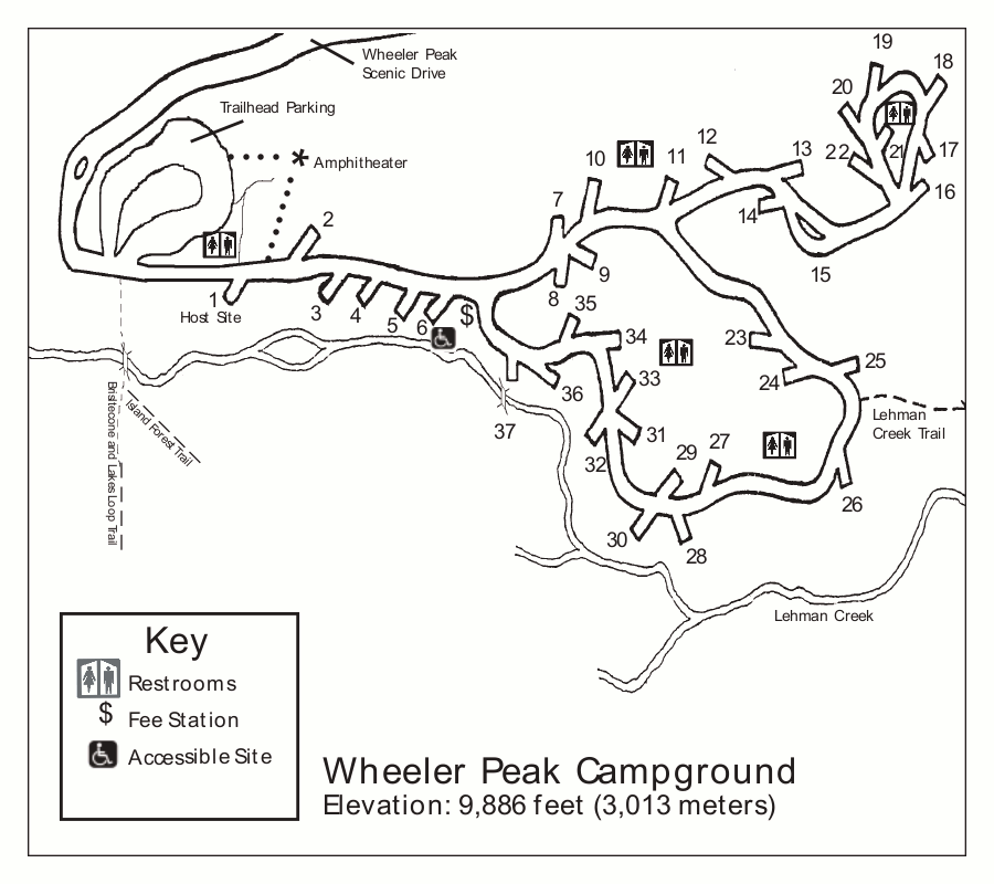 This is the Wheeler Peak Campground map, located at the end of the Wheeler Peak Scenic Drive and is the closest to the Wheeler Peak trail. It’s the highest elevation campground in Great Basin.
 This is a Upper Lehman Creek Campground map. This campground has 22 sites and is the second one along the Wheeler Peak Scenic Drive, after Lower Lehman Creek Campground.
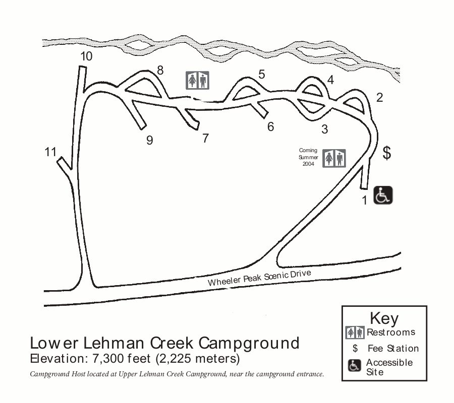 Here is the Lower Lehman Creek Campground map. This is the only campground in Great Basin National Park open all year, being at the lowest elevation on the Wheeler Peak Scenic Drive.
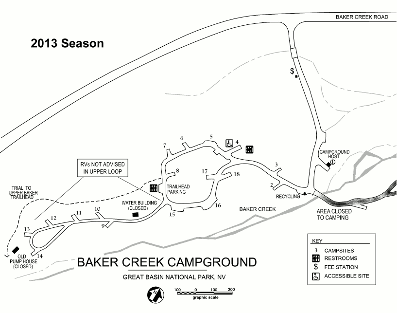 Here’s a Baker Creek Campground map. This campground has 38 sites and is typically open May through October and is located off the Baker Creek Road.
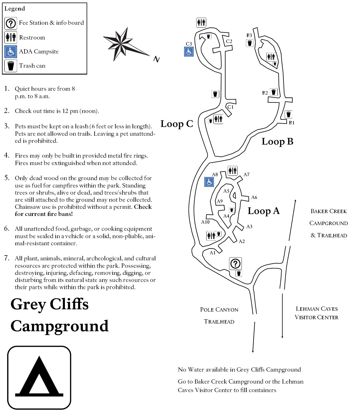 This Grey Cliffs Campground map focuses on this campground located off the Baker Creek Road. It has just sixteen sites and is quieter than some of the campgrounds on the Wheeler Peak Scenic Drive.
Great Basin lodging map
 It’s probably no surprise to learn that Nevada is pretty desolate. So, if you’re looking for lodging near Great Basin, there’s a good chance you’ll end up in Ely, an hour drive away. To the right is an Expedia interactive lodging map of Ely; if you zoom out, you’ll see there’s nothing closer! I’d recommend browsing Expedia’s top-rated Ely lodging to start so you can compare reviews, prices, amenities, and photos.
Various Great Basin maps
 Here’s a Lehman Cave 3D map. Lehman Cave is the longest known cave in Nevada and contains two miles of passageways, though the entire cave is not accessible on the ranger-guided tours.
 The Great Basin geologic map showcases the various rock formations found in the park, including the limestone that forms Lehman Caves and the metamorphic quartzite forming the Wheeler Peak summit.
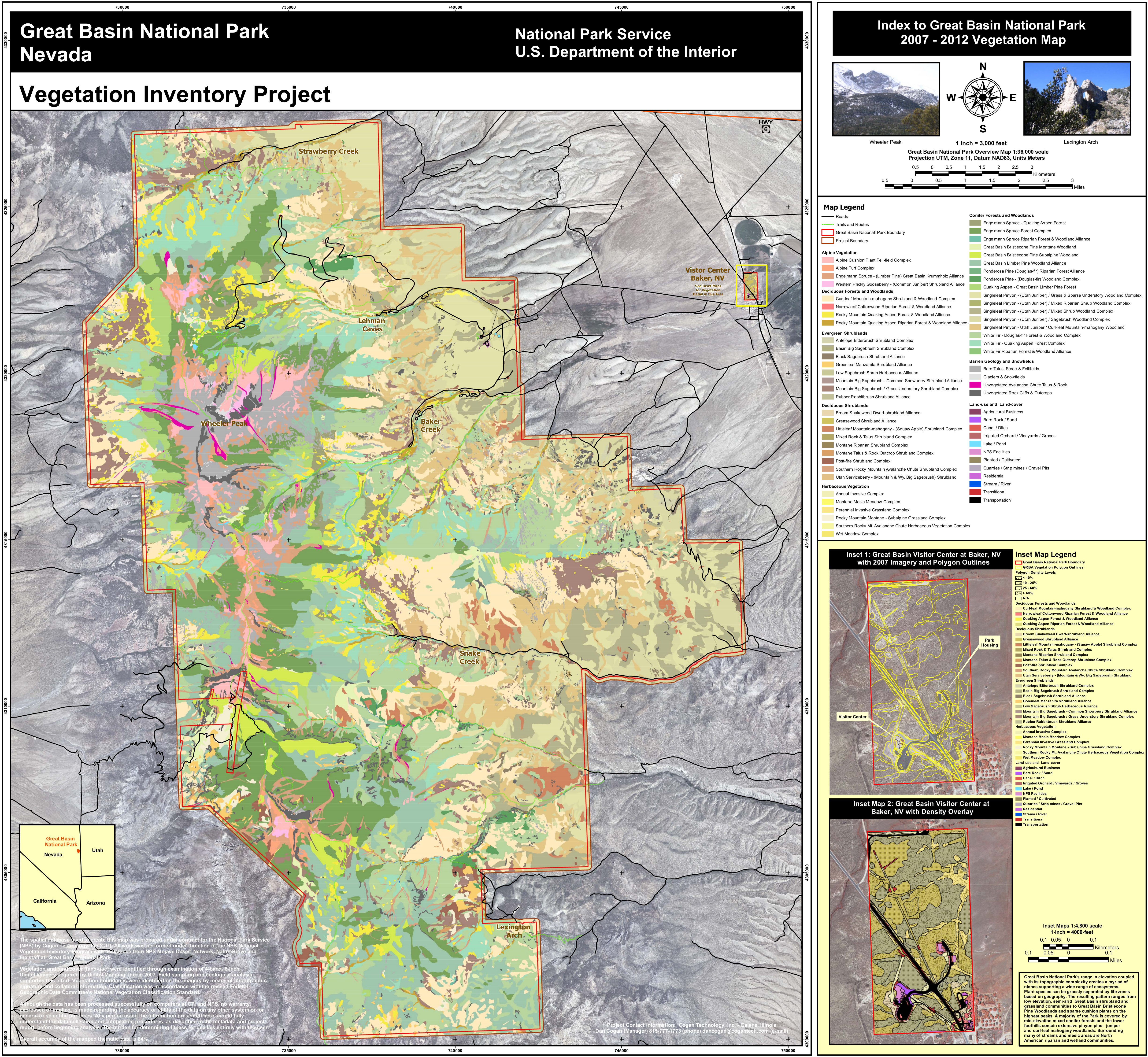 This map of Great Basin National Park vegetation color-codes the various plant and tree communities that live in the park with labels on popular visitor areas for easier orientation.
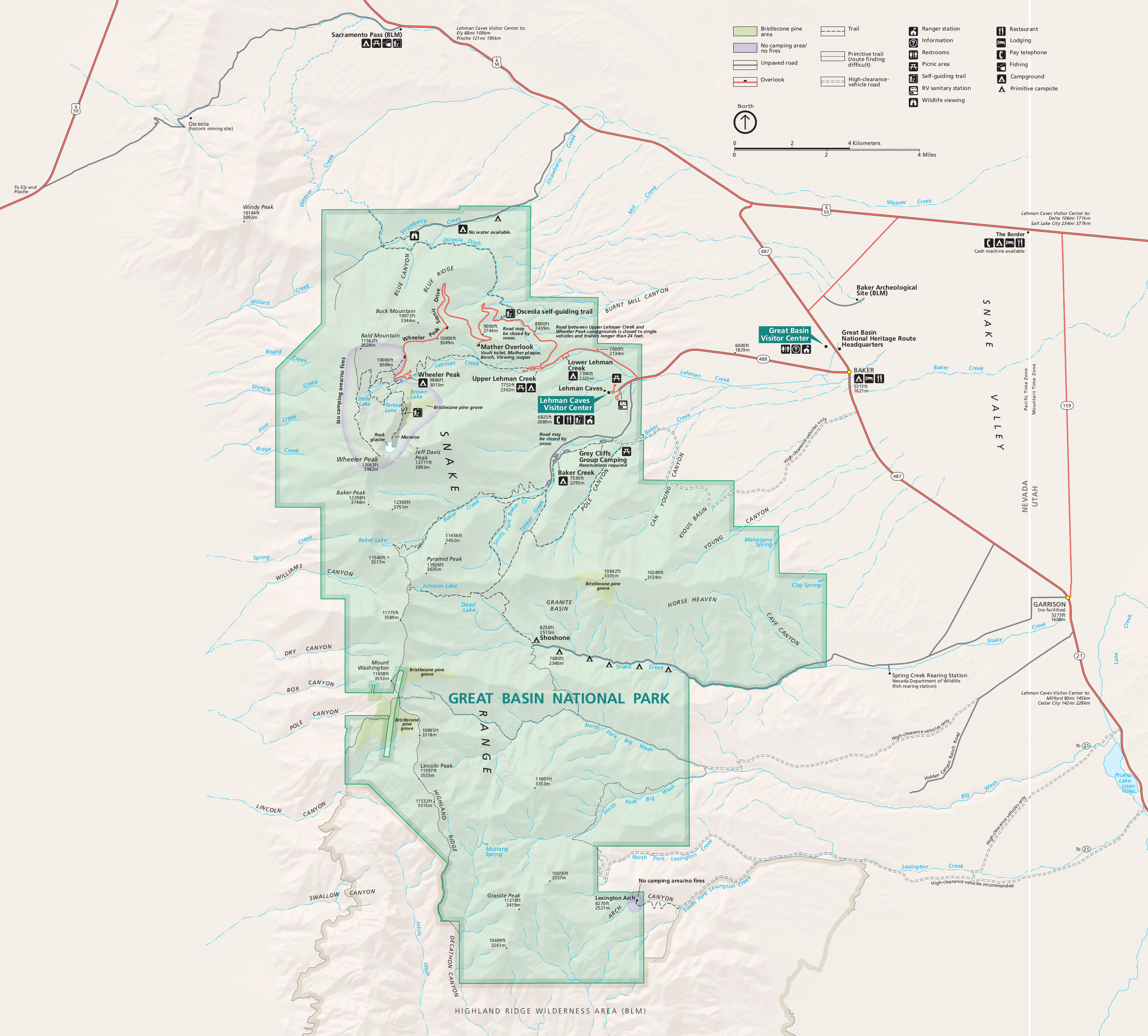 This is the old Great Basin map from the park brochure, showing the viewpoints, roads, trails, Wheeler Peak, and Lehman Caves. Click the image to view a full size map or download the PDF.
…and more!
< Return to National Park Maps home
< Return to Park List
< Return to List by State