If you’re looking for a Cumberland Island map, you’ve come to the right place; currently I’ve collected 6 free Cumberland Island National Seashore maps to view and download (PDF files and external links will open in a new window.) On this page you’ll find the official park map and a few others focusing on campgrounds and such. You can also browse the best-selling Cumberland Island maps and guidebooks on Amazon.
Cumberland Island brochure map
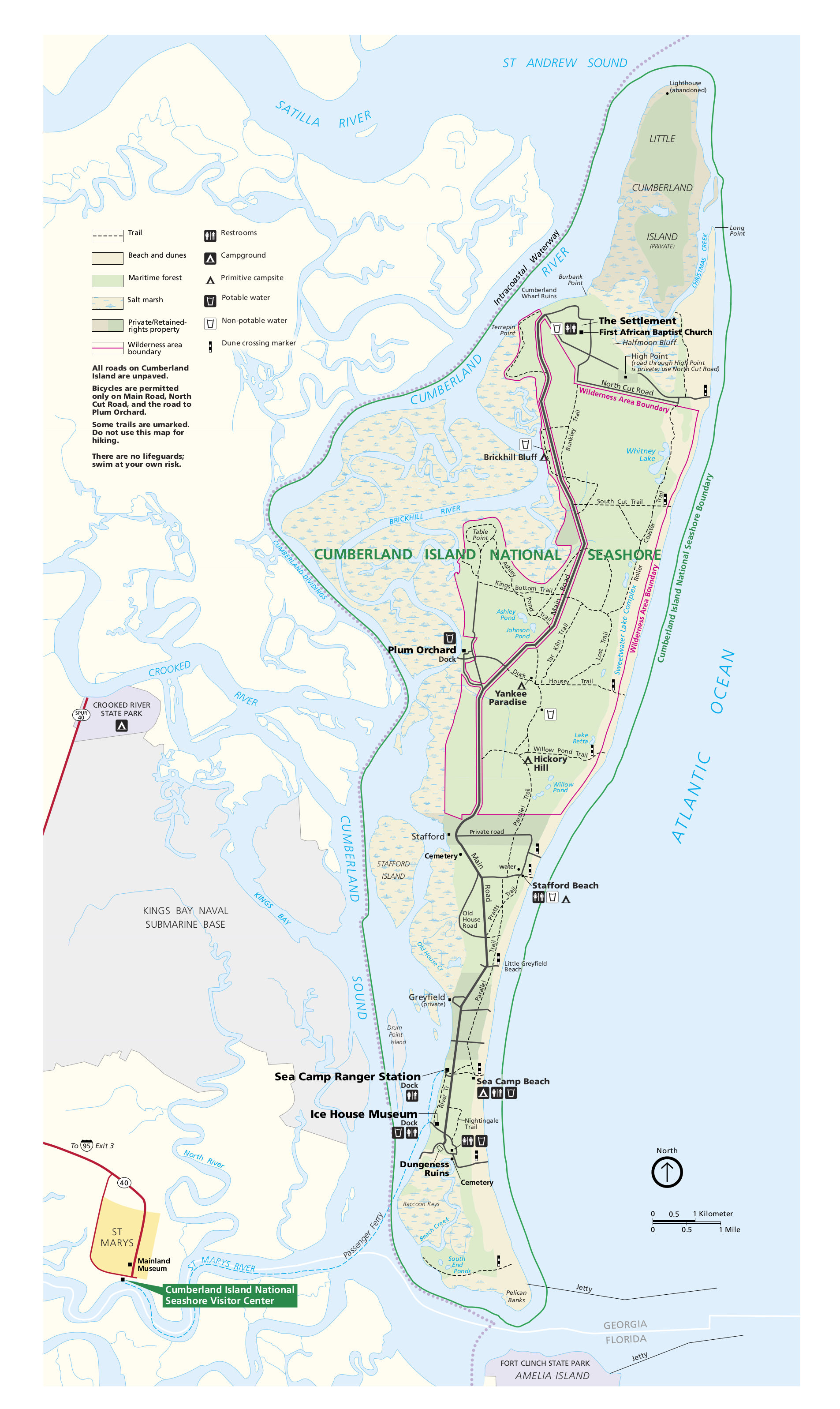 This is the Cumberland Island National Seashore map from the official park brochure showing the trails, facilities, and points of interest. Click the image to view a full size map or download the PDF.
Cumberland Island camping maps
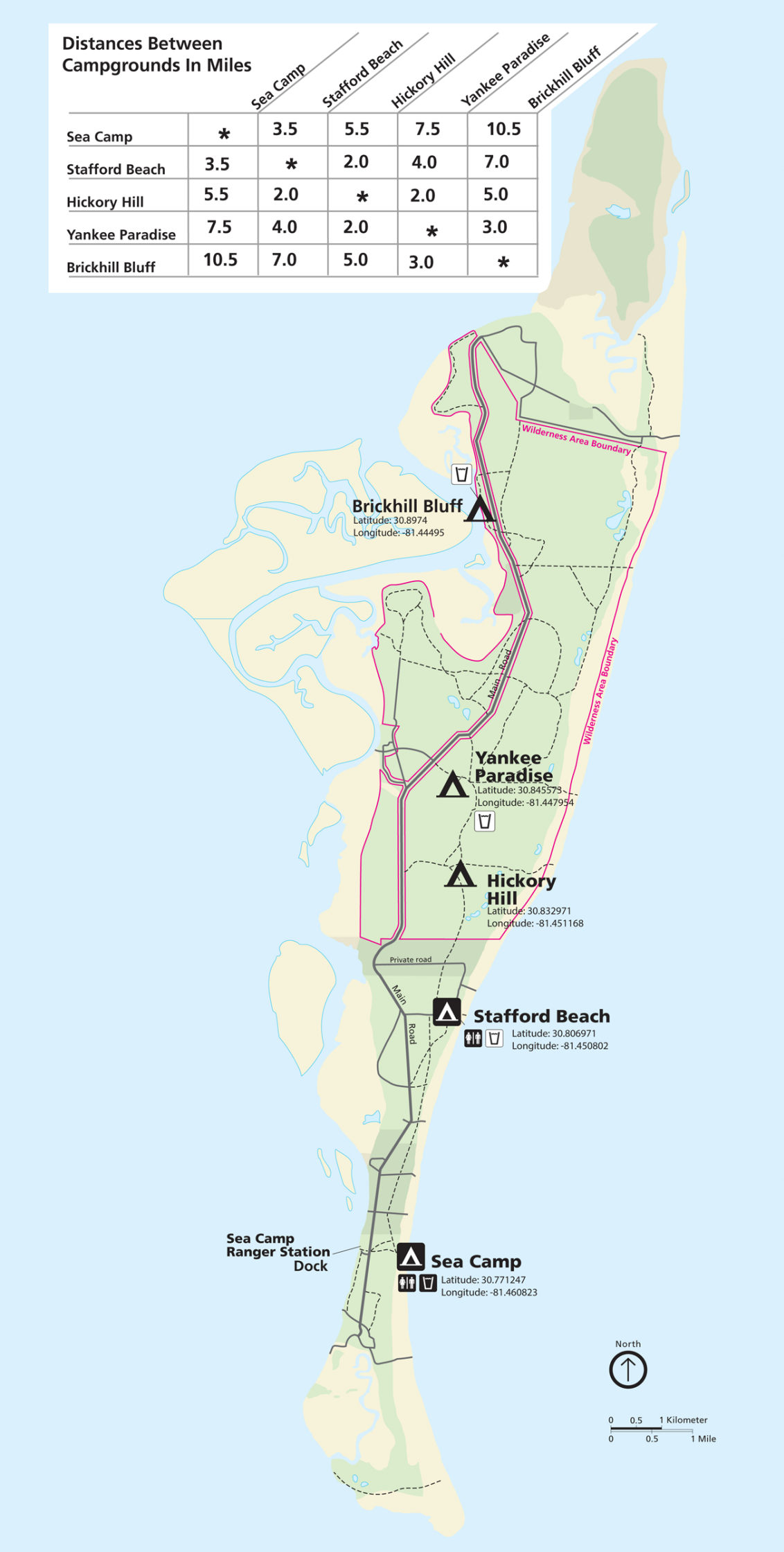 The Cumberland Island campground map shows the location of the two most popular developed campgrounds (to the south) as well as the three primitive campgrounds (to the north).
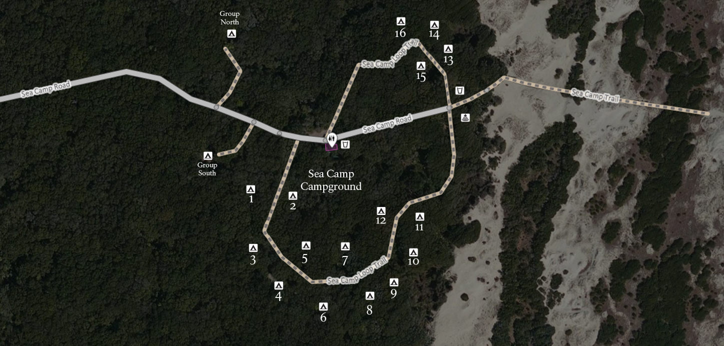 Here’s a Sea Camp Campground map, showing the most popular of Cumberland Island’s campgrounds. It’s the largest campground and nearest to the Sea Camp dock and ranger station.
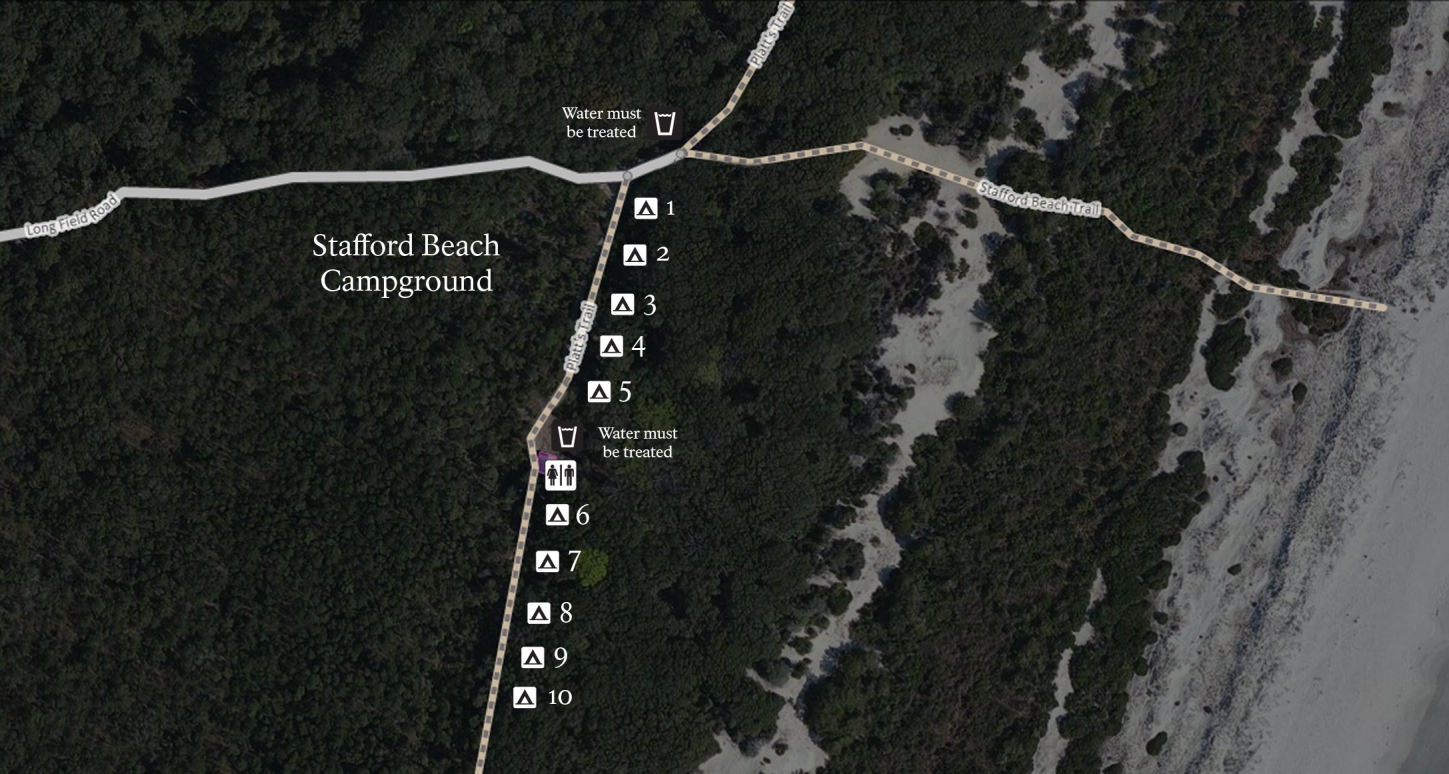 The Stafford Beach campground map focuses on the second most popular campground in the park, which has a few more amenities than the primitive campgrounds: fire rings, restrooms, and water.
Other Cumberland Island maps
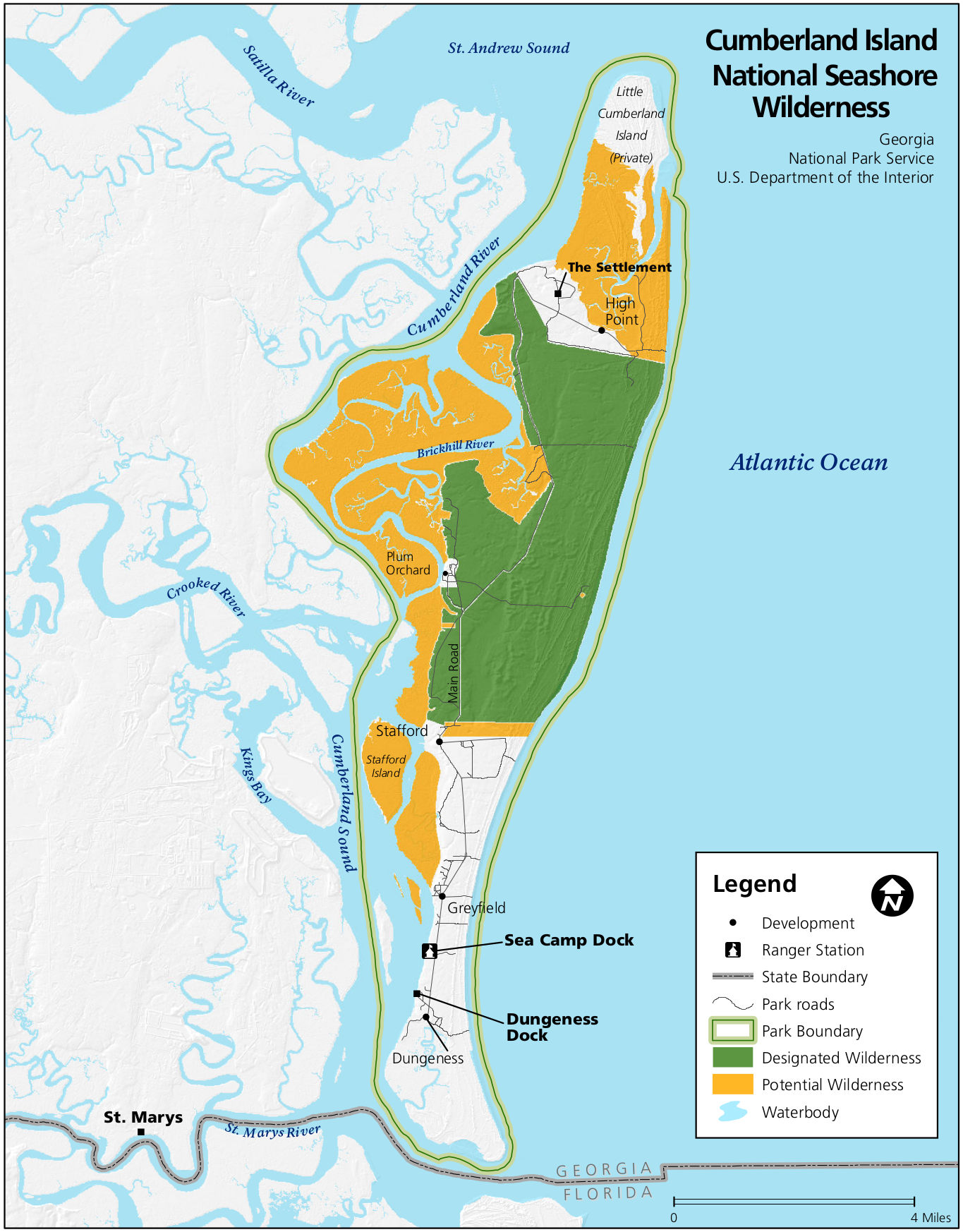 This is a Cumberland Island wilderness map, showing the park lands that are currently designated wilderness as well as those that are eligible for future wilderness designation.
…and more!
< Return to National Park Maps home
< Return to Park List
< Return to List by State
Need more help? Browse Amazon’s best-selling Cumberland Island maps and guidebooks.