If you’re looking for a Cape Lookout map, you’ve come to the right place; currently I’ve collected 8 free Cape Lookout National Seashore maps to view and download. (PDF files and external links will open in a new window.) Here you’ll find one map to cover the entire national seashore and a few maps that zoom in on specific visitor destinations within the park. You can also browse best-selling Cape Lookout maps and guidebooks on Amazon.
Cape Lookout map from the park brochures
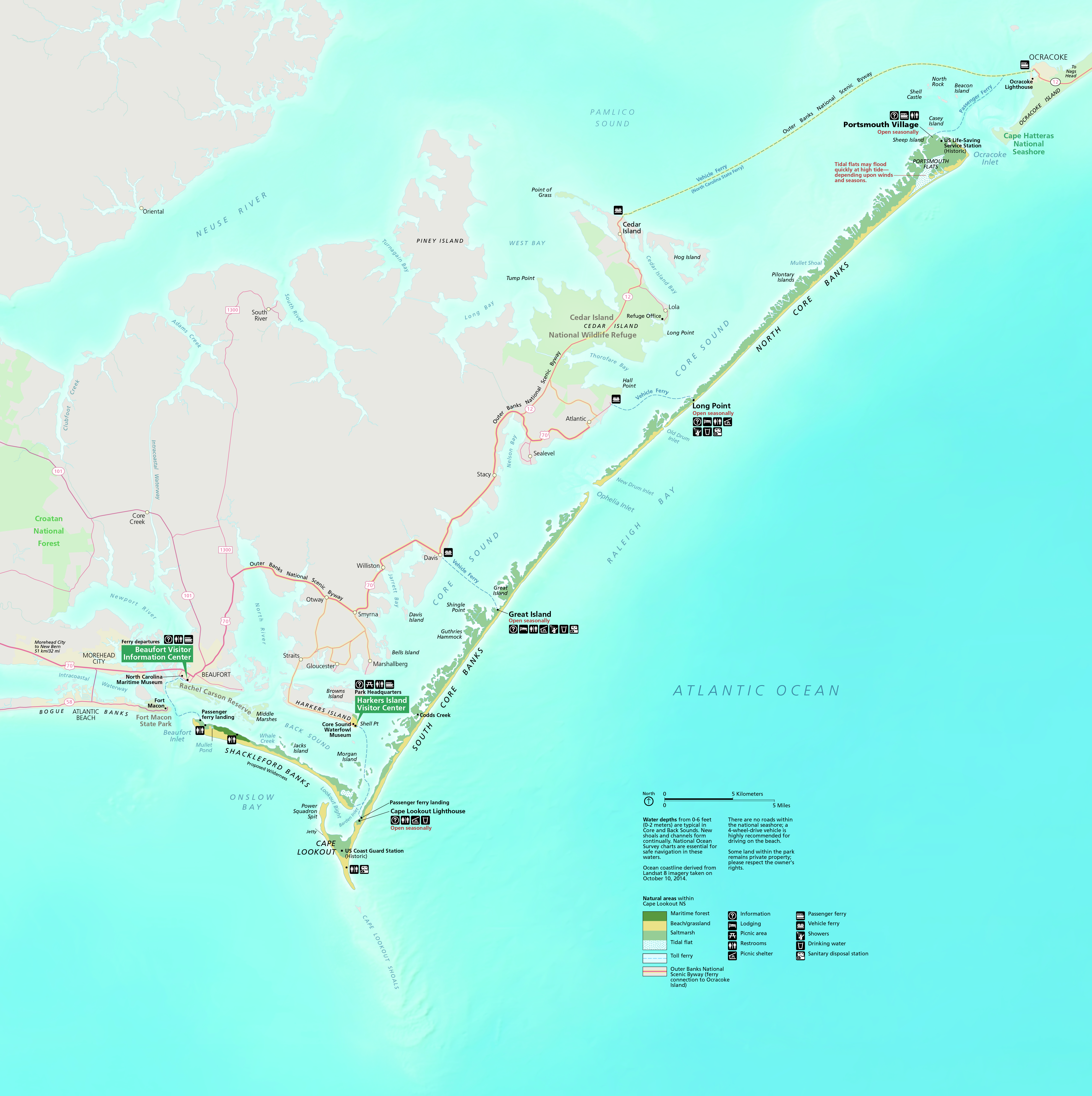 This is the official Cape Lookout map that shows the ferry routes, visitor services, and beaches along the barrier islands. Click the image to view a full size JPG (3.9 mb) or download the PDF (3.3 mb).
 This is the old Cape Lookout map, which still looks nice, but has since been superseded by the newly revised one above. Click the image to view a full size JPG (900 kb) or download the PDF (450 kb).
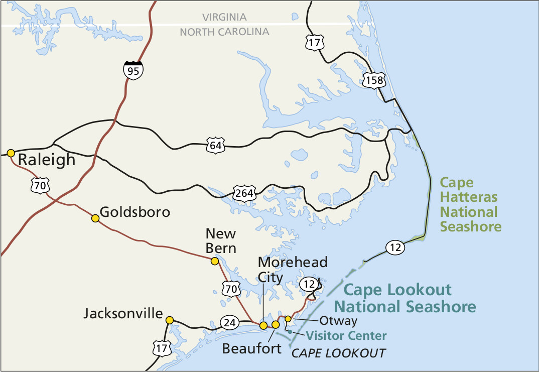 Here’s a regional Cape Lookout map, showing the nearby North Carolina roads and towns and the park’s location compared to Cape Hatteras. Click the image to view a full size JPG (150 kb) or download the PDF (100 kb).
Detailed Cape Lookout maps
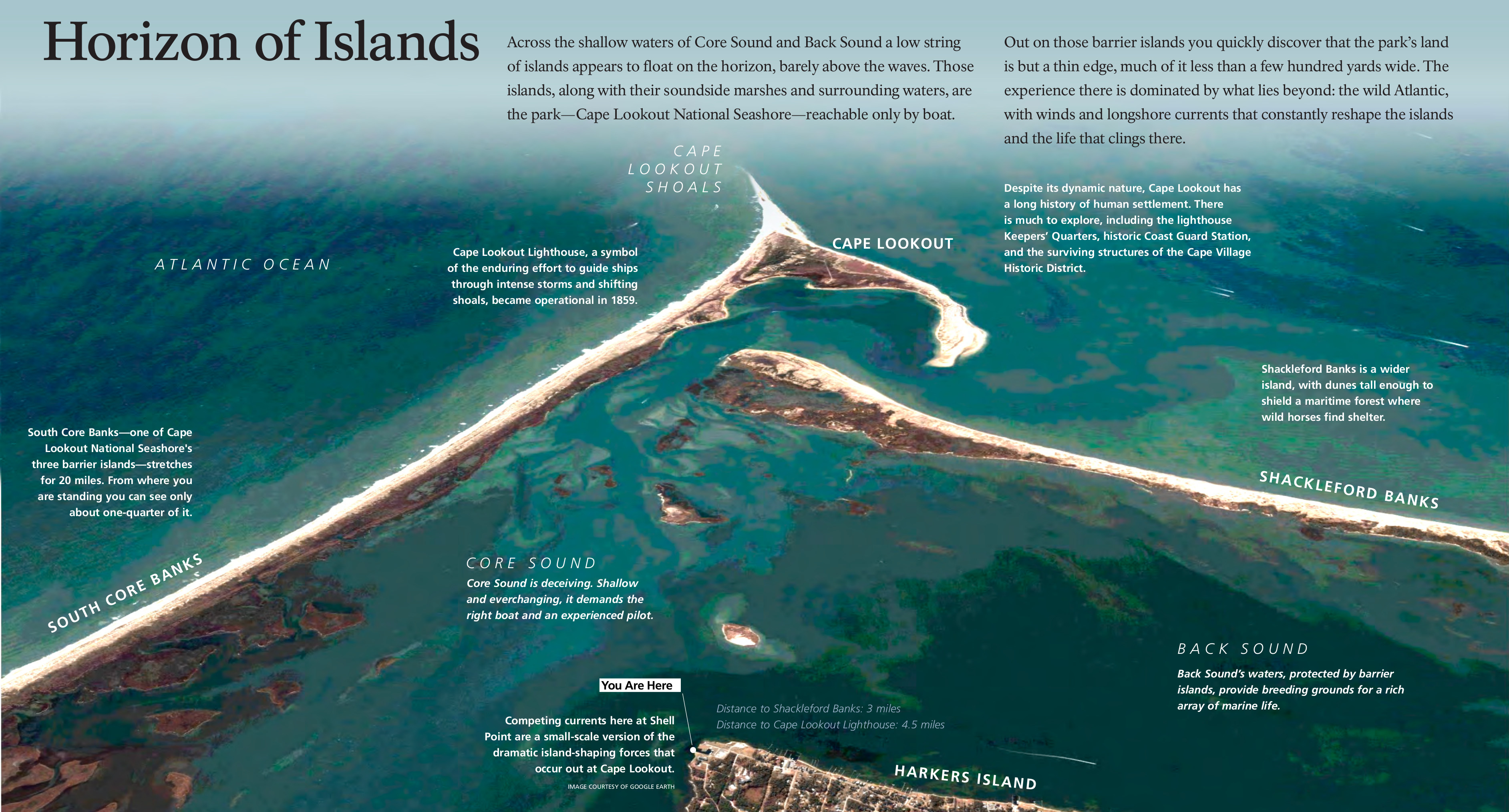 This aerial map of Cape Lookout (1.3 mb) is featured on a wayside exhibit near the main park headquarters and visitor center on Harkers Island and shows where Shackleford Banks and South Core Banks meet.
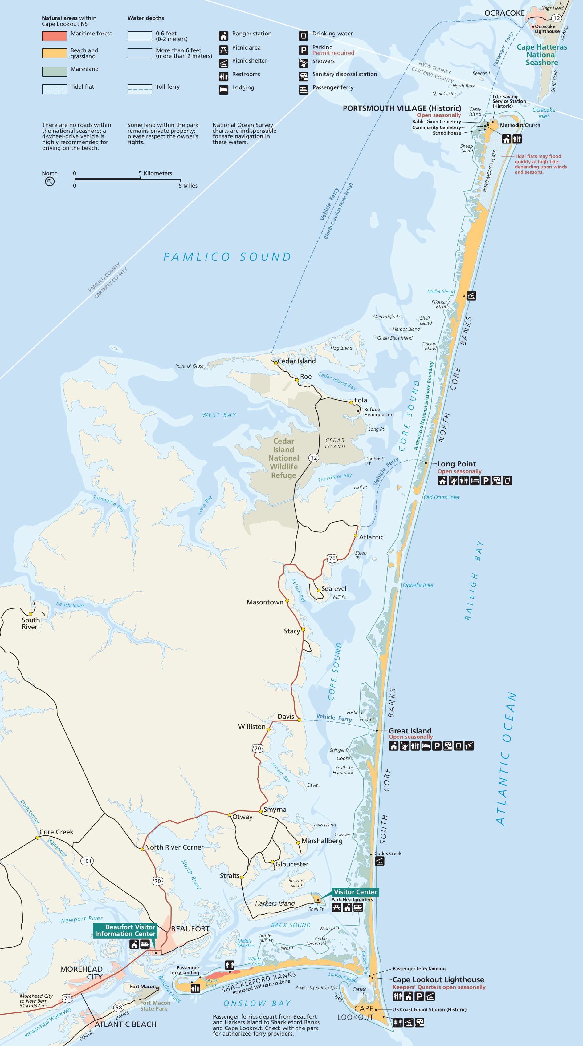
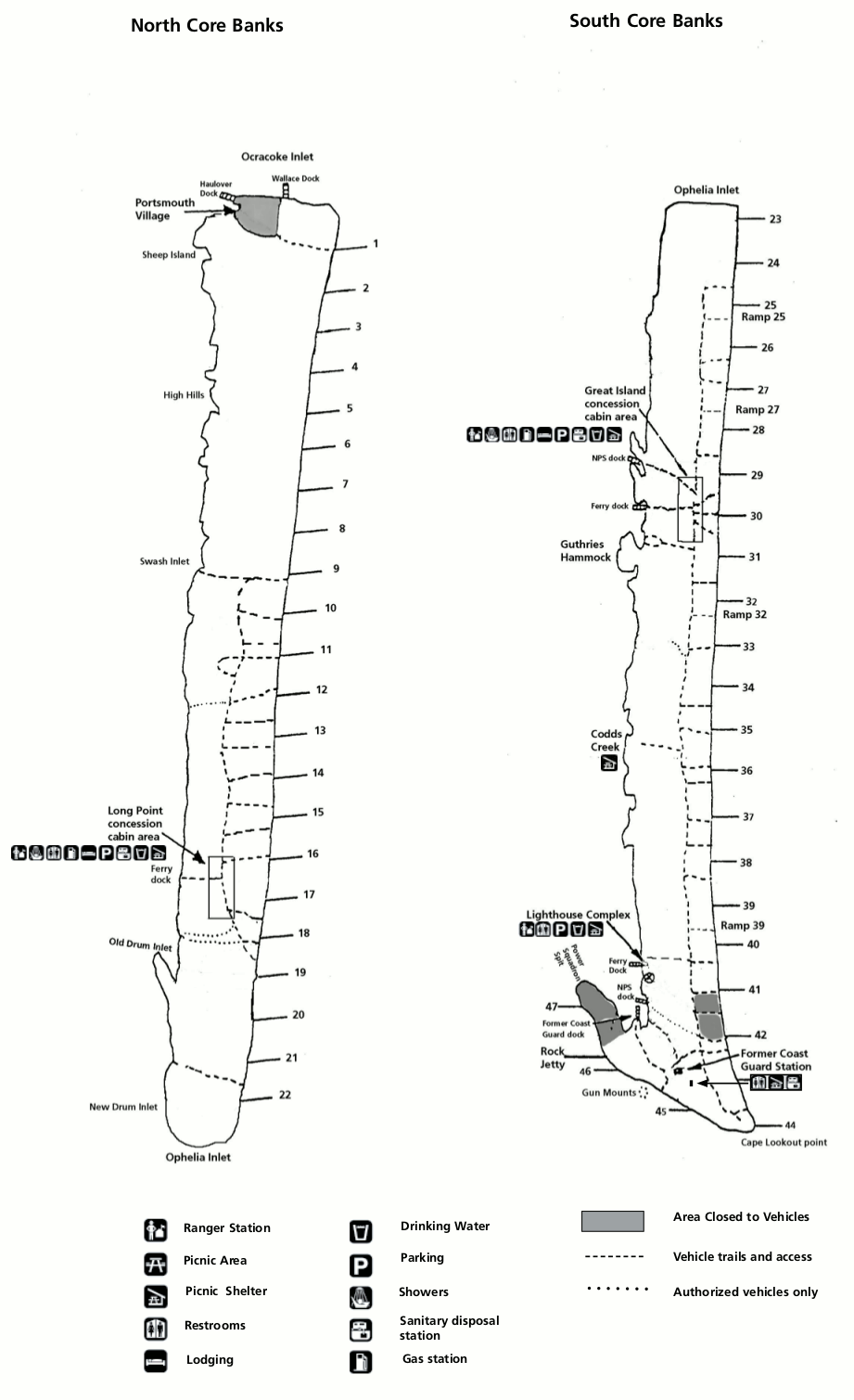 Here is a Cape Lookout driving map (150 kb), showing the driving routes on the barrier islands to the various camping areas and points of interest where visitor services are concentrated.
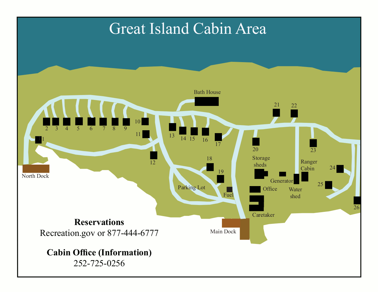 This is the Great Island cabin area map, zooming in on the developed area on South Core Banks, accessible by ferry. Click the image to view a full size GIF (60 kb) or download the PDF (15 kb).
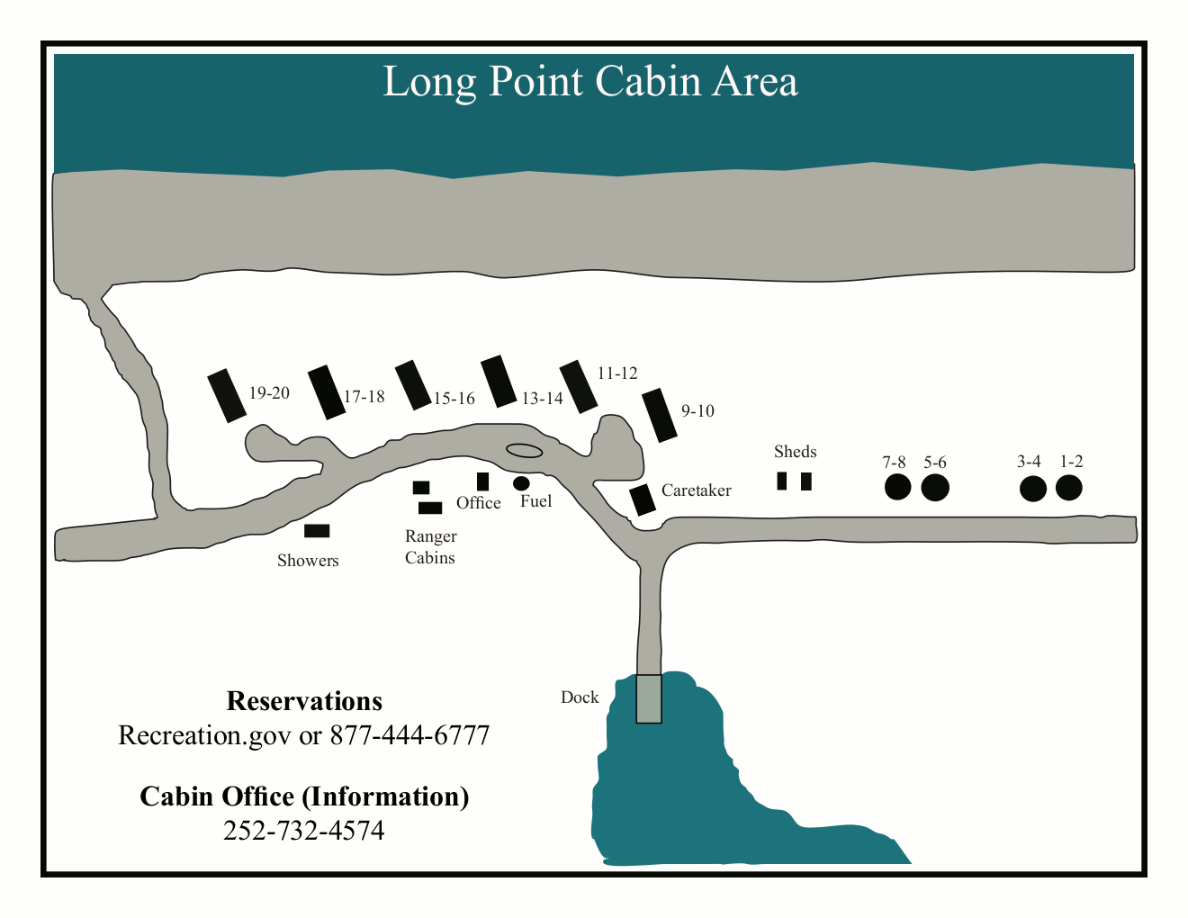 Here’s the Long Point cabin area map, showing the main visitor area on North Core Banks (ferry from Atlantic). Click the image to view a full size GIF (50 kb) or download the PDF (25 kb).
…and more!
< Return to National Park Maps home
< Return to Park List
< Return to List by State
Need more help? Browse Amazon’s best-selling Cape Lookout maps and guidebooks.