If you’re looking for a Wrangell-St Elias map, you’ve come to the right place; currently I’ve collected 8 free Wrangell-St Elias maps to view and download. (PDF files and external links will open in a new window.) These maps focus on specific roads in the park while also showing the entire park and surrounding Alaskan campgrounds. You can also browse the best-selling Wrangell-St Elias maps and guidebooks on Amazon.
Wrangell-St Elias map from the park brochures
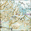
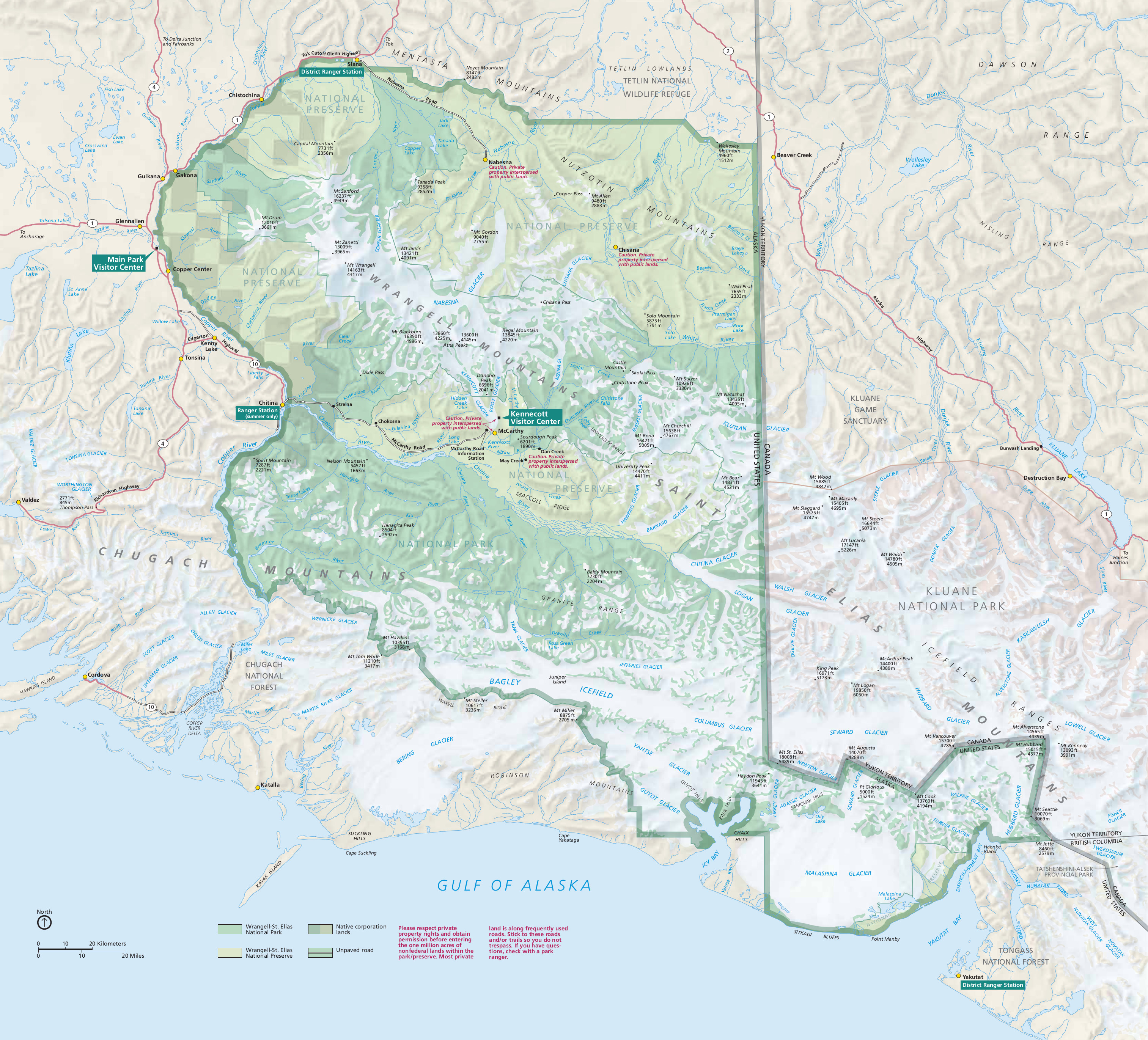 Here’s the official Wrangell-St Elias map from the brochure, showing all the details of this enormous national park (largest in U.S.). Click the image to view a full size JPG (2.2 mb) or download the PDF (4.6 mb).
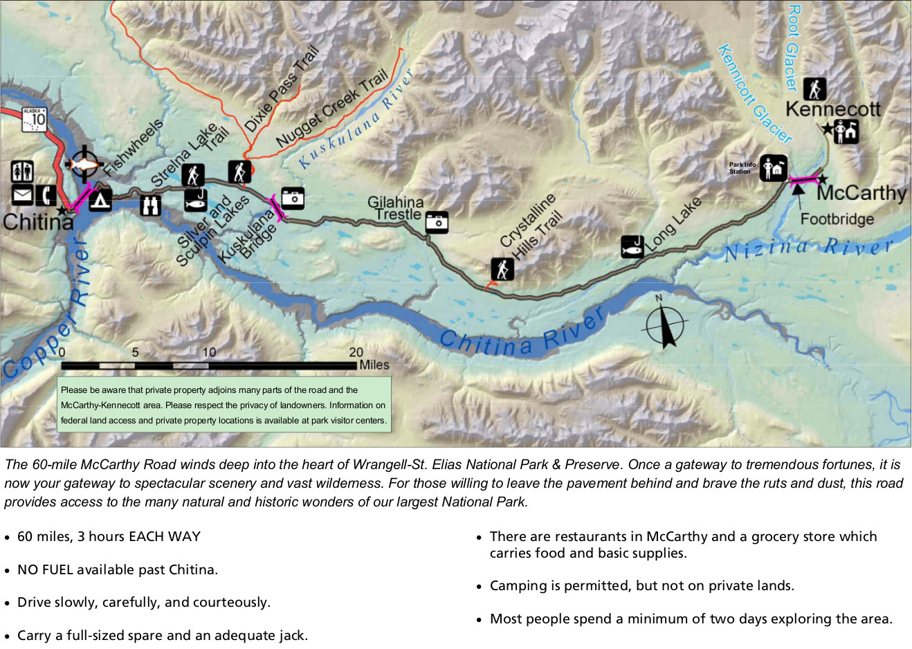 This is a McCarthy Road map (300 kb) from park newspaper, zooming in on this most-visited part of the park that leads to McCarthy and Kennecott south of the Wrangell Mountains. Expect 3 hours each way.
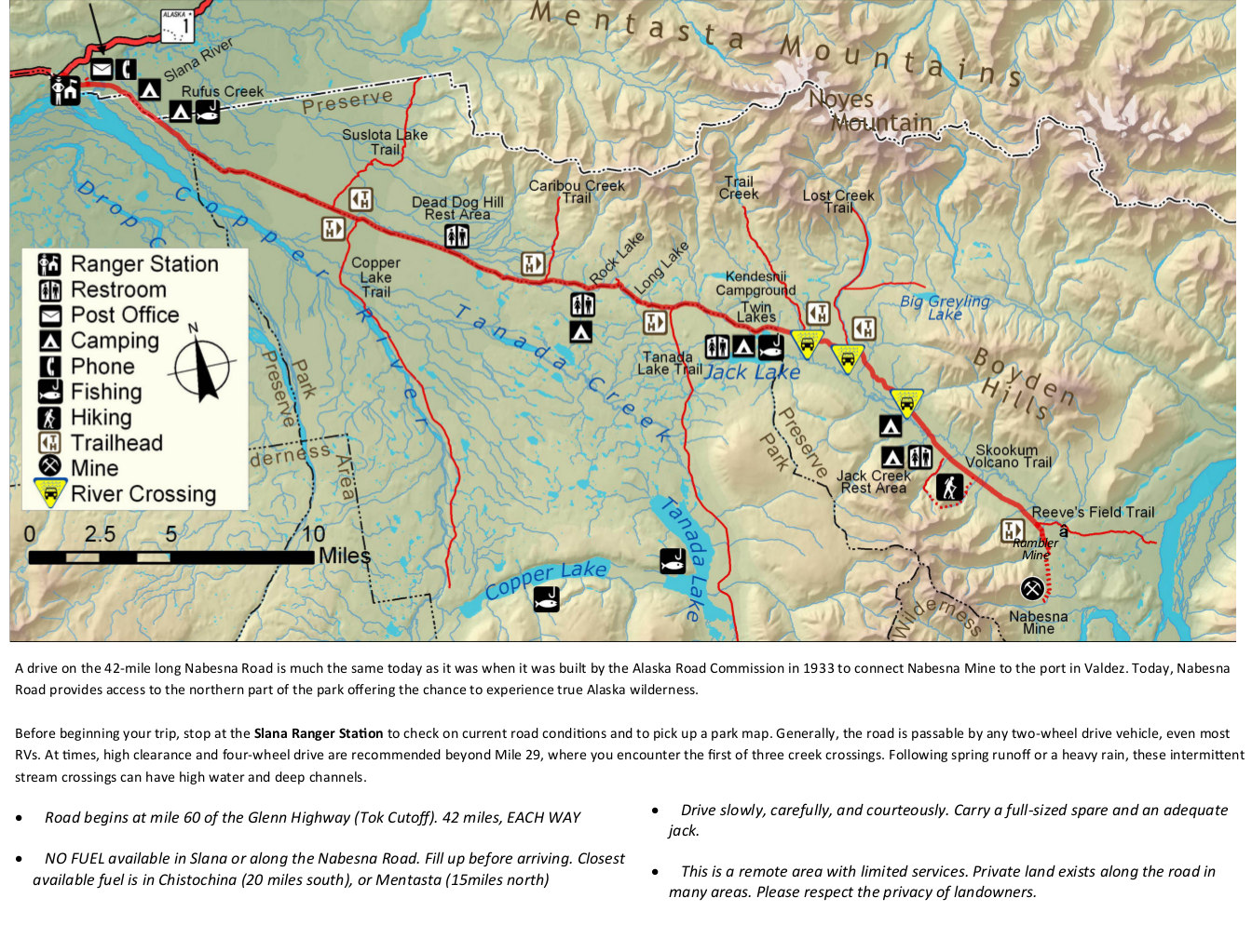 The Nabesna Road map (450 kb) from newspaper shows the other maintained road inside the park, allowing you to access the northern part of the park. Labeled are ranger stations, restrooms, camping, and more.
Wrangell-St Elias trail map
 Wrangell-St Elias is a huuuuuuuuge park – largest national park in the United States, actually. The maps on this page do a good job of providing an overview of the park. However, if you’re looking for a map that has a bit more detail, you may want to check out the National Geographic Trails Illustrated map of Wrangell-St Elias – it’ll show the topography in more detail than you’ll find in the free maps.
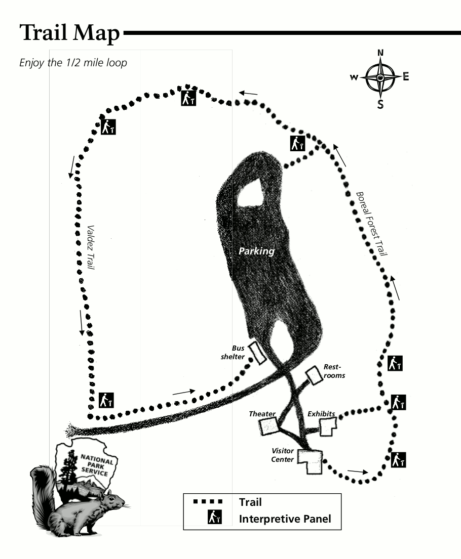 Here’s the Boreal Trail map (150 kb), focusing on the short 1/2-mile loop that departs from the main park visitor center south of Glennallen. This map shows the location of each wayside exhibit that’s a part of the loop.
Wrangell-St Elias camping map
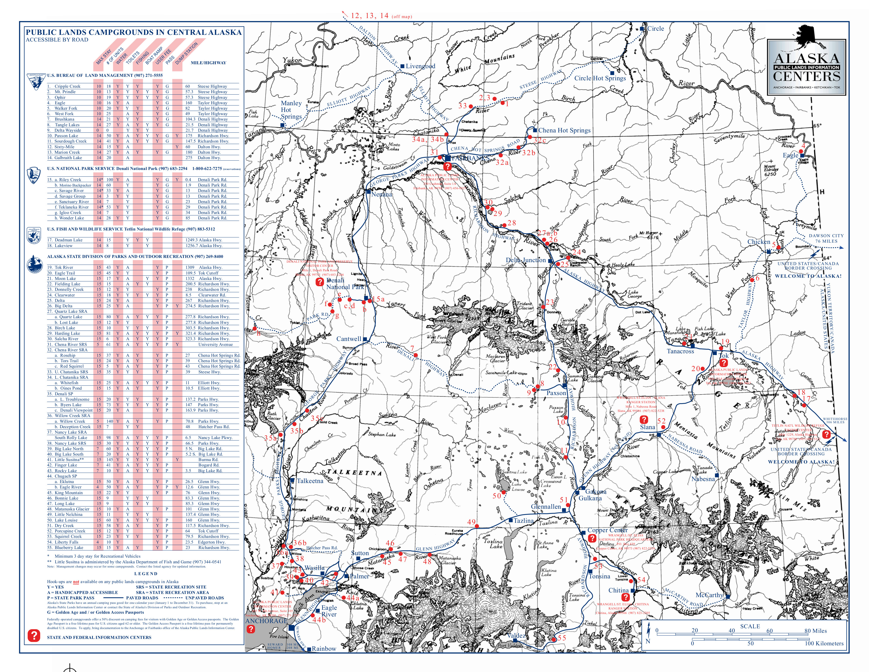 This Wrangell-St Elias campground map shows all the campgrounds in the entire central Alaska region, including Anchorage and Fairbanks. Click the image to view a full size JPG (2.5 mb) or download the PDF (2.0 mb).
Various Wrangell-St Elias maps
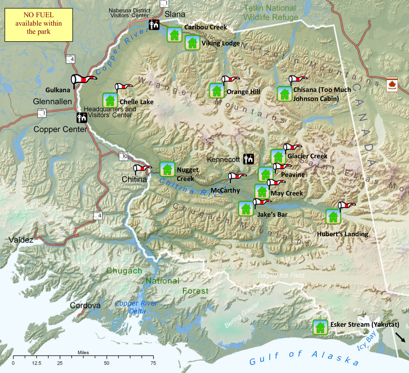 This is a Wrangell-St Elias airstrip and cabin map (600 kb), showing the general locations of each of the park’s airstrips and cabins. For when you want to take your airplane out for a quick trip, naturally.
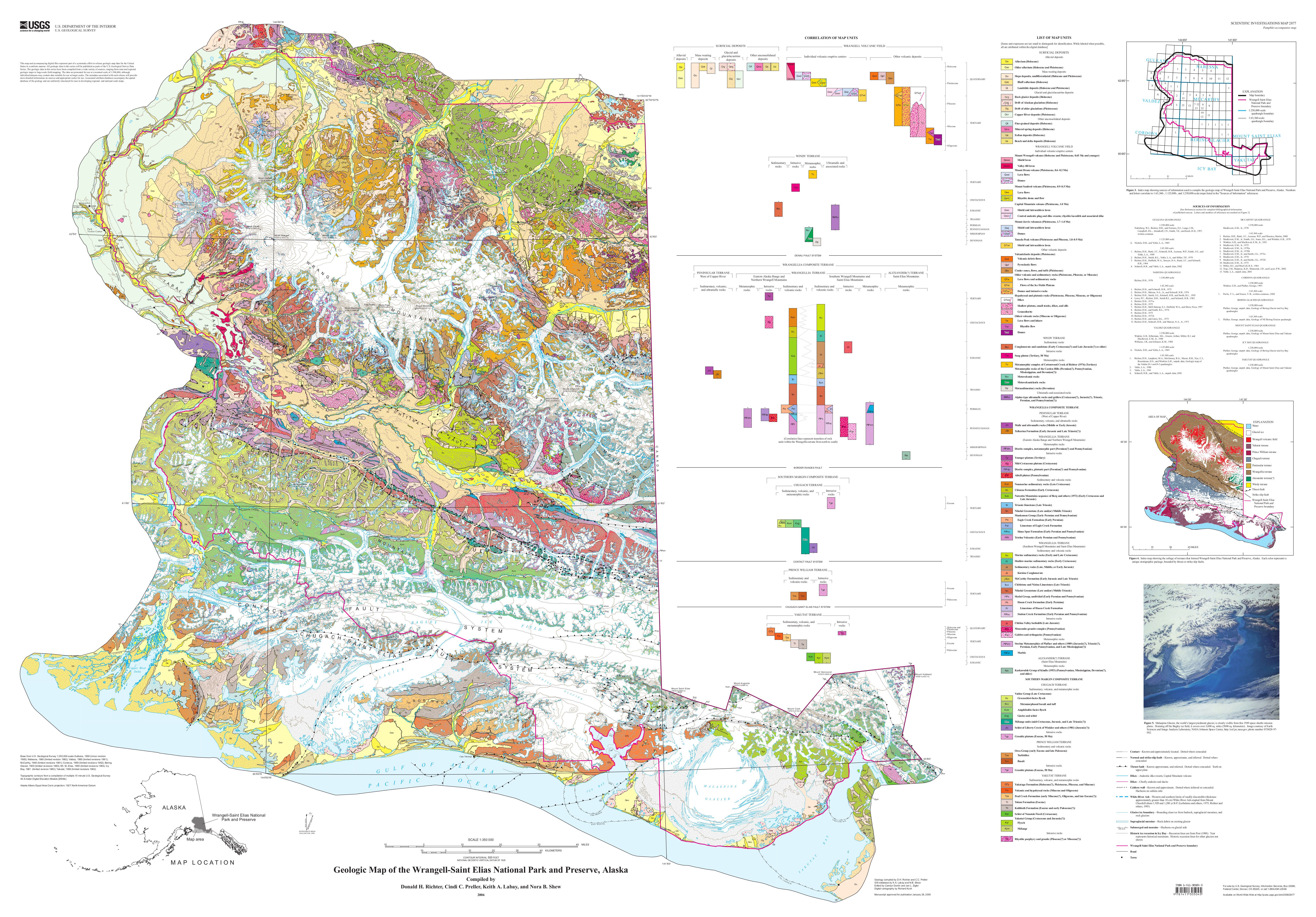 Here’s a Wrangell-St Elias geologic map, which has got to be one of the most complicated geologic maps in the nation! Click the image to view a full size JPG (8.6 mb) or download the PDF (21.0 mb).
…and more!
< Return to National Park Maps home
< Return to Park List
< Return to List by State
Need more help? Browse Amazon’s best-selling Wrangell-St Elias maps and guidebooks.