If you’re looking for a Women’s Rights map, you’ve come to the right place; currently I’ve collected 3 free Women’s Rights National Historical Park maps to view and download. (PDF files and external links will open in a new window.) On this page you’ll find maps showing the location of park buildings as well as a more general map showing the entire region. You can also browse the best-selling Upstate New York maps and guidebooks on Amazon.
Women’s Rights map from the park brochures
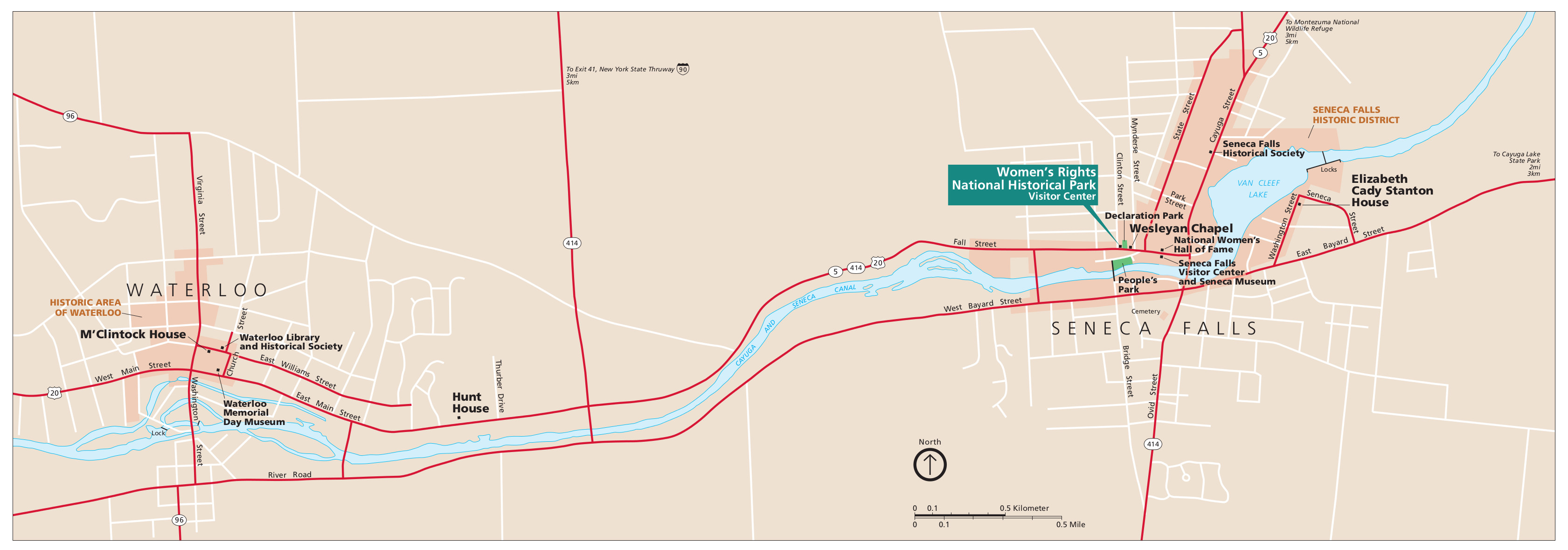 Here is the official Women’s Rights map from the brochure, showing the park land in Seneca Falls and Waterloo. Click the image to view a full size JPG (200 kb) or download the PDF (700 kb).
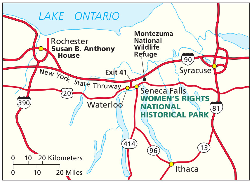 This is a regional Women’s Rights map, showing access to the park from various roads and highways around New York. Click the image to view a full size JPG (150 kb) or download the PDF (75 kb).
…and more!
< Return to National Park Maps home
< Return to Park List
< Return to List by State
Need more help? Browse Amazon’s best-selling Upstate New York maps and guidebooks.