If you’re looking for a Voyageurs map, you’ve come to the right place; currently I’ve collected 17 free Voyageurs National Park maps to view and download. (PDF files and external links will open in a new window.) This page has both summer and winter recreation maps, showing everything from ski and snowmobile trails to houseboat sites, camspites, and hiking trails. You can also browse the best-selling Voyageurs maps and guidebooks on Amazon.
Official Voyageurs map from the brochures
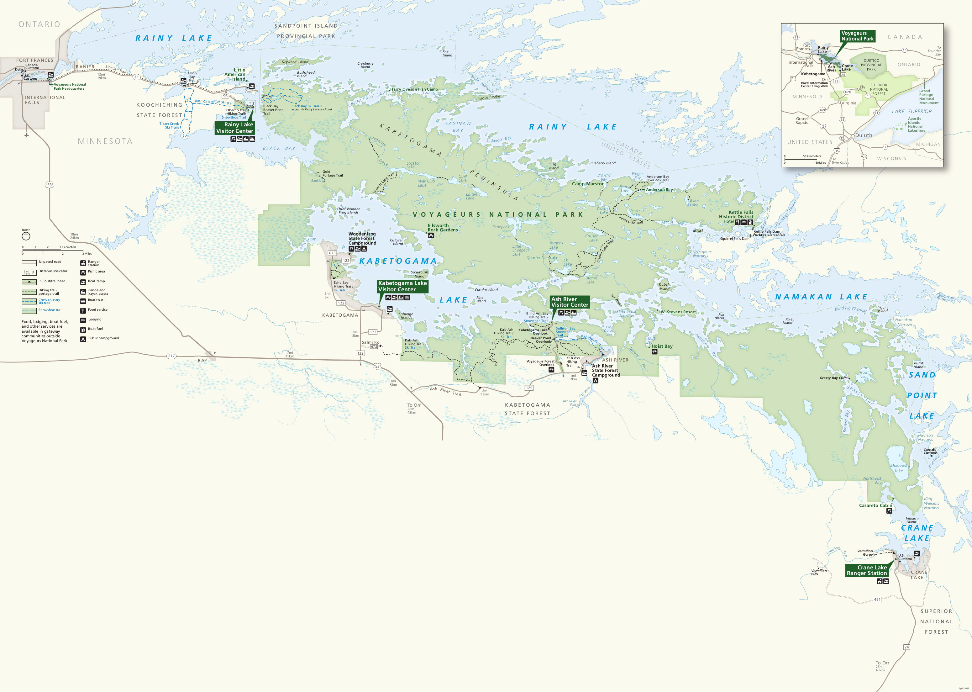 This is the official Voyageurs National Park map from the brochure, showing the visitor centers, trails, campgrounds, islands, and roads. Click the image to view a full size JPG (750 kb) or download the PDF (8.5 mb).
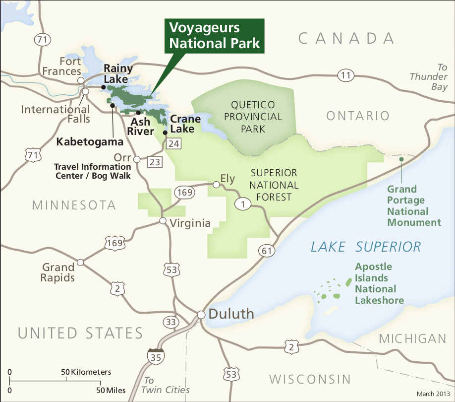 This is a regional map of Voyageurs National Park, which shows the park in relation to International Falls, Duluth, and other cities. Click the image to view a full size JPG (100 kb) or download the PDF (900 kb).
Voyageurs campsite and houseboat maps
 The Voyageurs campsite and houseboat map used to be available for free in the park, but is now out-of-print. Click the image to view a full size JPG (1.5 mb) or download the PDF (650 kb).
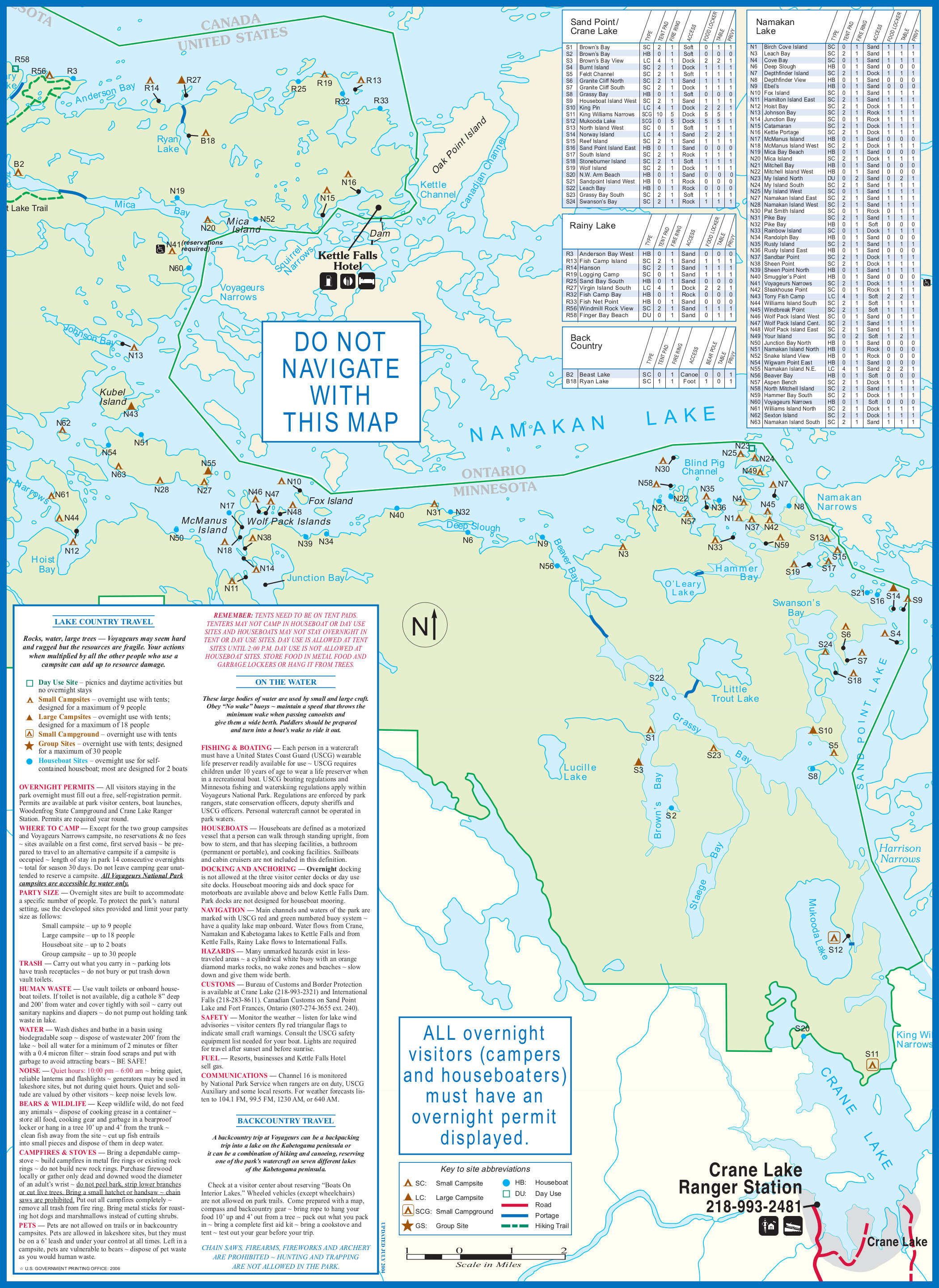 Here is the backside of the Voyageurs campsite and houseboat map, showing Namakan Lake, Sand Point Lake, and Crane Lake. Click the image to view a full size JPG (1.6 mb) or download the PDF (500 kb).
Voyageurs hiking and winter trails maps
 The maps below are nice for short easy day hikes, but the National Geographic Trails Illustrated map is more appropriate if you’re going to do a lot of hiking or boating. It features all the park’s boat-in campsites, so is incredibly helpful if you’re doing any paddling or boat camping. It also labels visitor destinations and points of interest that make worthwhile boating journeys.
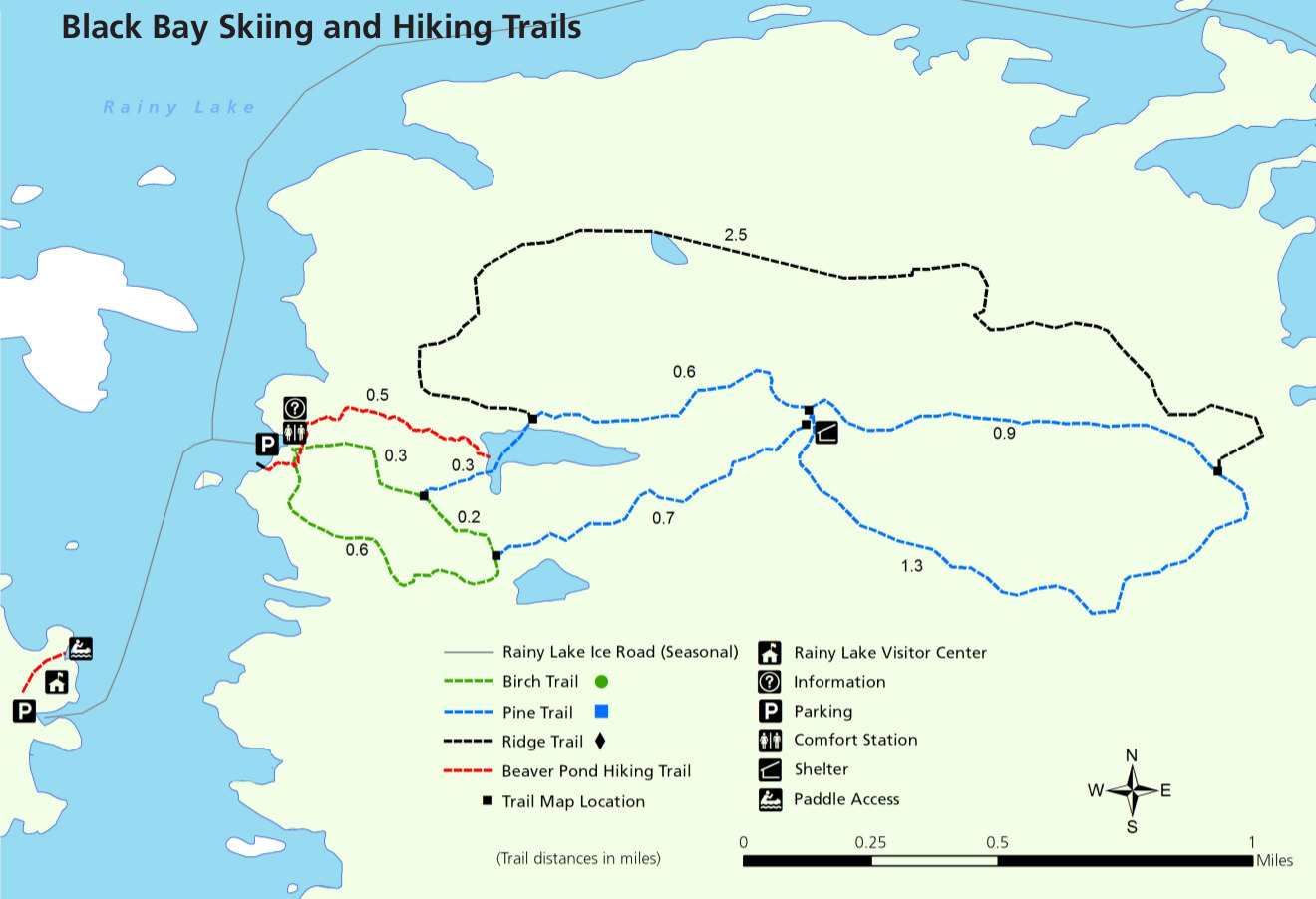 This is a Black Bay ski and hiking trail map (150 kb), showing the summer and winter trails located near the Rainy Lake Visitor Center. These are accessible via the ice road in winter and by boat in summer.
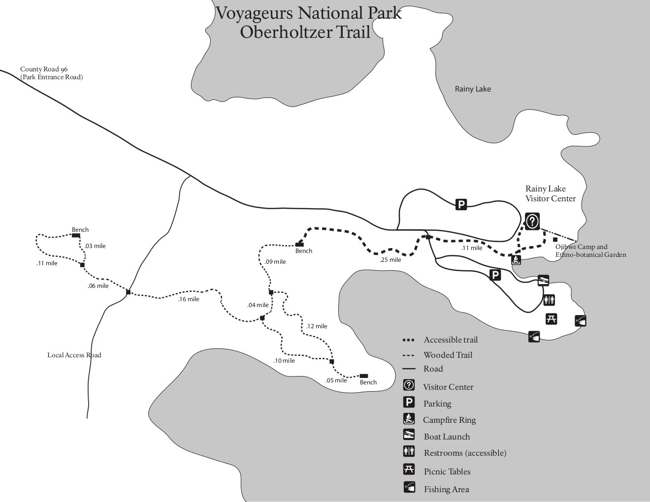 This Oberholtzer Trail map (100 kb), which starts from the Rainy Lake Visitor Center and is great for hiking and snowshoeing. This is one of your hiking options if you don’t have a boat or water transportation.
 Here is an Echo Bay trail map (50 kb), showing both the hiking and ski trails near the Kabetogama Lake Visitor Center area. These trails are accessible by car during summer and winter.
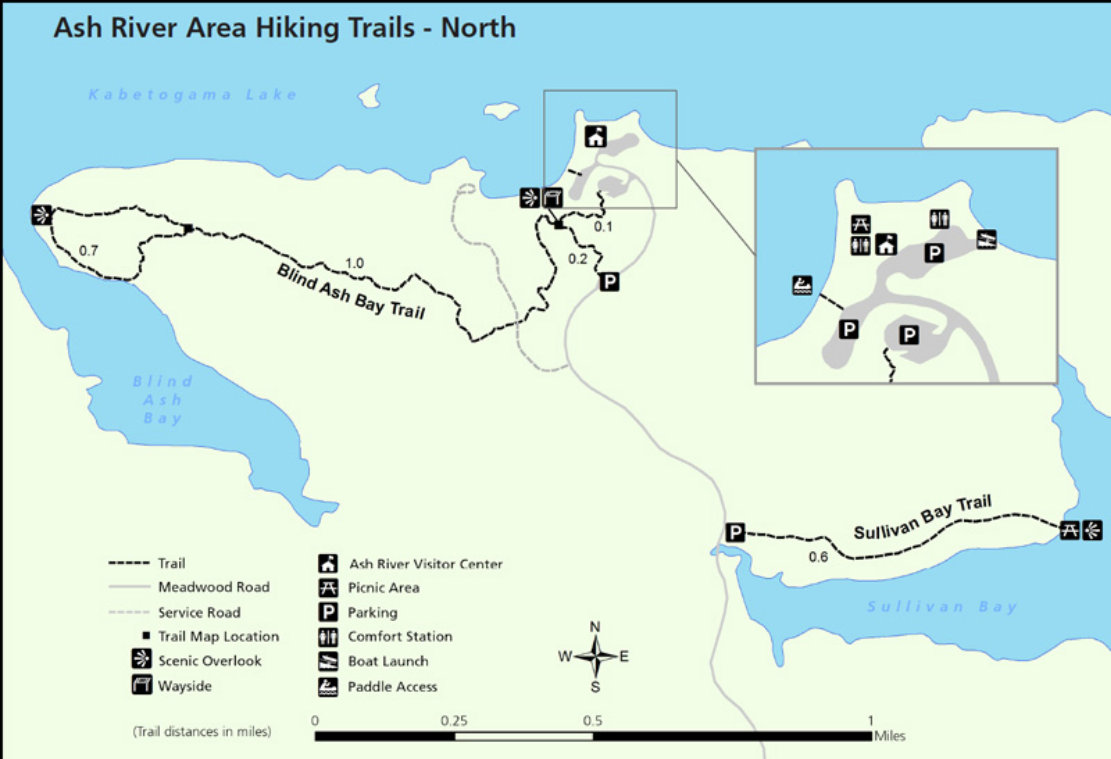 Here is an Ash River trails map (100 kb), including Blind Ash Bay, Sullivan Bay, and other ones near the Ash River Visitor Center. This is the quietest and least busy of the park’s three visitor centers.
 Here is a map of the southern Ash River trails (100 kb), including the eastern portion of the long-distance Kab-Ash Trail the Beaver Pond Overlook, and the Sullivan Bay trail.
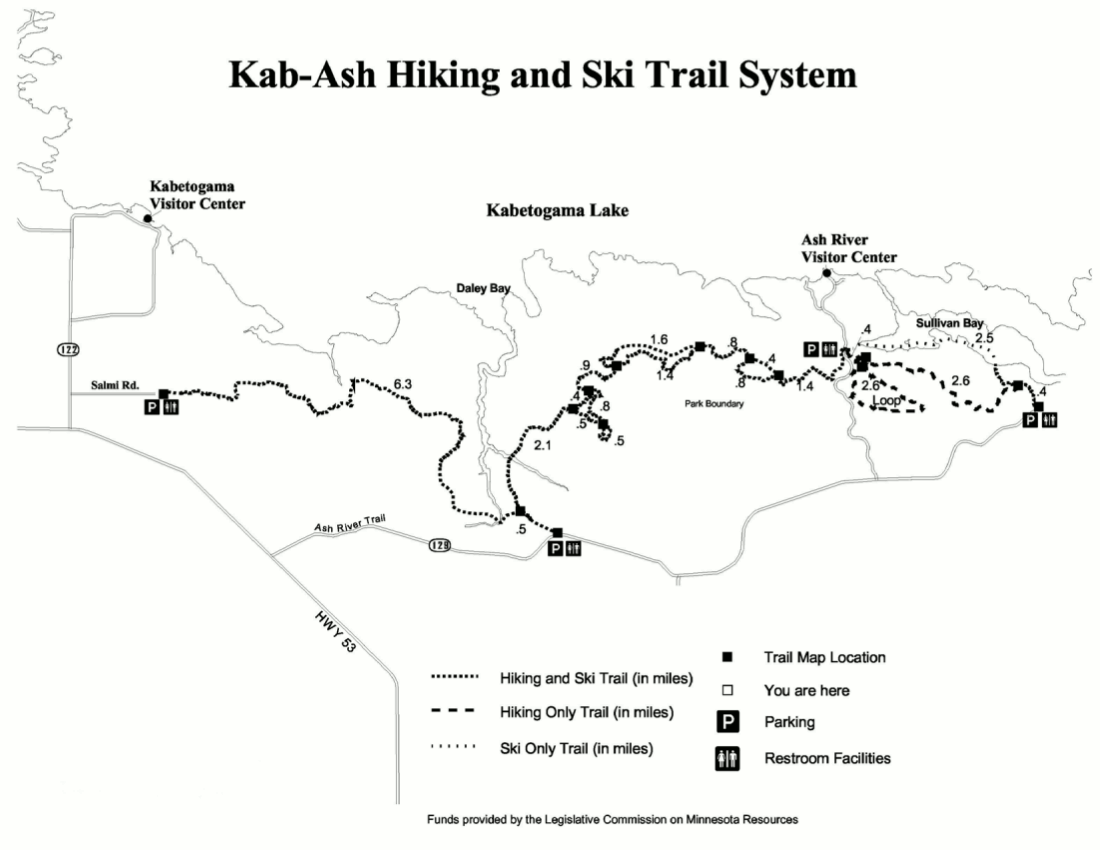 Here is a Kab-Ash Trail map (100 kb), showing the entire length of the trail from the Ash River area to the Kabetogama Lake Visitor Center area. This map also marks the ski routes open in winter.
 This is a map of the Cruiser Lake trail system (100 kb), accessible only by boat from both Rainy Lake and Kabetogama Lake. This will give you a much more wilderness-type experience than anything accessible by car.
Voyageurs lodging map
 For staying overnight near Voyageurs National Park, you’ll need to find lodging in International Falls if you want a hotel. To the right you can open a Hotels.com interactive lodging map to see the few options in town. There aren’t many, but there are a few nice ones; here’s a link to Hotels.com’s top-rated Voyageurs area lodging to compare reviews, amenities, photos, and prices.
Voyageurs snowmobile map
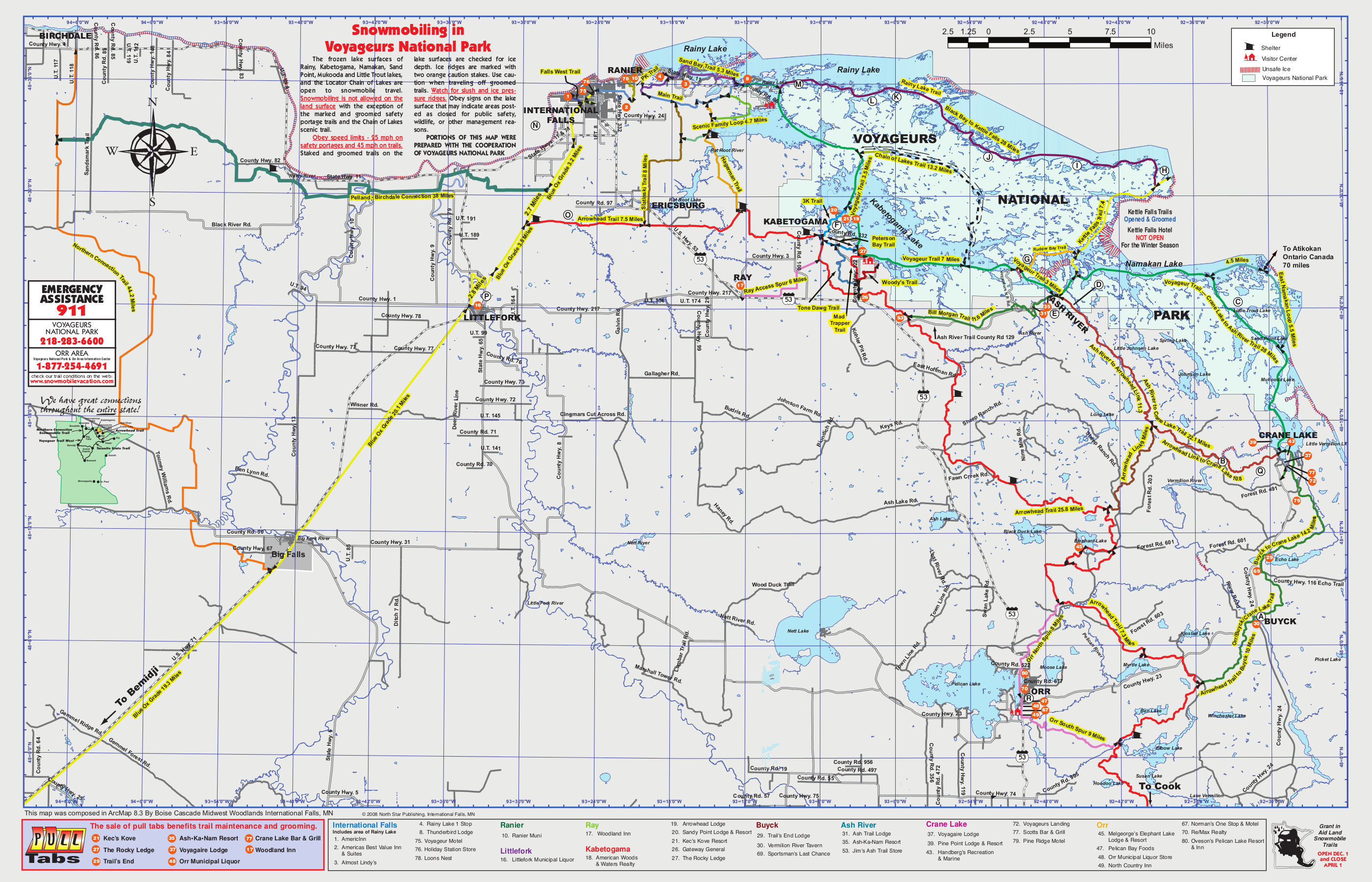 Here’s a snowmobile trails map, showing the trails inside Voyageurs as well as in the surrounding area. Click the image to view a full size JPG (1.5 mb) or download the PDF (3.2 mb).
Voyageurs day use sites maps
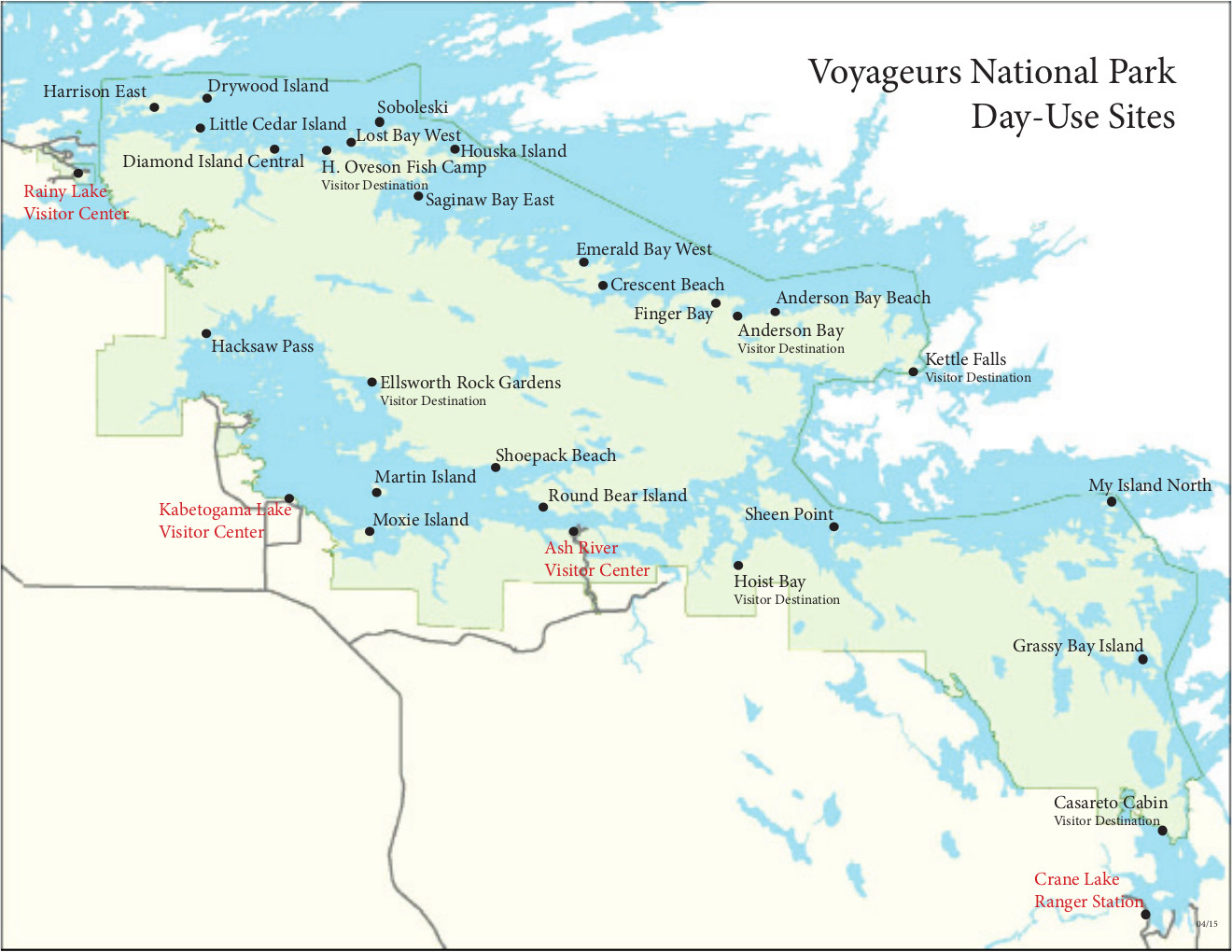 This is a map of all the day use sites (250 kb) in Voyageurs National Park, accessible from the water on all lakes in the park. You cannot camp in these sites, but they make for great picnics.
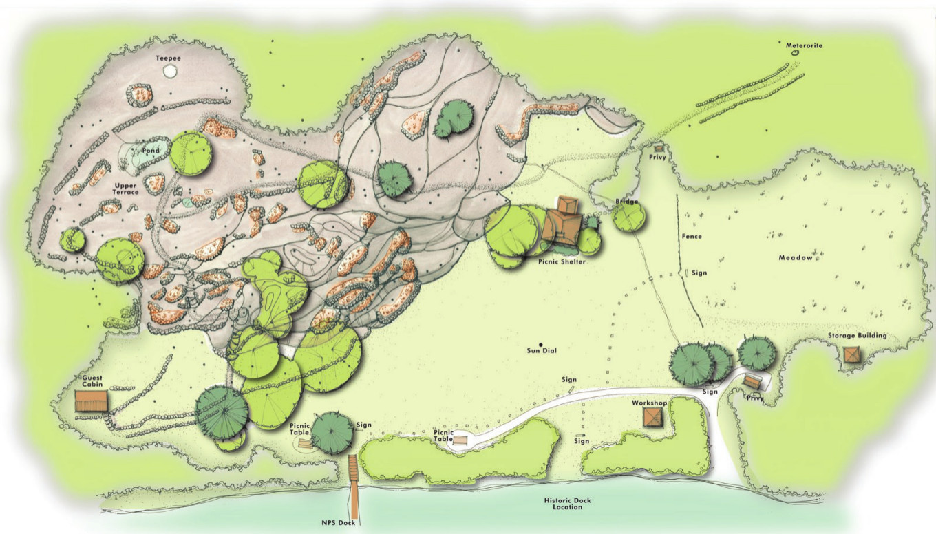 Here’s a detailed Ellsworth Rock Gardens map (250 kb), located on Kabetogama Lake a bit northeast of the Kabetogama Visitor Center. You can take one of the park’s boat tours to visit this location.
Scientific Voyageurs maps
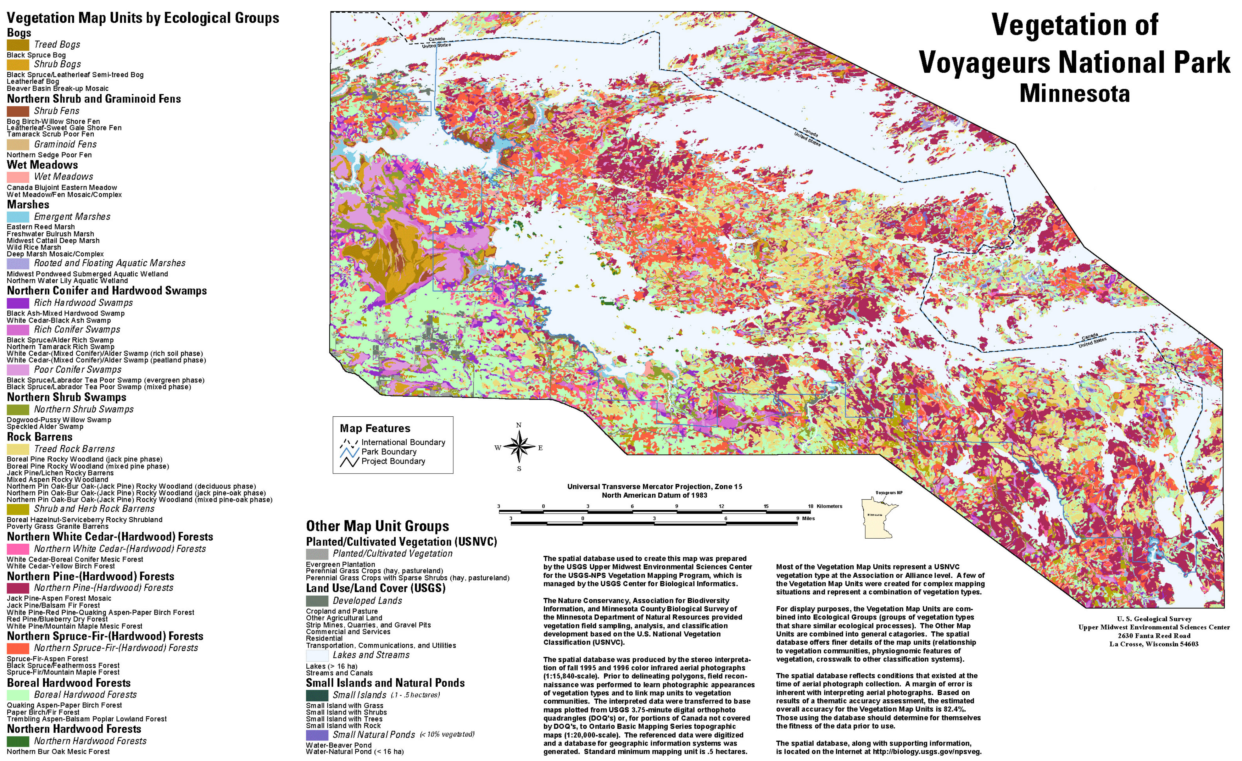 Here’s a Voyageurs vegetation map (2.2 mb), showing the location of different forest types as well as bogs, marshes, swamps, and meadows across the roadless Kabetogama Peninsula.
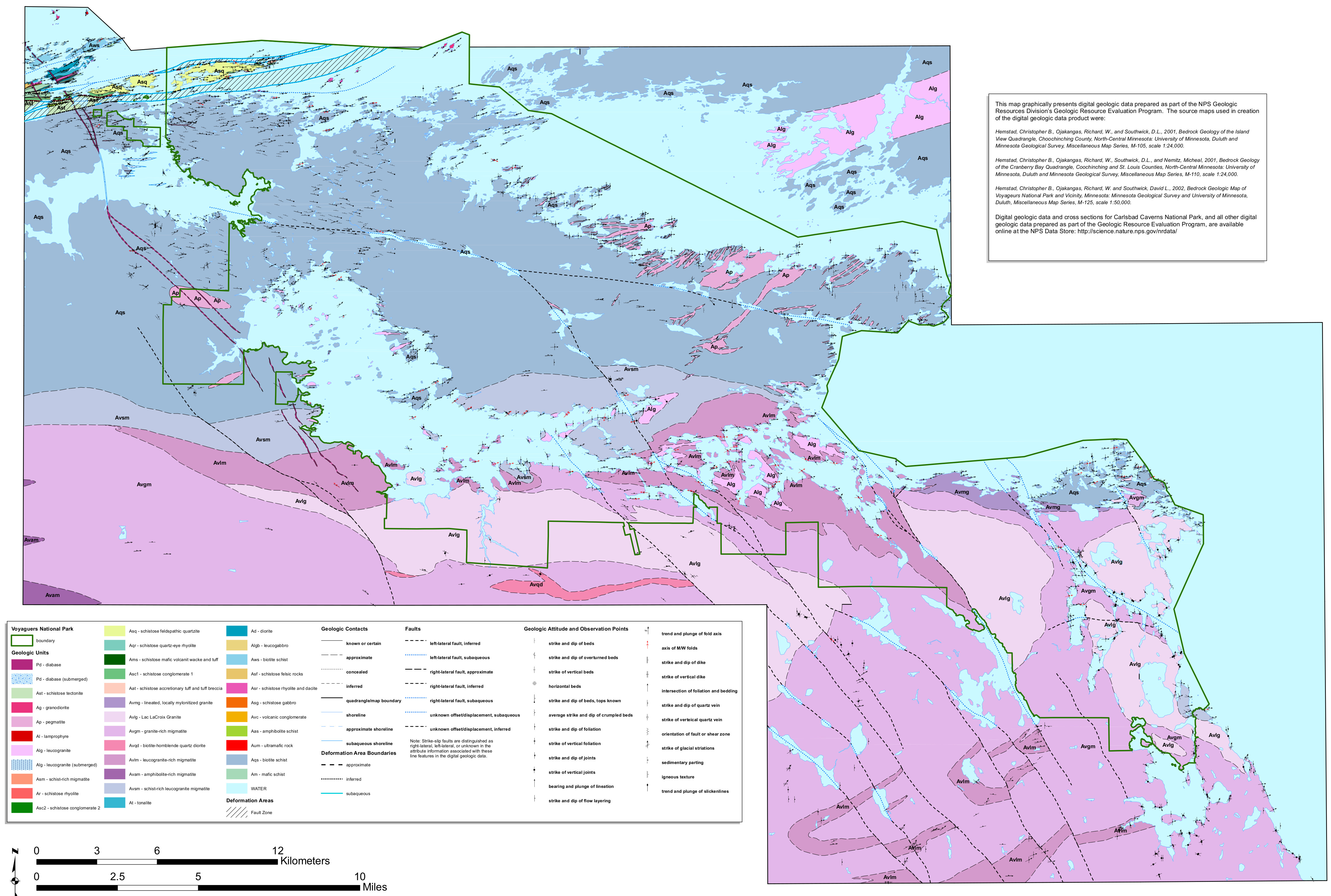 The geologic map of Voyageurs (2.2 mb) shows the very old geology of the park, made mostly of ancient Precambrian metamorphic rocks – older than even the ones at the bottom of the Grand Canyon.
…and more!
< Return to National Park Maps home
< Return to Park List
< Return to List by State
Need more planning help? Browse Amazon’s best-selling Voyageurs maps and guidebooks.