If you’re looking for a Valley Forge map, you’ve come to the right place; currently I’ve collected 13 free Valley Forge National Historical Park maps to view and download. (PDF files and external links will open in a new window.) Here you’ll find maps that show hiking and biking trails as well as those that cover the area’s history. You can also browse the best-selling Valley Forge books on Amazon.
Valley Forge maps from the park brochure
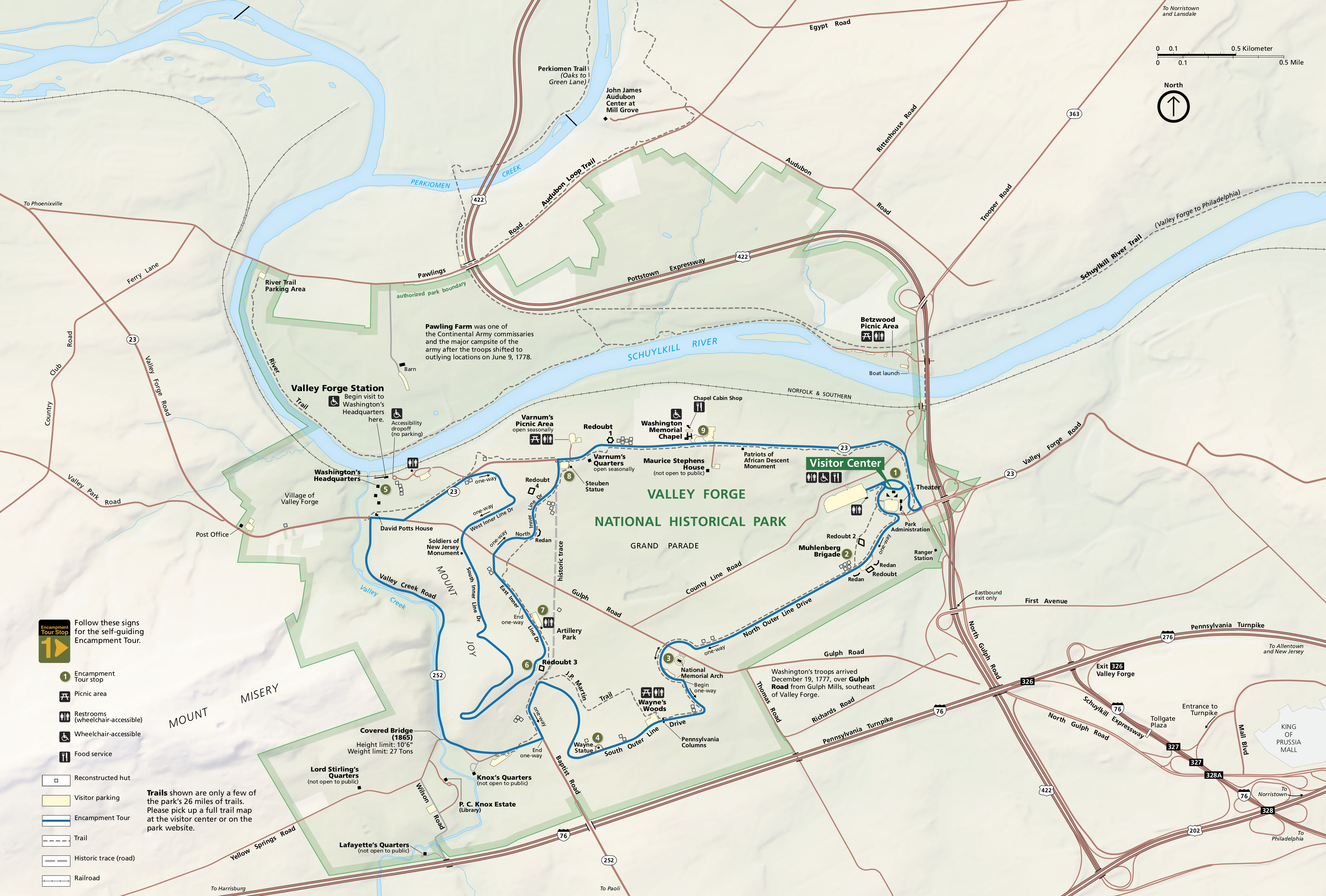 Here is the official Valley Forge map showing the various tour routes, trails, roads, and points of interest. Click the image to view a full size JPG (1.7 mb) or download the PDF (17.9 mb).
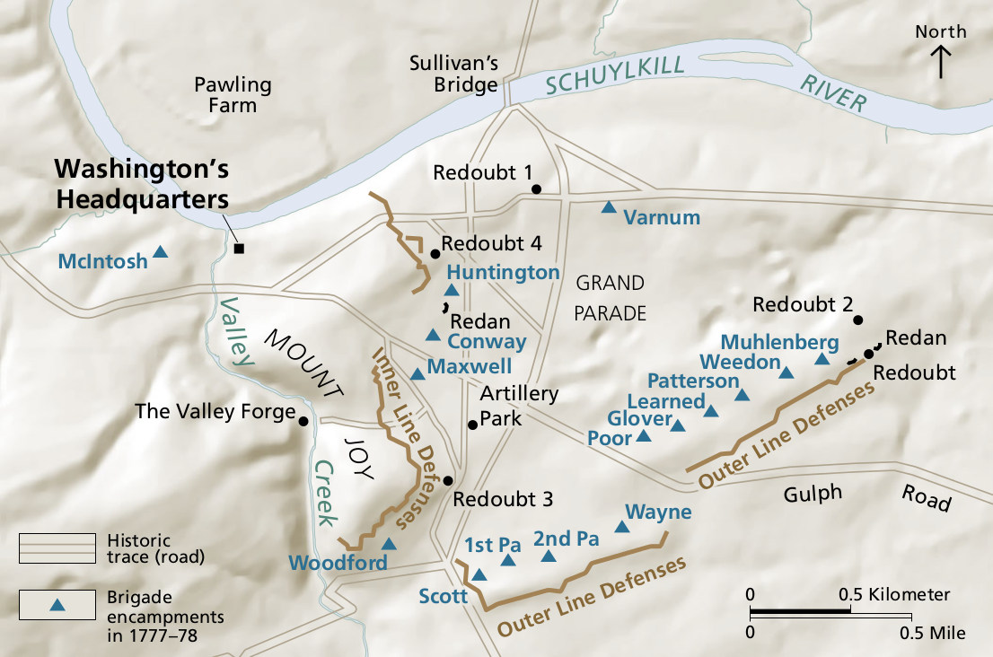 Here’s a Valley Forge historical map showing the layout of Washington’s encampments during the winter of 1777-78. Click the image to view a full size JPG (200 kb) or download the PDF (3.0 mb).
Valley Forge trail maps
 This is a Valley Forge trail map, labeling and color coding all the trails in Valley Forge National Historical Park. Click the image to view a full size JPG (700 kb) or download the PDF (550 kb).
 Here’s a Valley Forge bike trail map, highlighting the park’s 18+ miles of bicycle trails north and south of the Schuylkill River. Click the image to view a full size JPG (500 kb) or download the PDF (400 kb).
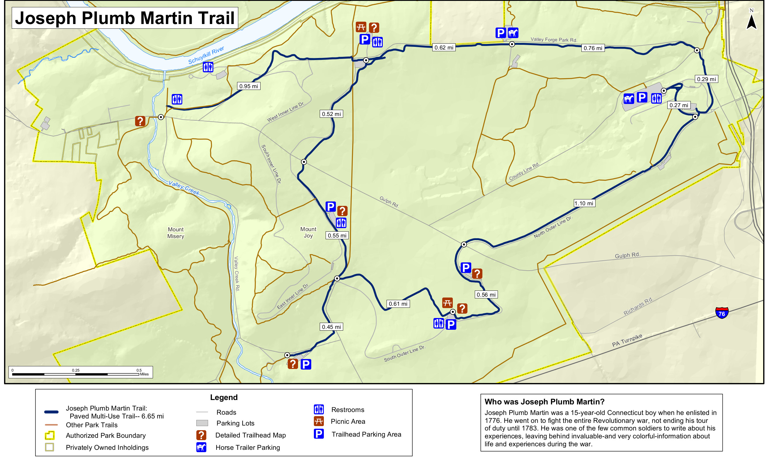 The Joseph Plumb Martin trail map (750 kb) shows this hilly and relatively unshaded bicycle and pedestrian trail connecting many of the park’s features. This makes a nice six-and-a-half-mile loop.
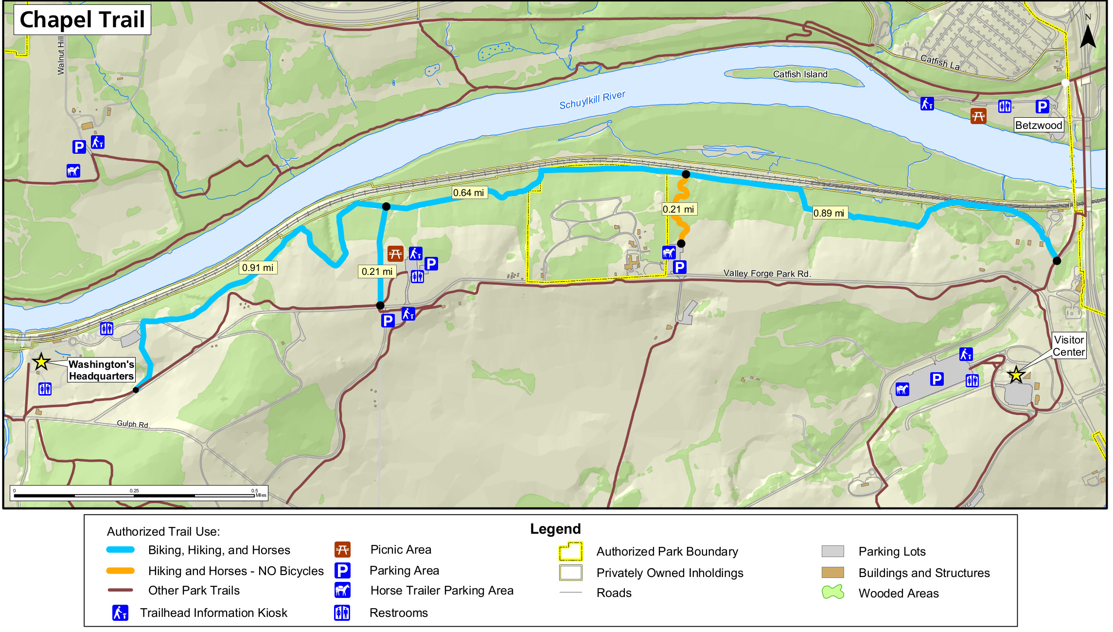 This Chapel trail map (650 kb) shows this mostly-flat route (for biking, hiking, horses) near the railroad tracks south of the Schuylkill River, roughly from Washington’s headquarters to the visitor center.
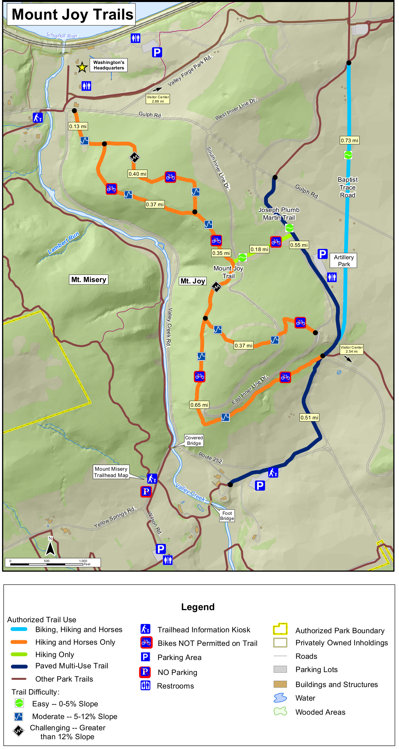 This is a Mt. Joy trail map (700 kb) that shows the hilly trails around Mt. Joy that have some nice views looking over Valley Forge and Valley Creek. The Mount Joy trails are mostly for hikers and horses.
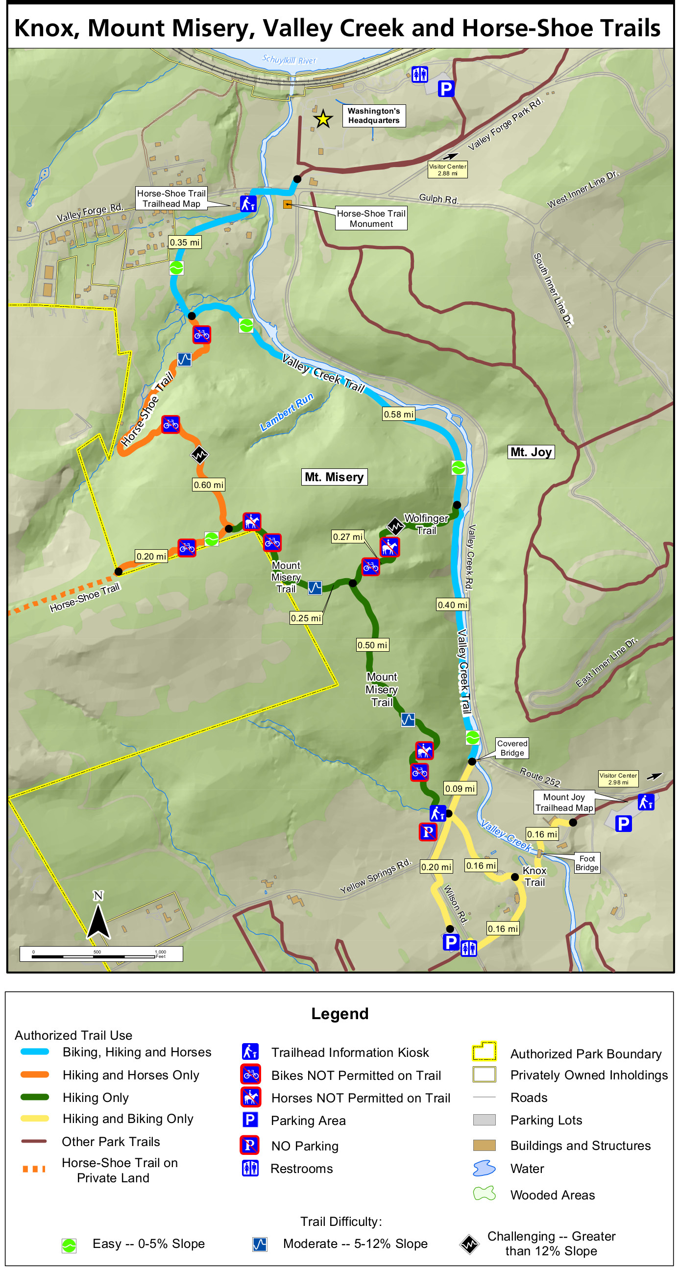 Here’s a Mt. Misery trail map (750 kb) that focuses on the various trails west of Valley Creek that travel on and around Mt. Misery, which is across Valley Creek west of Mt. Joy.
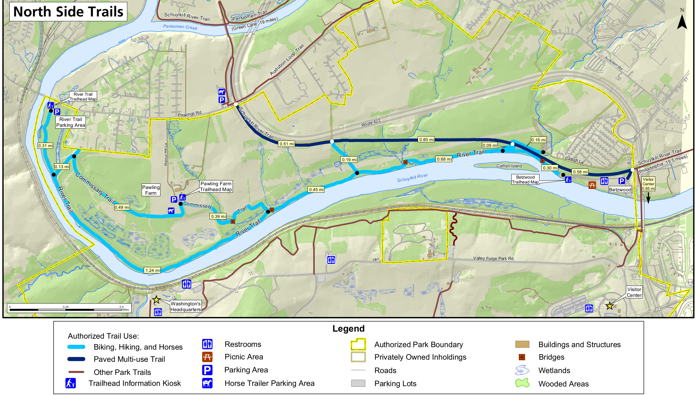 The north side trails map (900 kb) shows the trails north of the Schuylkill River including the River trail, Commissary trail, and Schuylkill River trail. The majority of these are multiuse, for hikers, bikers, and horses.
Valley Forge monuments map
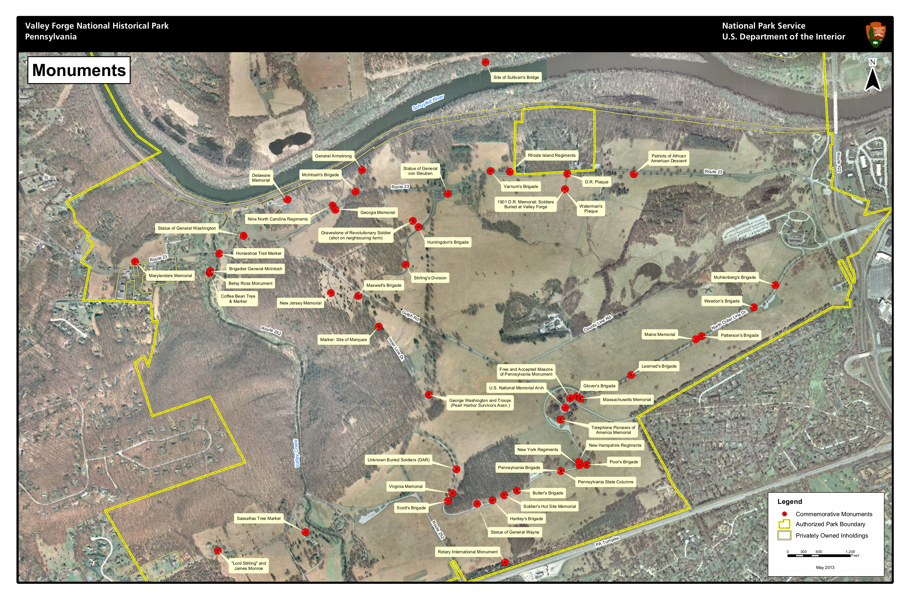 This monuments map of Valley Forge (1.8 mb) shows the location of each commemorative monument inside the Valley Forge National Historical Park, overlaid on a satellite photo.
Valley Forge geologic map
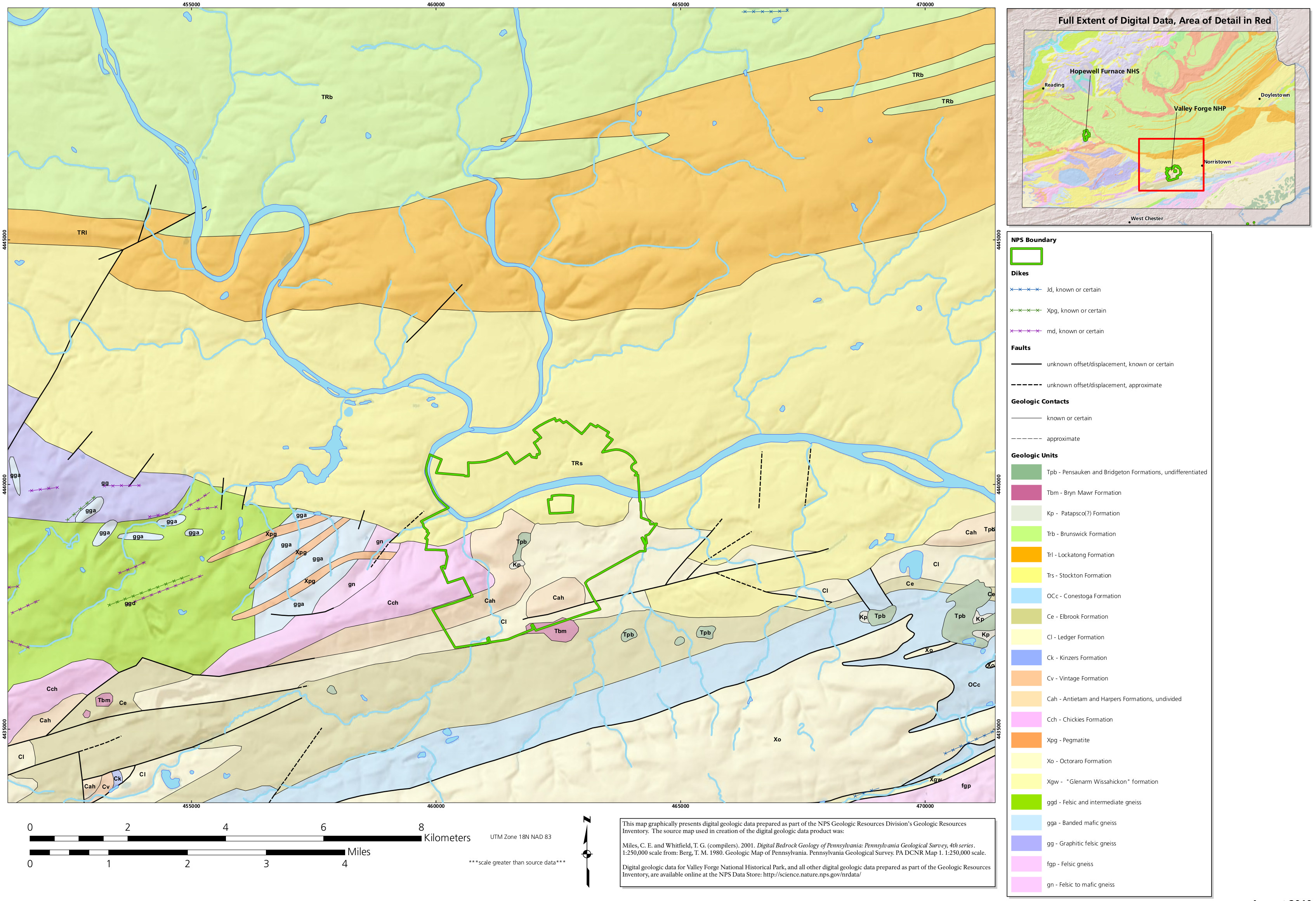 Here’s a geologic map of Valley Forge National Historical Park (1.2 mb), including the rock layers within the park boundaries as well as outside the actual park itself in surrounding Pennsylvania.
Valley Forge land cover map
 This Valley Forge vegetation map (550 kb) shows the forests present in the park, as well as other types of land cover, such as plantations, cropland, quarries, meadows, and human development.
…and more!
< Return to National Park Maps home
< Return to Park List
< Return to List by State
Need more help? Browse Amazon’s best-selling Valley Forge books.