If you’re looking for a Sunset Crater map, you’ve come to the right place; currently I’ve collected 5 free Sunset Crater Volcano National Monument maps to view and download. (PDF files and external links will open in a new window.) On this page you’ll find detail maps covering the Sunset Crater Volcano, hiking trails, and other Flagstaff-area national parks. You can also browse best-selling Flagstaff maps and guidebooks on Amazon.
Sunset Crater brochure maps
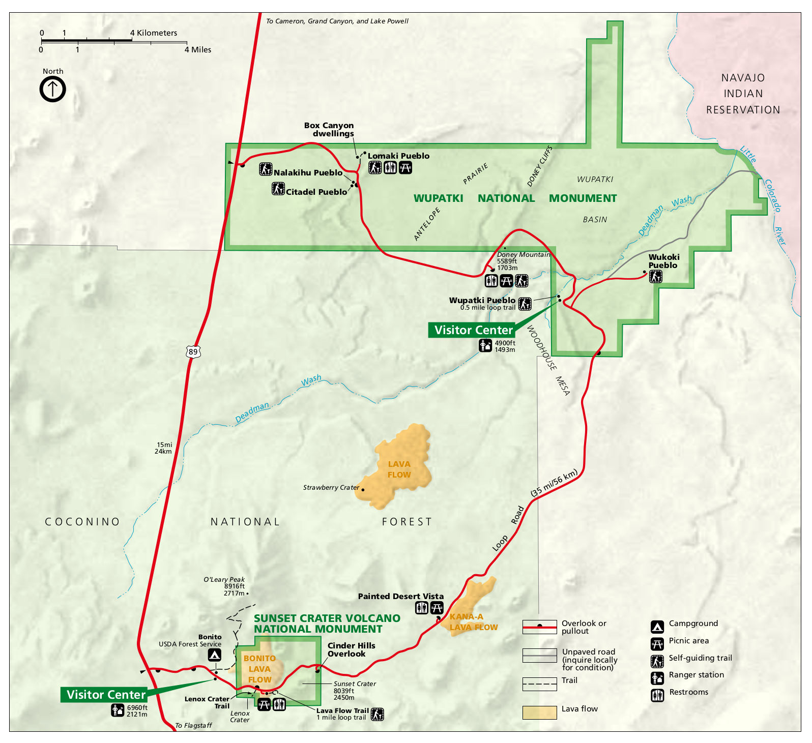 This is the official Sunset Crater map, which also includes nearby Wupatki National Monument, connected by the Loop Road. Click the image to view a full size JPG (300 kb) or download the PDF (150 kb).
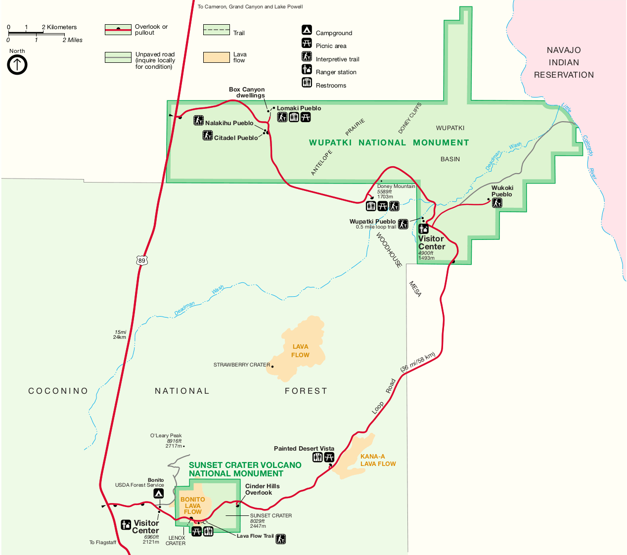 The printable Sunset Crater Volcano map is basically the same as the map above, but it prints nicer on black-and-white printers. Click the image to view a full size GIF (100 kb) or download the PDF (50 kb).
Other Sunset Crater maps
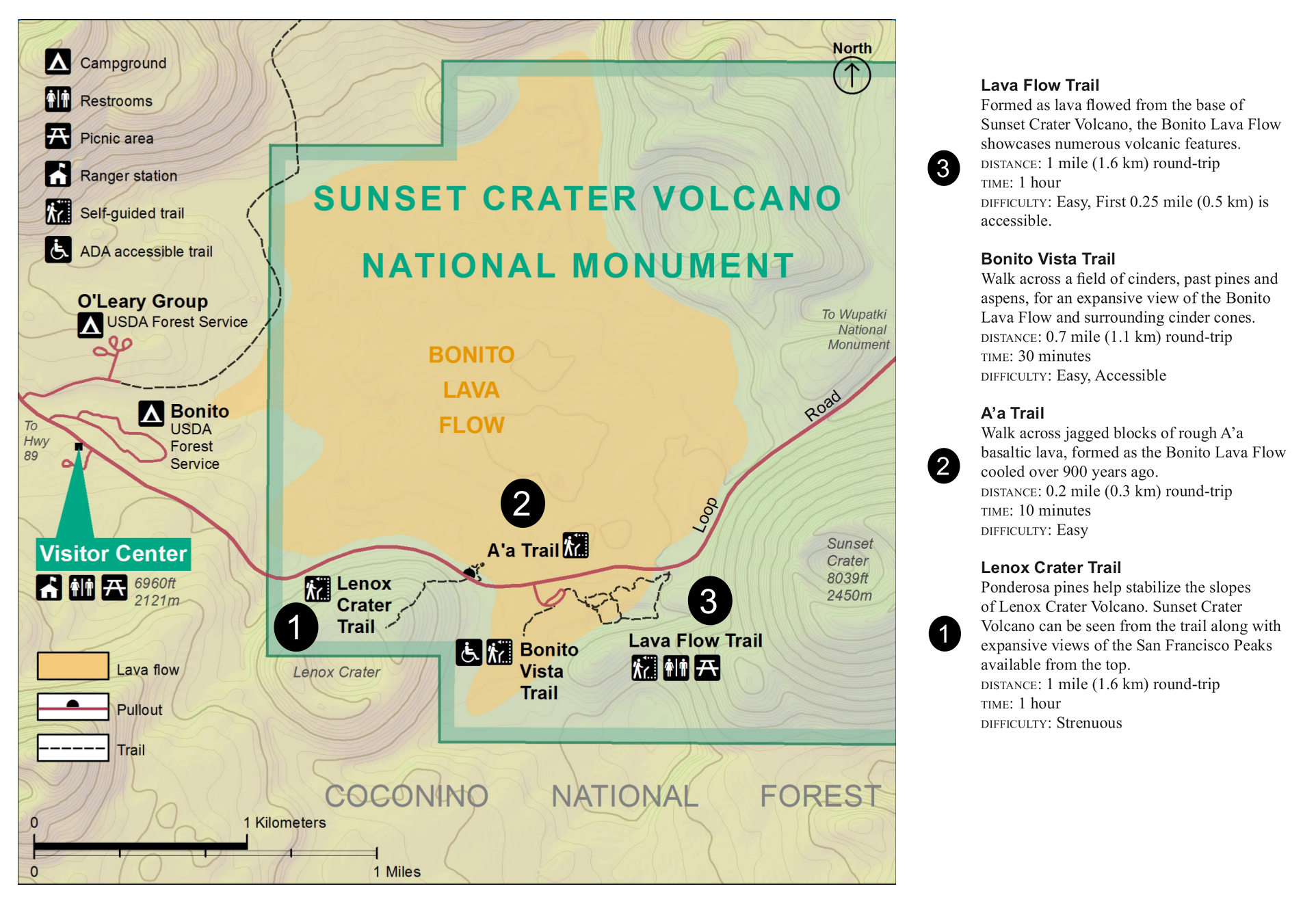 Here’s a Sunset Crater trail map (400 kb), showing a few of the park trails, complete with topo lines. Trail distances and descriptions are also provided, along with time estimates to complete each hike.
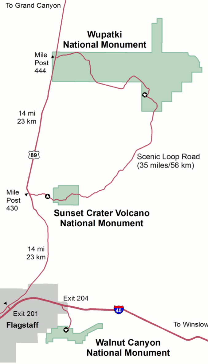 This regional map of Sunset Crater (75 kb) also includes Walnut Canyon and Wupatki National Monuments, showing where each of the three parks are in relation to Flagstaff, AZ.
…and more!
< Return to National Park Maps home
< Return to Park List
< Return to List by State
Need more planning help? Browse Amazon’s best-selling Flagstaff maps and guidebooks.