If you’re looking for a Padre Island map, you’ve come to the right place; currently I’ve collected 13 free Padre Island National Seashore maps to view and download (PDF files and external links will open in a new window.) On this page you’ll find the official park brochure maps as well as a bunch of geologic maps. You can also browse the best-selling Texas maps and guidebooks on Amazon.
Padre Island brochure maps
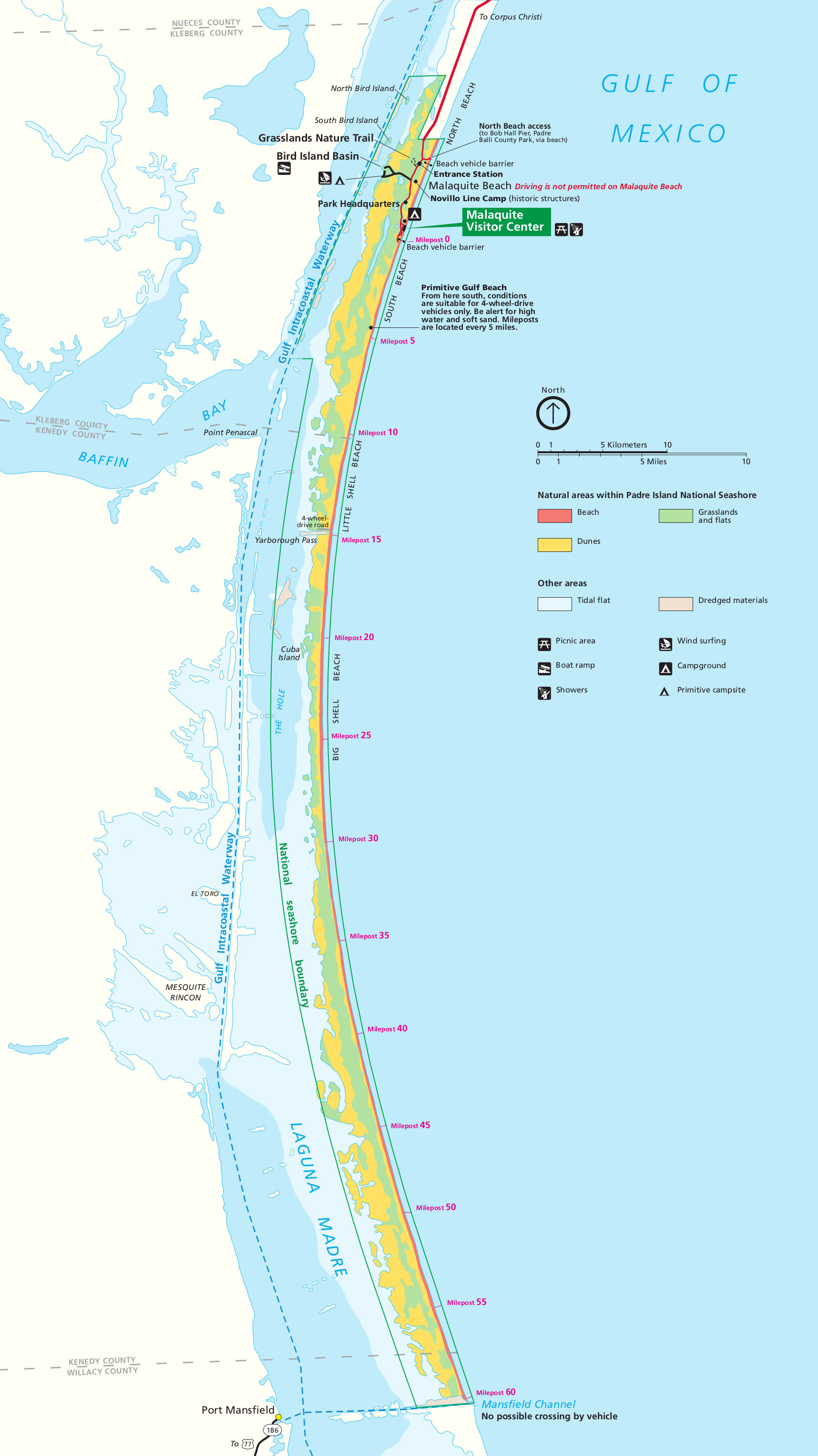 Here is the official Padre Island map from the park brochure, showing the longest stretch of undeveloped barrier island in the world. Click the image to view a full size JPG (500 kb) or download the PDF (1.7 mb).
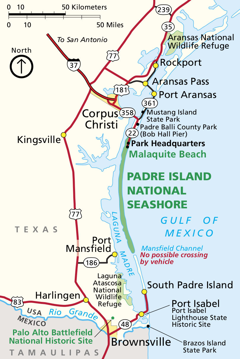 This is a Padre Island National Seashore regional map, zooming out to show Corpus Christi, Brownsville, South Padre Island, and more. Click the image to view a full size JPG (200 kb) or download the PDF (250 kb).
Padre Island geologic maps
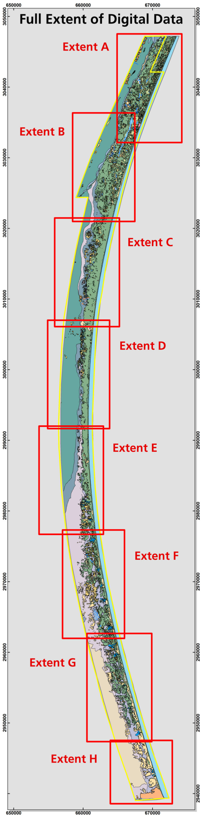 Here is the Padre Island geologic overview map (250 kb), showing the entire park’s geology, but very zoomed out. Each of the locations of the eight highly-detailed geologic maps below are shown here.
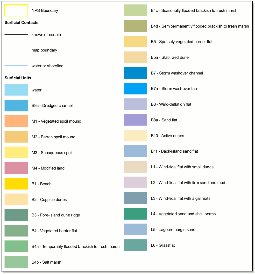 This is the Padre Island geologic map legend (50 kb). Use this as a reference for the labels given to geologic units you’ll see on the eight Padre Island geologic maps below.
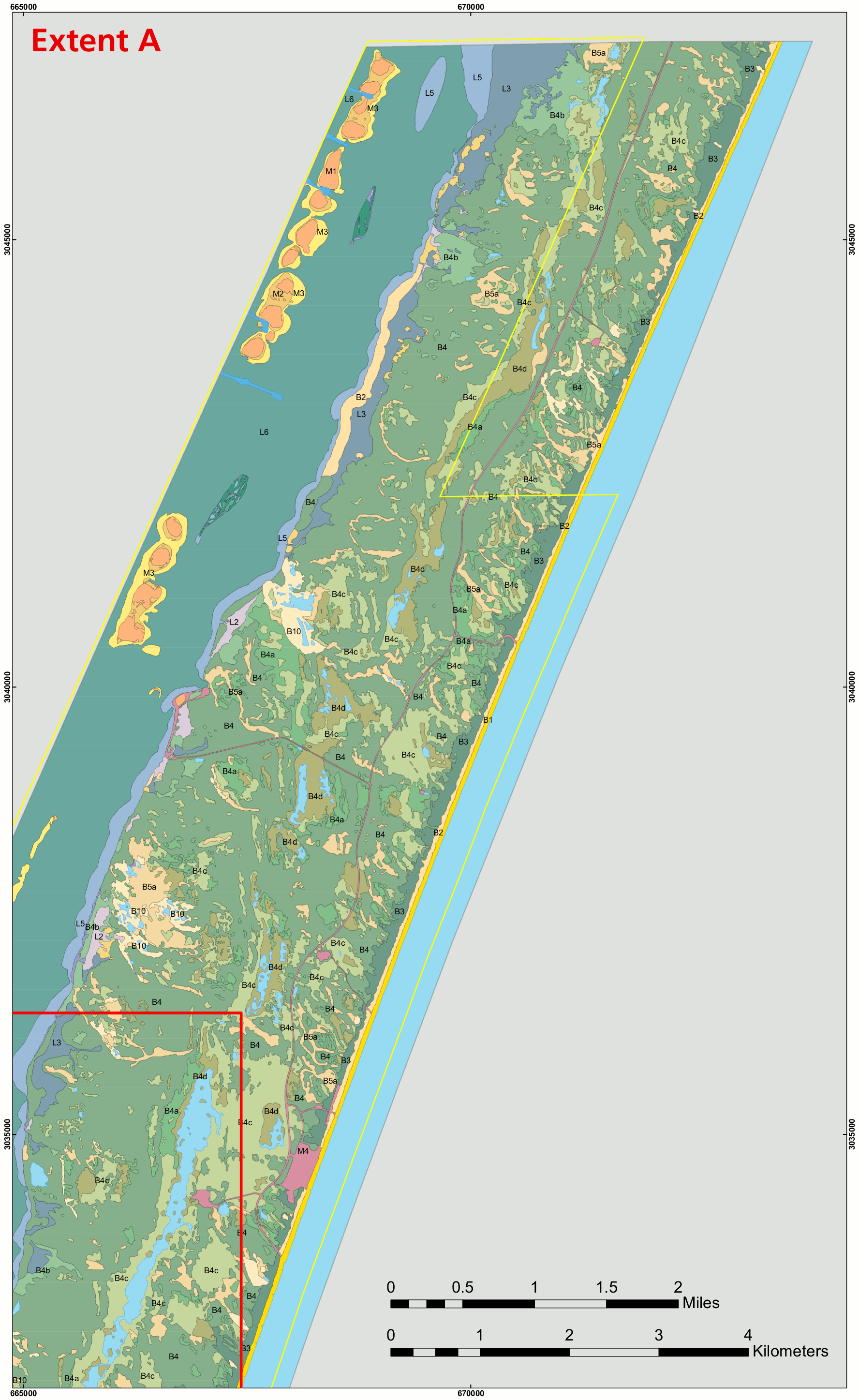 Here’s Padre Island geologic map A (700 kb), the northernmost of the geologic maps on this page. The ones below are in sequential order, from north to south throughout Padre Island.
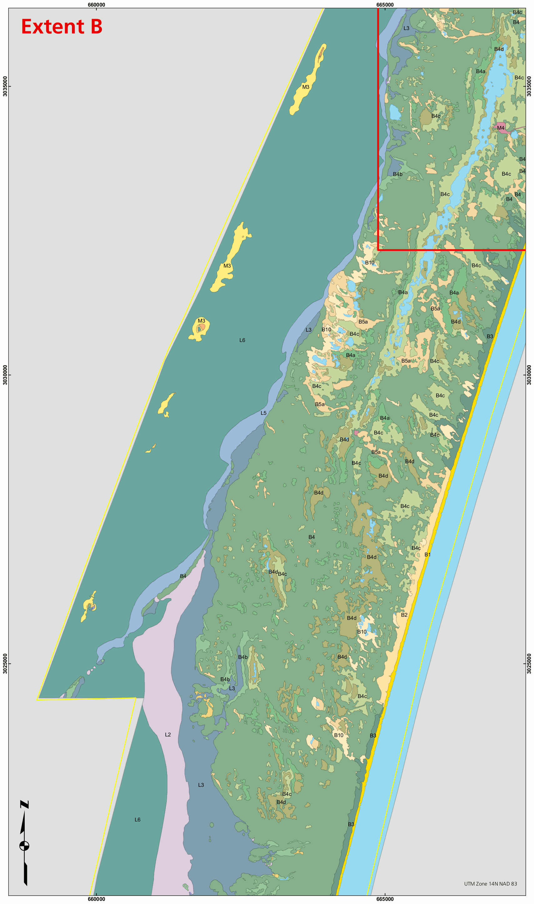 Here’s Padre Island geologic map B (550 kb), showing the area from the end of the park entrance road on down past milepost five, where Padre Island narrows.
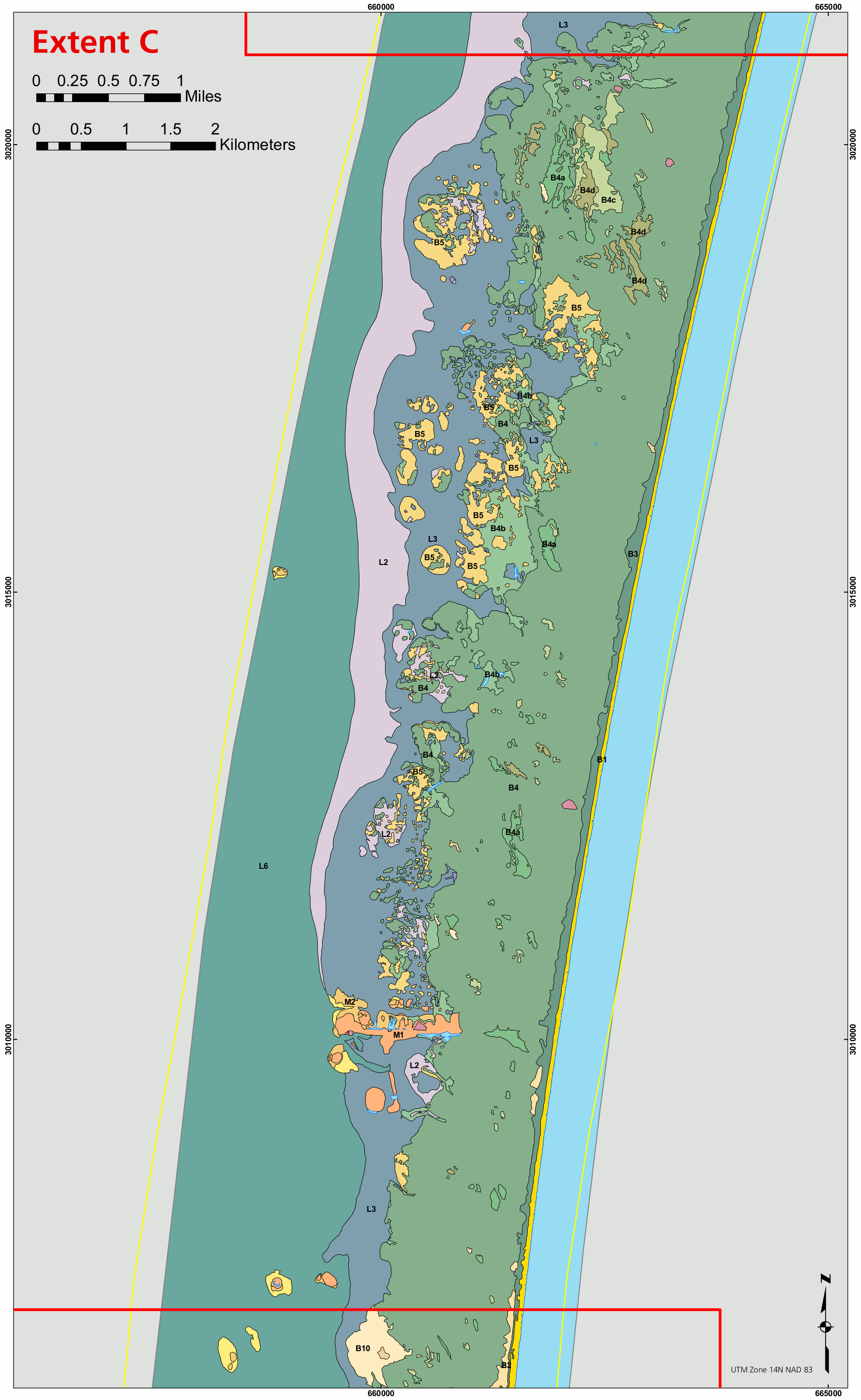 Here’s Padre Island geologic map C (350 kb), which shows the area between mileposts 10 and 15 (and a bit more), including Little Shell Beach and the surrounding area.
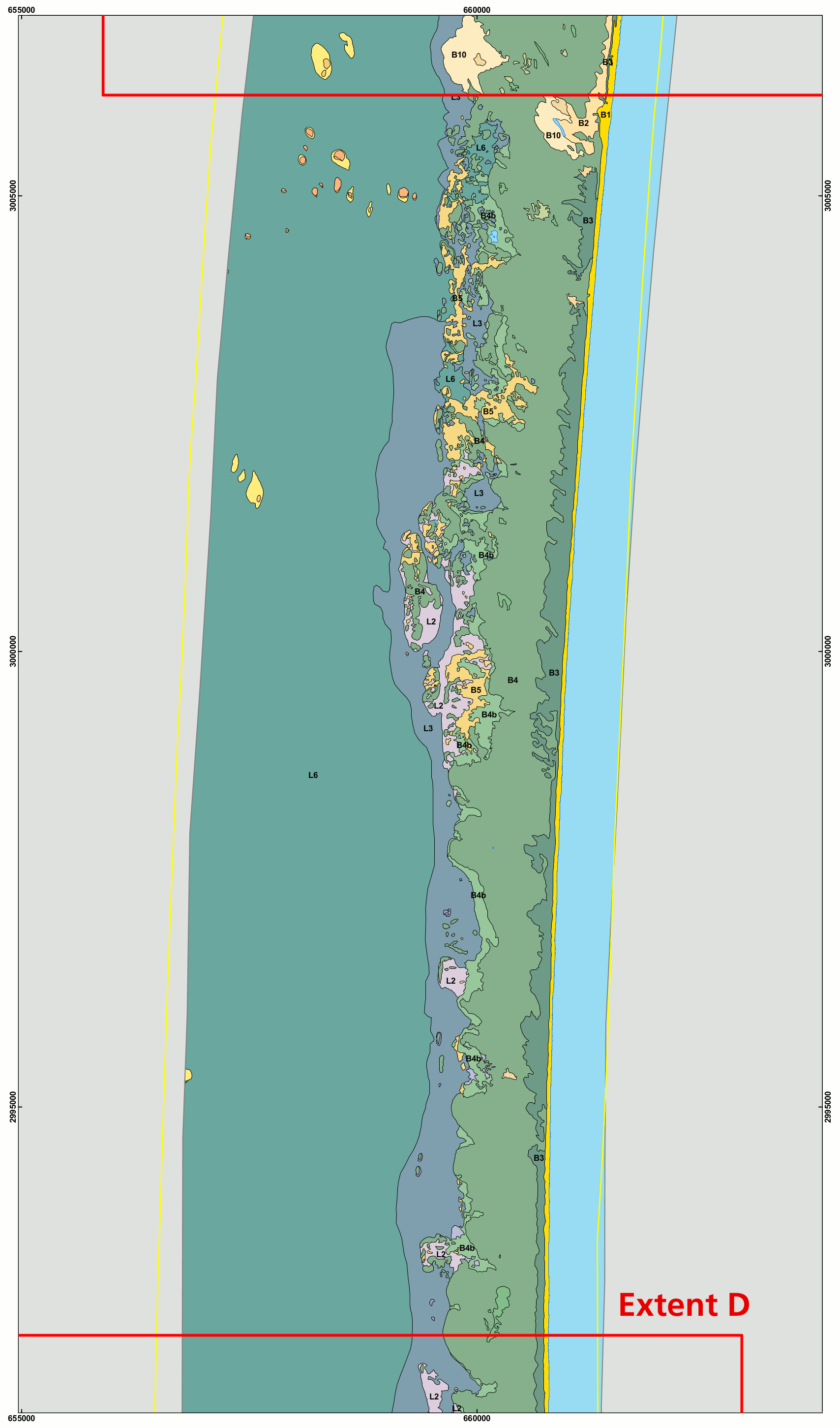 Here’s Padre Island geologic map D (250 kb), a bit further south along the island. This map ranges down past milepost 20, reaching toward Big Shell Beach.
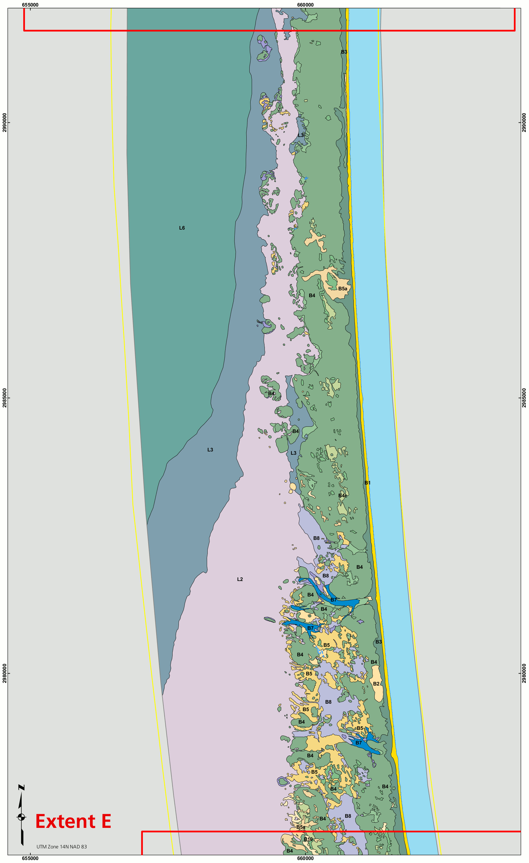 Here’s Padre Island geologic map E (300 kb), approximately covering the area from milepost 25 toward milepost 35, with just a bit of the southern part of Big Shell Beach.
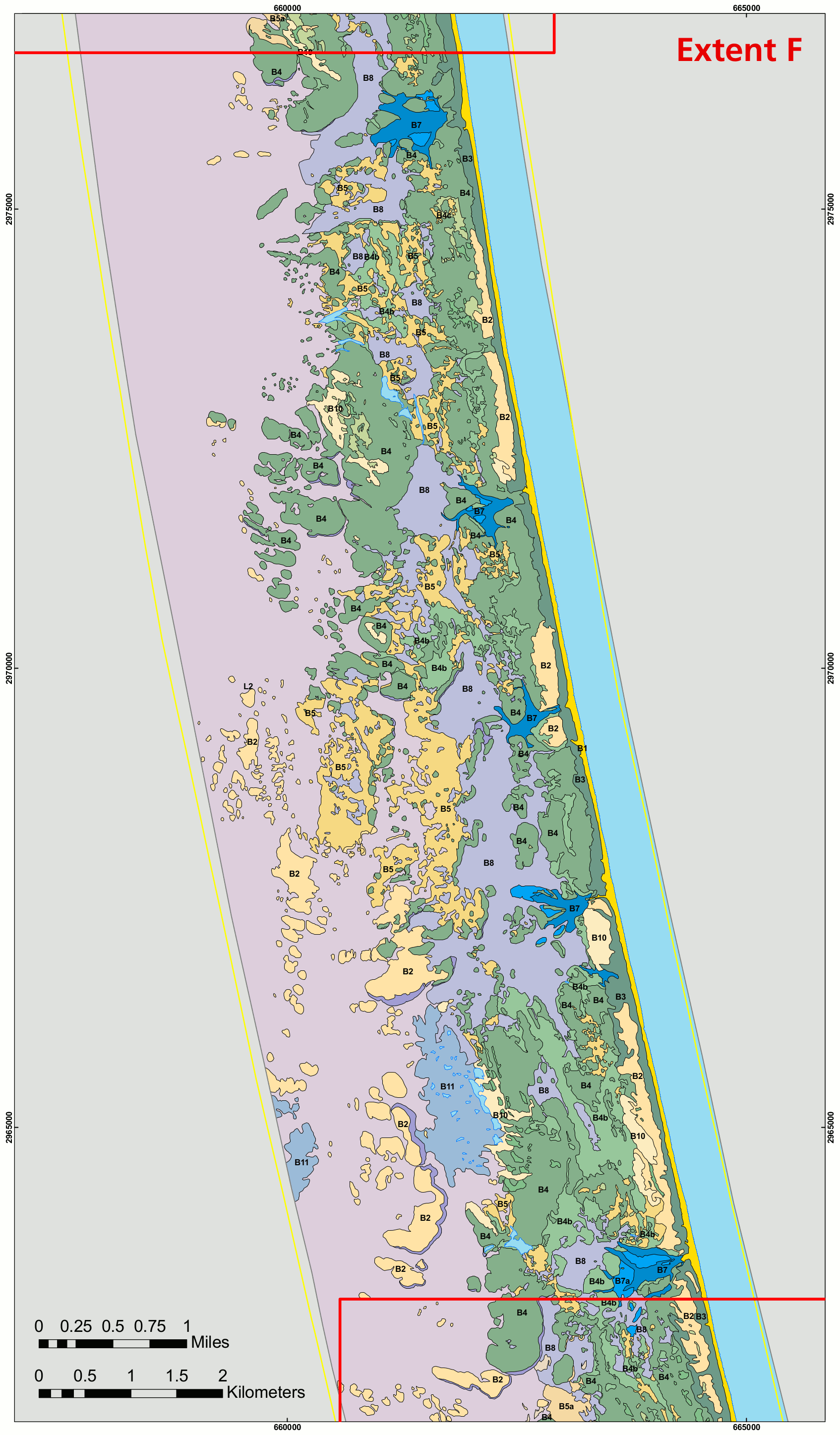 Here’s Padre Island geologic map F (500 kb), showing the area to the north of milepost 45. This map has some of the most varied geology of all of these.
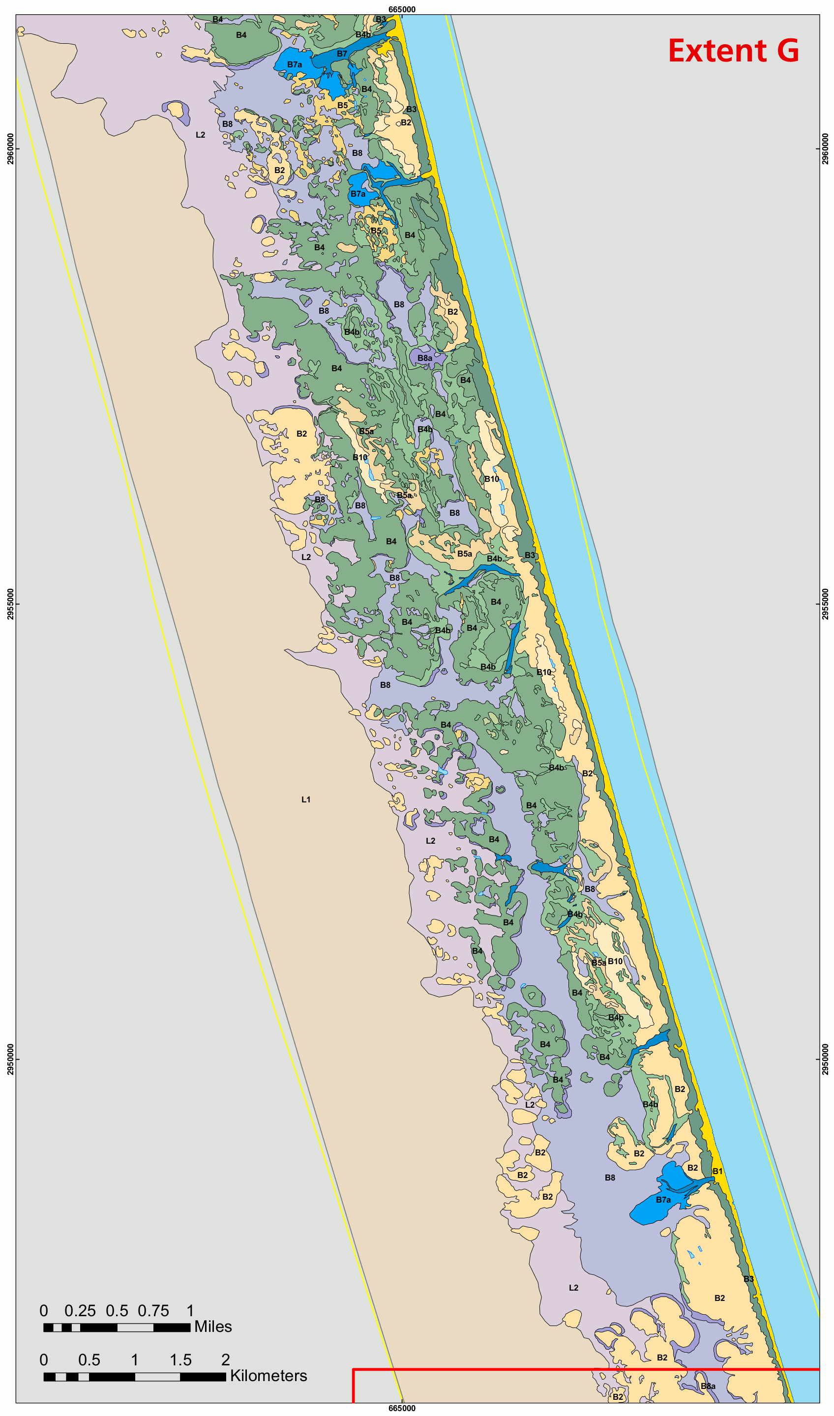 Here’s Padre Island geologic map G (450 kb), which approximately covers the area from milepost 45 to milepost 55 (with a little wiggle-room on either end).
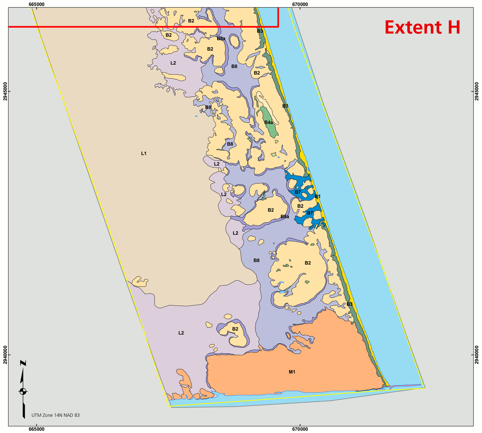 Here’s Padre Island geologic map H (150 kb) — finally! — the southernmost geologic map of Padre Island National Seashore. It ends at Mansfield Channel, marking the southern boundary of the park.
Other Padre Island maps
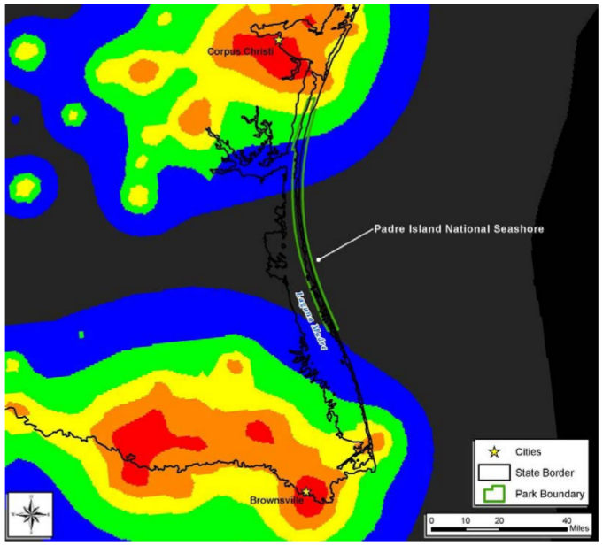 The Padre Island night sky map (50 kb) shows the amount of light pollution along the seashore. As you can see, most of it comes from Corpus Christi and Brownsville, to the north and south of the park.
…and more!
< Return to National Park Maps home
< Return to Park List
< Return to List by State
Need more trip-planning help? Browse Amazon’s best-selling Texas maps and guidebooks.