If you’re looking for a Ozark map, you’ve come to the right place; currently I’ve collected 11 free Ozark National Scenic Riverways maps to view and download. (PDF files and external links will open in a new window.) Here you’ll find some maps that show the entire park while others focus in on specific trails. You can also browse the best-selling Ozark maps and guidebooks on Amazon.
Ozark map from the park brochures
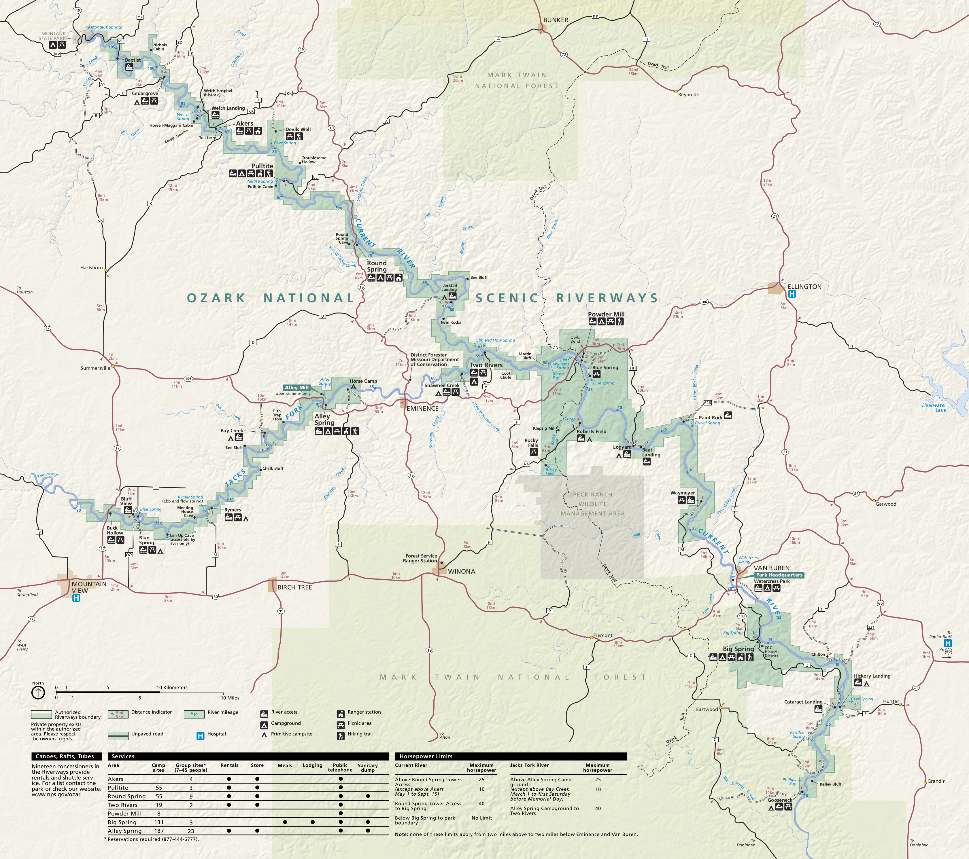 This is the official Ozark map from the park brochure, showing the Jacks Fork and Current rivers and the surrounding region. Click the image to view a full size JPG (2.1 mb) or download the PDF (2.2 mb).
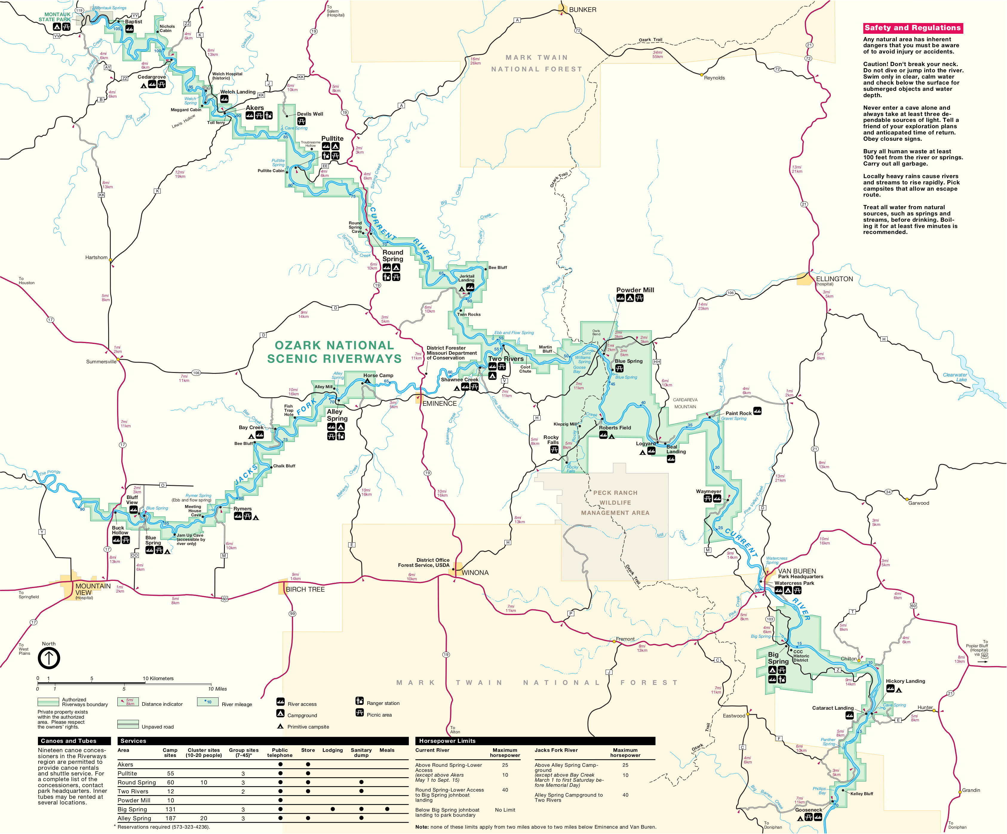 This unshaded Ozark map is similar to the one above but without the shaded topography, making for better printing. Click the image to view a full size JPG (1.4 mb) or download the PDF (300 kb).
Ozark trail maps
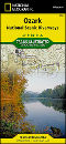
 If you want one trail map to cover the entire park, you’ll want the National Geographic Trails Illustrated map which shows the entire length of Ozark National Scenic Riverways (both Jacks Fork and Current rivers). It shows the river as well as the associated roads and trails that reach into the surrounding forest from the river. It’s definitely much more useful for in-depth trip planning than the free maps available here.
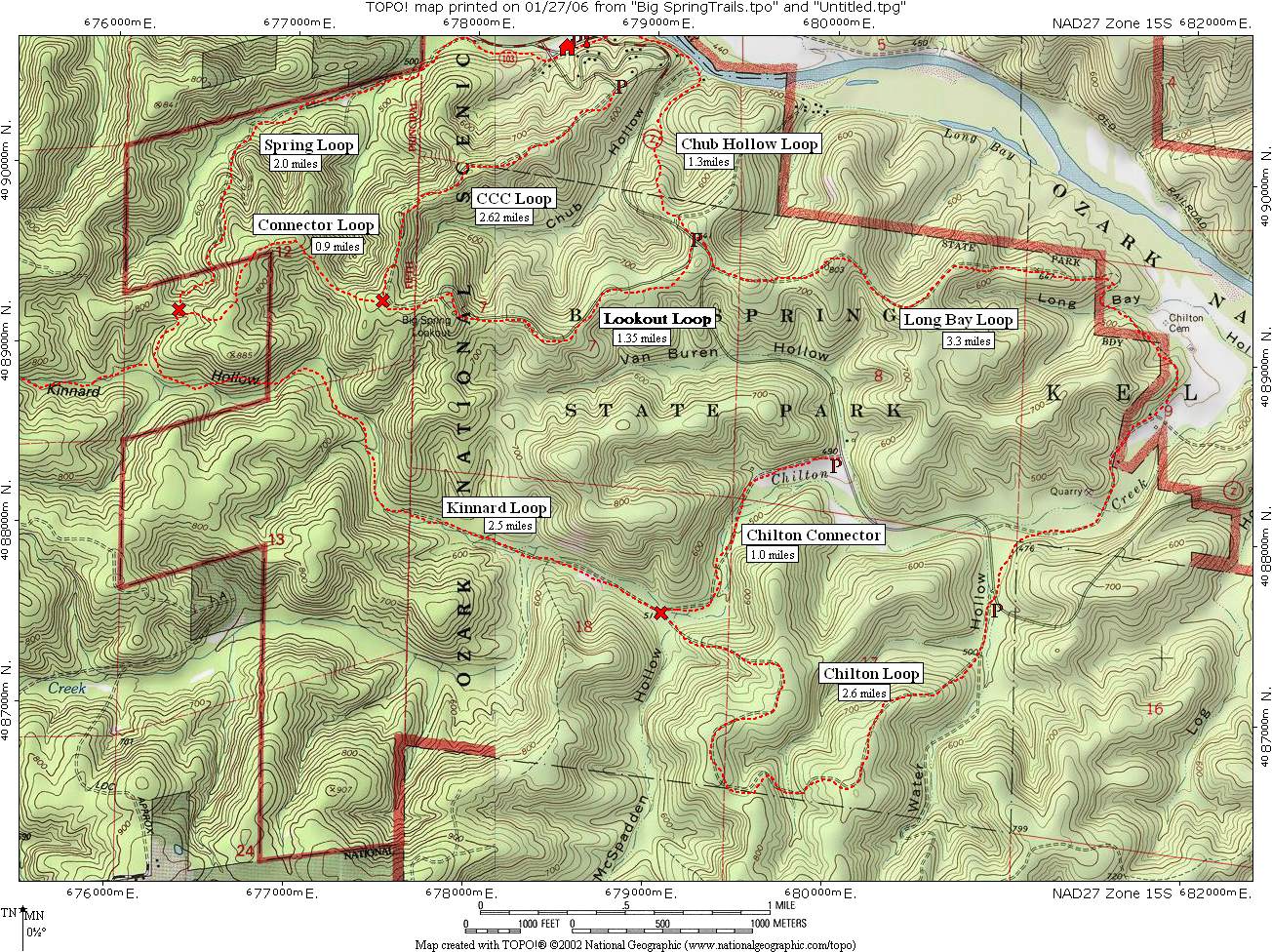 Here is a Big Spring trails map (400 kb) that shows the many loop hikes in the Big Spring region of Ozark National Scenic Riverways west of the Current River: Chubb Hollow, Kinnard Hollow, Chilton Creek.
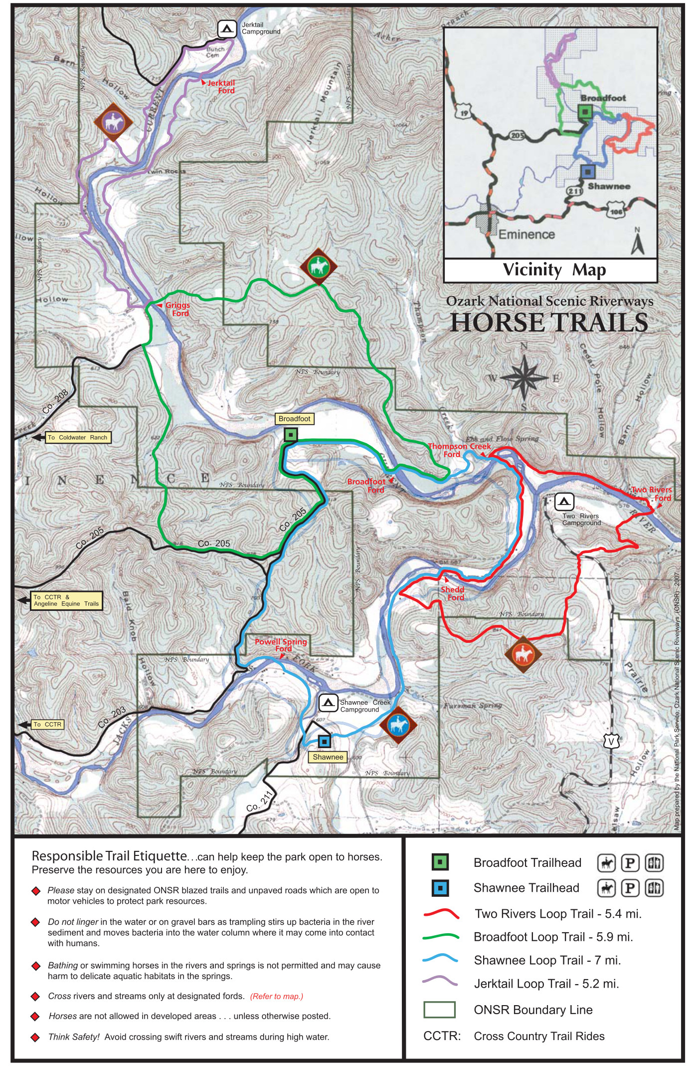 This is an Ozark horse trails map (1.0 mb), color-coding the various horse trails, fords, and trailheads along the Jacks Fork and Current rivers, along with the mileages of various loops.
Ozark location maps
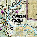
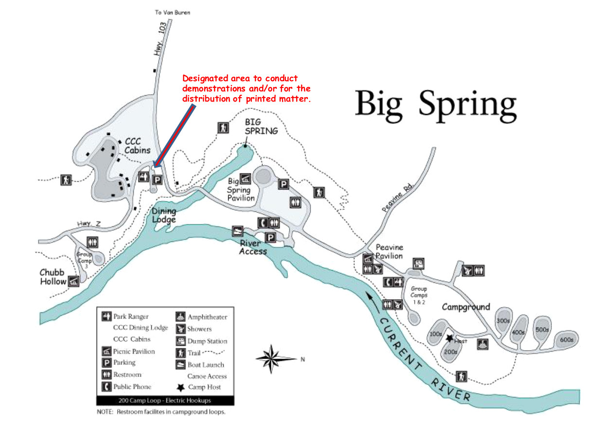 Here’s a Big Spring area map (150 kb) that shows the Big Spring Campground loops as well as the CCC cabins, dining lodge, picnic pavilions, river access, and of course the Big Spring itself.
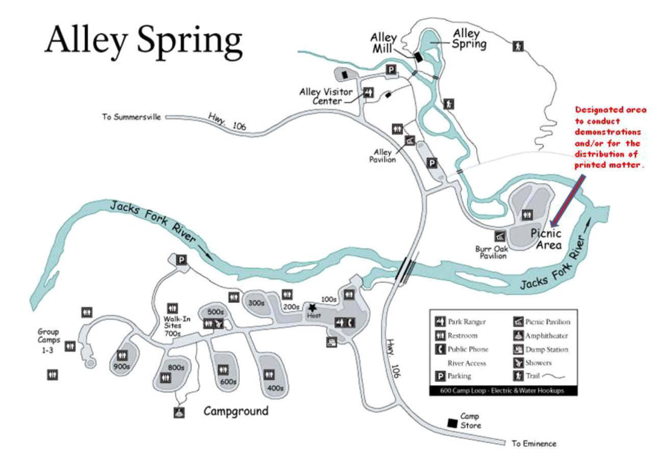 This Alley Spring area map (150 kb) focuses on the Alley Spring vicinity of the Jacks Fork River, including the several loops of the campground, visitor center, Alley Mill, Alley Spring, and picnic area.
 This is a Round Spring area map (120 kb) shows this stretch of the Current River including the campground, group camps, canoe rentals, river landings, Round Spring, and Round Spring Cave.
Ozark geologic maps
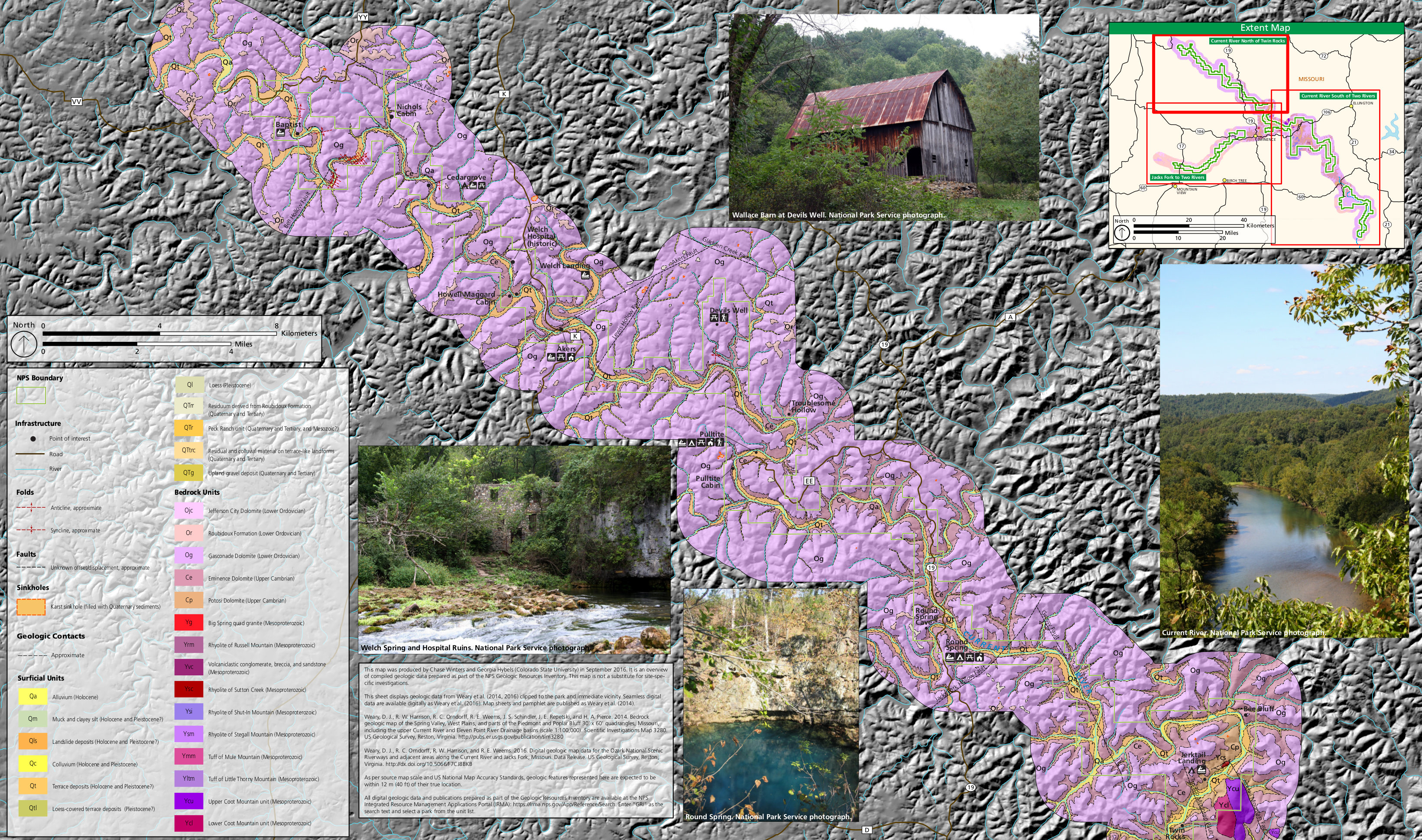 Here’s a north Ozark geologic map (2.3 mb) focusing on area along the Current River north of Twin Rocks, in the northwesternmost part of Ozark National Scenic Riverways.
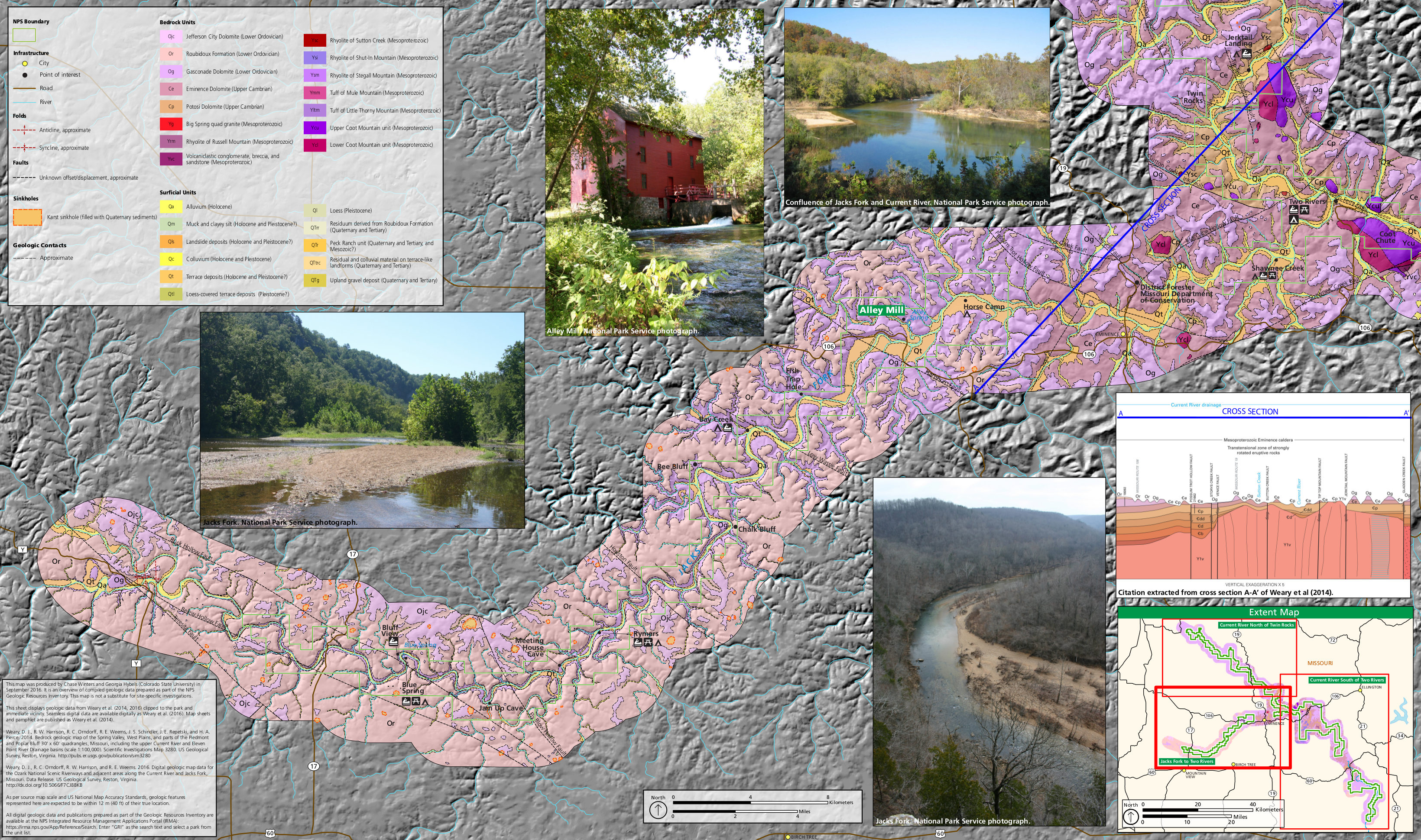 This west Ozark geologic map (2.1 mb) shows the area around the Jacks Fork River, upstream and southeast of Two Rivers. This shows the area just south of the map above.
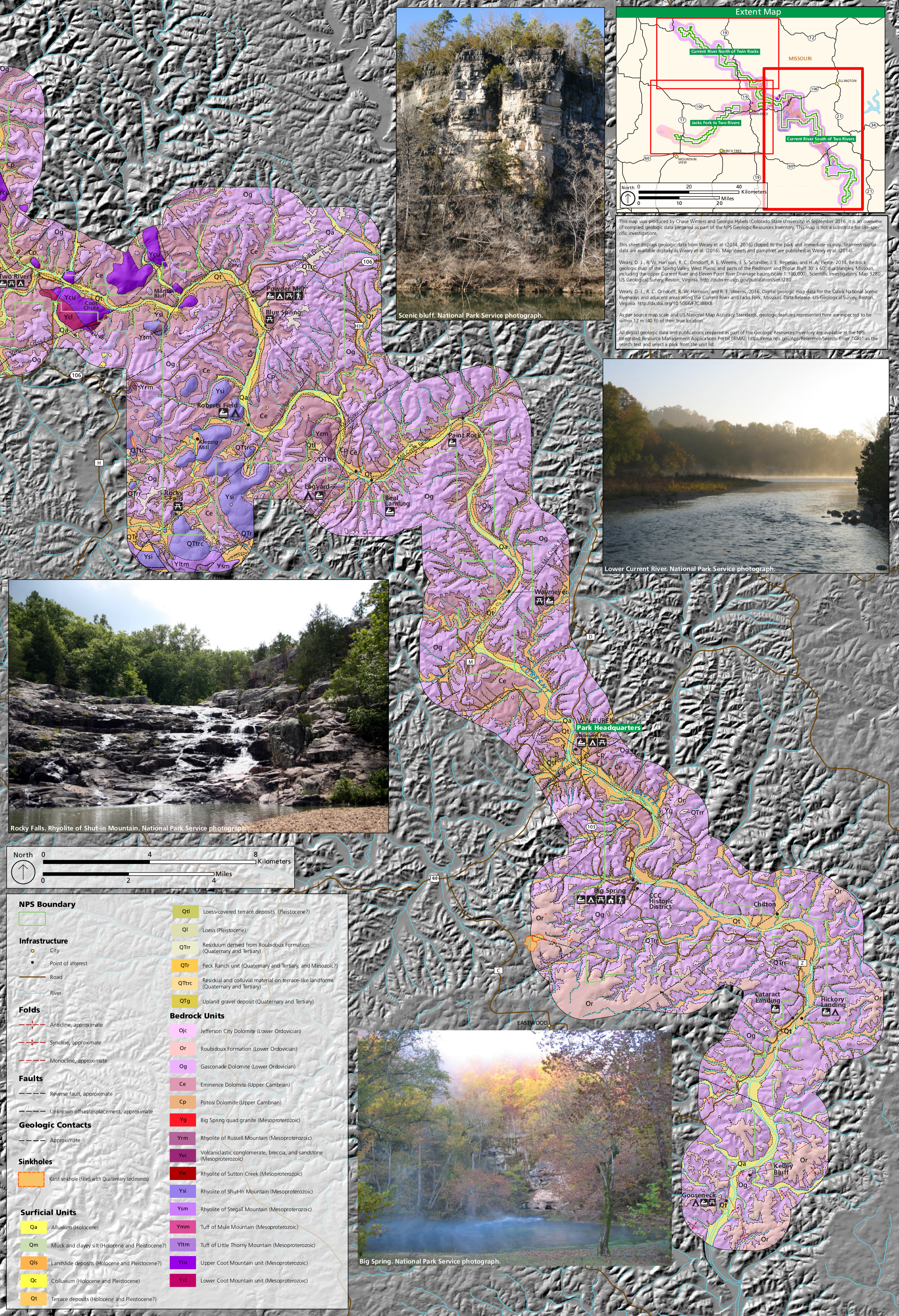 The east Ozark geologic map (2.8 mb) zooms in on the rock layers around the Current River, south of the confluence at Two Rivers. This map shows the area east of the two maps above.
…and more!
< Return to National Park Maps home
< Return to Park List
< Return to List by State
Need more trip-planning help? Browse Amazon’s best-selling Ozark maps and guidebooks.