If you’re looking for a New River Gorge map, you’ve come to the right place; currently I’ve collected 16 free New River Gorge National Park maps to view and download. (PDF files and external links will open in a new window.) On this page you’ll find maps covering the entire park as well as maps focused on hiking, driving, and climbing. You can also browse best-selling New River Gorge maps and guidebooks on Amazon.
New River Gorge brochure maps
 Here’s the official New River Gorge map, including the park lands as well as surrounding state parks and protected areas. Click the image to view a full size JPG (1.2 mb) or download the PDF (6.5 mb).
New River Gorge scenic drive maps
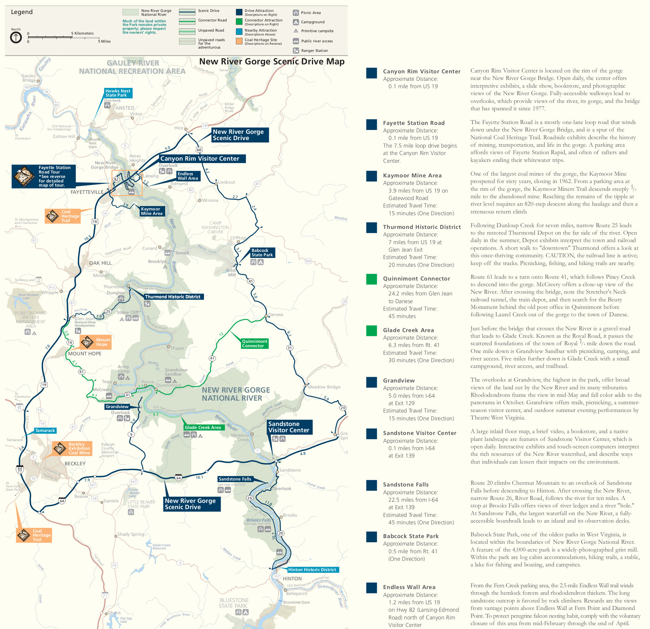 This is a New River Gorge scenic drive map (800 kb) displays several possible scenic drives nearby the New River for you to choose from, including text descriptions, mileages, and estimating drive times.
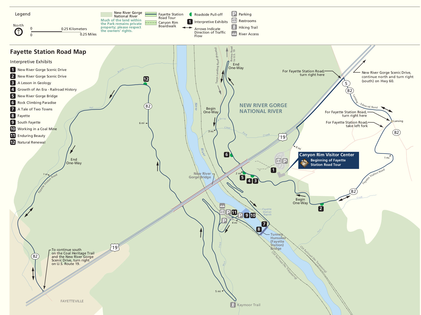 The Fayette Station tour map shows this auto tour route that starts from the Canyon Rim Visitor Center, labeling exhibits along the way. Click the image to view a full size JPG (250 kb) or download the PDF (950 kb).
New River Gorge trail maps
 The free maps below do a decent job of showing the various trails in the different sections of the park along the New River. However, if you plan to do a good amount of hiking, you may want to buy a detailed trail map like the National Geographic Trails Illustrated map of New River Gorge; this is the best single map showing every trail in all of New River Gorge National Park. No need for managing a bunch of separate ones!
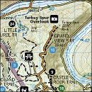
 This is an overview map of New River Gorge trails (900 kb), providing context showing where each of the maps below are located in and around the park. It’s a map of the maps, effectively!
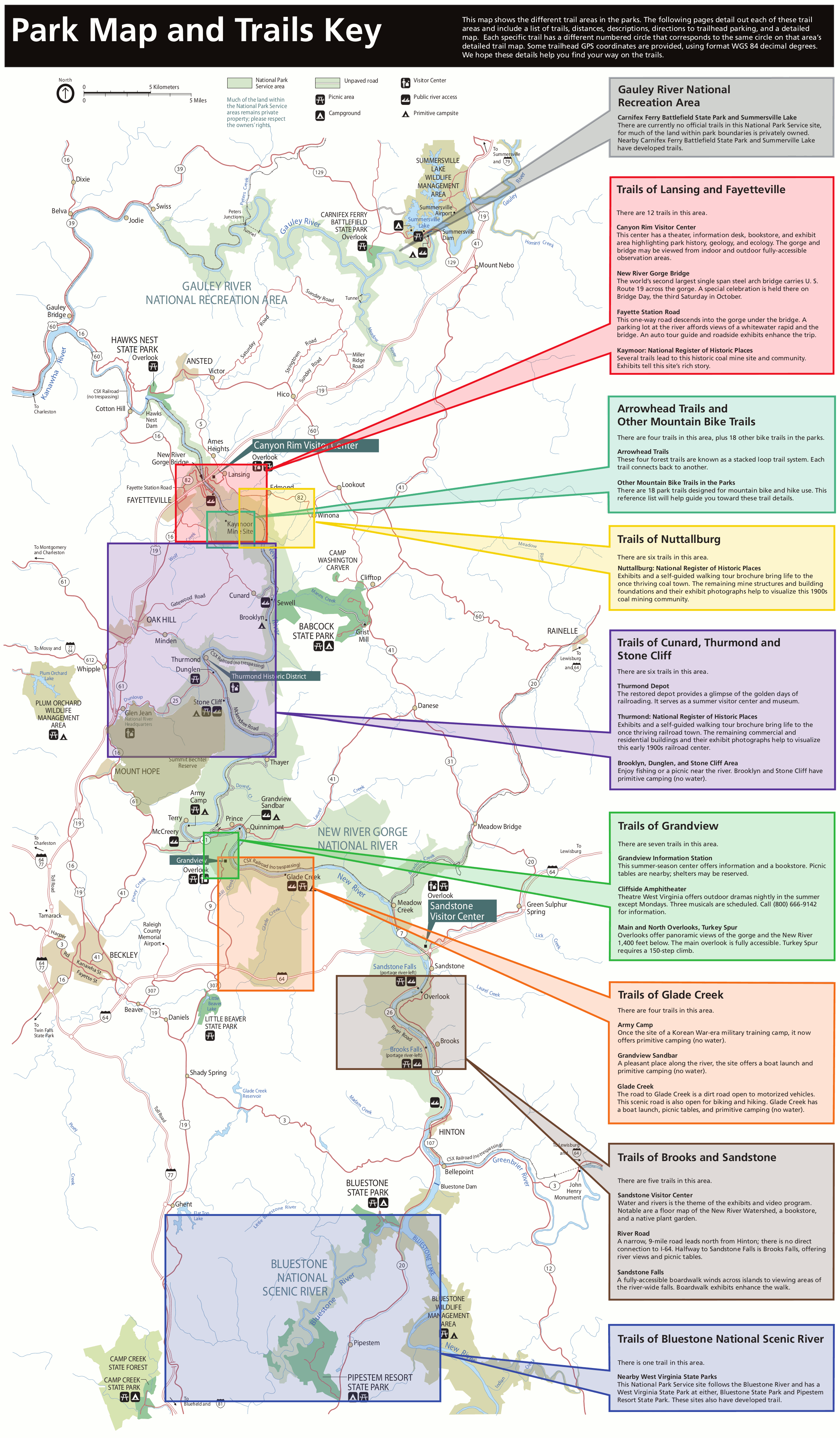
 The Lansing and Fayetteville trail map (1.6 mb) shows the very popular area of the New River Gorge and labels a number of trail options. Here’s where you can see the New River Gorge Bridge – don’t miss it!
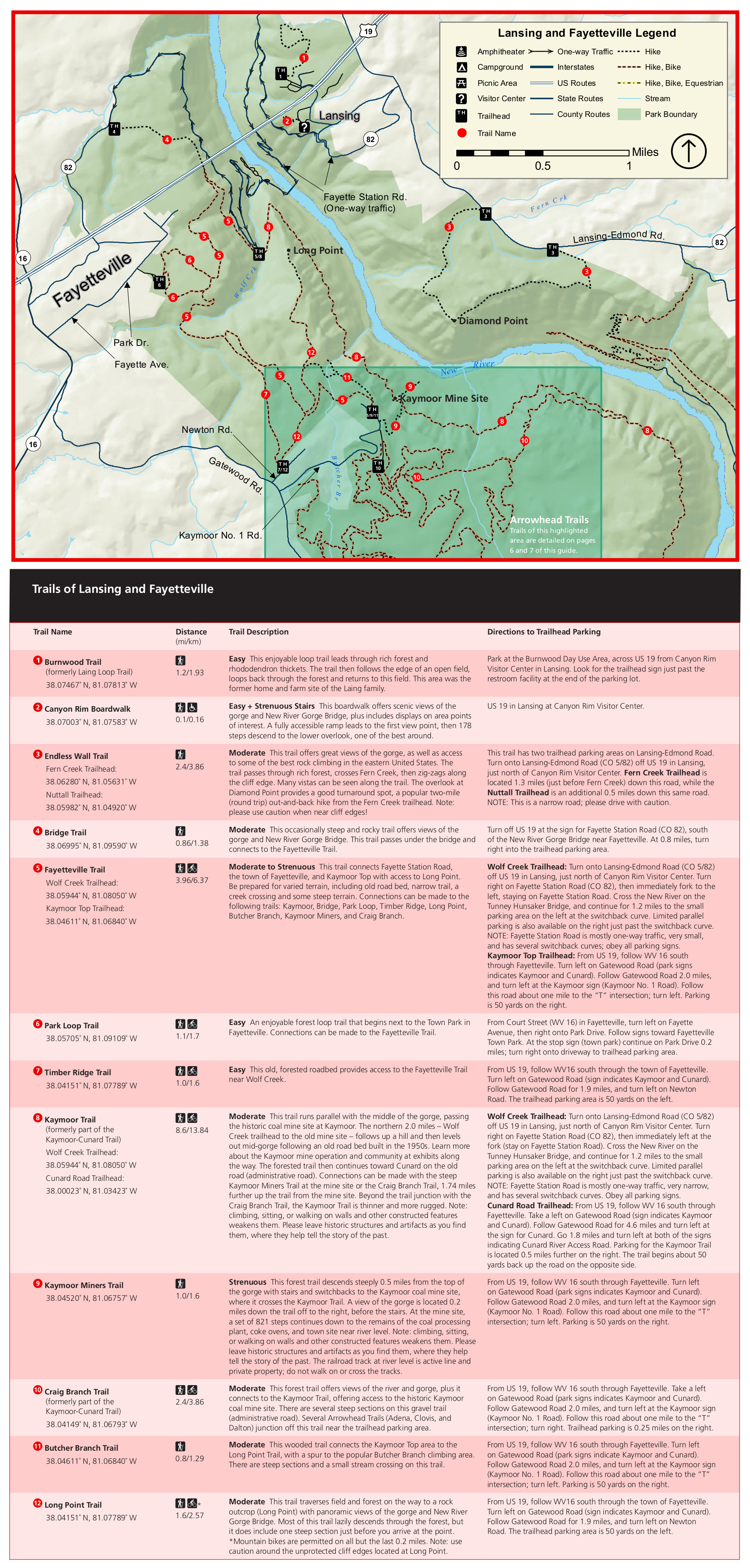
 This Arrowhead trail map (750 kb) shows the part of the park especially popular with mountain bikers. Included are descriptions of each of the four major loops, with difficulty levels and distance.
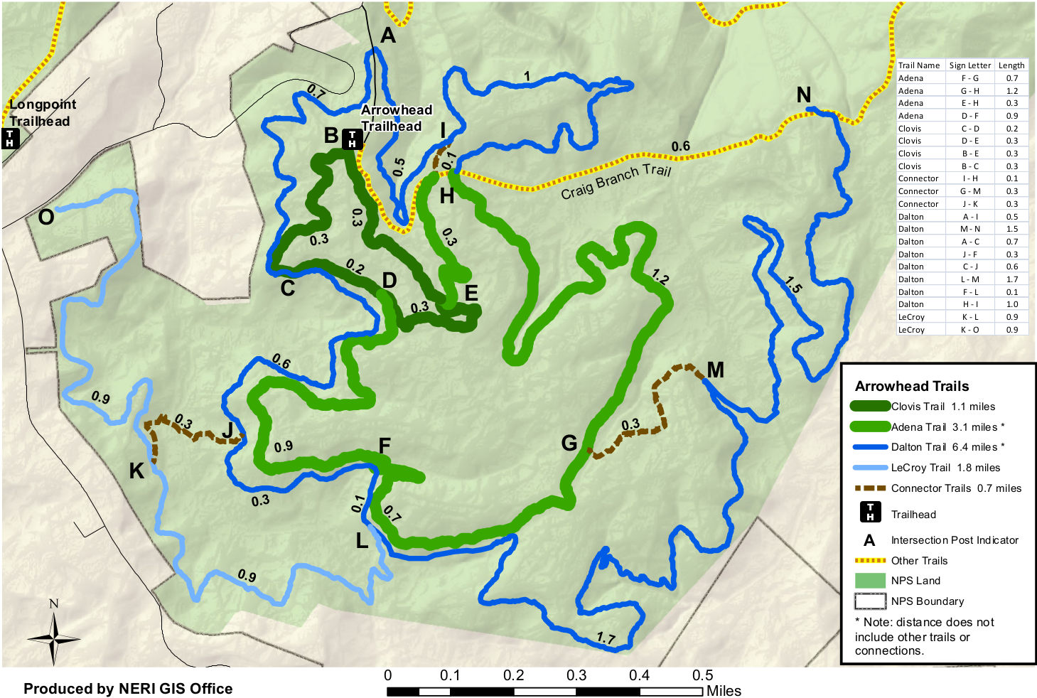 Here’s a colorful Arrowhead trail map (300 kb), which I feel is a bit easier to distinguish each of the major loops described in the map above. Distances between each trail intersection are included.
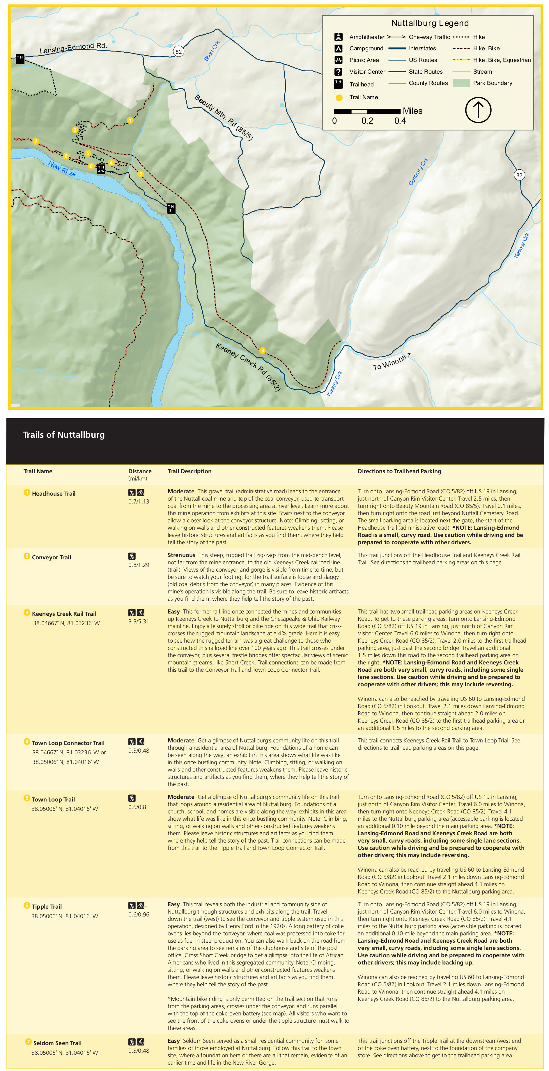 The Nuttallburg trail map (1.1 mb) labels seven trails in this area, most of them located along the New River at the former Nuttallburg town and mine site. These are some great trails for history!
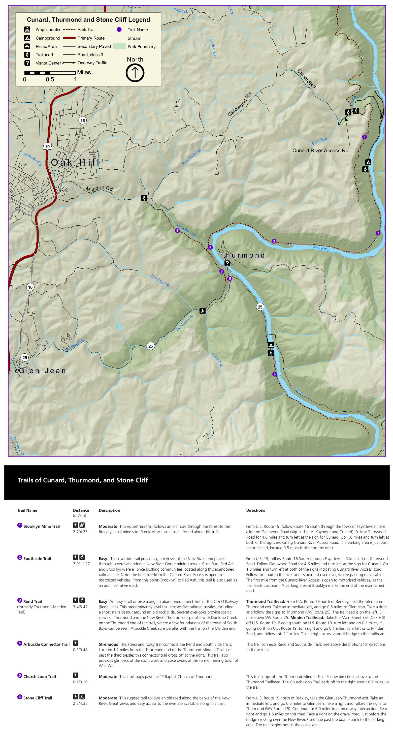 This is a Thurmond, Stone Cliff & Cunard trail map (700 kb), moving a bit further south (upstream) along the New River from the maps above. Six trails are described in the provided hiking table.
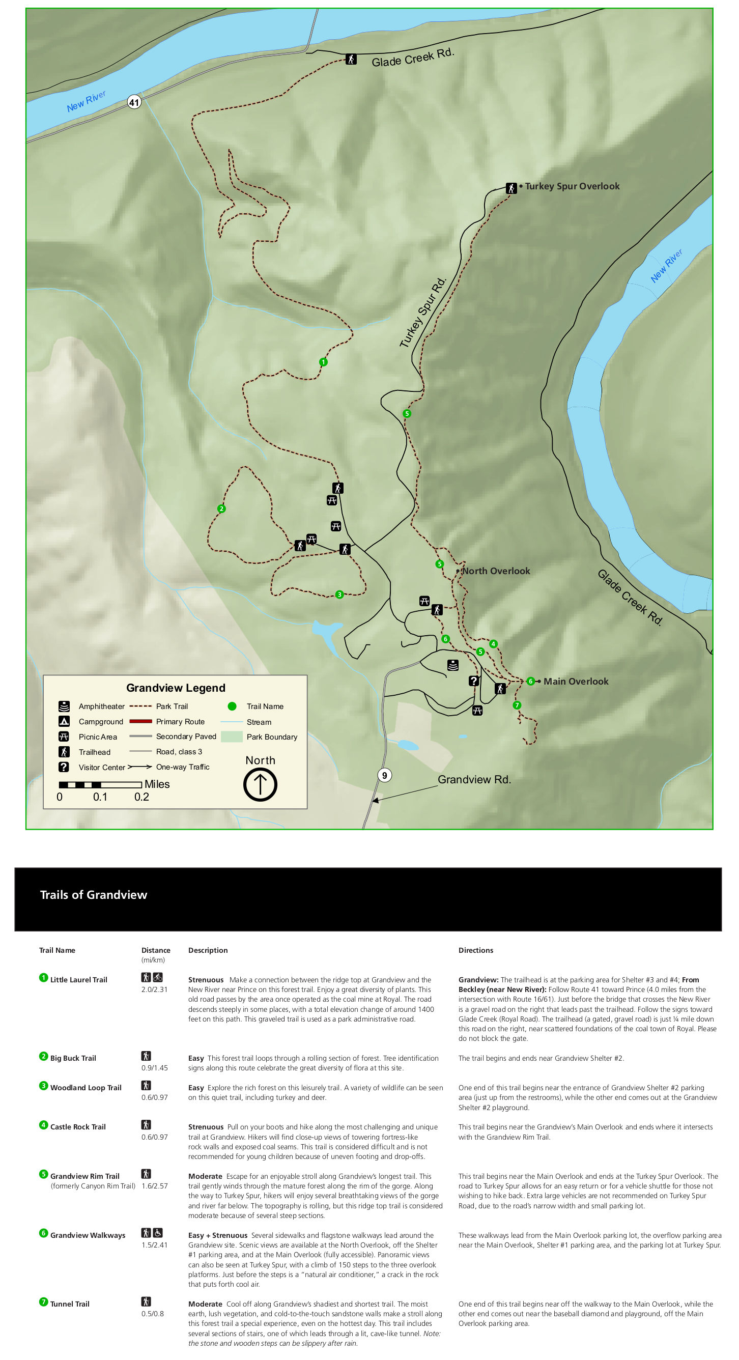 Here is a Grandview trail map (450 kb), showing several trails that are among the best in the park. The name is accurate: you get very grand views of the New River Gorge from this popular hiking destination.
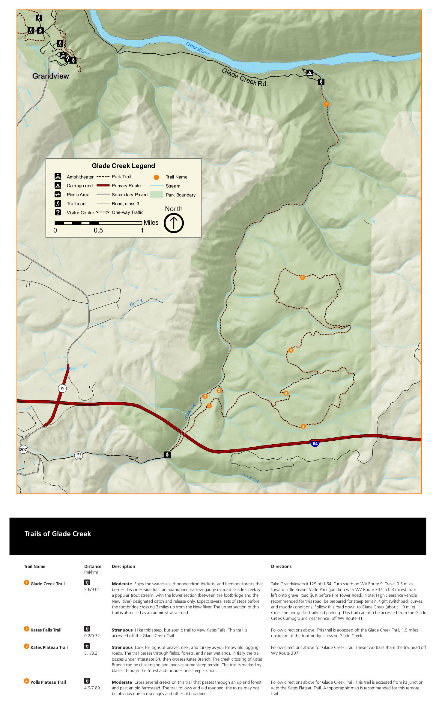 The Glade Creek trail map (400 kb) shows a few hiking options along and around Glade Creek. This is a good spot to explore if you want to explore along the creek and few a number of waterfalls.
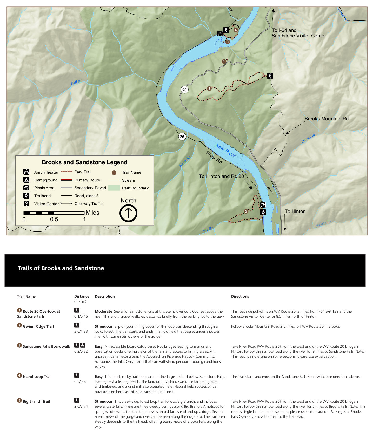 Here’s a Brooks and Sandstone trail map (350 kb), focusing on a few trails on both sides of the New River in the southern region of the park. These are mostly pretty short hikes, but a couple are strenuous.
Various New River Gorge maps
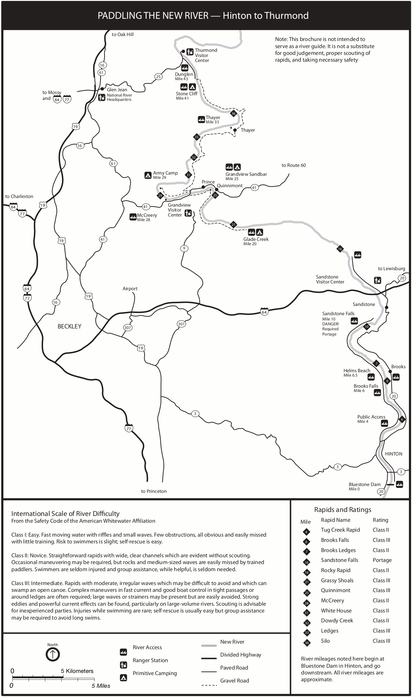 The New River Gorge paddling map (200 kb) provides a very general overview of the New River. A number of rapids are labeled, along with their class, and other features of interest to paddlers.
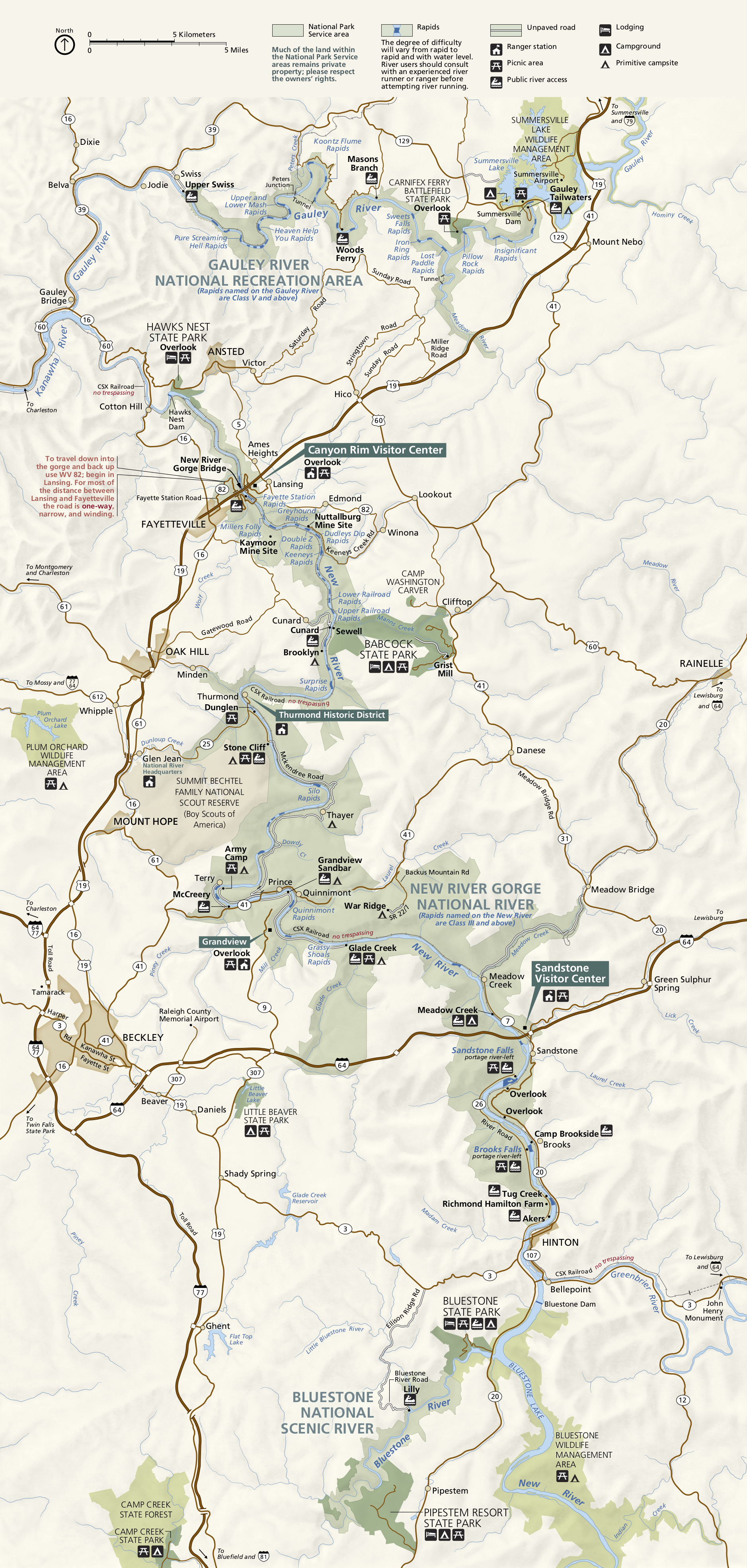
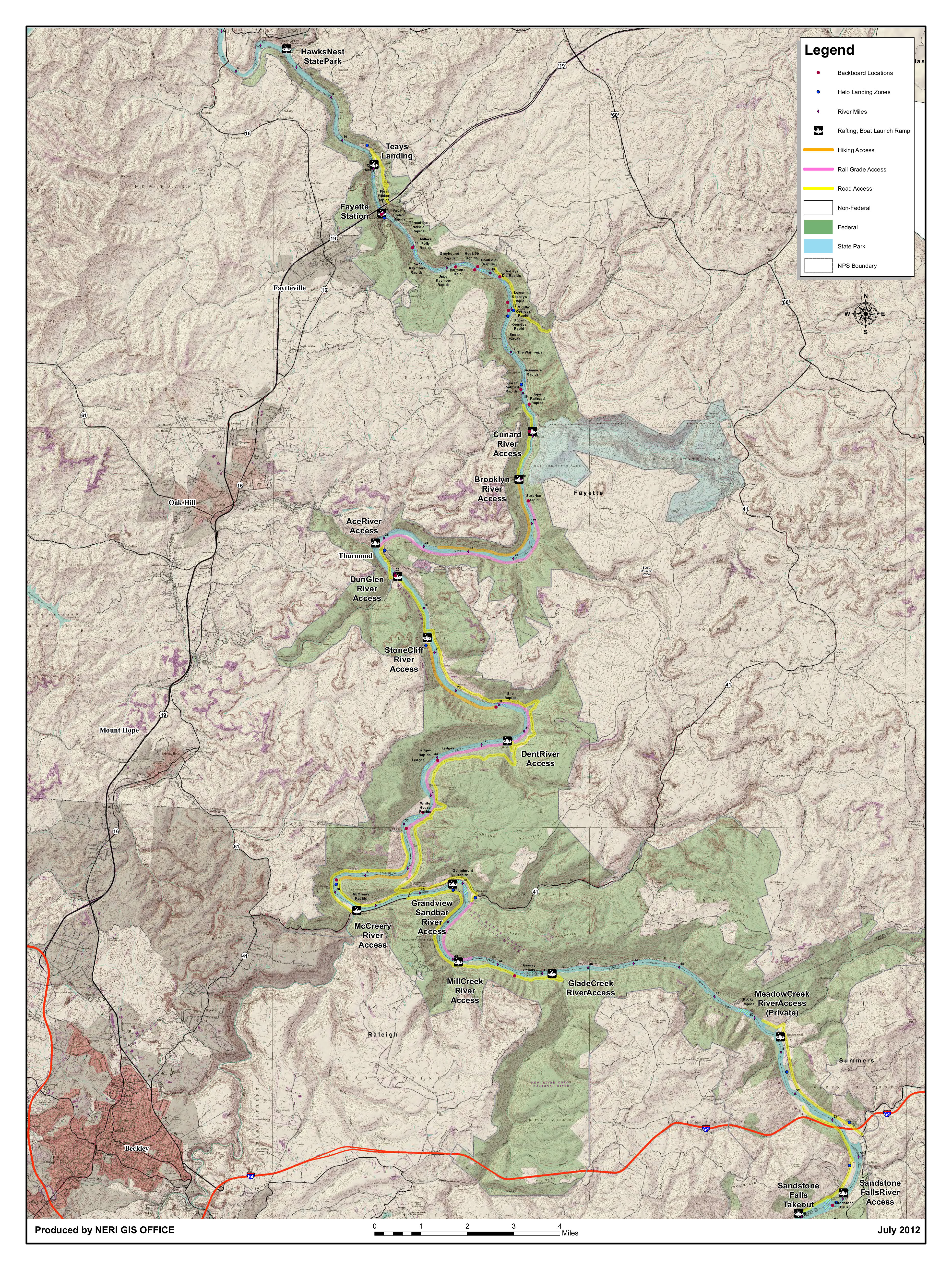 Here’s a New River Gorge river map, highlighting access routes to the New River and labeling named rapids. Click the image to view a full size JPG (5.8 mb) or download the PDF (8.3 mb).
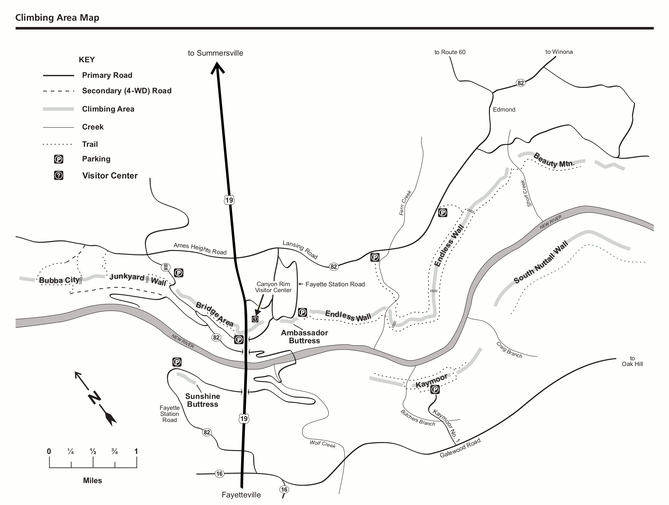 This is a New River Gorge climbing map (200 kb), showing the points of interest to rock climbers in the bridge area (around the Canyon Rim Visitor Center). This isn’t like climbing out west, but it’ll do in a pinch!
…and more!
< Return to National Park Maps home
< Return to Park List
< Return to List by State
Need more planning help? Browse Amazon’s best-selling New River Gorge maps and guidebooks.