If you’re looking for a Montezuma Castle map, you’ve come to the right place; currently I’ve collected 5 free Montezuma Castle National Monument maps to view and download (PDF files and external links will open in a new window.) On this page you’ll find the official park map as well as maps zooming in on specific areas. You can also browse the best-selling Arizona maps and guidebooks on Amazon.
Montezuma Castle brochure map
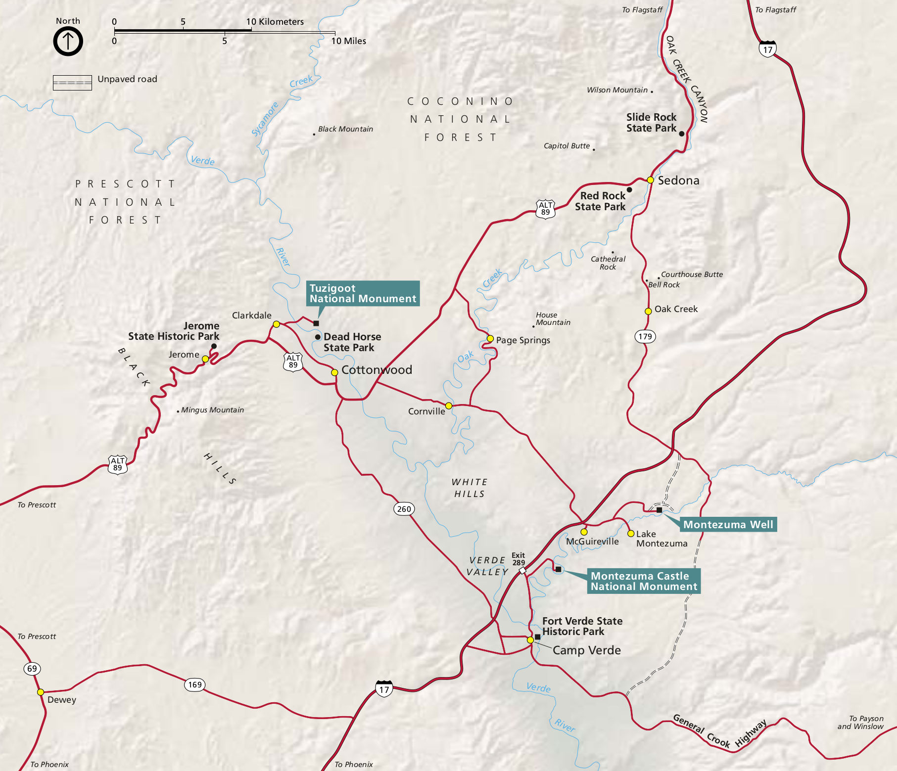 Here’s the official Montezuma Castle map, which also shows the location of Montezuma Well and Tuzigoot National Monument. Click the image to view a full size JPG (350 kb) or download the PDF (750 kb).
Other Montezuma Castle maps
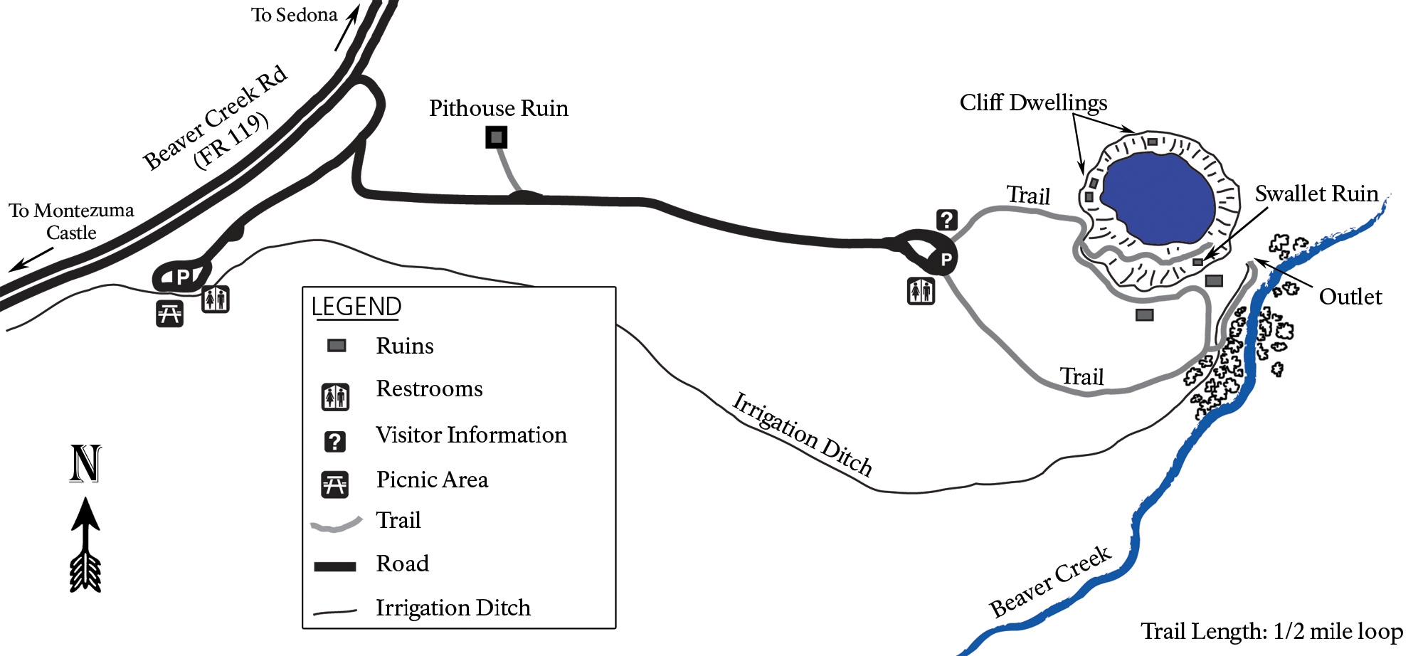 Here’s a Montezuma Well map (350 kb). It’s still a part of Montezuma Castle National Monument, but you do have to drive 11 miles to get there. Make sure you check out this unique desert oasis!
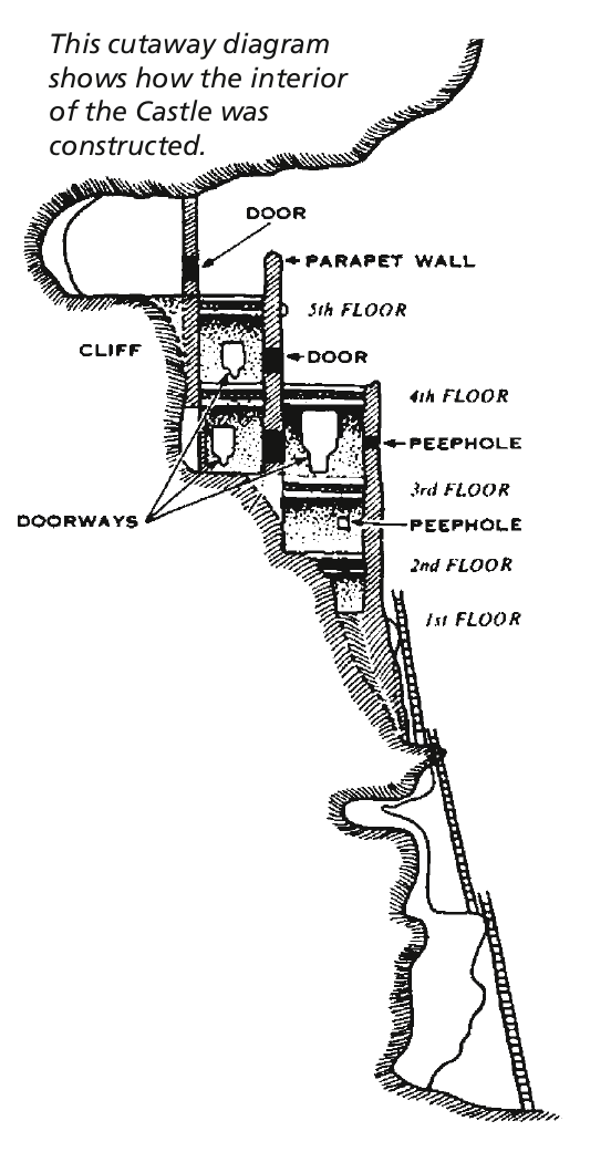 This is a Montezuma Castle cross-section (30 kb), showing the layout of this incredibly well-preserved cliff dwelling that was constructed over a few centuries nearly 1,000 years ago.
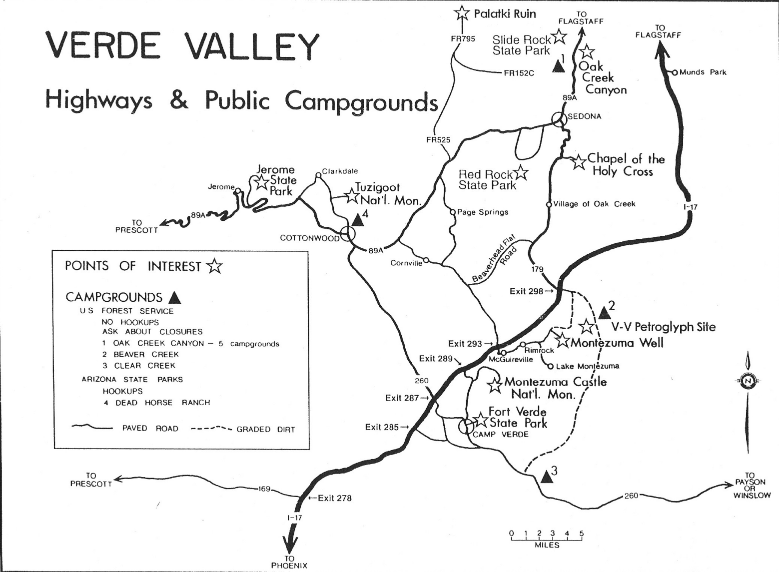 The Montezuma Castle regional map (300 kb) is hand-drawn and shows a lot of points of interest in the Verde Valley. You’ll find this handy if you’re going to a few sites nearby or in Sedona.
…and more!
< Return to National Park Maps home
< Return to Park List
< Return to List by State
Need more trip-planning help? Browse Amazon’s best-selling Arizona maps and guidebooks.