If you’re looking for a Marsh-Billings-Rockefeller map, you’ve come to the right place; currently I’ve collected 6 free Marsh-Billings-Rockefeller National Historical Park maps to view and download. (PDF files and external links will open in a new window.) Here you’ll find maps of the entire park as well as an inset map, trail map, and historic walking tour map. You can also browse the best-selling Vermont maps and guidebooks on Amazon.
Marsh-Billings-Rockefeller map from the park brochures
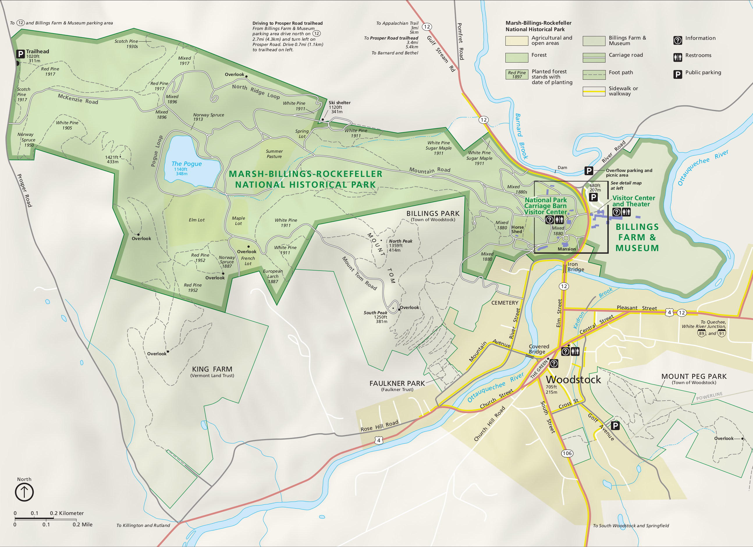 This is the Marsh-Billings-Rockefeller map from the official brochure and includes the roads, facilities, trails, and points of interest. Click the image to view a full size JPG (850 kb) or download the PDF (1.9 mb).
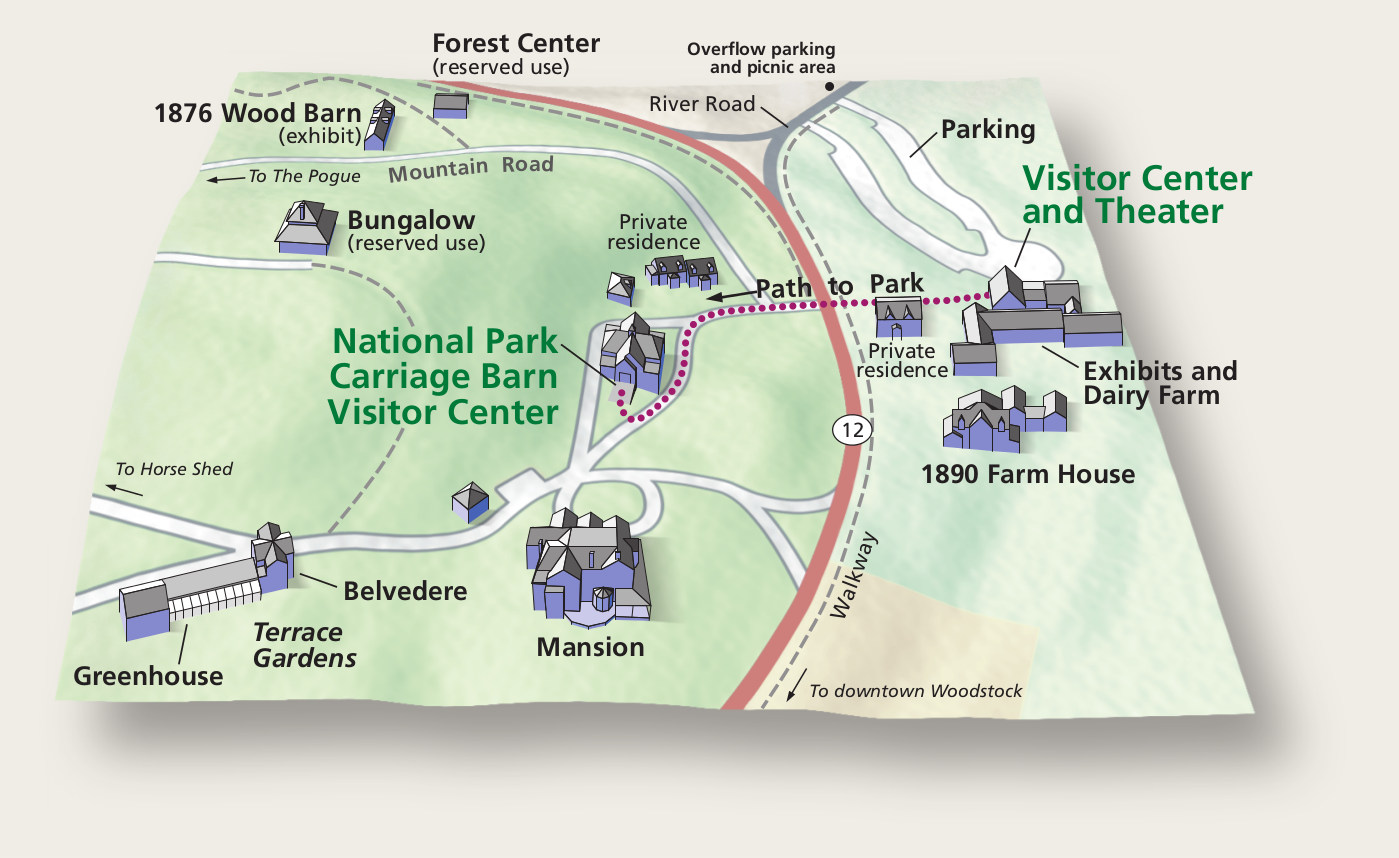 Here’s a detail map of Marsh-Billings-Rockefeller, zooming in on the main visitor center area with the historic buildings. Click the image to view a full size JPG (200 kb) or download the PDF (2.1 mb).
Woodstock trail map
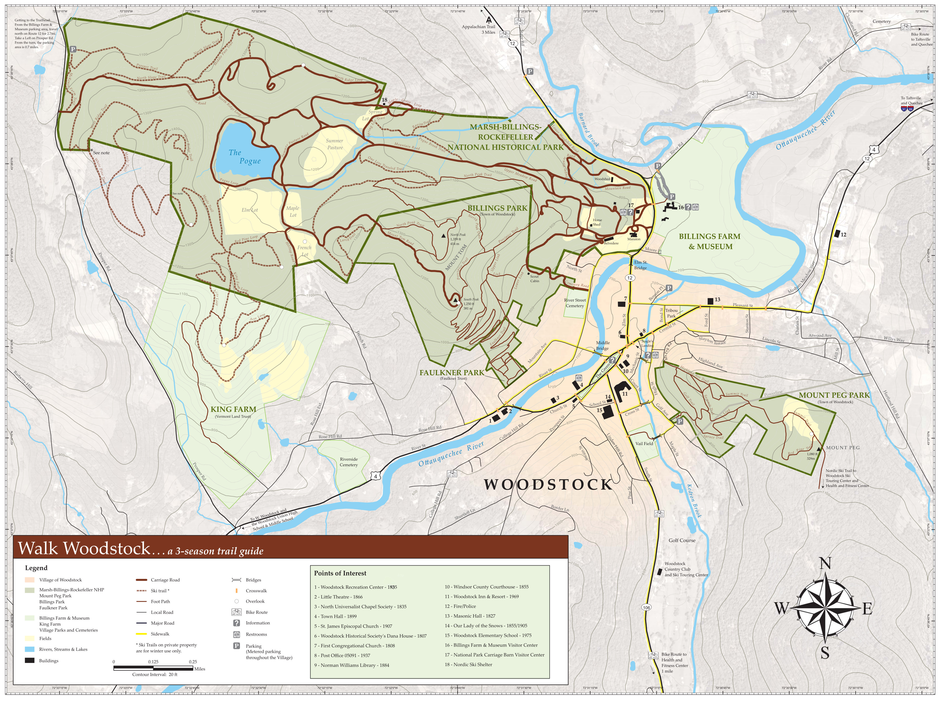 Here’s a Woodstock trail map, showing the trails in the park itself and also the ones in surrounding parks in Woodstock, Vermont. Click the image to view a full size JPG (2.2 mb) or download the PDF (10.2 mb).
Marsh-Billings-Rockefeller walking tour map
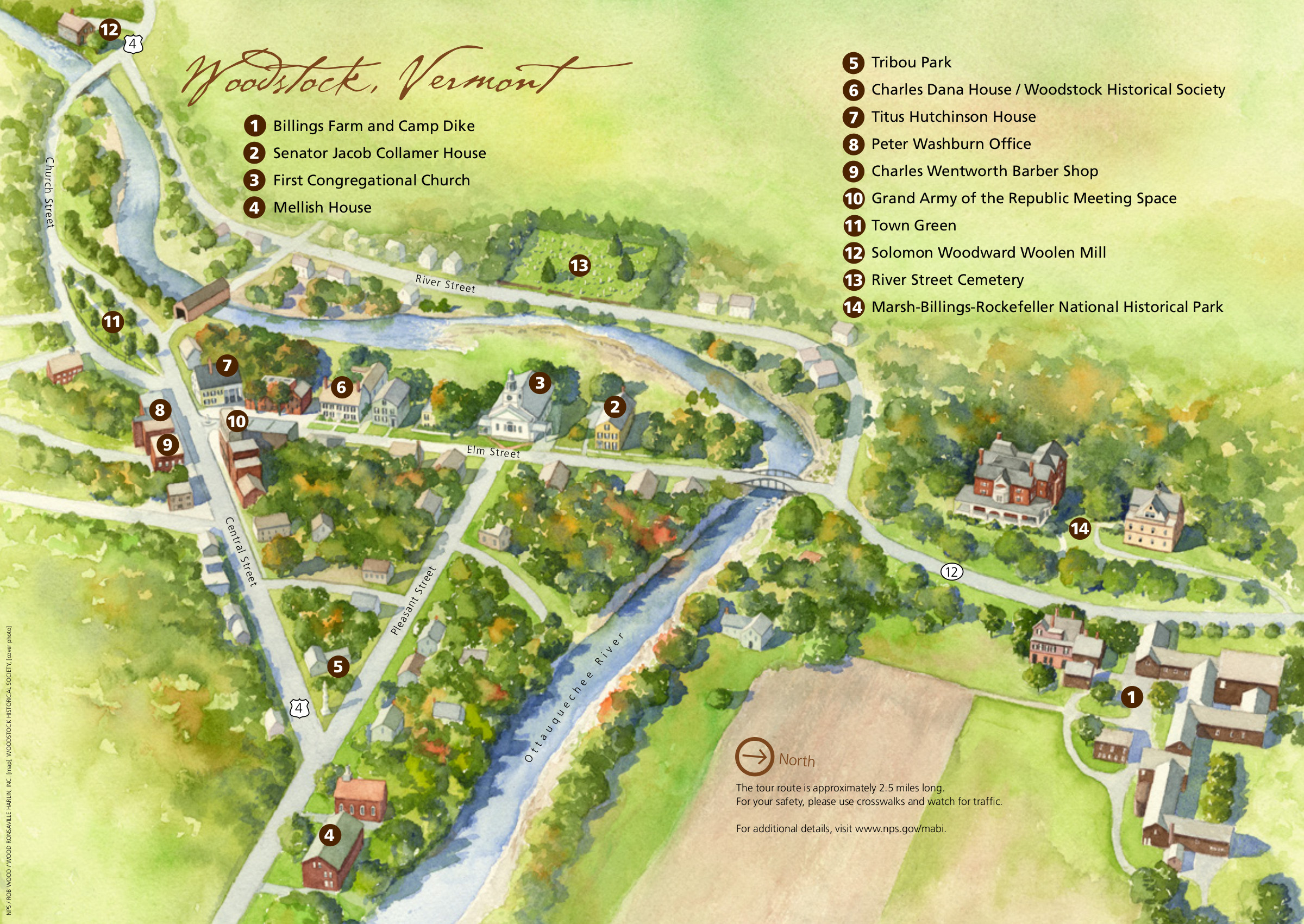 This walking tour map labels a number of sites to see on a self-guided tour. Click the image to view a full size JPG (1.1 mb) or visit NPS.gov to download the complete walking tour brochure or iPhone app.
Marsh-Billings-Rockefeller vegetation map
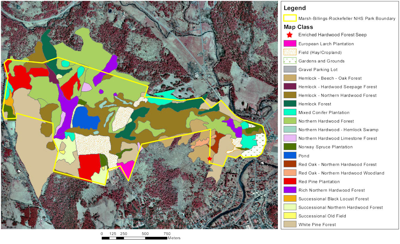 Here’s a vegetation map of Marsh-Billings-Rockefeller (300 kb), showing the different types of forest present in the park based on dominant species – hemlock, oak, pine, and so on.
…and more!
< Return to National Park Maps home
< Return to Park List
< Return to List by State
Still need planning help? Browse Amazon’s best-selling Vermont maps and guidebooks.