Happy 2017, everyone! I started this site just over three years ago now, and am pretty pleased with how things have progressed. Three years ago on this date, I had all of 261 maps on 27 pages. Today I have 1,249 maps on 114 park pages. Sure, you could argue that I should have much more than that considering all the time that’s passed since then, but I’ve moved a few times, changed jobs, and had a relatively busy personal life. Cut me some slack! 🙂 This site will probably never be paying my bills, so it’ll remain just a free-time project for me. OK, new updates:
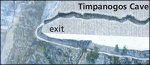 Rainbow Bridge Maps and Timpanogos Cave Maps are both live – two national monuments that tend to not get too much visitation. They’re pretty much at the opposite ends of the accessibility spectrum as well – Timpanogos Cave is right off the highway just outside the Salt Lake City metro area, while Rainbow Bridge can only be realistically visited by boat from Lake Powell.
 I’ve also added new maps from a bunch of park wayside exhibits: you’ll find some battle maps on the Harpers Ferry Maps page, new trail maps on Everglades Maps, trail maps of Giant Forest on Sequoia Maps, trail and geological maps on Lassen Volcanic Maps, Exit Glacier maps on Kenai Fjords Maps,
  and aerial photography maps on Cape Lookout Maps. Additionally, you’ll find a couple extra random ones I uncovered on park websites: a map showing ancient Lake Florissant on Florissant Fossil Beds Maps, and Yosemite picnic areas on Yosemite Maps.
Whew. See, I haven’t just been sitting around doing nothing!
Thanks for your effort on this! Finding clear digital maps is not always easy. If I had found this site years ago it would have saved me a lot of time (and squinting at inferior maps).