If you’re looking for a Lake Mead map, you’ve come to the right place; currently I’ve collected 29 free Lake Mead National Recreation Area maps to view and download. (PDF files and external links will open in a new window.) Here you will find maps of the full park, as well as maps showing specific campgrounds and trails. You can also browse the best-selling Lake Mead maps and guidebooks on Amazon.
Lake Mead map from the park brochures
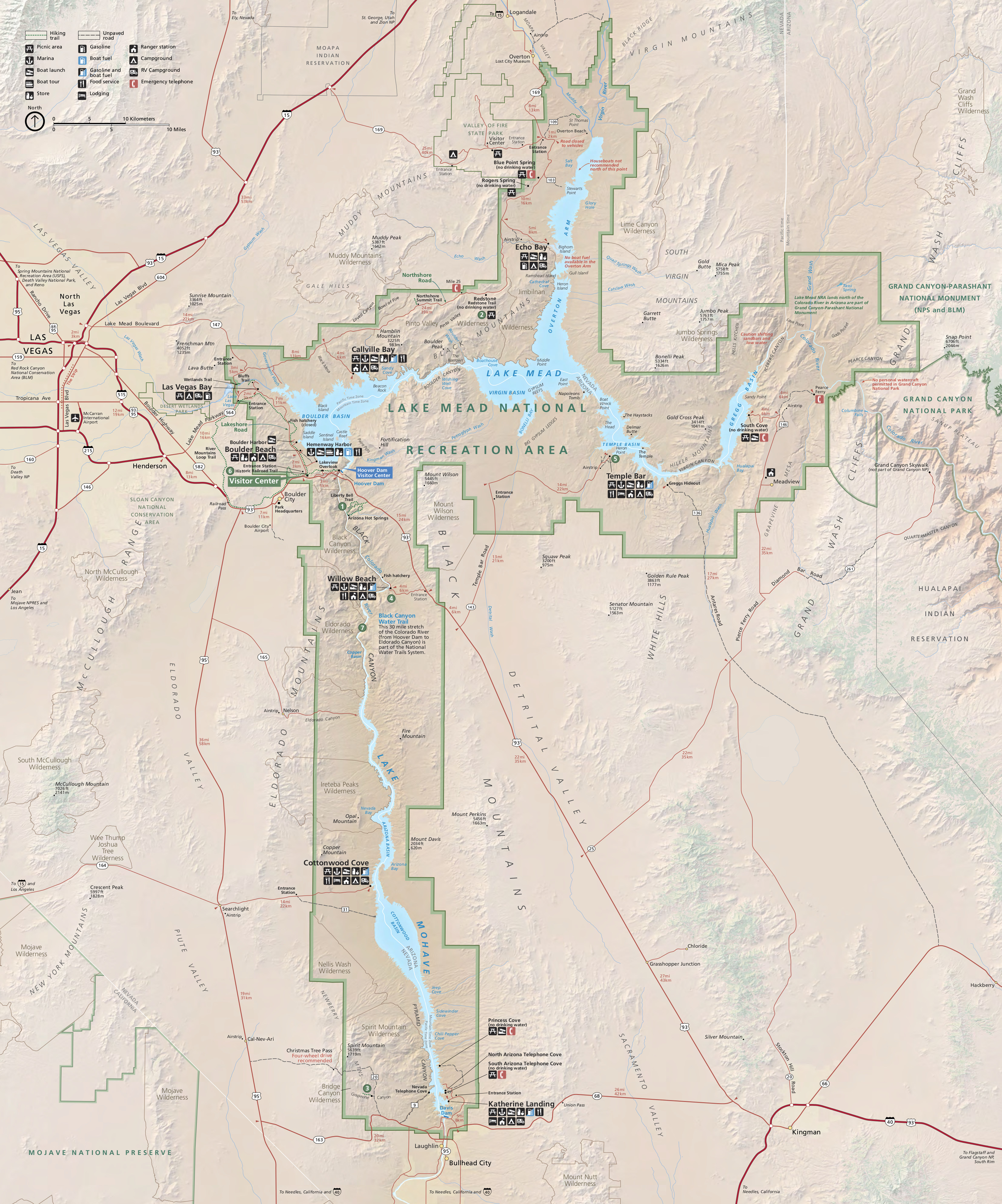 Here’s the official Lake Mead National Recreation map, which includes Lake Mohave and the Hoover Dam. Click the image to view a full size JPG (2.6 mb) or download the PDF (2.3 mb).
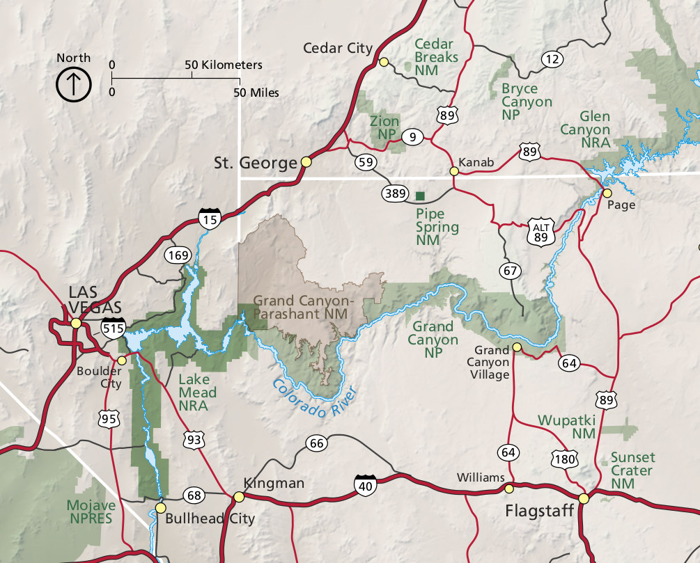 This is a regional Lake Mead map that shows the park’s proximity to Las Vegas, Grand Canyon, Zion, and other locations. Click the image to view a full size JPG (250 kb) or download the PDF (7.3 mb).
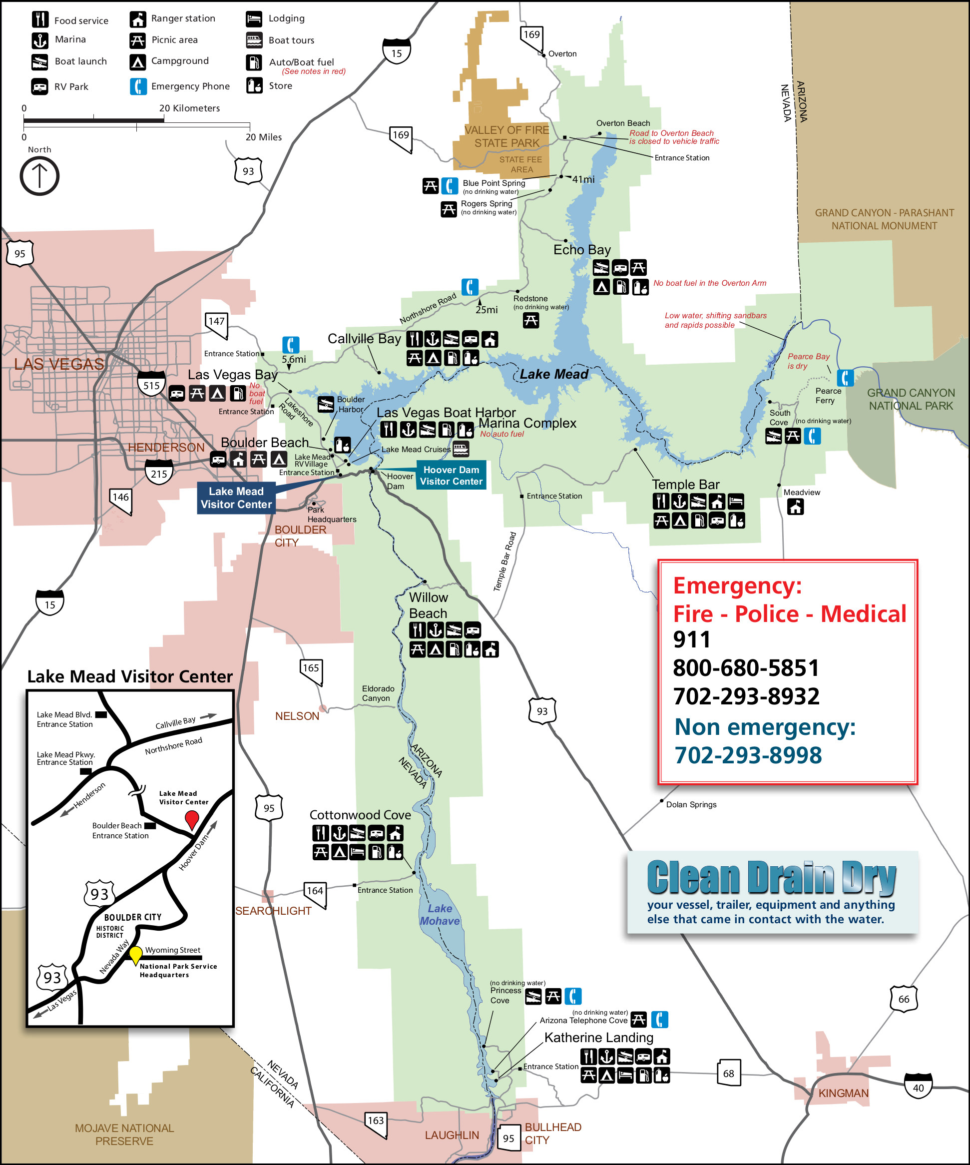 Here’s a printable Lake Mead map (750 kb) from the park newspaper – it doesn’t have as much topographic detail as the official map above so it prints out a bit nicer if you’re using a black-and-white printer.
Lake Mead trail maps

 There are lots of free maps for Lake Mead National Recreation Area, as this page attests. However, if you’re looking for one single map to cover the entire park in topographic detail, you should probably consider purchasing the National Geographic Trails Illustrated Lake Mead map. This one map will cover everything – trails, canyons, backcountry roads, the Colorado River, and even Lake Mohave.
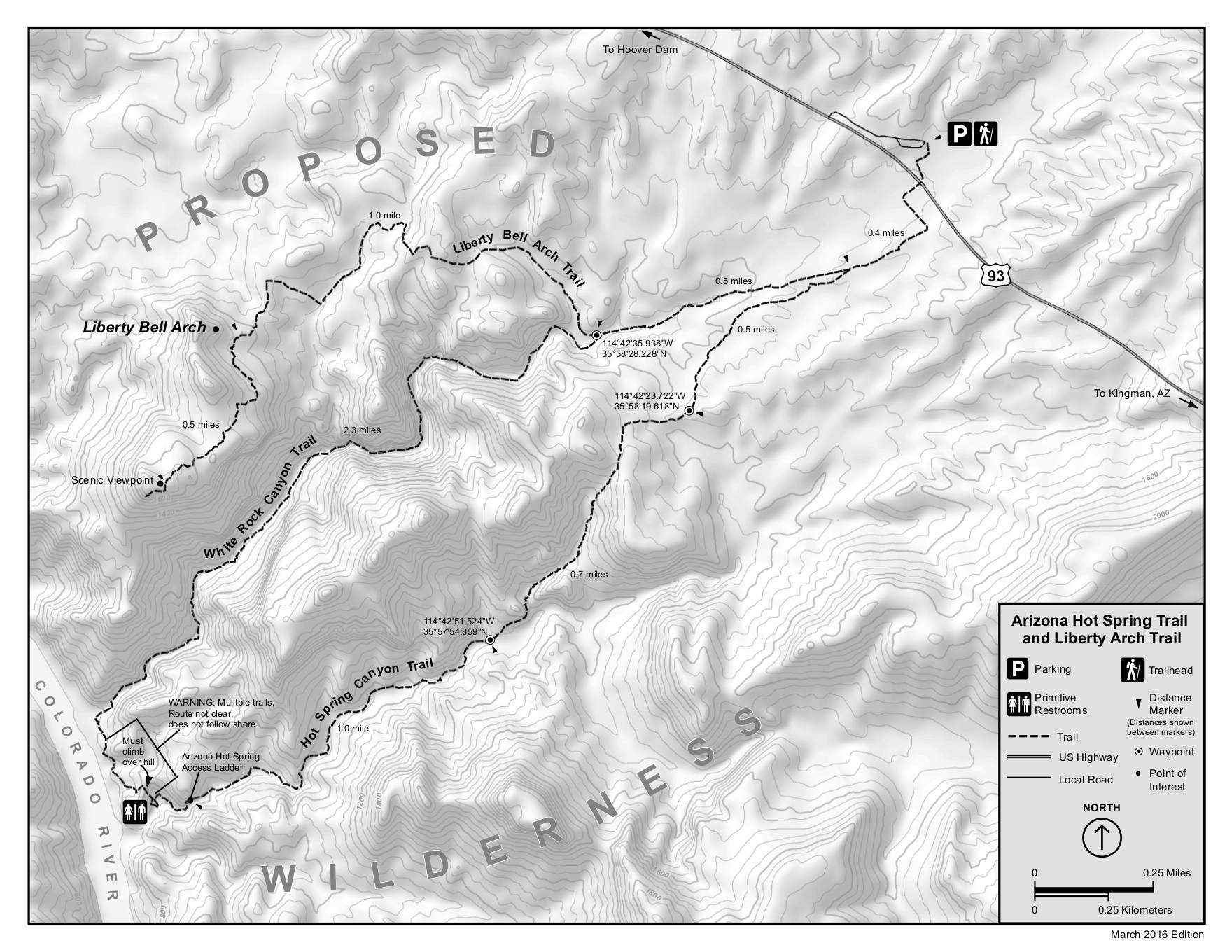 The Arizona Hot Spring trail map (500 kb) shows the loop route to the hot spring as well as another trail to the scenic viewpoint beyond Liberty Bell Arch. Both trails are a bit southeast of Hoover Dam.
 Here’s a Historic Railroad Trail map, showing the trail starting from the main Hoover Dam area and viewpoint. Click the image to view a full size JPG (800 kb) or download the PDF (3.9 mb).
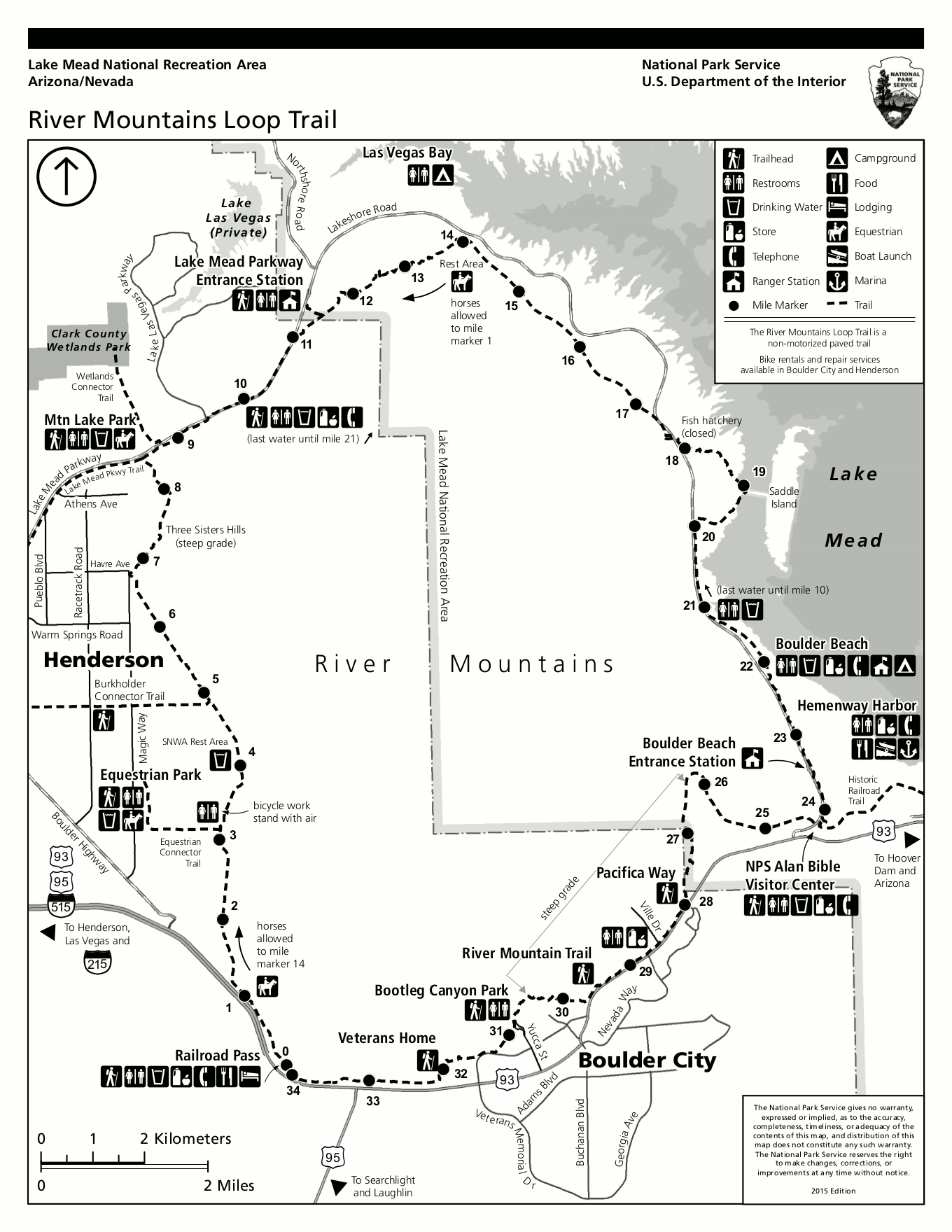 The River Mountains Loop trail map shows this popular fully-paved hike and bike route through the River Mountains near Boulder Beach. Click the image to view a full size GIF (300 kb) or download the PDF (400 kb).
 Here’s a Las Vegas Wetlands/Las Vegas Bluffs trail map, located in the northwest corner of the park near Las Vegas Bay. Click the image to view a full size JPG (400 kb) or download the PDF (4.1 mb).
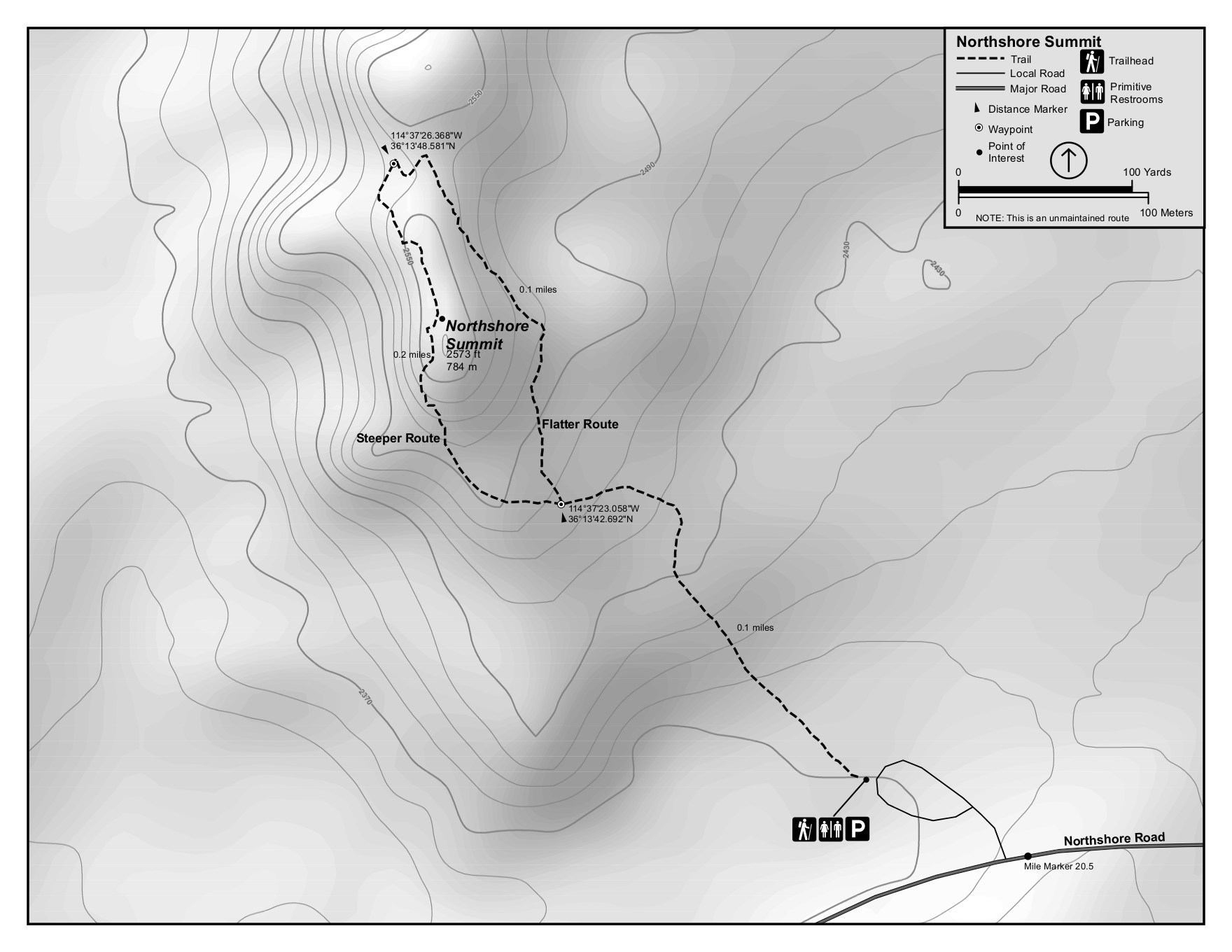 This is a Northshore Summit trail map showing the short hike north of Boulder Canyon on the Northshore Road. Click the image to view a full size JPG (250 kb) or download the PDF (2.0 mb).
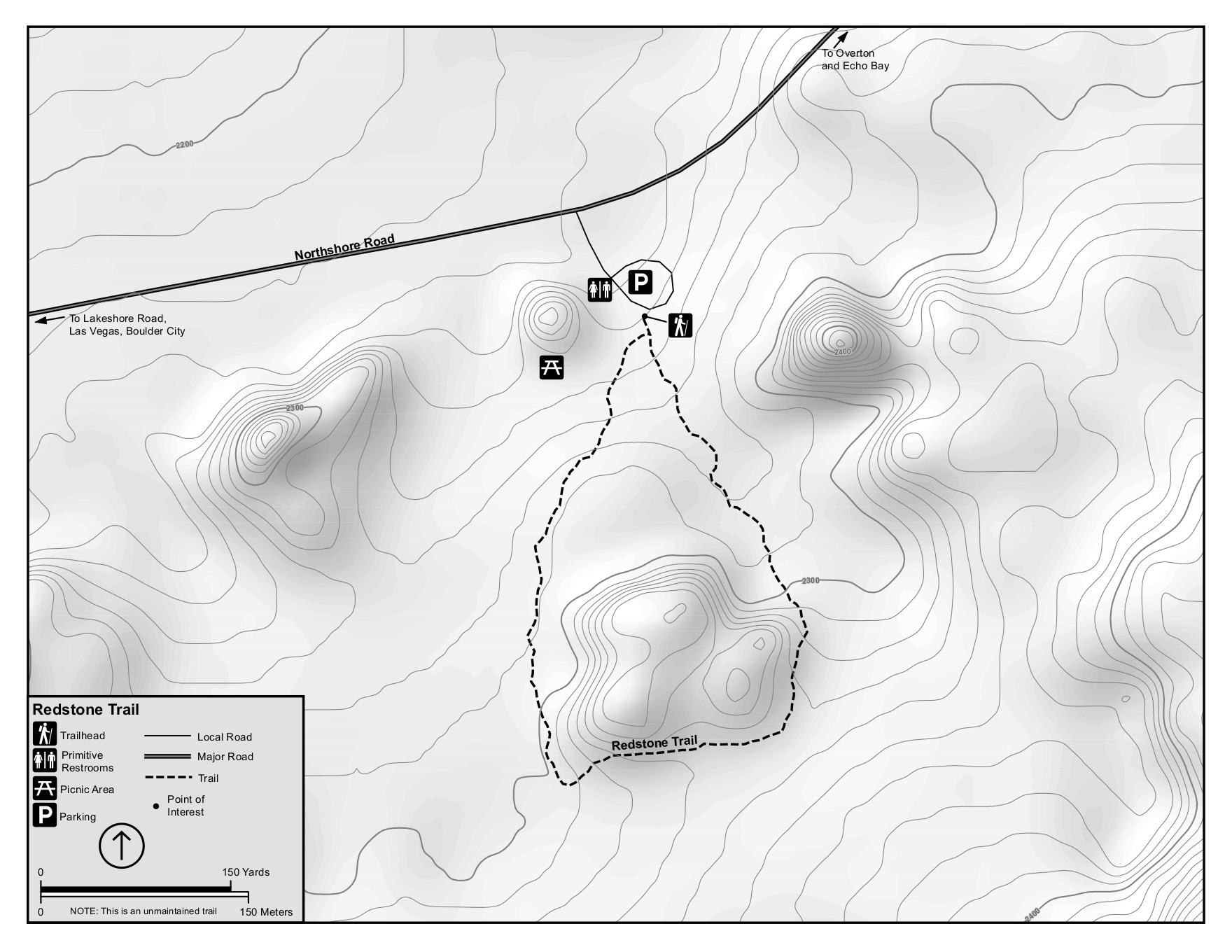 Next is the Redstone trail map, a bit further east along the Northshore Road on the way to Echo Bay and Overton Arm. Click the image to view a full size JPG (300 kb) or download the PDF (1.6 mb).
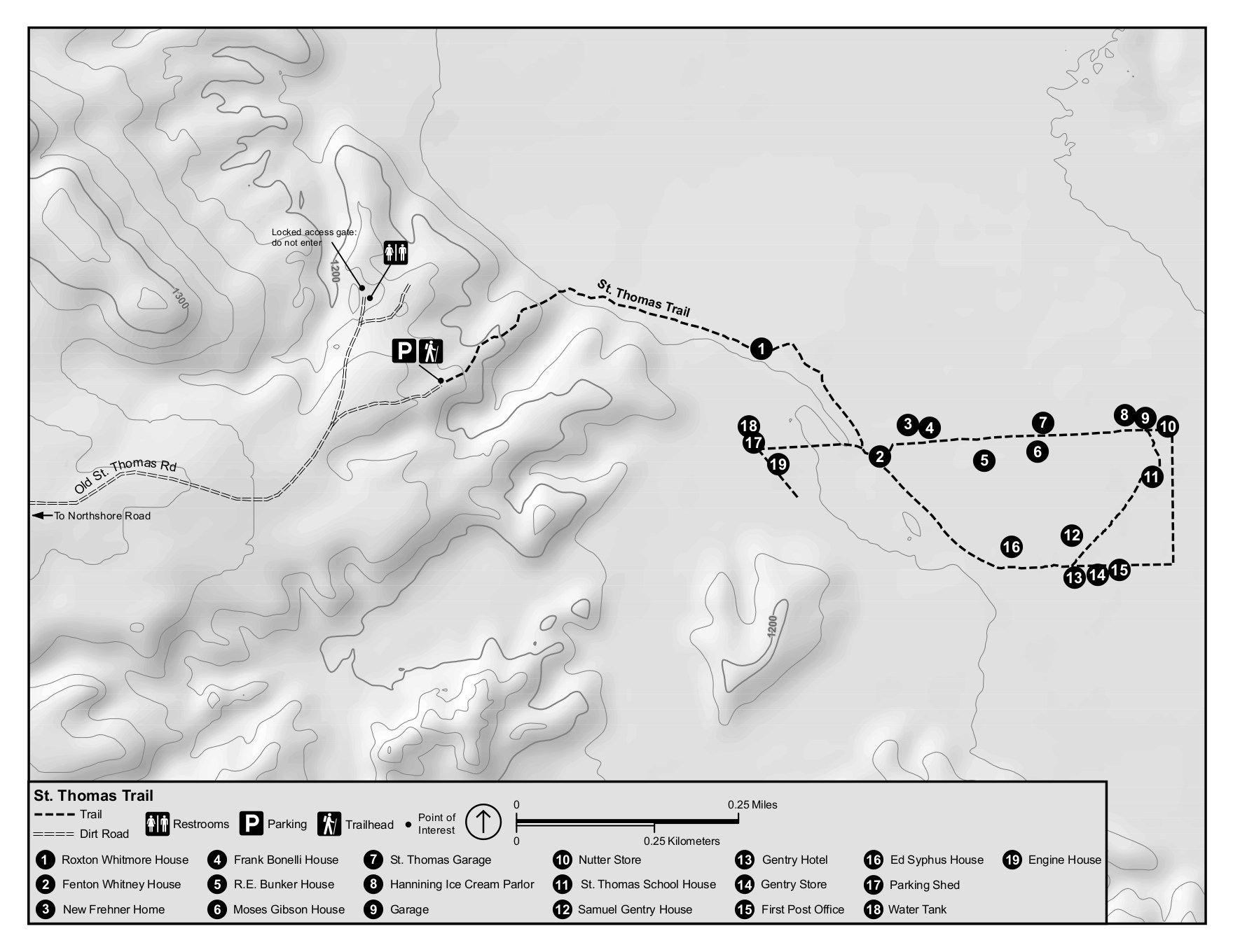 The St. Thomas trail map labels the ghost town buildings in this town that was originally flooding by the rising water levels of Lake Mead. Click the image to view a full size JPG or download the PDF (2.3 mb).
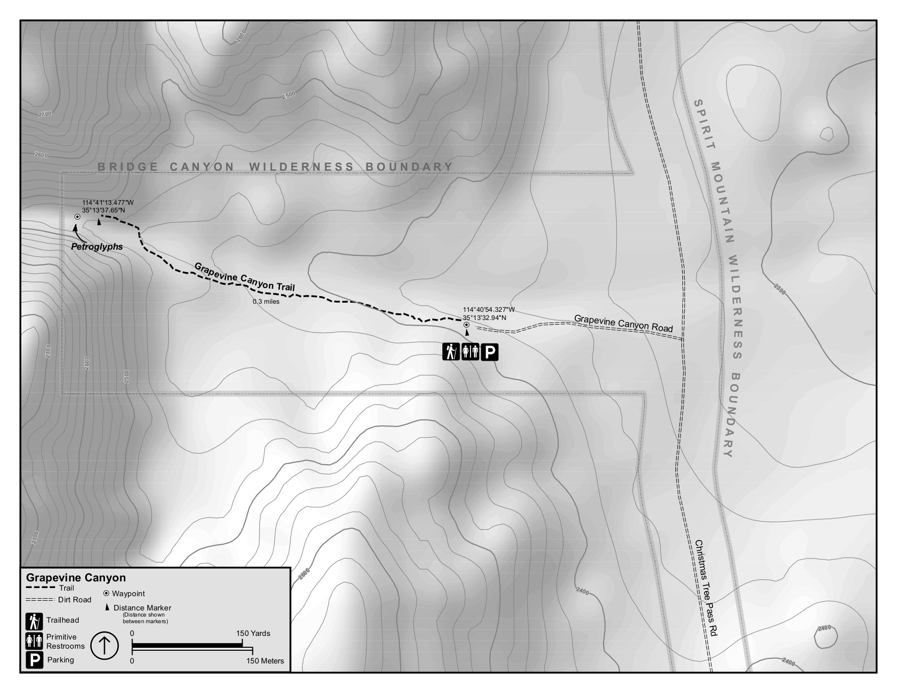 Here’s a Grapevine Canyon trail map, located to the west near southern end of Lake Mohave. Click the image to view a full size JPG (300 kb) or download the PDF (2.1 mb).
Lake Mead campground maps
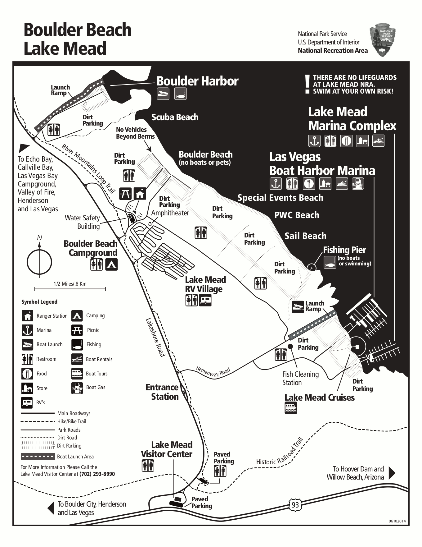
Here’s a Boulder Beach campground map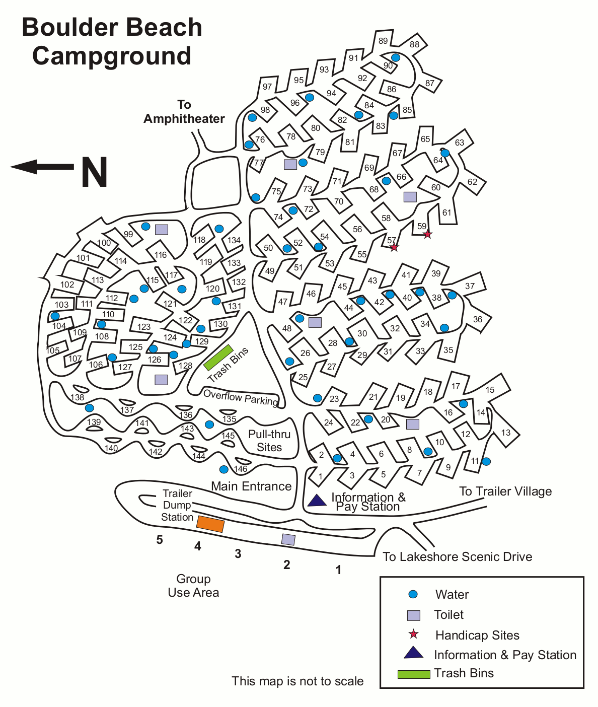 (200 kb), showing the layout of the large campground located nearest Hoover Dam and the park visitor center, labeling restrooms, trash, water, and services.
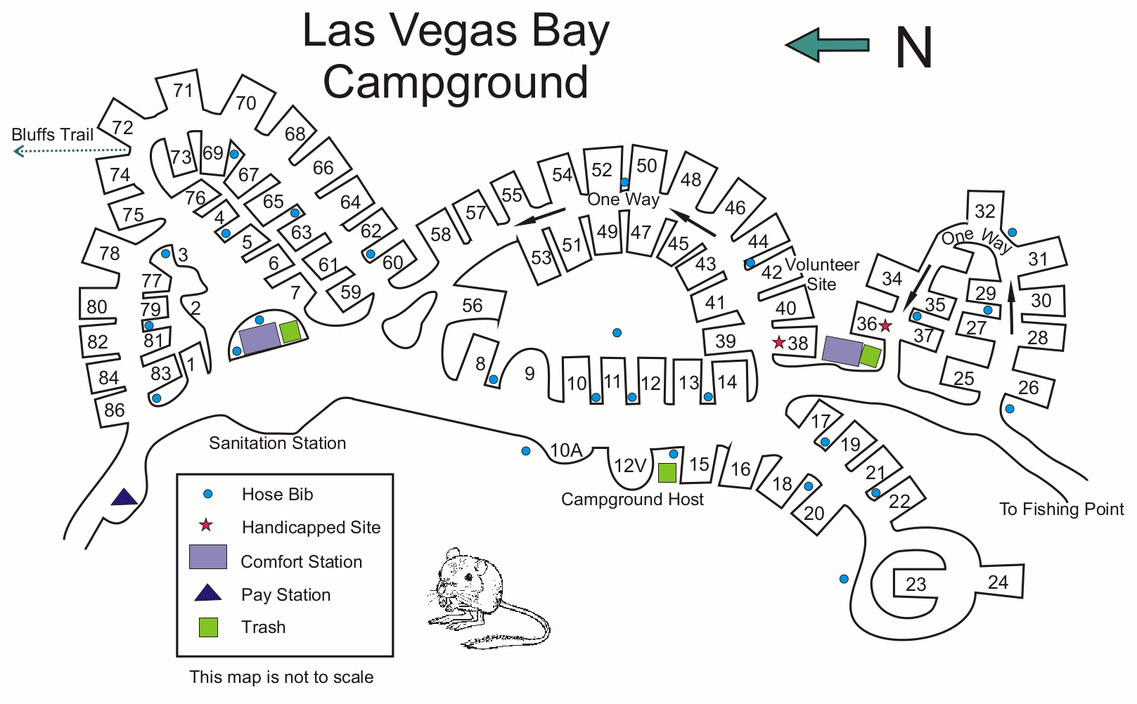 This Las Vegas Bay campground map (150 kb) shows the campground nearest Las Vegas that used to be located pretty close to the water. With today’s lower lake levels, it’s not currently on the water.
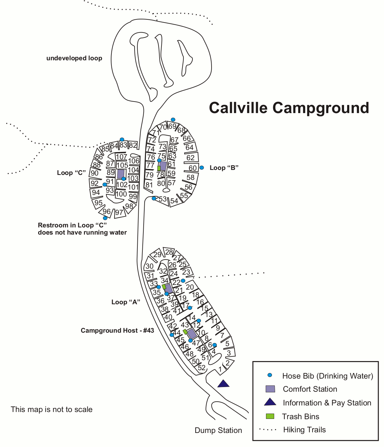 The Callville Bay campground map (100 kb) shows the three loops and trails of the first campground located along the Northshore Road east of Las Vegas Bay, on the way to Overton Arm.
 This Echo Bay campground map (100 kb) shows both the Upper and Lower campground of Echo Bay — the only campground on the Overton Arm of Lake Mead, in the northern part of the park.
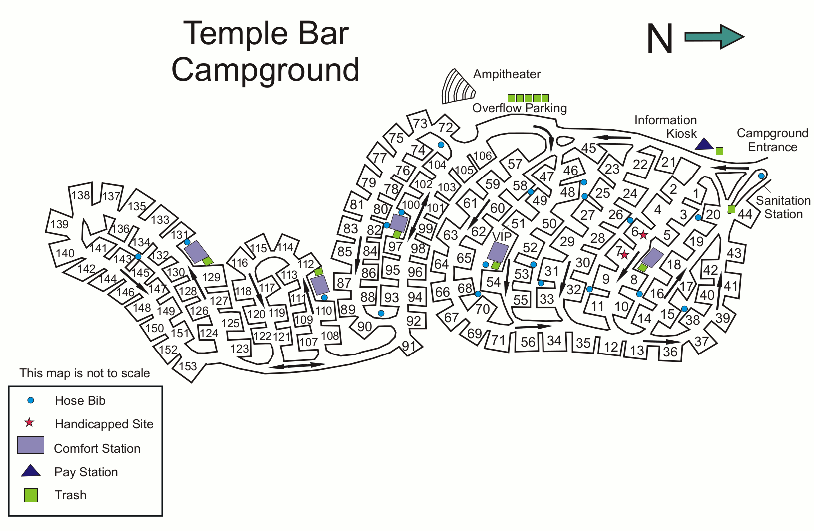 The Temple Bar campground map (200 kb) shows the easternmost campground in Lake Mead National Recreation Area. It’s the largest on the lake, with about 150 campsites.
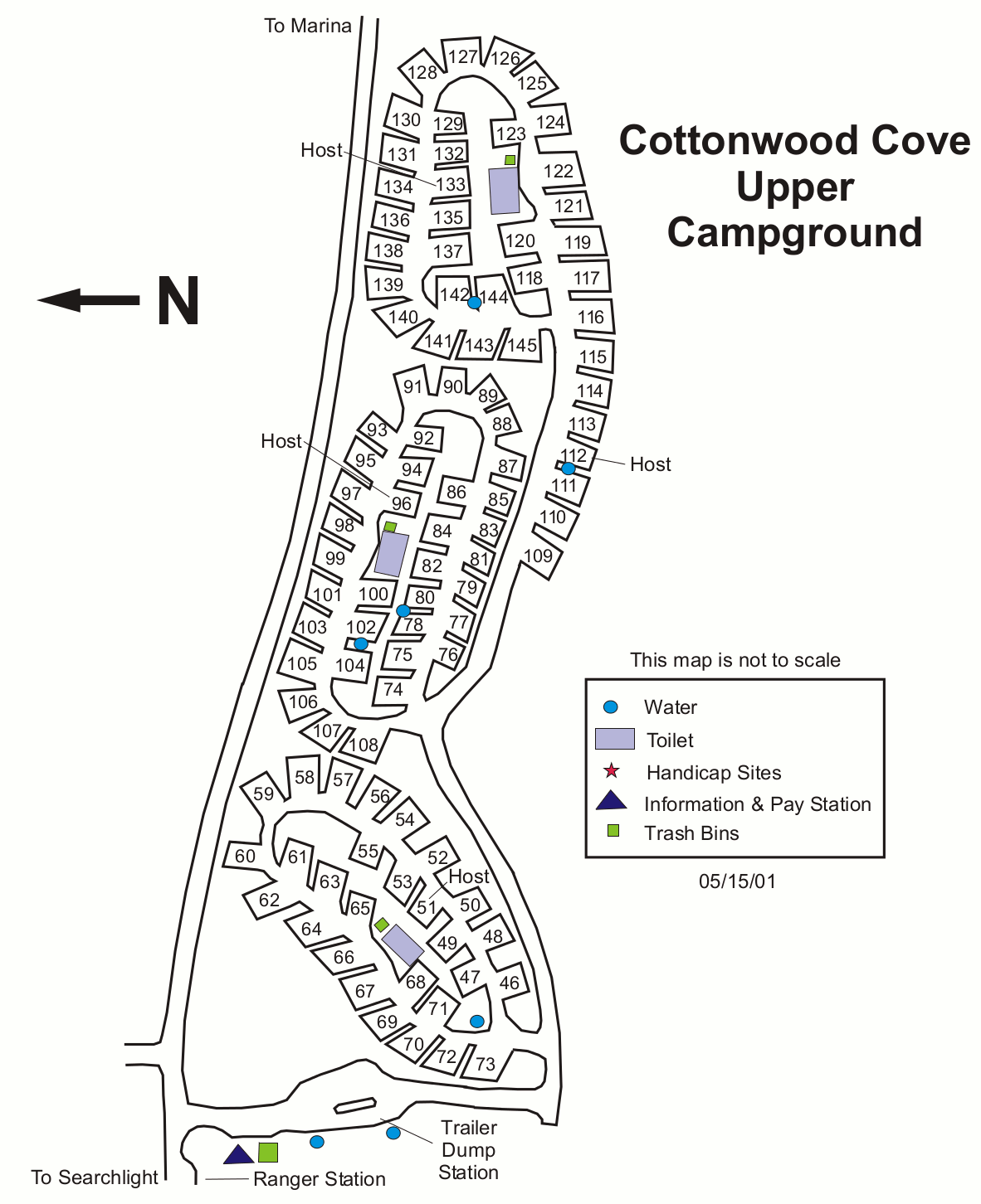 Here’s an Upper Cottonwood Cove campground map (150 kb), showing the three-loop layout of one of the two campgrounds located on the western shore of Lake Mohave, south of Lake Mead.
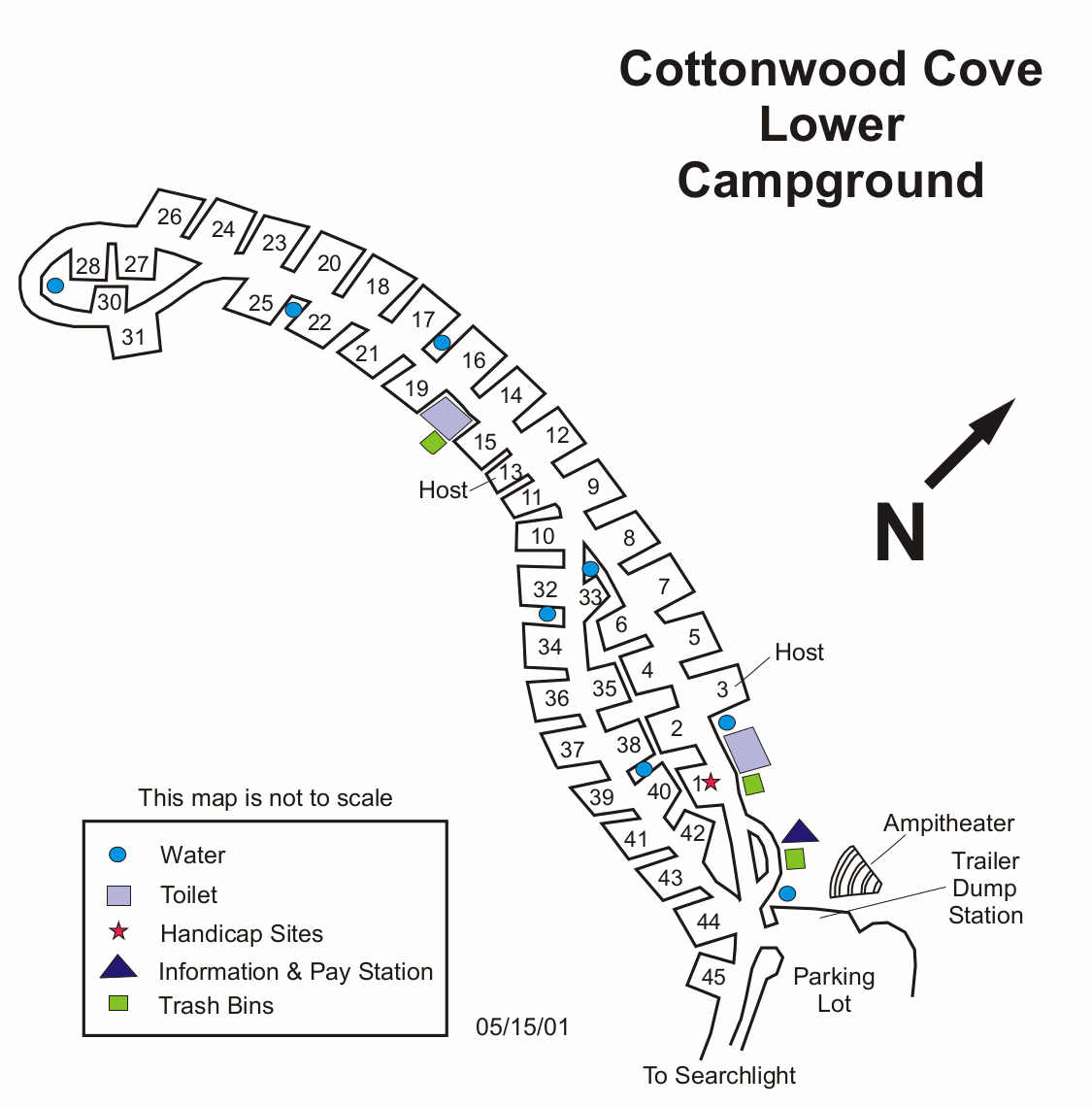 The Lower Cottonwood Cove campground map (80 kb) shows the smaller of two Cottonwood Cove campgrounds on the west side of Lake Mohave, accessed from Route 95 south of Boulder City.
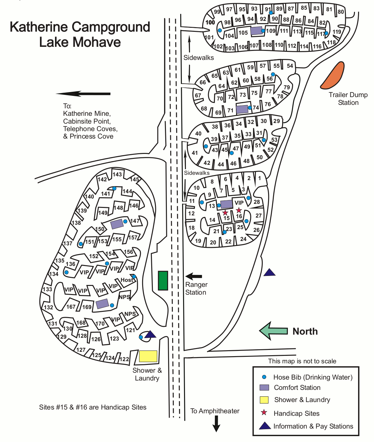 This Katherine Landing campground map (200 kb) shows the five loops of the recreation area’s largest campground (and the nearest one to Bullhead City) on the southeast part of Lake Mohave.
Various Lake Mead maps
 Here’s a Boulder Beach map which shows the major developed area of the park close to Hoover Dam. Click the image to view a full size GIF (250 kb) download the PDF (900 kb).
 The Black Canyon map focuses on the Colorado River features between Lake Mead and Lake Mohave. Click the image to view a full size JPG (600 kb) download the PDF (3.2 mb)
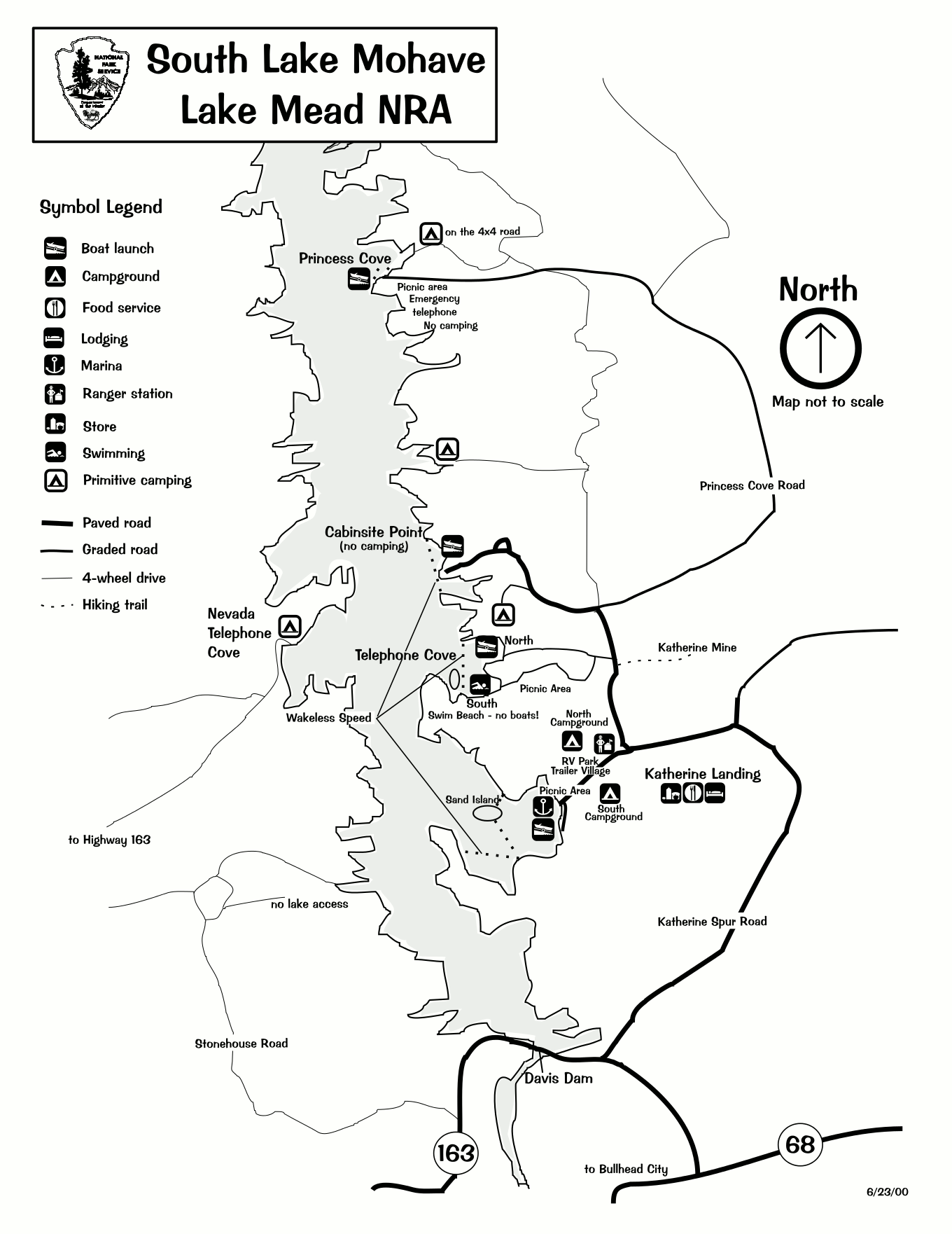 This South Lake Mohave map shows the major Lake Mohave access points from Bullhead City. Text Click the image to view a full size GIF (200 kb) download the PDF (400 kb).
Scientific Lake Mead maps
 Here’s a Lake Mead vegetation map (6.7 mb), showing what’s growing on every surface on all park lands. It also includes a series of inset maps showing important areas in additional detail.
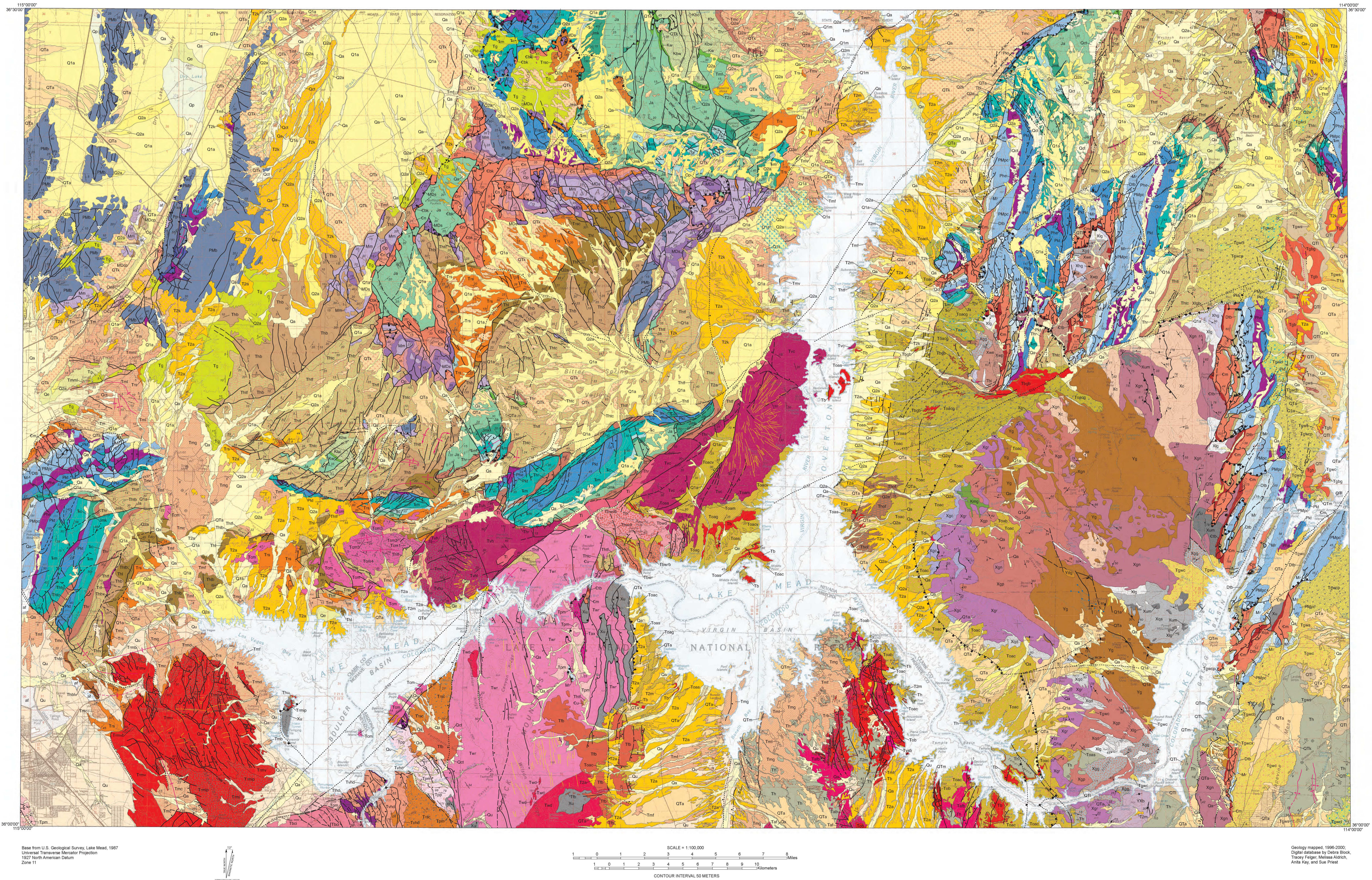 This Lake Mead geologic map (5.3 mb) shows all the rock types surrounding the reservoir and includes most of the National Recreation Area lands (excepting Lake Mohave to the south).
Lake Mead backcountry maps
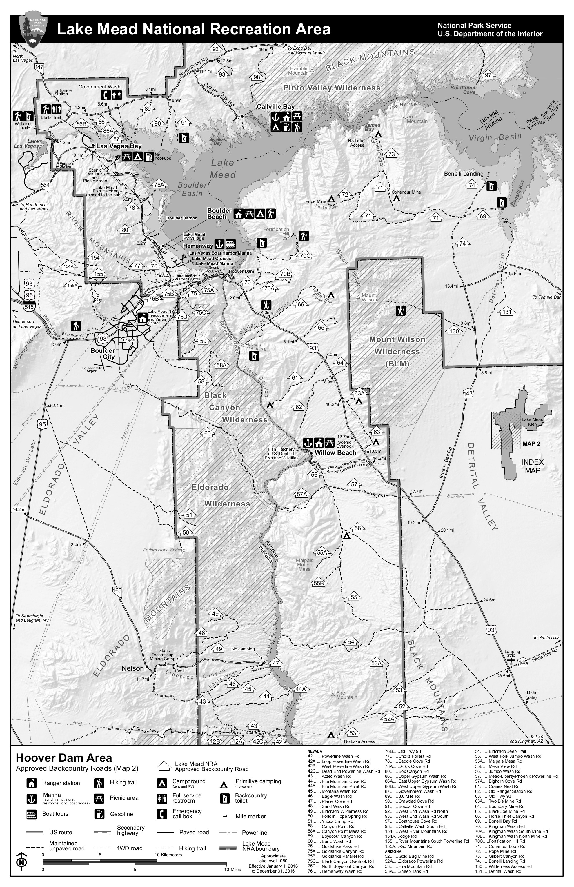 This is a Hoover Dam area backcountry map, focusing on the busiest part of the park on the western end of Lake Mead. Click the image to view a full size JPG (1.5 mb) download the PDF (2.7 mb).
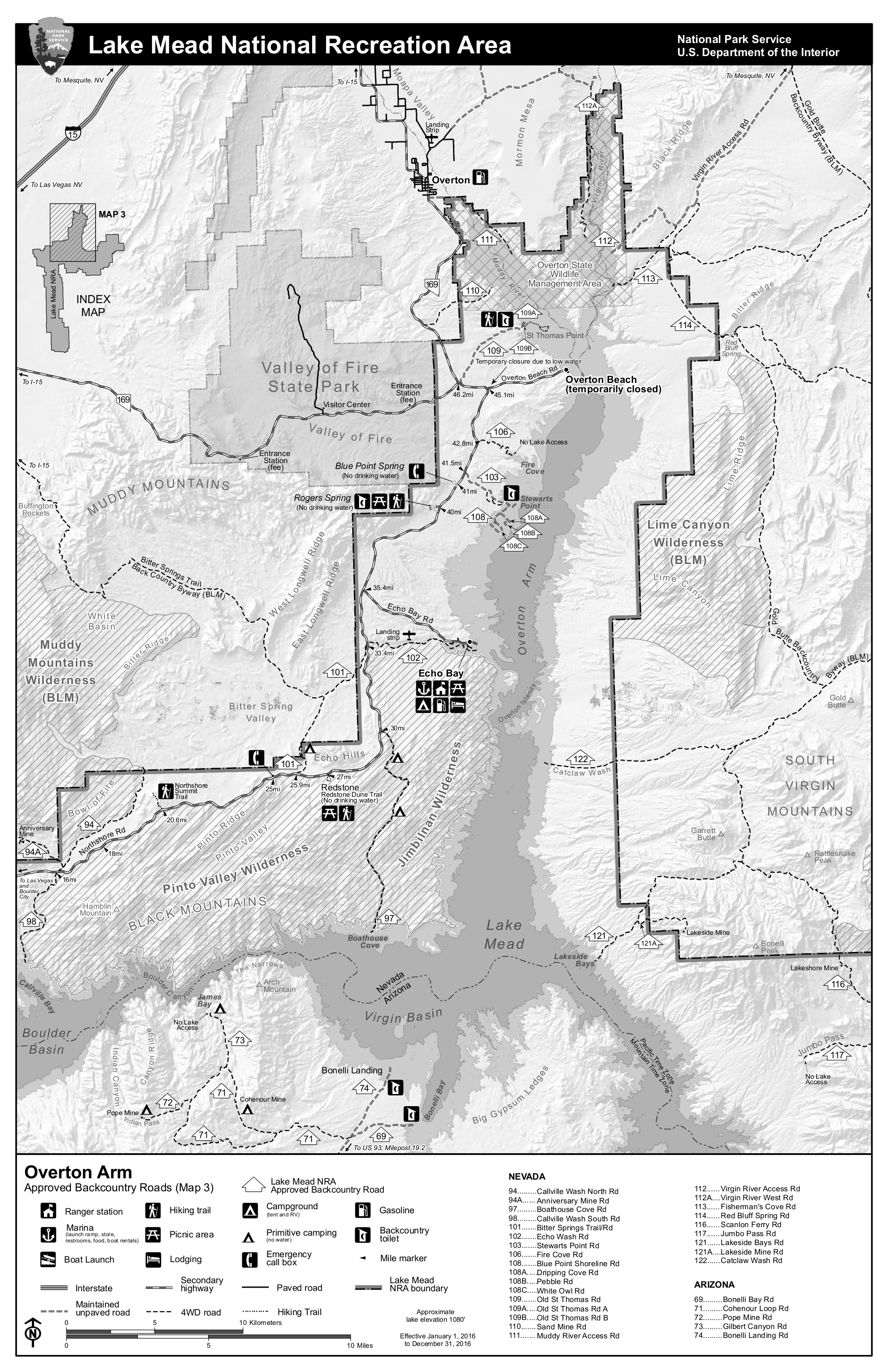 Here’s an Overton Arm area backcountry map, showing the northern branch of Lake Mead. Click the image to view a full size JPG (1.3 mb) download the PDF (2.6 mb).
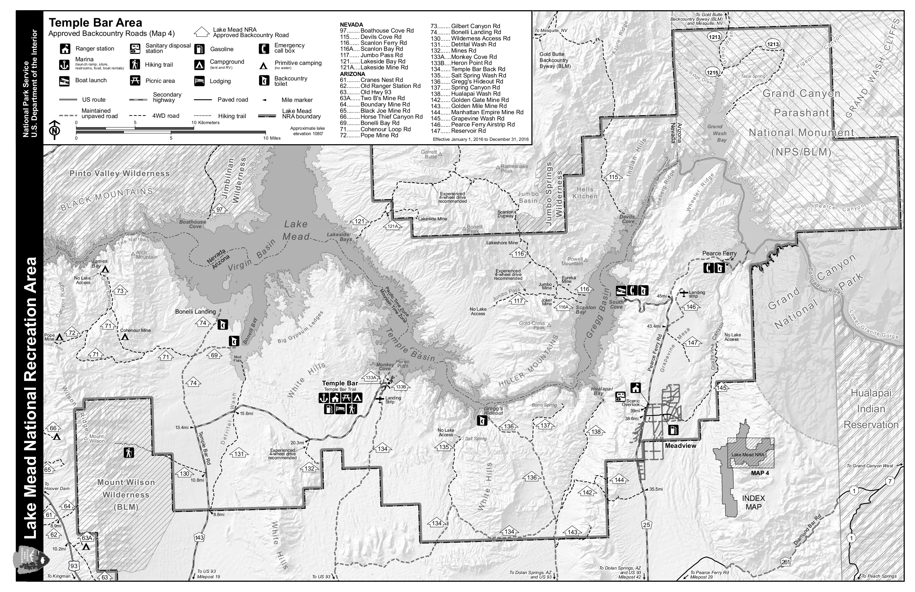 This Temple Bar area backcountry map shows the far eastern part of Lake Mead where it buts up against Grand Canyon National Park. Click the image to view a full size JPG (1.5 mb) download the PDF (3.6 mb).
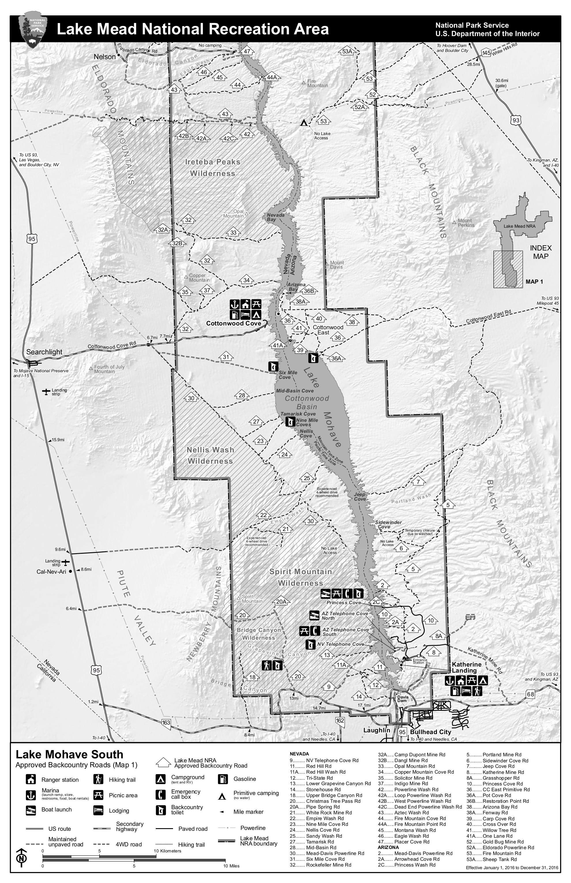 The Lake Mohave backcountry map, which focuses on the area around Lake Mohave north of Bullhead City. Click the image to view a full size JPG (1.4 mb) download the PDF (2.5 mb).
…and more!
< Return to National Park Maps home
< Return to Park List
< Return to List by State
Need more planning help? Browse Amazon’s best-selling Lake Mead maps and guidebooks.