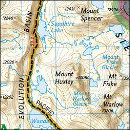
If you’re looking for a Kings Canyon map, you’ve come to the right place; currently I’ve collected 21 free Kings Canyon National Park maps to view and download. (PDF files and external links will open in a new window.) On this page you’ll find maps that cover the entire park (along with Sequoia) and maps that focus on specific areas, such as campgrounds. You can also browse the best-selling Kings Canyon maps and guidebooks on Amazon.
Kings Canyon map from the park brochures
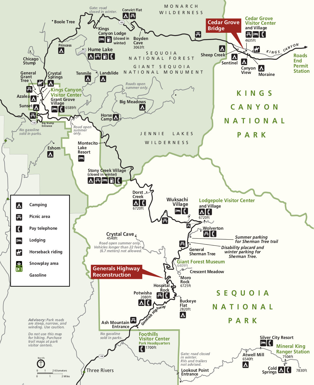
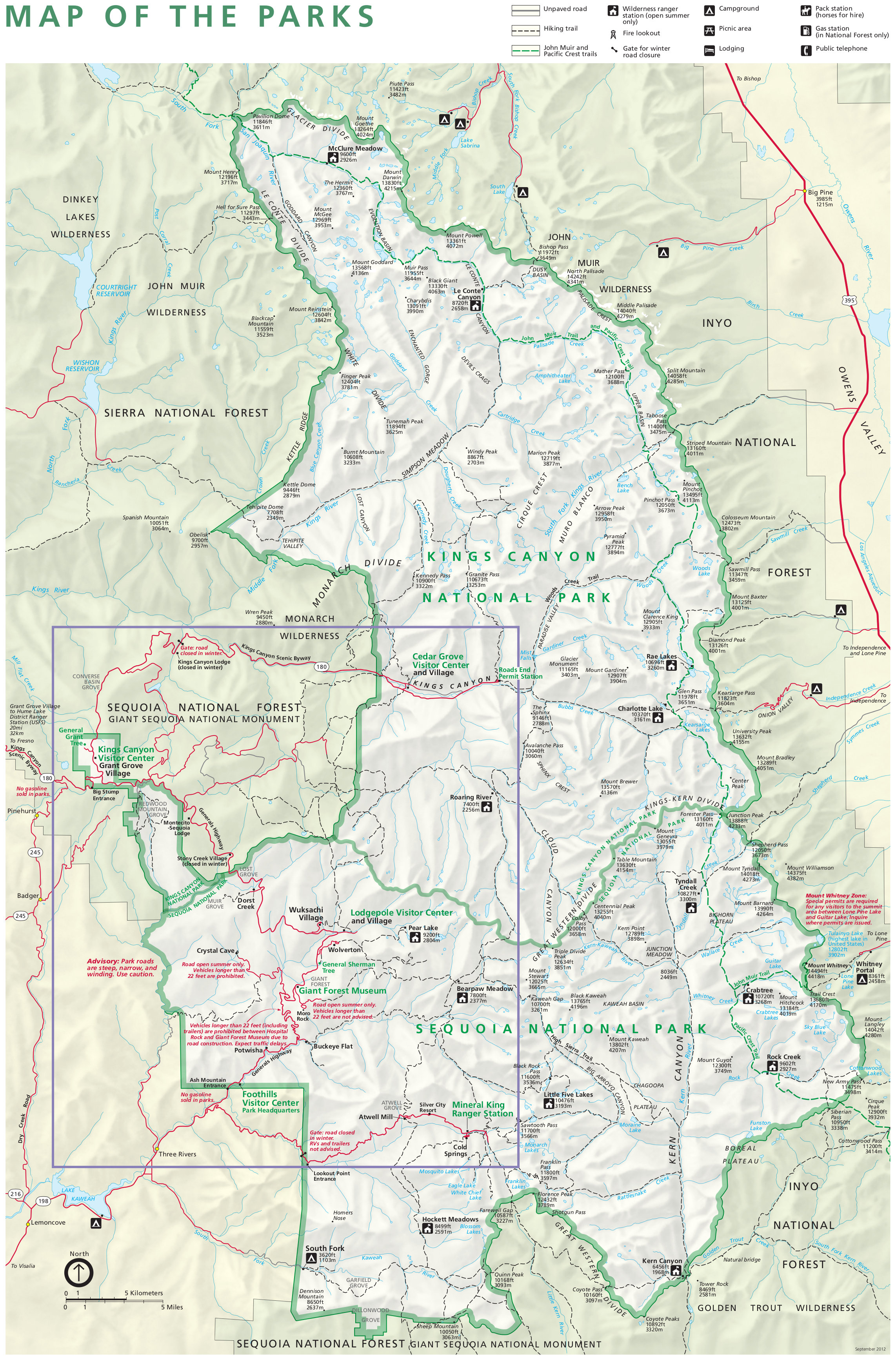 This is the official Sequoia and Kings Canyon National Park map, showing all of both Kings Canyon and Sequoia. Click the image to view a full size JPG (1.9 mb) or download the PDF (1.3 mb).
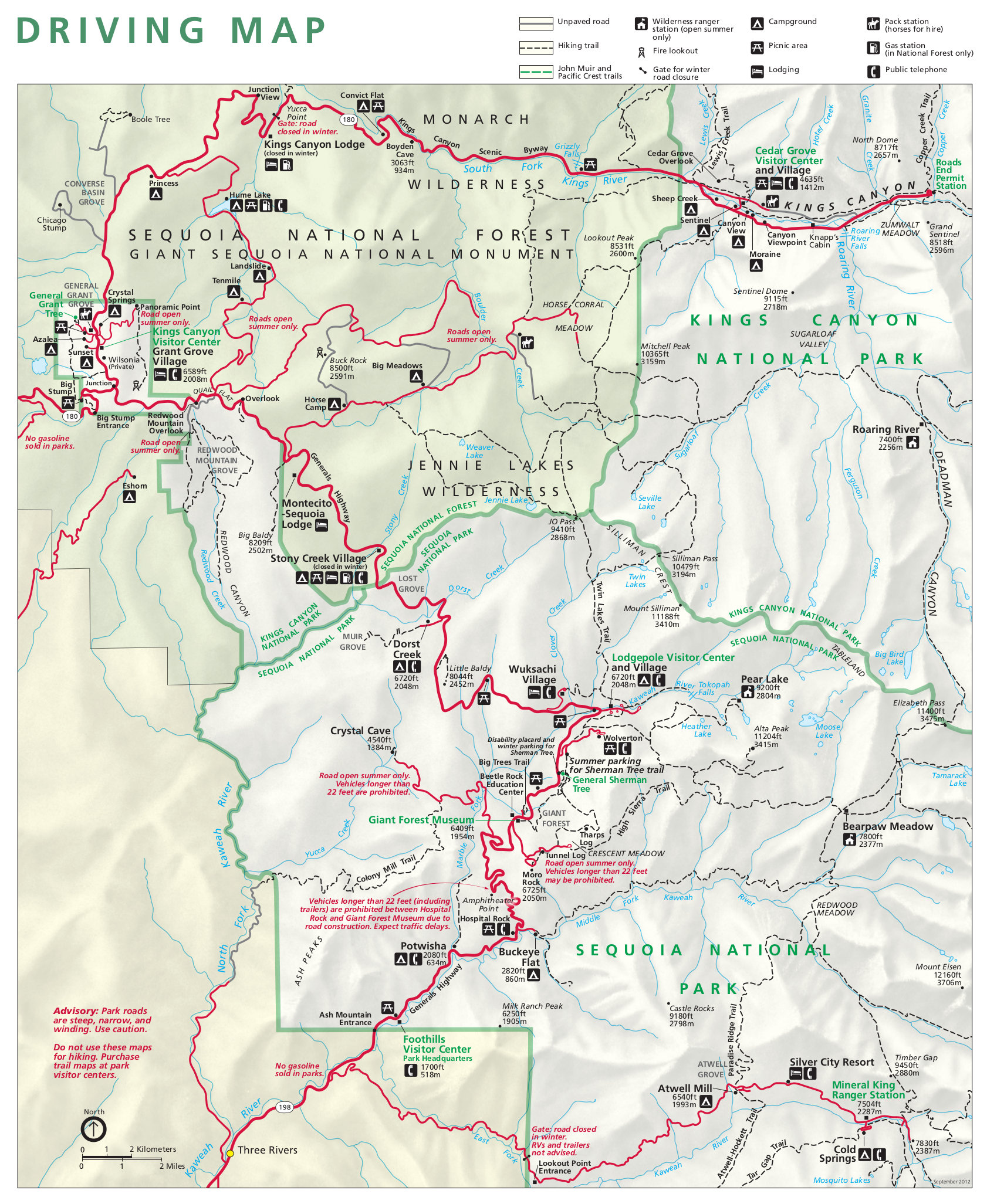 This is a detail map of Kings Canyon and Sequoia showing all the park’s roads in greater detail than the map above. Click the image to view a full size JPG (850 kb) or download the PDF (4.2 mb).
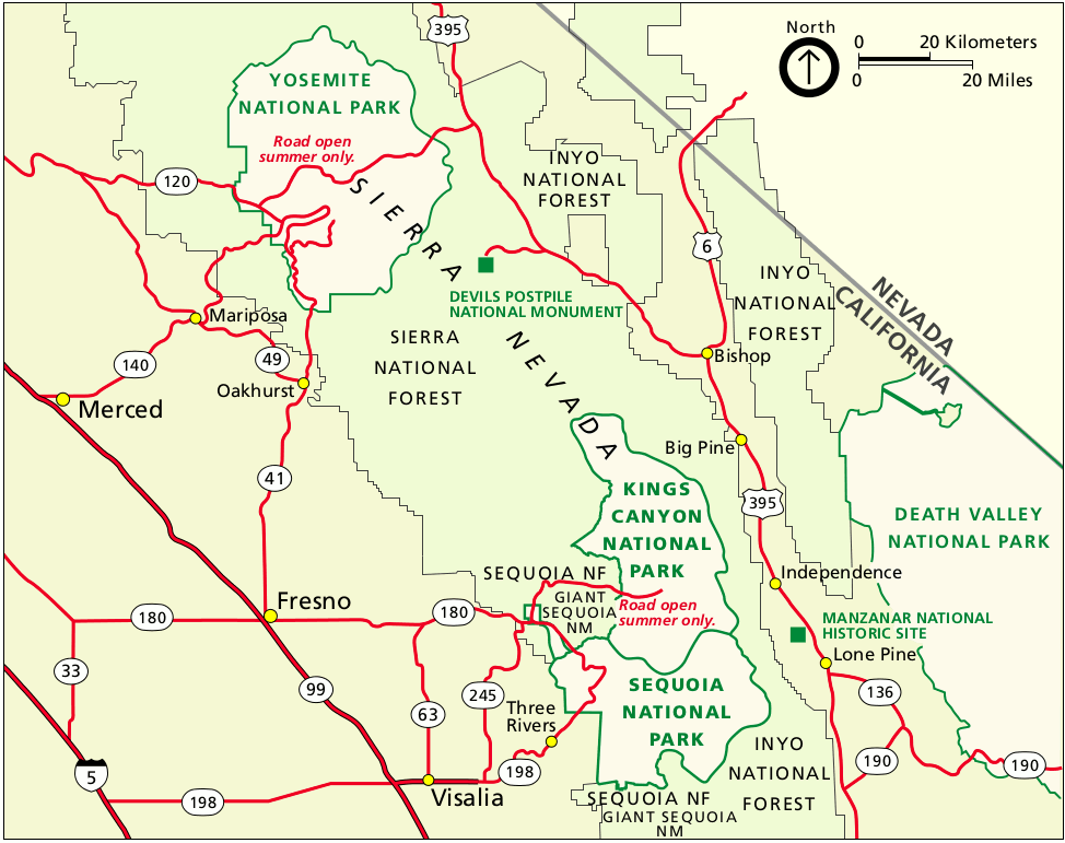 This is regional Sequoia and Kings Canyon map, showing the parks in relation to areas such as Yosemite, Fresno, Visalia, and Three Rivers. Click the image to view a full size GIF (100 kb) or download the PDF (100 kb).
Kings Canyon and Sequoia trail maps
 If you’re planning on doing any long hikes over overnight backpacking trips into the wilderness, you’ll want detailed trail maps that show topographic lines and trail mileages. The National Geographic Trails Illustrated maps are a great choice for planning trips and on-trail travel. Region-specific Tom Harrison maps like the Kings Canyon High Country and Mt. Whitney High Country maps are also exceptional.
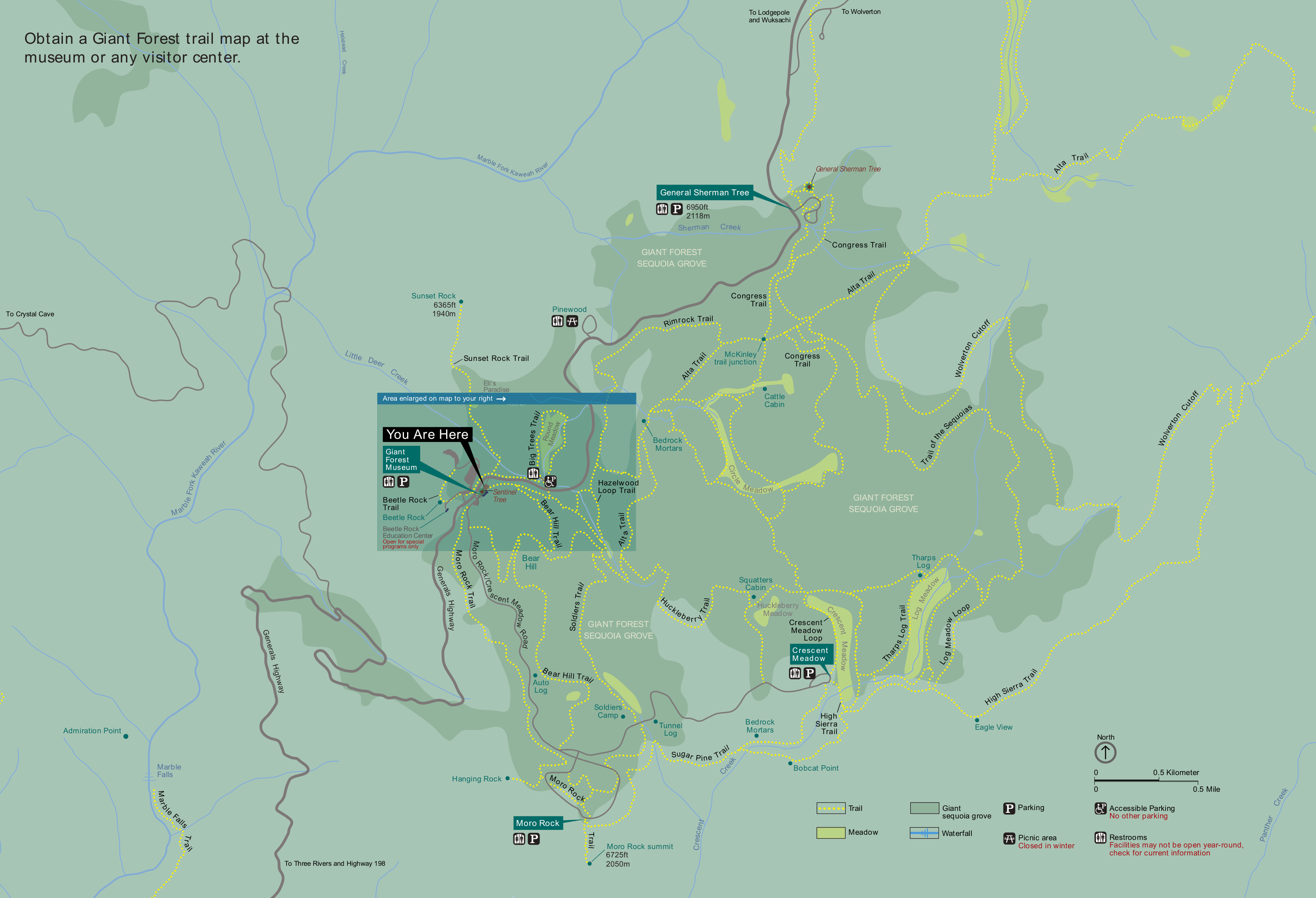 This Giant Forest trail map (400 kb) is on the wayside sign in front of the Giant Forest Museum in Sequoia. It shows the extensive network of trails through the Giant Forest, including the General Sherman Tree.
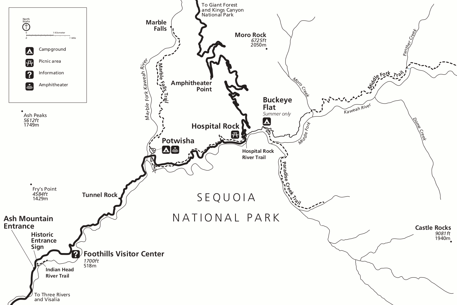 This is a Foothills trail map of Sequoia National Park (100 kb). It shows the popular trails in the Foothills district, which is not ideal for hiking during the summer because it is very, very hot.
Kings Canyon and Sequoia road and shuttle maps
 This is another road map of Sequoia and Kings Canyon (250 kb). This map is more suitable for printing than the above full-park maps since it does not have terrain shading and works well in grayscale ink.
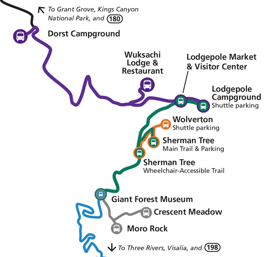 This is a bus map of Sequoia National Park’s shuttles (50 kb), which operate during the summer months. It shows all bus stops including the General Sherman Tree, Moro Rock, Lodgepole, and the Wuksachi Lodge.
Kings Canyon and Sequoia campground maps
The following is a listing of campgrounds located in both Sequoia and Kings Canyon; they are listed here from north to south, starting at Roads End in Kings Canyon.
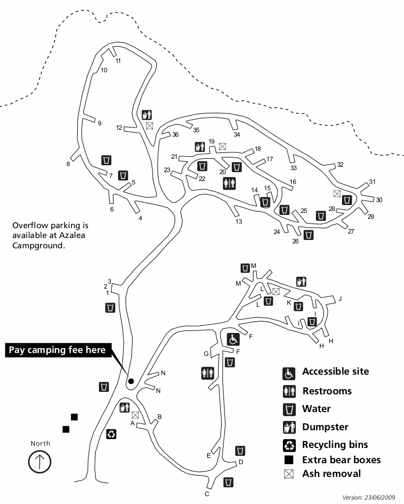
 This is a Moraine Campground map (100 kb), located furthest east of all the Cedar Grove area campgrounds in Kings Canyon National Park, nearest to Road’s End and furthest from the village and visitor center.
 This is a Canyon View Campground map (75 kb), located near Cedar Grove in Kings Canyon. This is a group campground only. (Personally I find it nice to separate out the larger groups from family campers.)
 This is a Sentinel Campground map (100 kb), located at Cedar Grove in Kings Canyon National Park. You’ll find warmer temperatures here than the Grant Grove campgrounds listed further below.
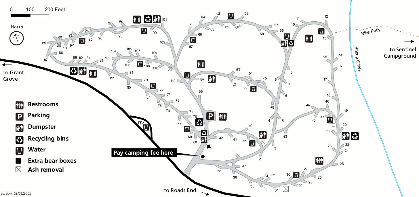 This is a Sheep Creek Campground map (100 kb), located near Cedar Grove in Kings Canyon National Park. This campground and the ones before are lower elevation campgrounds in Kings Canyon proper.
 This is a Crystal Springs Campground map (75 kb), open summers and also located near Grant Grove in Kings Canyon National Park. These next few campgrounds are high elevation with cooler temperatures.
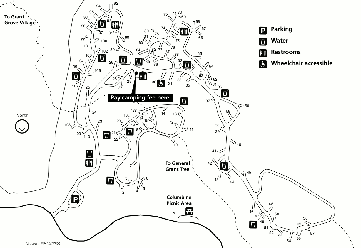 This is an Azalea Campground map (100 kb), located near Grant Grove in Kings Canyon National Park. It is Kings Canyon’s only all-year campground, with pleasant temperatures in summer (snow in winter).
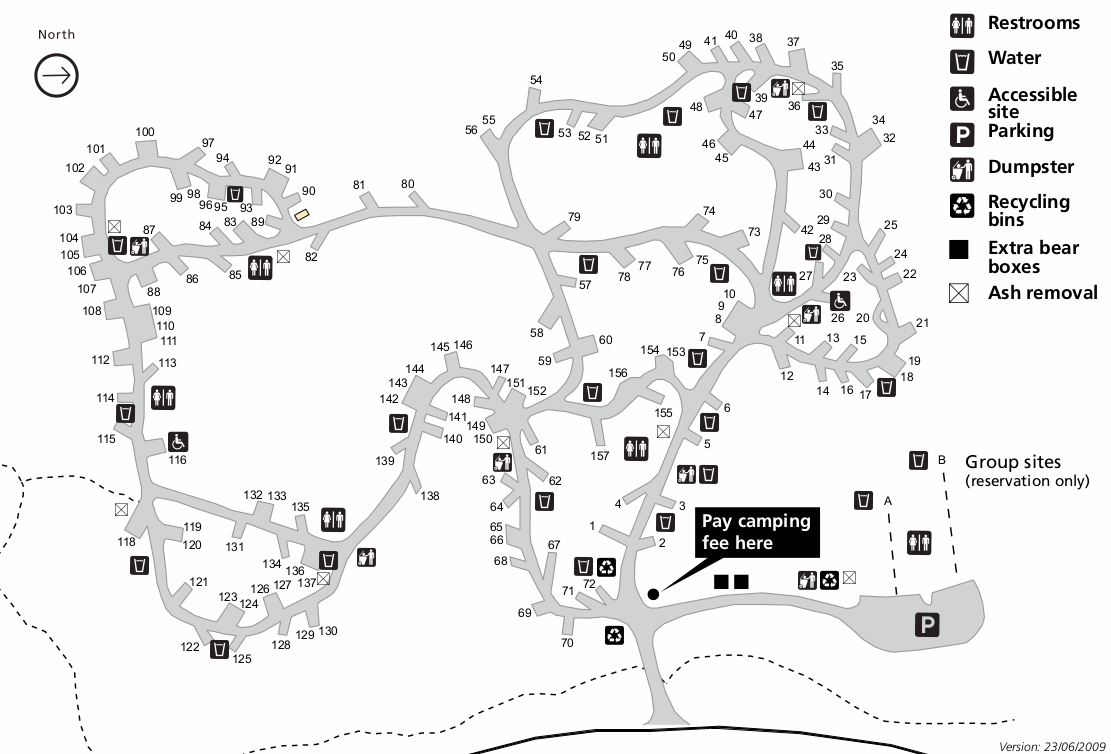 This is a Sunset Campground map (100 kb), open summers with over 100 sites and located near Grant Grove in Kings Canyon National Park. This is another high-elevation forested campground.
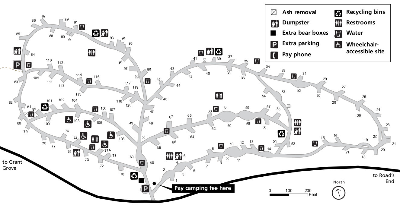
 This is a Dorst Creek campground map (150 kb), located on the way to Lodgepole along the Generals Highway. This high-elevation campground stays cool during summer months like Grant Grove.
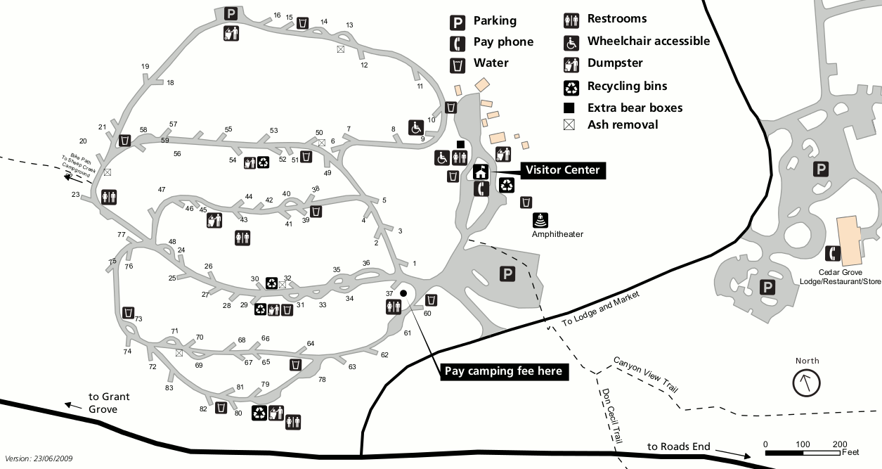
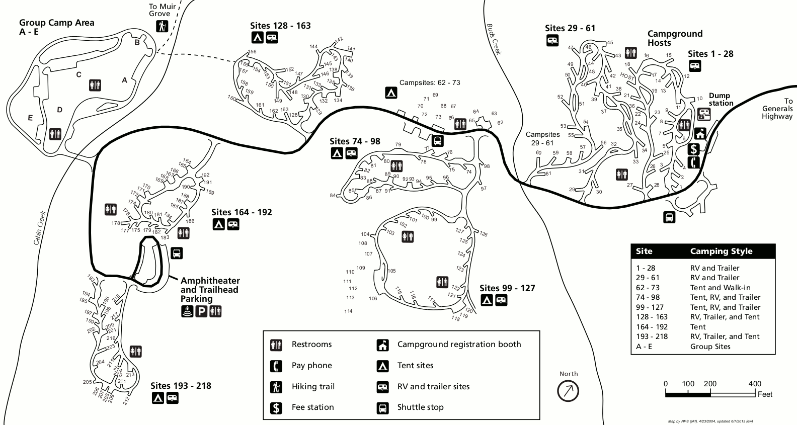
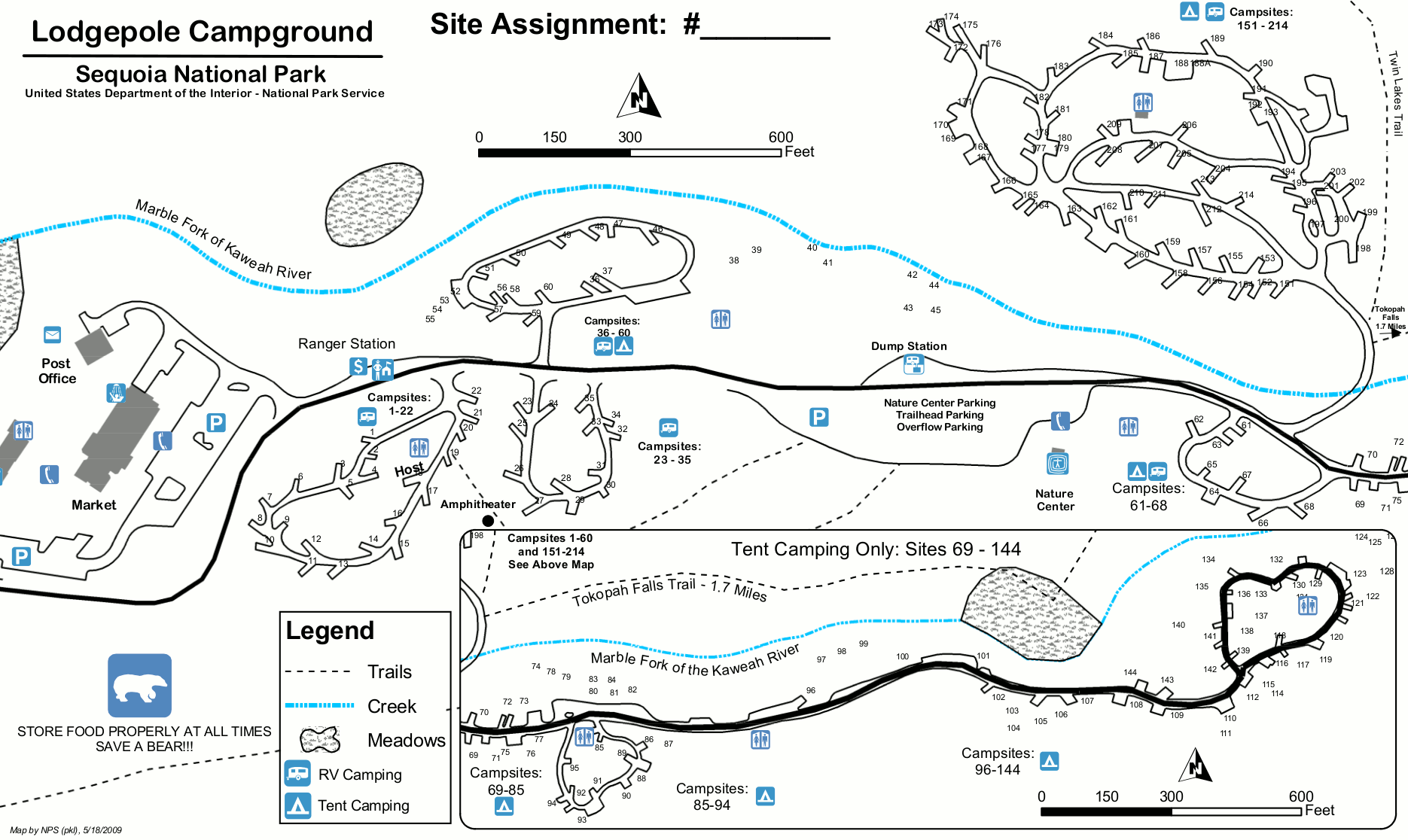 This is a Lodgepole campground map. Lodgepole is the closest campground to Giant Forest in Sequoia National Park. Click the image to view a full size JPG (300 kb) or download the PDF (400 kb).
 This is a Buckeye Flat campground map (60 kb), open seasonally (summers) along the Generals Highway in the low elevation Foothills district in Sequoia National Park.
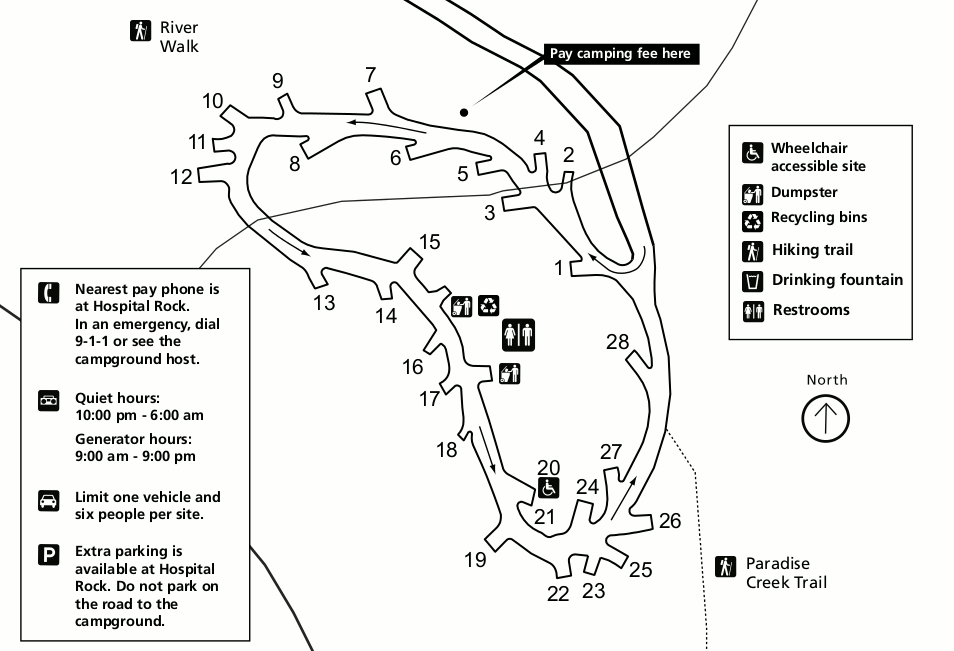
 This is a Potwisha campground map (70 kb), open all year and located along the Generals Highway in the low elevation Foothills district in Sequoia National Park. It’ll be hot during the summer!
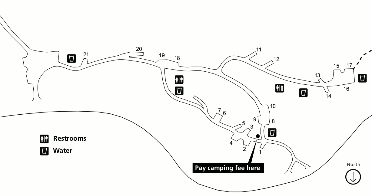 This is an Atwell Mill campground map (40 kb), open during the summer months along the Mineral King Road in Sequoia National Park. This is a very isolated part of Sequoia National Park down a rough road.
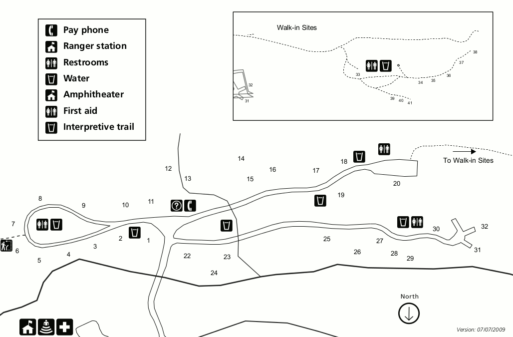 This is a Cold Springs campground map (50 kb), open during the summer months in Mineral King (very remote!) in Sequoia National Park. You probably won’t be going here unless you’re a hardcore visitor!
Kings Canyon map prints and gifts
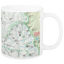
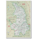 Printed high-resolution Kings Canyon map posters and other products are available at the Kings Canyon Maps store. For art prints, gift ideas, and souvenirs featuring other national parks, support this site and visit the National Park Maps store; you’ll find items to bring on vacation, keep at home for the memories, or give to your park-enthusiast friends and family.
…and more!
< Return to National Park Maps home
< Return to Park List
< Return to List by State
Need more help? Browse Amazon’s best-selling Kings Canyon maps and guidebooks.