If you’re looking for a Jean Lafitte map, you’ve come to the right place; currently I’ve collected 10 free Jean Lafitte National Historical Park and Preserve maps to view and download. (PDF files and external links will open in a new window.) On this page you’ll find maps covering each of the sites of the national park spread throughout southern Louisiana. You can also browse best-selling Louisiana and New Orleans maps and guidebooks on Amazon.
Jean Lafitte brochure maps
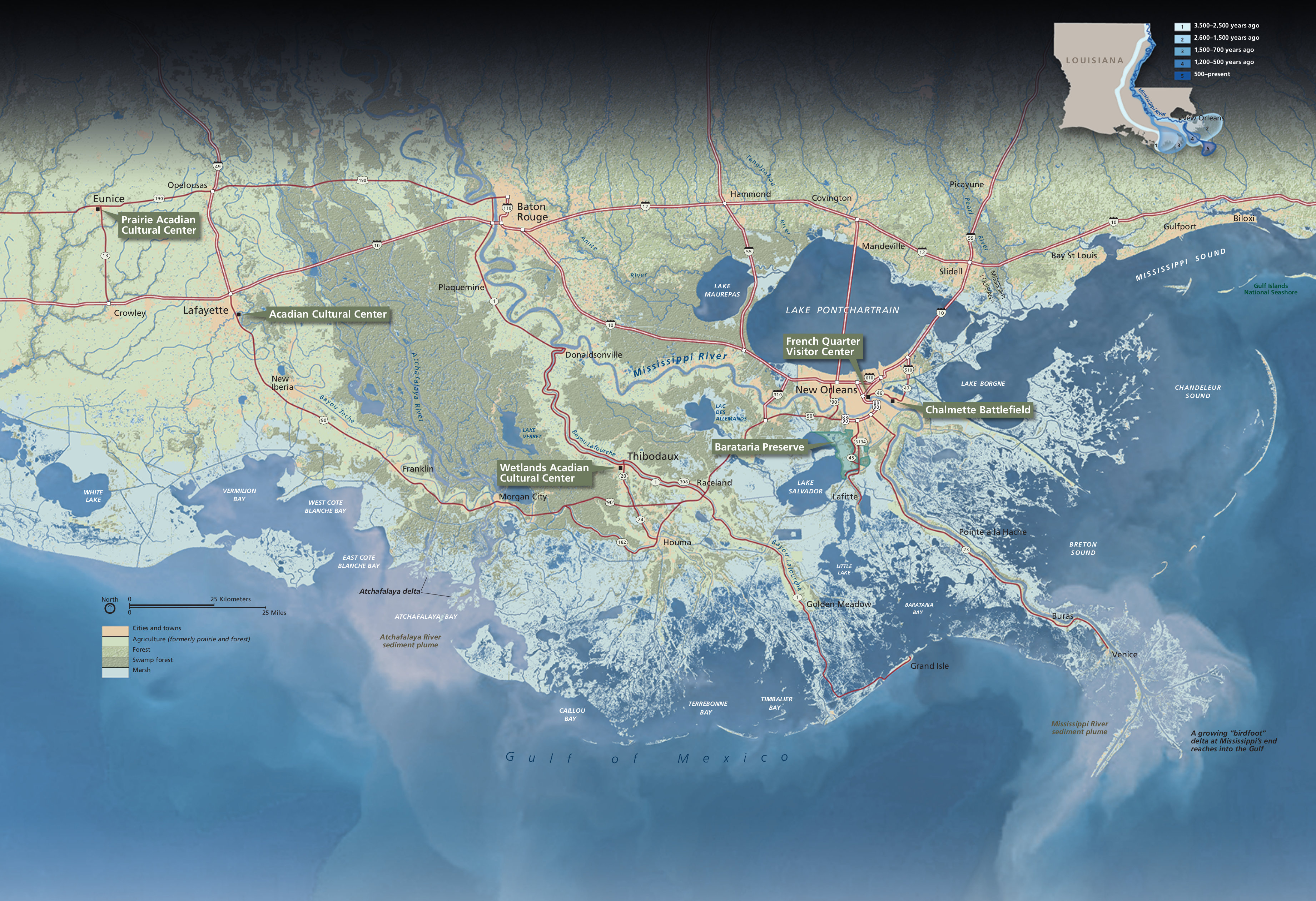 Here’s the overall Jean Lafitte map, showing each of the park units over this gorgeous view of southern Louisiana. Click the image to view a full size JPG (1.7 mb) or download the PDF (5.6 mb).
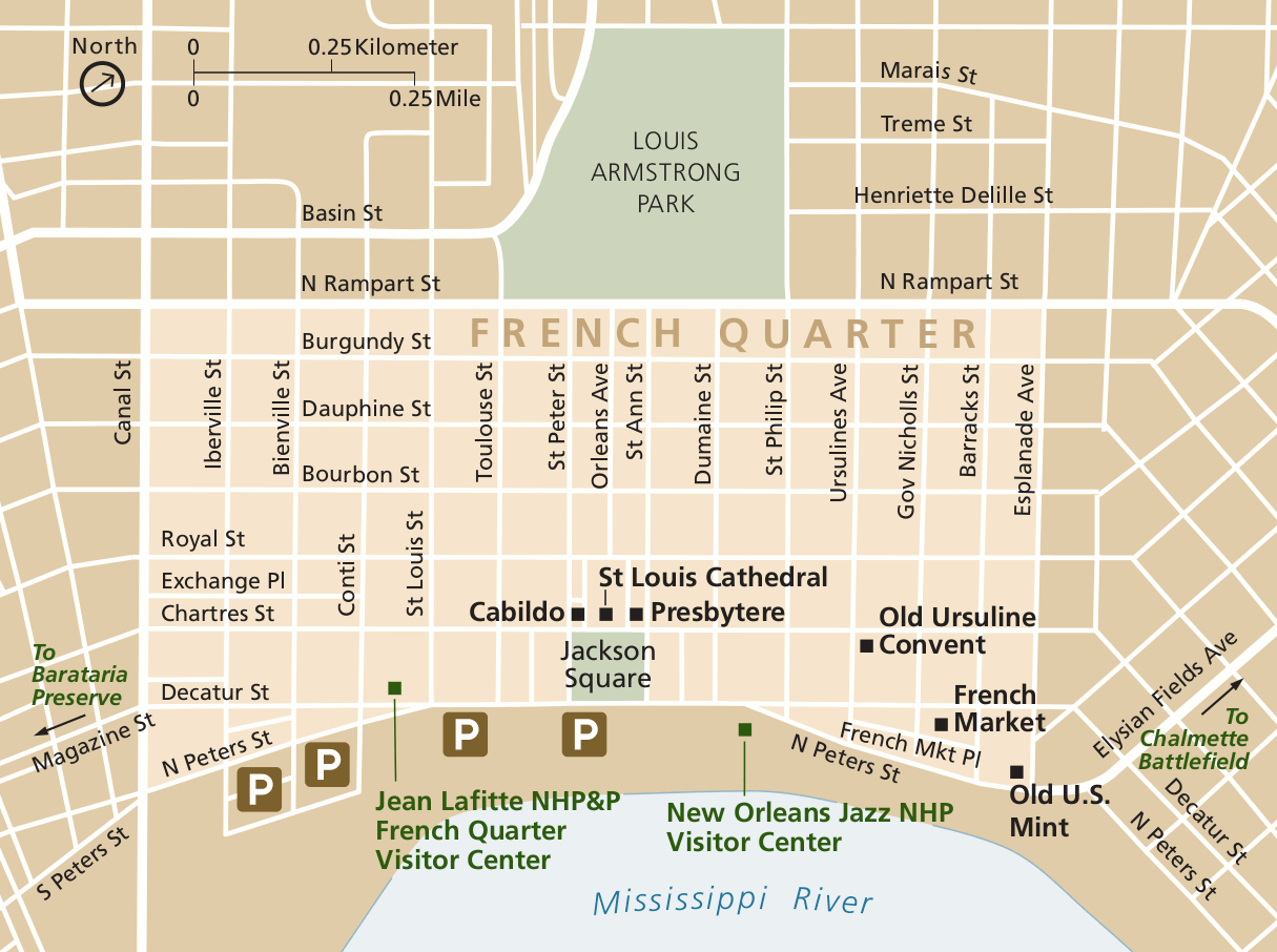 This New Orleans French Quarter street map shows the location of the Jean Lafitte Visitor Center and other NPS sites. Click the image to view a full size GIF (150 kb) or download the PDF (200 kb).
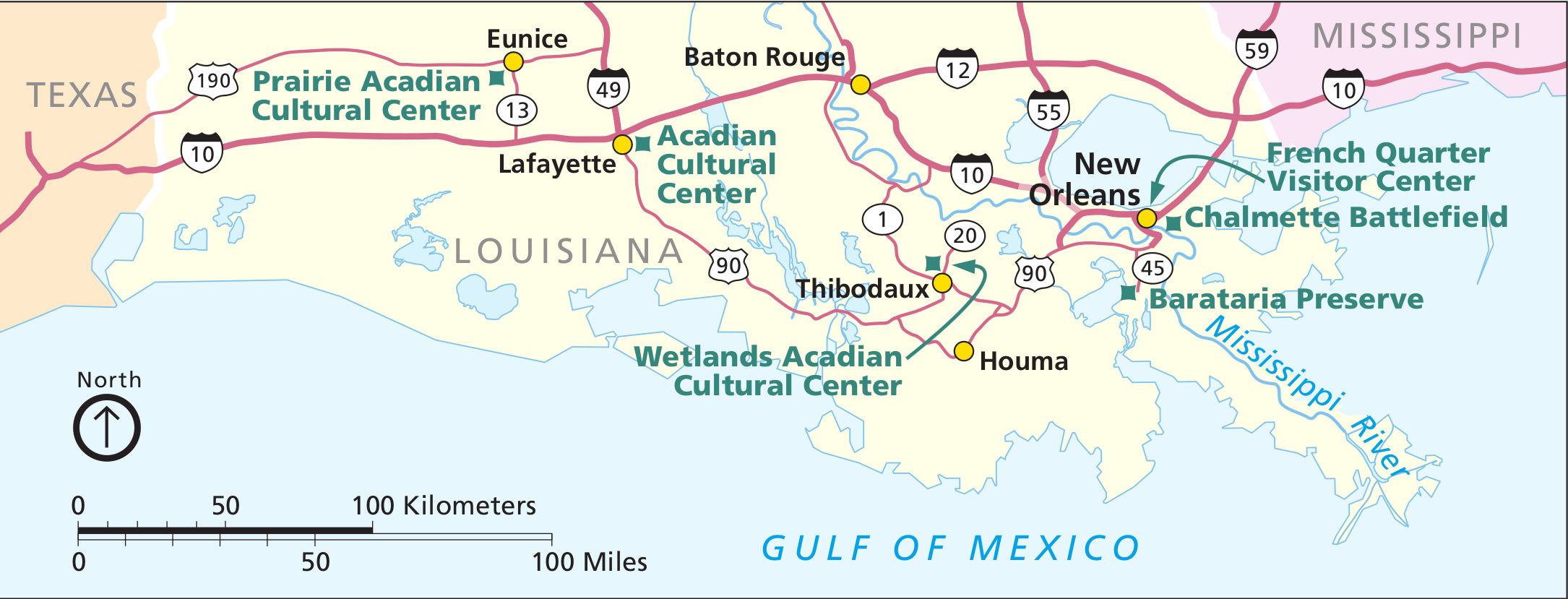
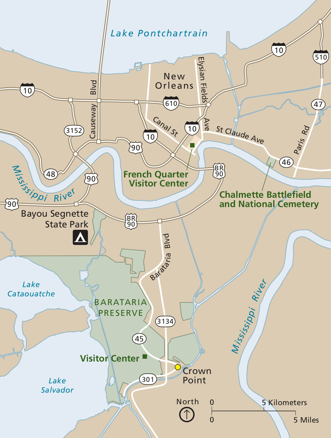 The New Orleans area map shows the Barataria Preserve and Visitor Center, as well as the location of the Chalmette Battlefield. Click the image to view a full size GIF (150 kb) or download the PDF (150 kb).
 The Wetlands Acadian Cultural Center street map shows the center’s location on Bayou Lafourche in Thibodaux. Click the image to view a full size GIF (50 kb) download the PDF (60 kb).
 This Acadian Cultural Center map shows the center’s location in Lafayette, nearby Vermilionville and the Vermilion River. Click the image to view a full size GIF (50 kb) or download the PDF (100 kb).
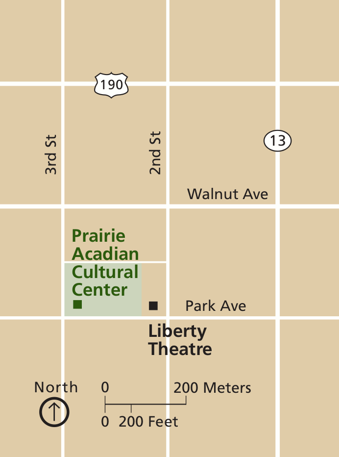 Here’s a Prairie Acadian Cultural Center street map, zooming in on Eunice, LA. This is the furthest north of the Jean Lafitte sites. Click the image to view a full size GIF or (30 kb) or download the PDF (60 kb).
 This Jean Lafitte regional map shows all the park sites (like the first map listed here). This one is easier for printing, however. Click the image to view a full size JPG (250 kb) downoad the PDF (500 kb).
Other Jean Lafitte maps
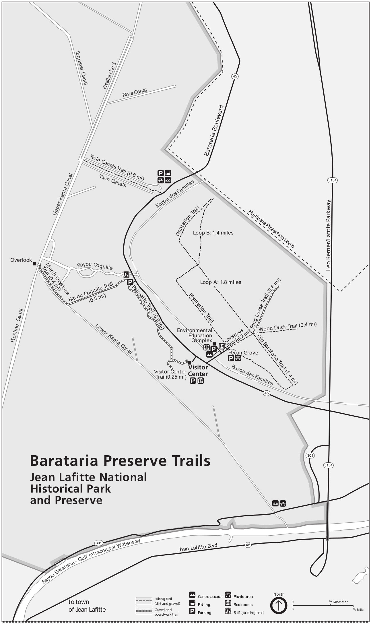 Here’s a Barataria trail map (250 kb), showing the trails in Barataria Preserve that branch out from the visitor center area on various loops and to the marsh overlook.
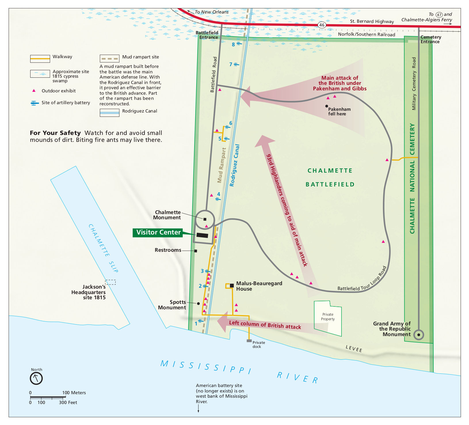 The Chalmette Battlefield map includes present day services (visitor center, loop road) and the historical battle maneuvers as well. Click the image to view a full size JPG (300 kb) or download the PDF (800 kb).
…and more!
< Return to National Park Maps home
< Return to Park List
< Return to List by State
Need more help? Browse Amazon’s best-selling Louisiana maps and guidebooks.