If you’re looking for a Great Falls map, you’ve come to the right place; currently I’ve collected 8 free Great Falls Park maps to view and download. (PDF files and external links will open in a new window.) On this page you’ll find detail maps covering the Great Falls Park trails and facilities, along with a couple others showing more of the Potomac River. You can also browse best-selling Potomac River maps and guidebooks on Amazon.
Great Falls brochure maps
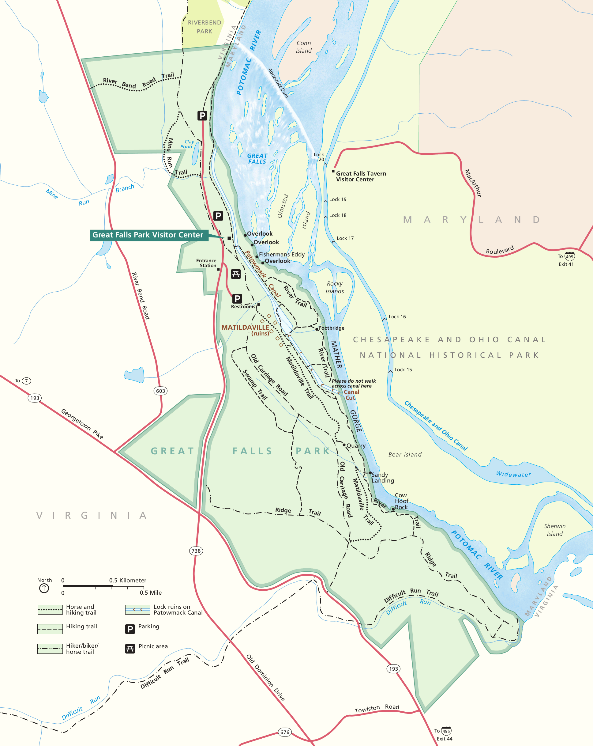
 This is the official Great Falls Park map, showing the visitor center, overlooks, trails, historic canals, and services. Click the image to view a full size JPG (700 kb) or download the PDF (5.1 mb).
 Here’s a printable Great Falls map, nearly identical to the one above but displayed without shading, making it easier to print at home. Click the image to view a full size GIF (450 kb) or download the PDF (5.0 mb).
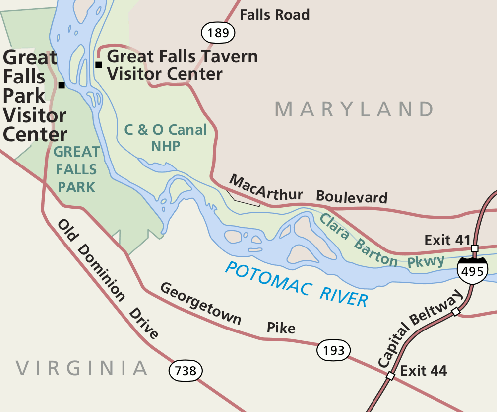 This regional Great Falls map zooms out just a bit in order to include the various area roads as well as the C&O Canal National Historical Park. Click the image to view a full size GIF (100 kb) or download the PDF (300 kb).
Great Falls trail maps
 Take a look at the Great Falls trail map (500 kb), labeling hiking trails, horse trails, and bike trails. Trail descriptions are also provided, along with hike lengths and time estimates to complete the different routes.
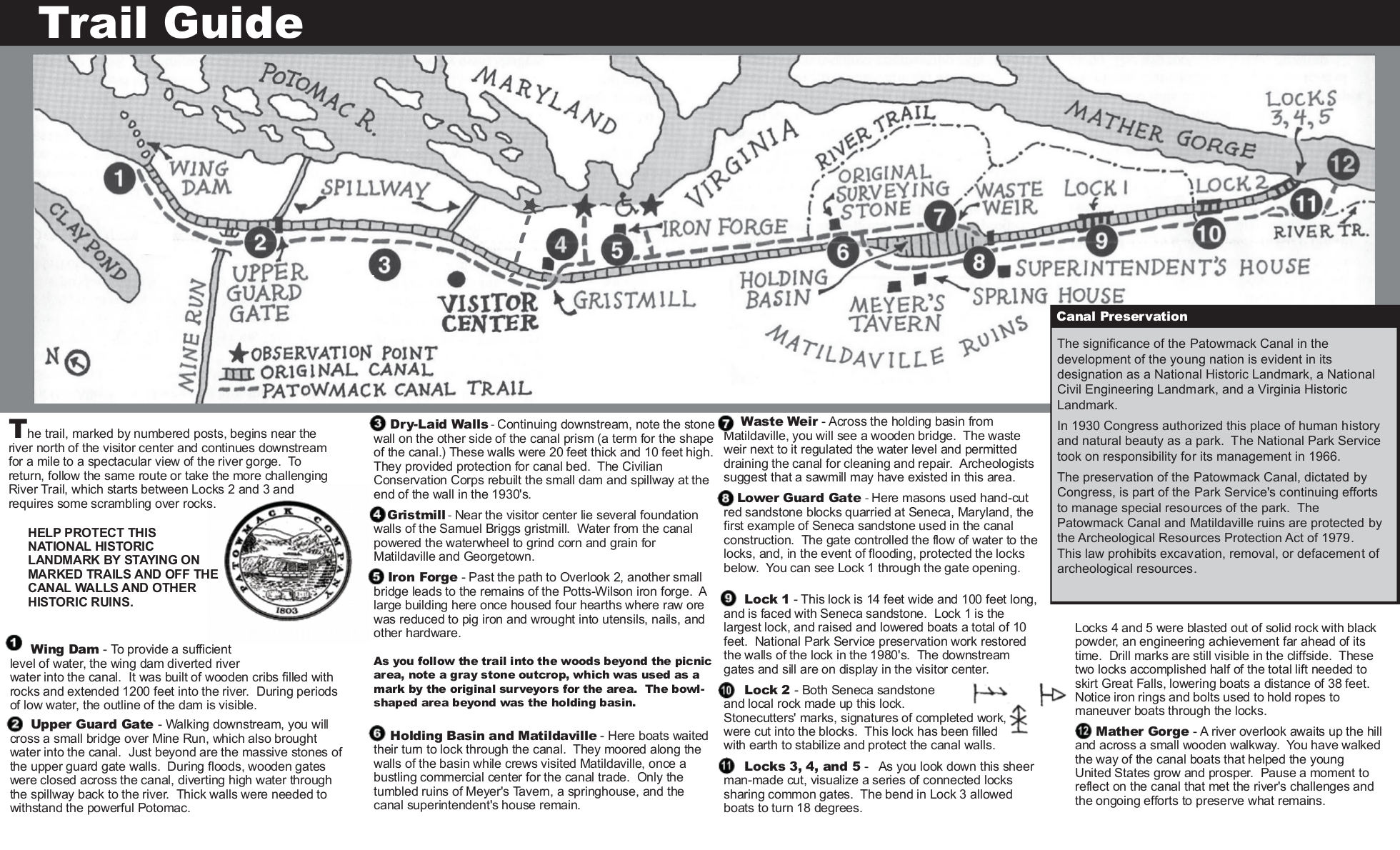 The Potowmack Canal trail map (500 kb) provides a self-guided tour of the Potowmack Canal trail, giving you a chance to learn about the history of transportation along the Potomac River.
Potomac River maps
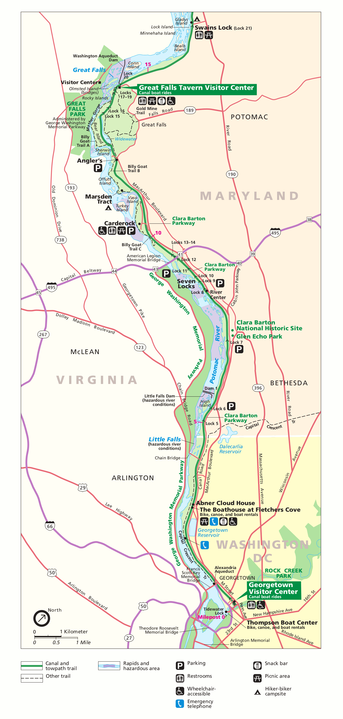 Here’s a Potomac River map, showing the stretch of river and C&O Canal from Great Falls Park downstream to Washington, D.C. Click the image to view a full size GIF (300 kb) or download the PDF (200 kb).
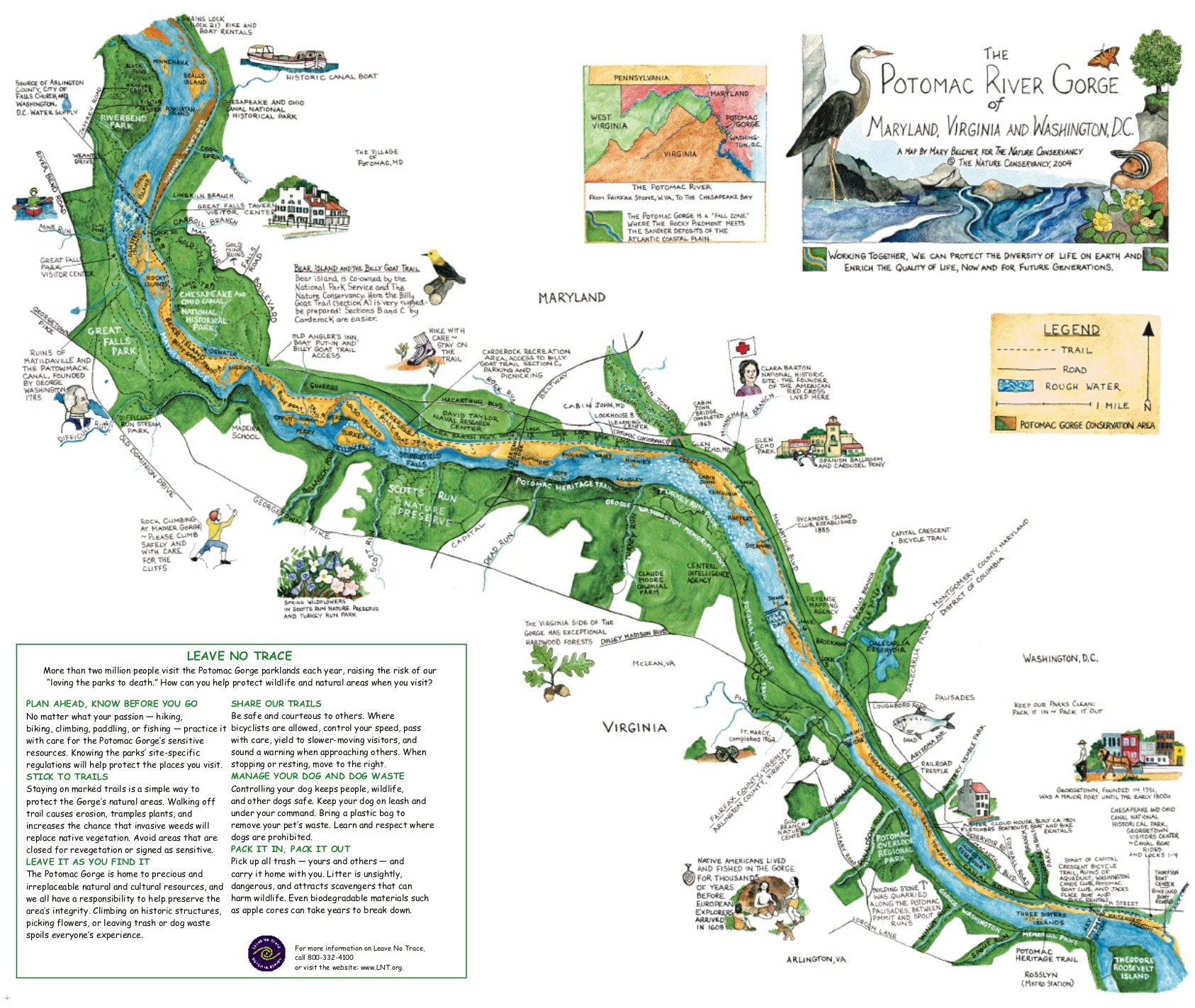 This Potomac River map (500 kb) is compliments of the Nature Conservancy. I recognize that it’s a bit tricky to read (a little higher resolution would be nice), but this is the highest quality version I can find.
…and more!
You can find maps of the Maryland side of Great Falls on the C&O Canal Maps page.
< Return to National Park Maps home
< Return to Park List
< Return to List by State
Need more help? Browse Amazon’s best-selling Potomac River maps and guidebooks.