If you’re looking for a Great Basin map, you’ve come to the right place; currently I’ve collected 8 free Great Basin National Park maps to view and download. (PDF files and external links will open in a new window.) Here’s you’ll see a few maps that cover the different campground layouts, as well as one that shows everything in the park. You can also browse the best-selling Great Basin maps and guidebooks on Amazon.
Great Basin map from the official brochure
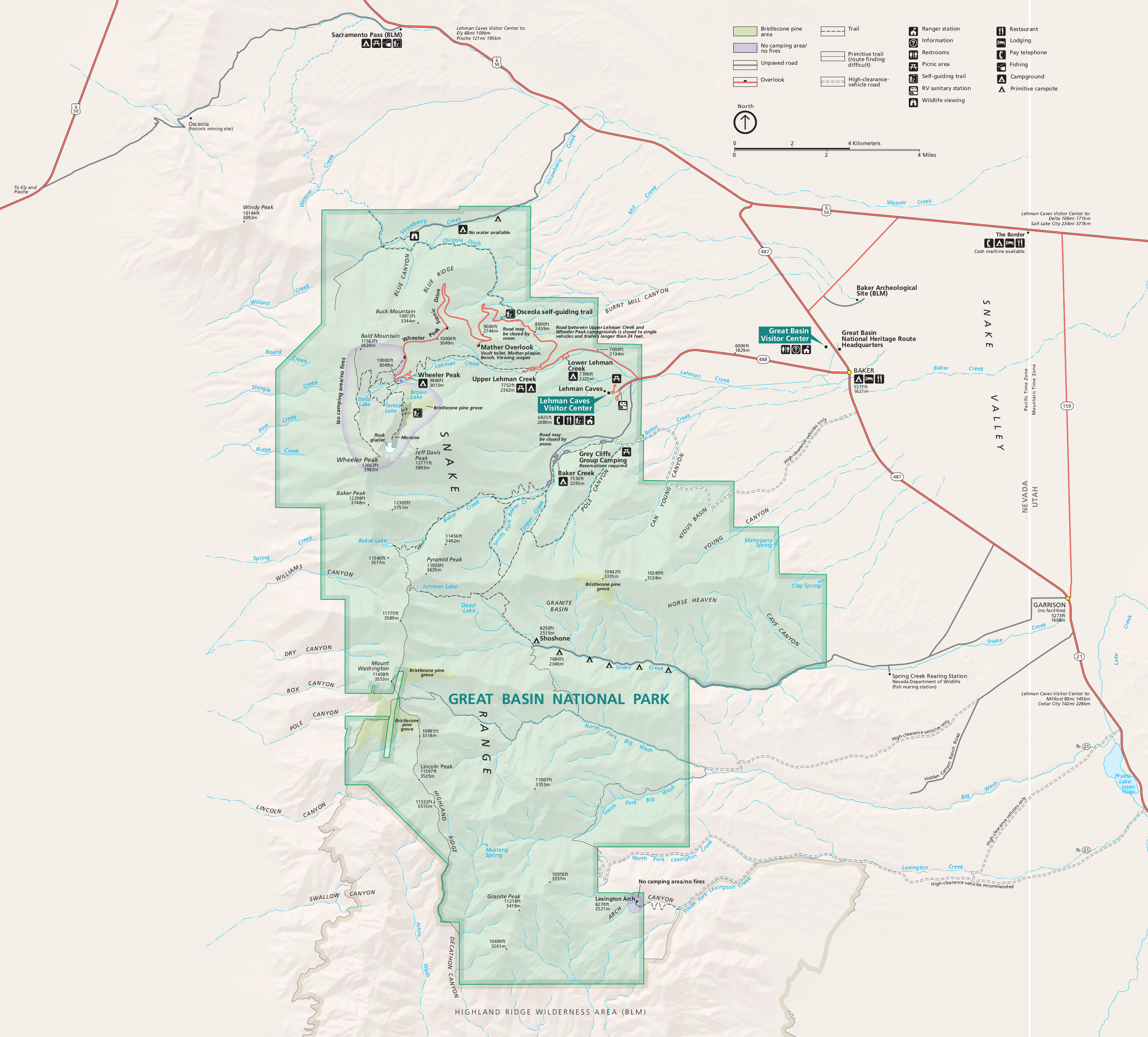 This is the Great Basin map from the park brochure, showing the viewpoints, roads, trails, Wheeler Peak, and Lehman Caves. Click the image to view a full size JPG (950 kb) or download the PDF (3.2 mb).
Great Basin campground maps
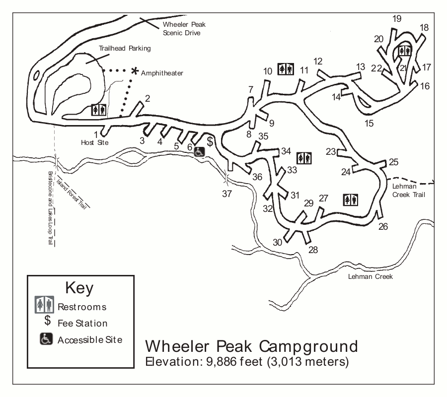 This is the Wheeler Peak Campground map (50 kb), located at the end of the Wheeler Peak Scenic Drive and is the closest to the Wheeler Peak trail. It’s the highest elevation campground in Great Basin.
 This is a Upper Lehman Creek Campground map (50 kb). This campground has 22 sites and is the second one along the Wheeler Peak Scenic Drive, after Lower Lehman Creek Campground.
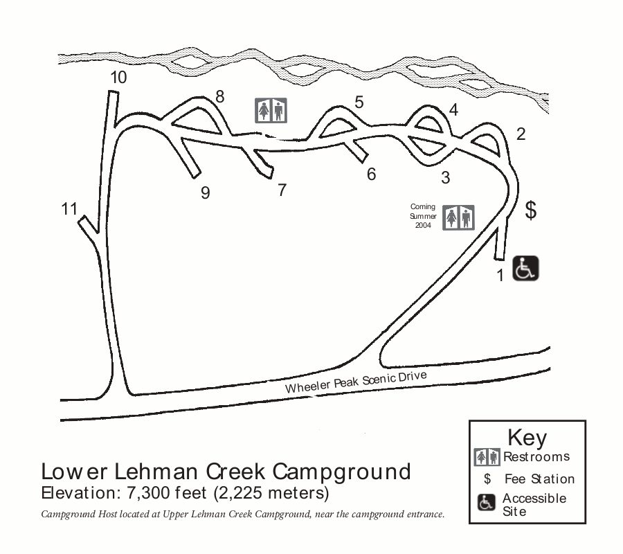 Here is the Lower Lehman Creek Campground map (50 kb). This is the only campground in Great Basin National Park open all year, being at the lowest elevation on the Wheeler Peak Scenic Drive.
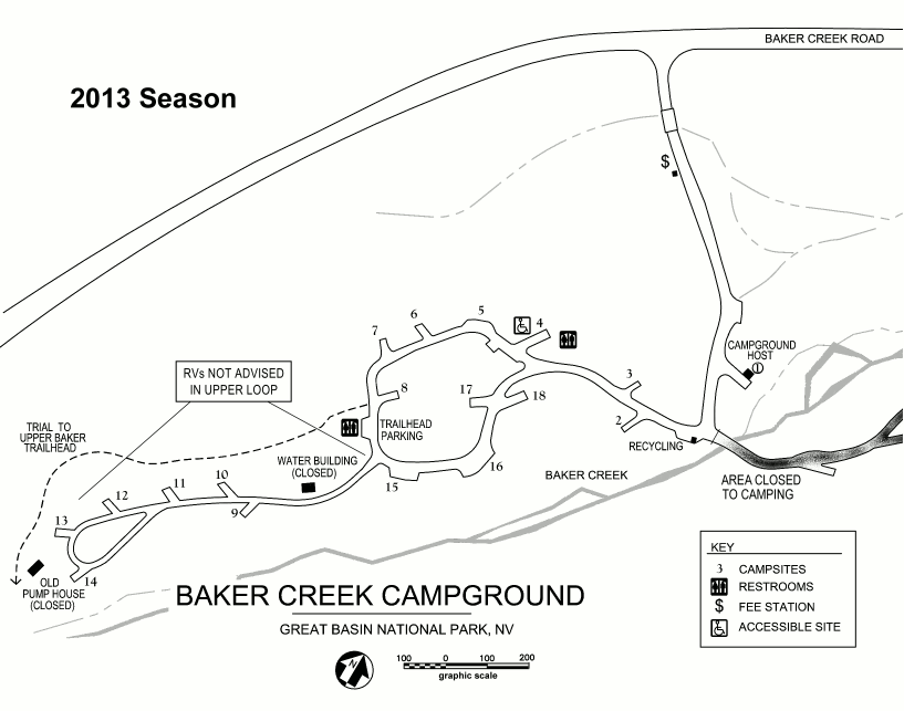 Here’s a Baker Creek Campground map (50 kb). This campground has 38 sites and is typically open May through October and is located off the Baker Creek Road.
Great Basin lodging map
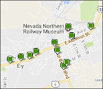 It’s probably no surprise to learn that Nevada is pretty desolate. So, if you’re looking for lodging near Great Basin, there’s a good chance you’ll end up in Ely, an hour drive away. To the right is a Hotels.com interactive lodging map of Ely; if you zoom out, you’ll see there’s nothing closer! I’d recommend browsing Hotels.com’s top-rated Ely lodging to start so you can compare reviews, prices, amenities, and photos.
Great Basin geologic map
 The Great Basin geologic map (2.0 mb) showcases the various rock formations found in the park, including the limestone that forms Lehman Caves and the metamorphic quartzite forming the Wheeler Peak summit.
Great Basin vegetation map
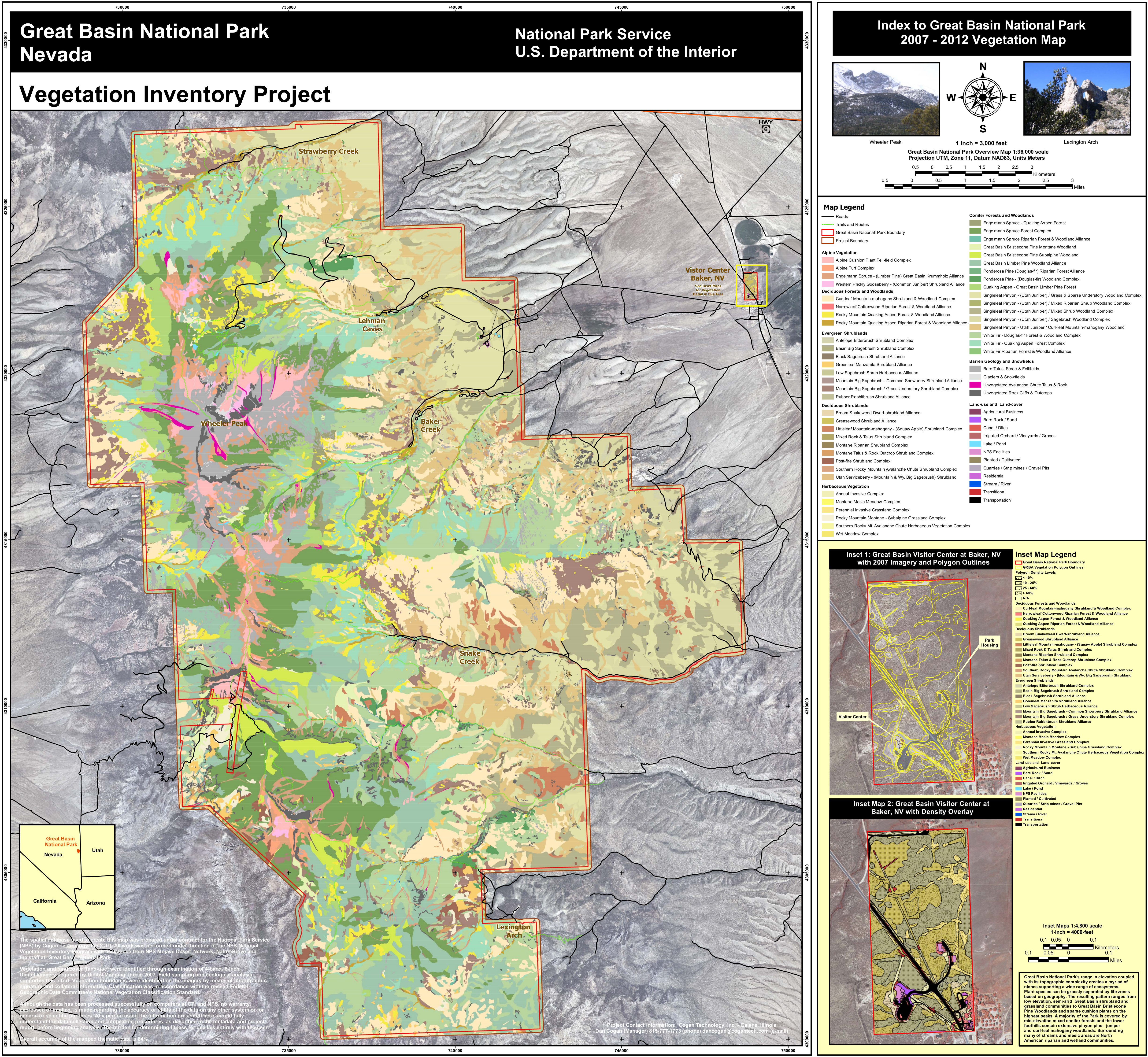 This map of Great Basin National Park vegetation (5.1 mb) color-codes the various plant and tree communities that live in the park with labels on popular visitor areas for easier orientation.
…and more!
< Return to National Park Maps home
< Return to Park List
< Return to List by State
Need more planning help? Browse Amazon’s best-selling Great Basin maps and guidebooks.