If you’re looking for a Flight 93 map, you’ve come to the right place; currently I’ve collected 5 free Flight 93 National Memorial maps to view and download. (PDF files and external links will open in a new window.) On this page you’ll find the official National Park Service brochure map and others showing memorial details and the surrounding region. You can also browse best-selling Pennsylvania maps and guidebooks on Amazon.
Flight 93 brochure map
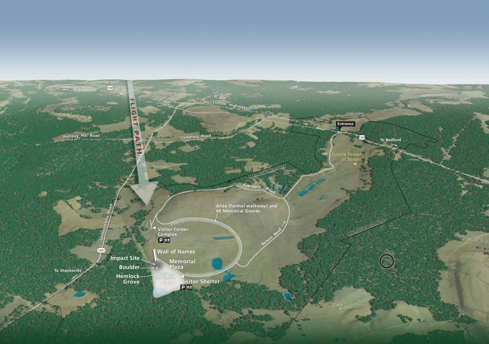 The official Flight 93 Memorial map from the park brochure shows the memorial features and the surrounding forest and field landscape. Click the image to view a full size JPG (350 kb) or download the PDF (700 kb).
Various Flight 93 maps
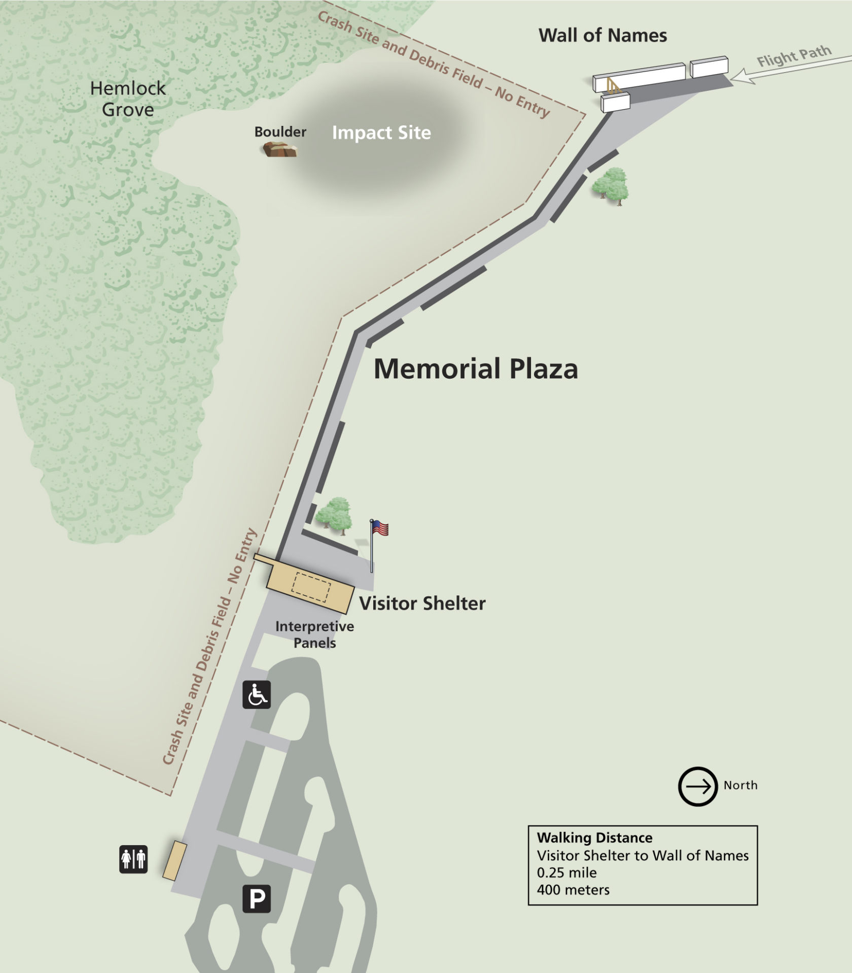 Here’s a detail map of the Flight 93 Memorial Plaza, zooming in on the Memorial Plaza features such as the Wall of Names and crash site. Click the image to view a full size JPG (200 kb) or download the PDF (700 kb).
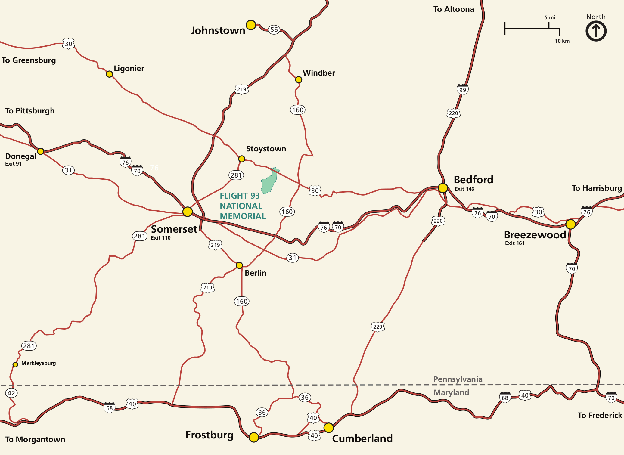 This is a regional Flight 93 National Memorial map (150 kb), showing the location of the park in relation to the various highways and towns in southern Pennsylvania and Maryland.
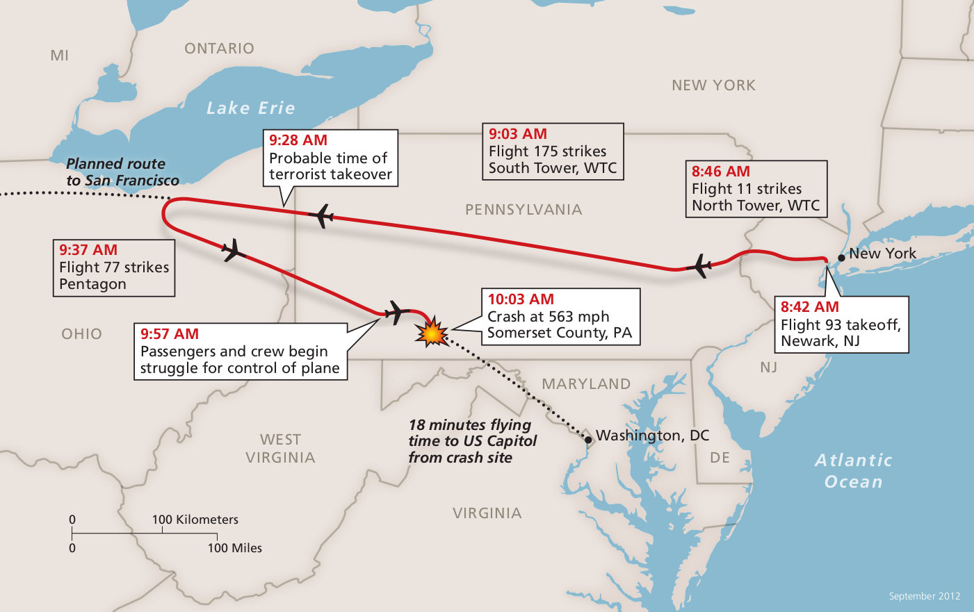 Here’s a route map of Flight 93, which includes a timeline of events starting with the takeoff Newark. Click the image to view a full size JPG (150 kb) or download the PDF (1.4 mb).
…and more!
< Return to National Park Maps home
< Return to Park List
< Return to List by State
Need more help? Browse Amazon’s best-selling Pennsylvania maps and guidebooks.