If you’re looking for a Dry Tortugas map, you’ve come to the right place; currently I’ve collected 9 free Dry Tortugas National Park maps to view and download. (PDF files and external links will open in a new window.) Although most of the maps focus on the main part of the park – Fort Jefferson and Garden Key – other maps show the rest of the park area. You can also browse the best-selling Dry Tortugas maps and guidebooks on Amazon.
Dry Tortugas map from the official brochures
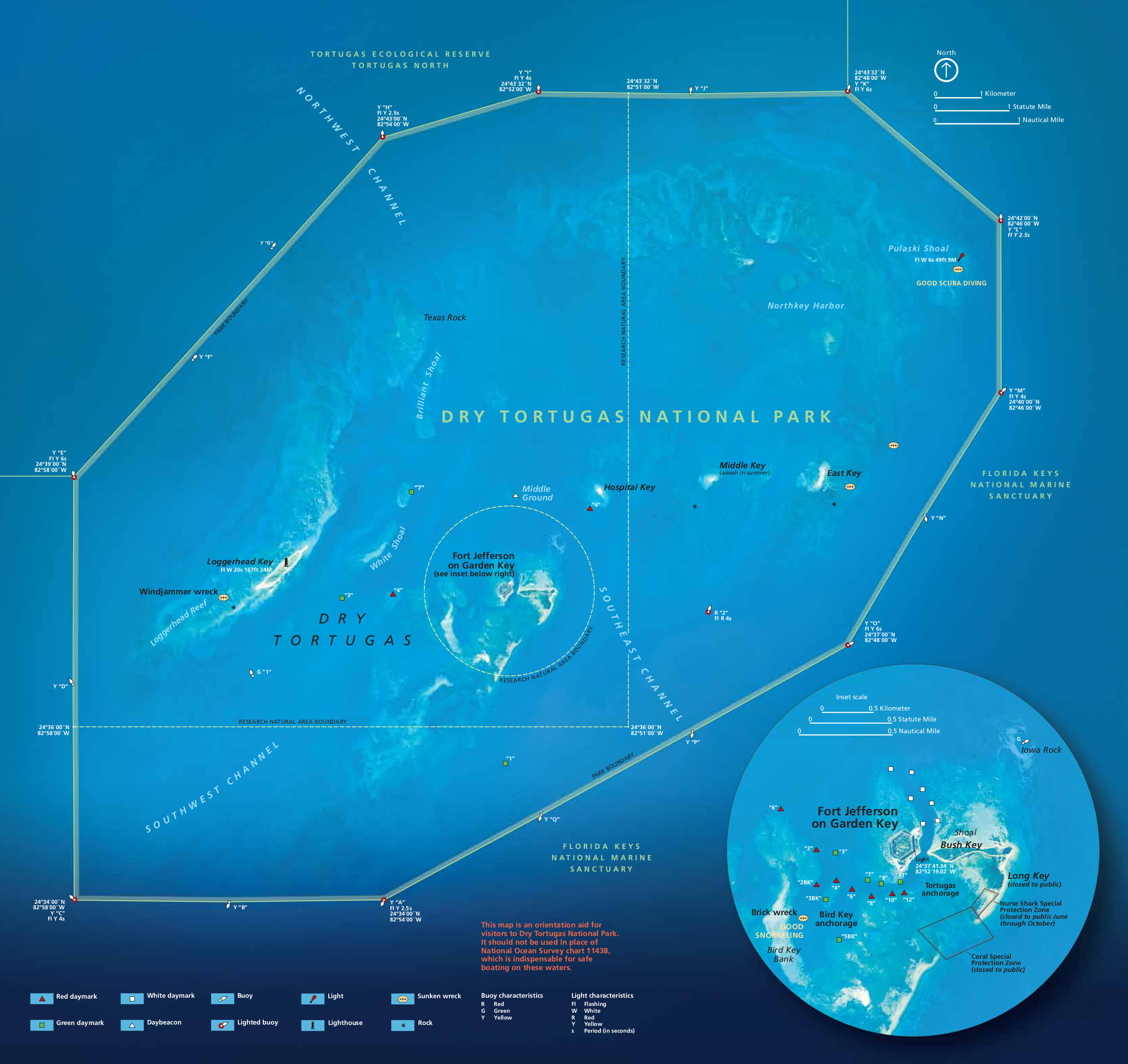 This is the official Dry Tortugas map that shows all the islands in the park, and contains an inset on Fort Jefferson and Garden Key. Click the image to view a full size JPG (550 kb) or download the PDF (800 kb).
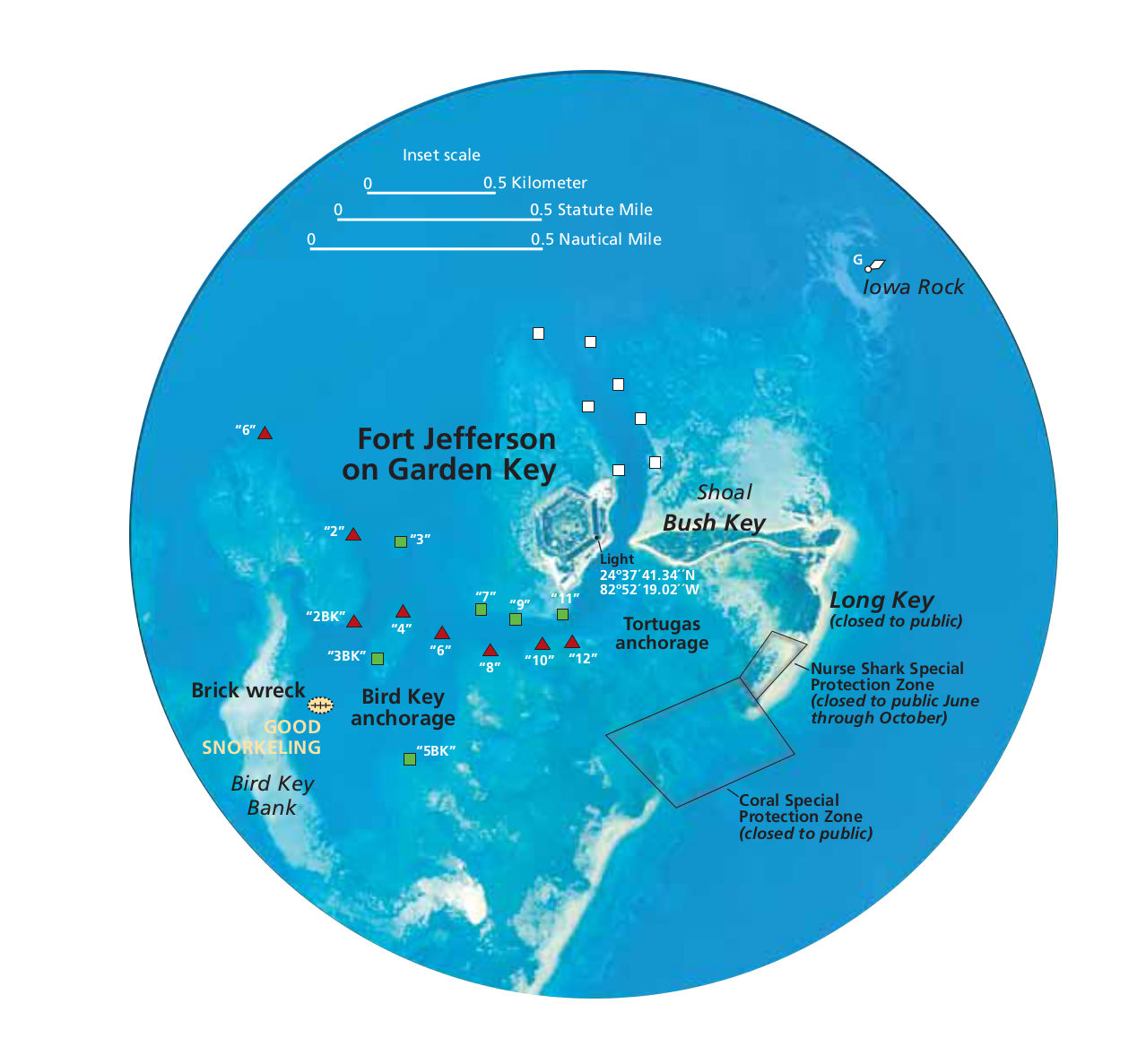 This is the inset map of Dry Tortugas (170 kb), which zooms in on the area around Fort Jefferson and Garden Key (from the map above). It also shows Bush Key, navigation aids, and good snorkeling.
Detailed Dry Tortugas maps
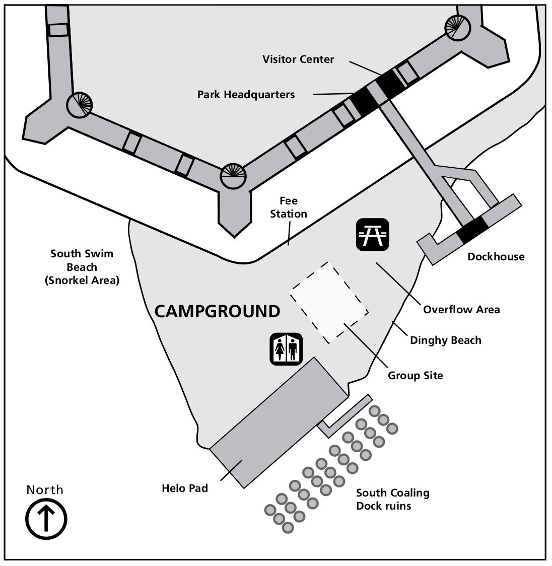 Here’s a Dry Tortugas campground map (100 kb), showing the camping area on Garden Key in relation to Fort Jefferson, the dock, snorkeling and swimming beaches, and other sites.
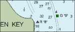
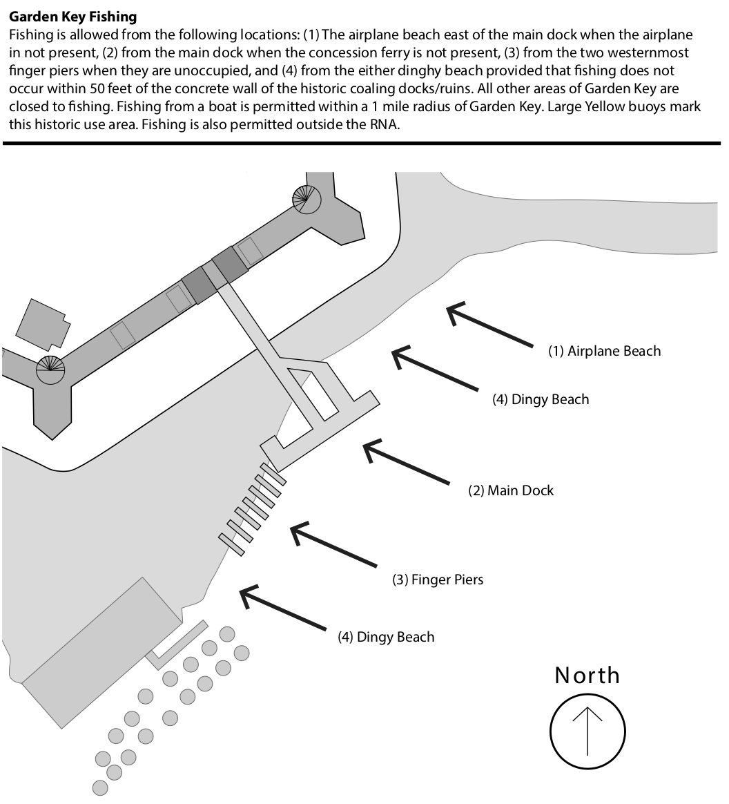 This is a fishing map of Dry Tortugas (130 kb), showing the five fishing areas on Garden Key located on and around the dock and nearby beaches. A text explanation clarifies the boundaries of the fishing areas.
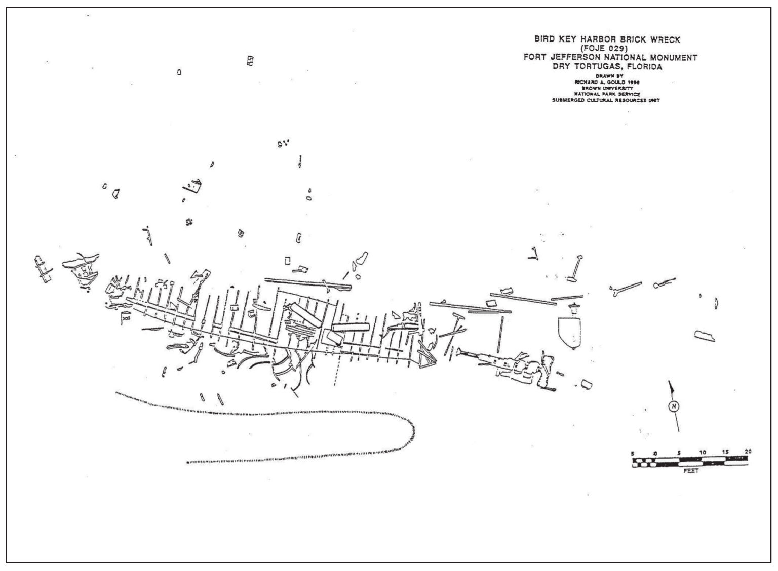 This is a Dry Tortugas shipwreck map (100 kb), showing the Brick wreck of Bird Key Harbor, located near good snorkeling areas southwest of Fort Jefferson and Garden Key.
Dry Tortugas nautical chart
 Here is a nautical Dry Tortugas National Park map provided by NOAA, featuring ocean depths all across the national park. This chart is only available as a PDF download (4.3 mb)
Dry Tortugas topographic and benthic maps
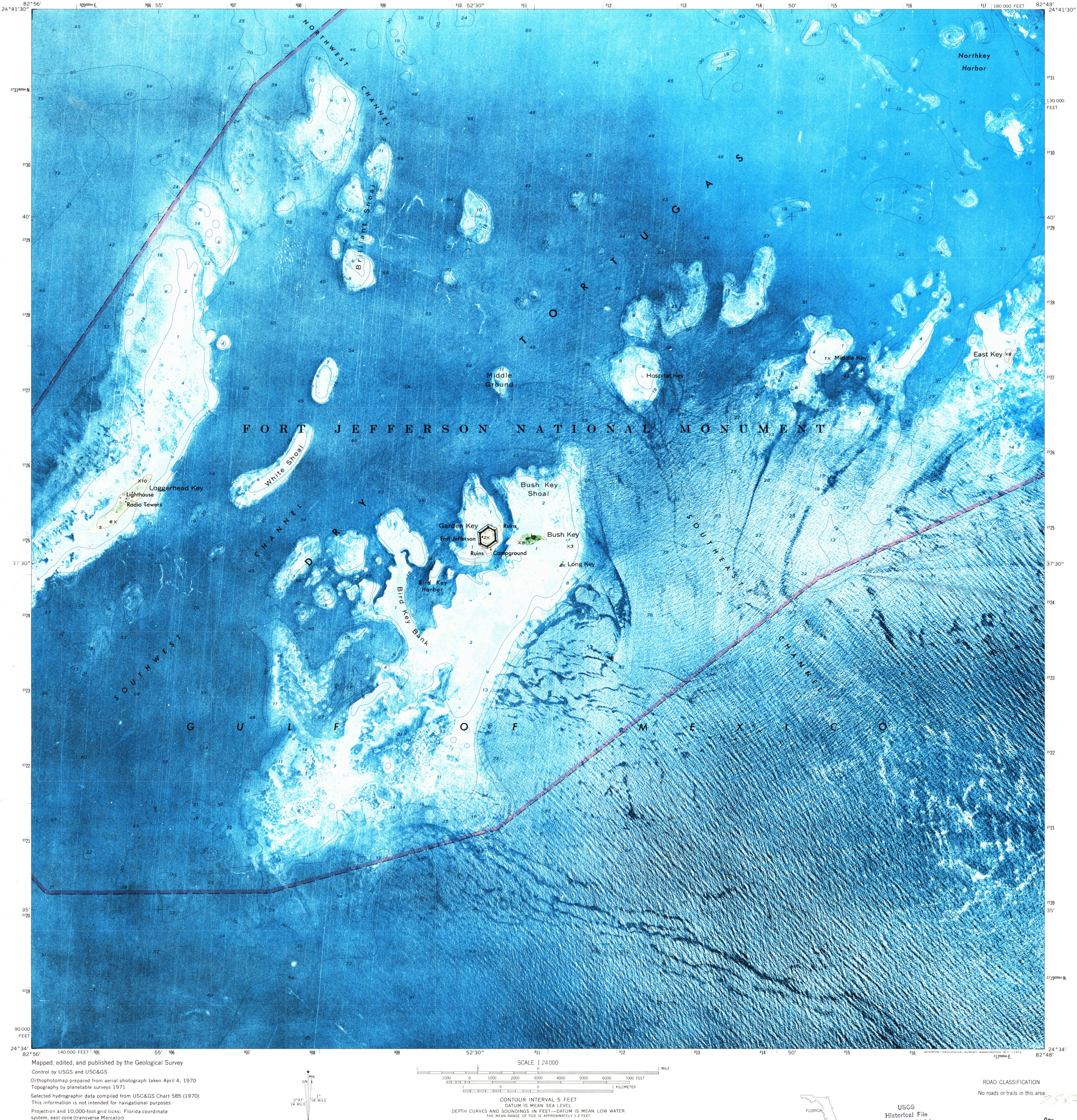 The Dry Tortugas topo map (7.1 mb) is admittedly is a strange one. Have you ever seen a topo map with so much blue and so few contour lines? That’s what happens when your entire park is right at sea level.
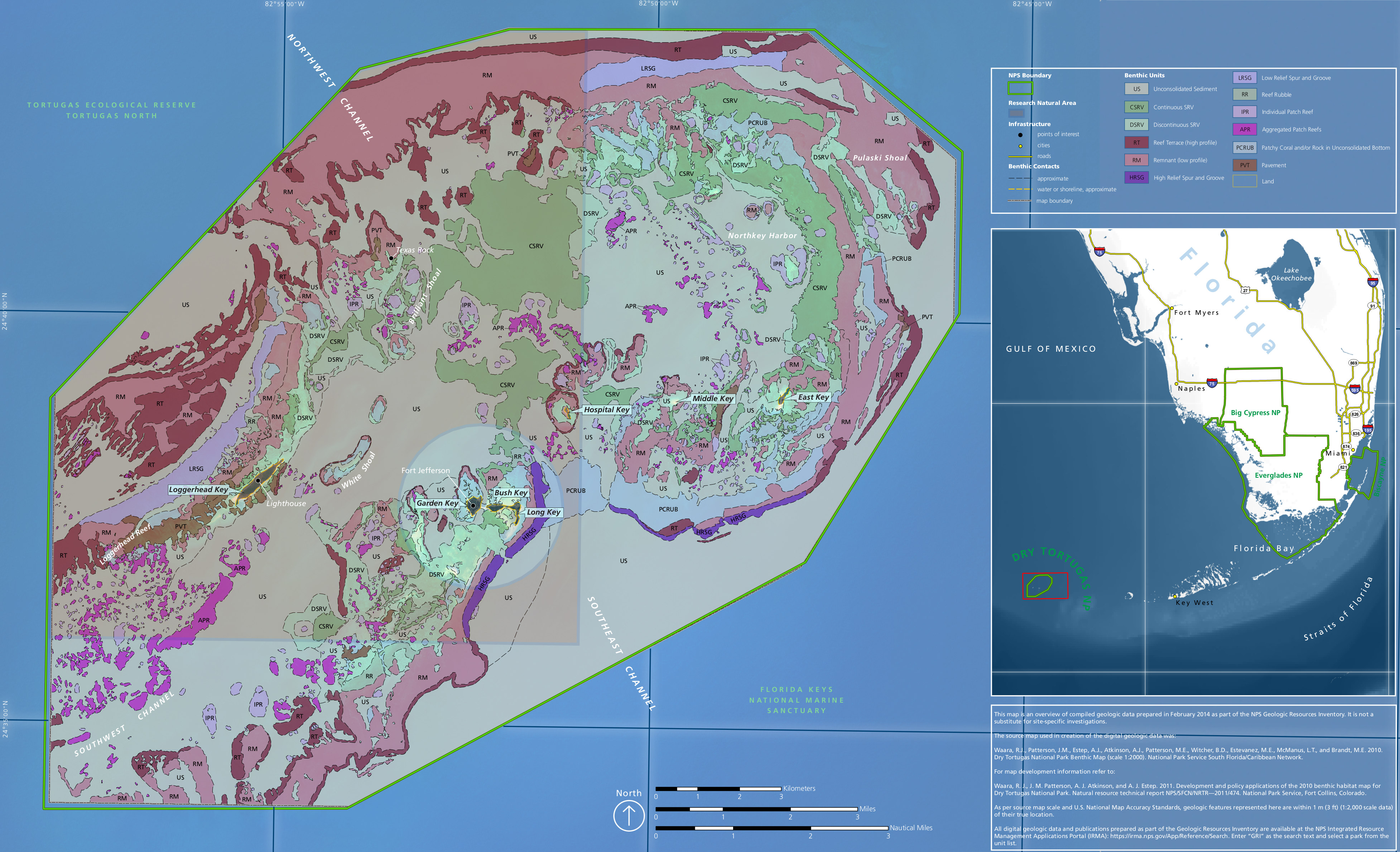 Here’s a Dry Tortugas benthic map (1.7 mb), showing the makeup of the seabed through Dry Tortugas National Park – reefs, sediments, and so on. Another great looking map!
…and more!
< Return to National Park Maps home
< Return to Park List
< Return to List by State
Need more planning help? Browse Amazon’s best-selling Dry Tortugas maps and guidebooks.