If you’re looking for a C&O Canal map, you’ve come to the right place; currently I’ve collected 8 free Chesapeake and Ohio Canal National Historical Park maps to view and download (PDF files and external links will open in a new window.) On this page you’ll find maps of the full canal, Potomac River, and Great Falls maps. You can also browse best-selling C&O Canal maps and guidebooks on Amazon.
C&O Canal brochure maps
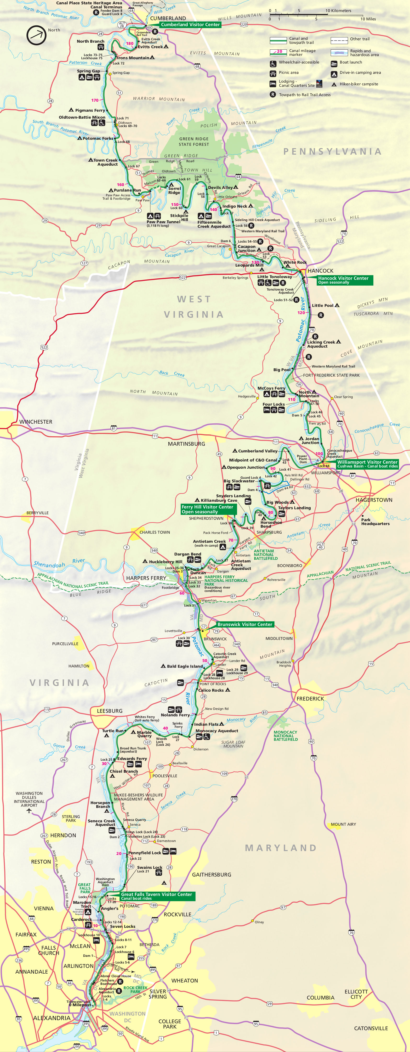 Here’s the official Chesapeake and Ohio Canal map from the brochure, showing the entire length from Cumberland, MD to Washington, D.C. Click the image to view a full size JPG (1.3 mb) or download the PDF (4.6 mb).
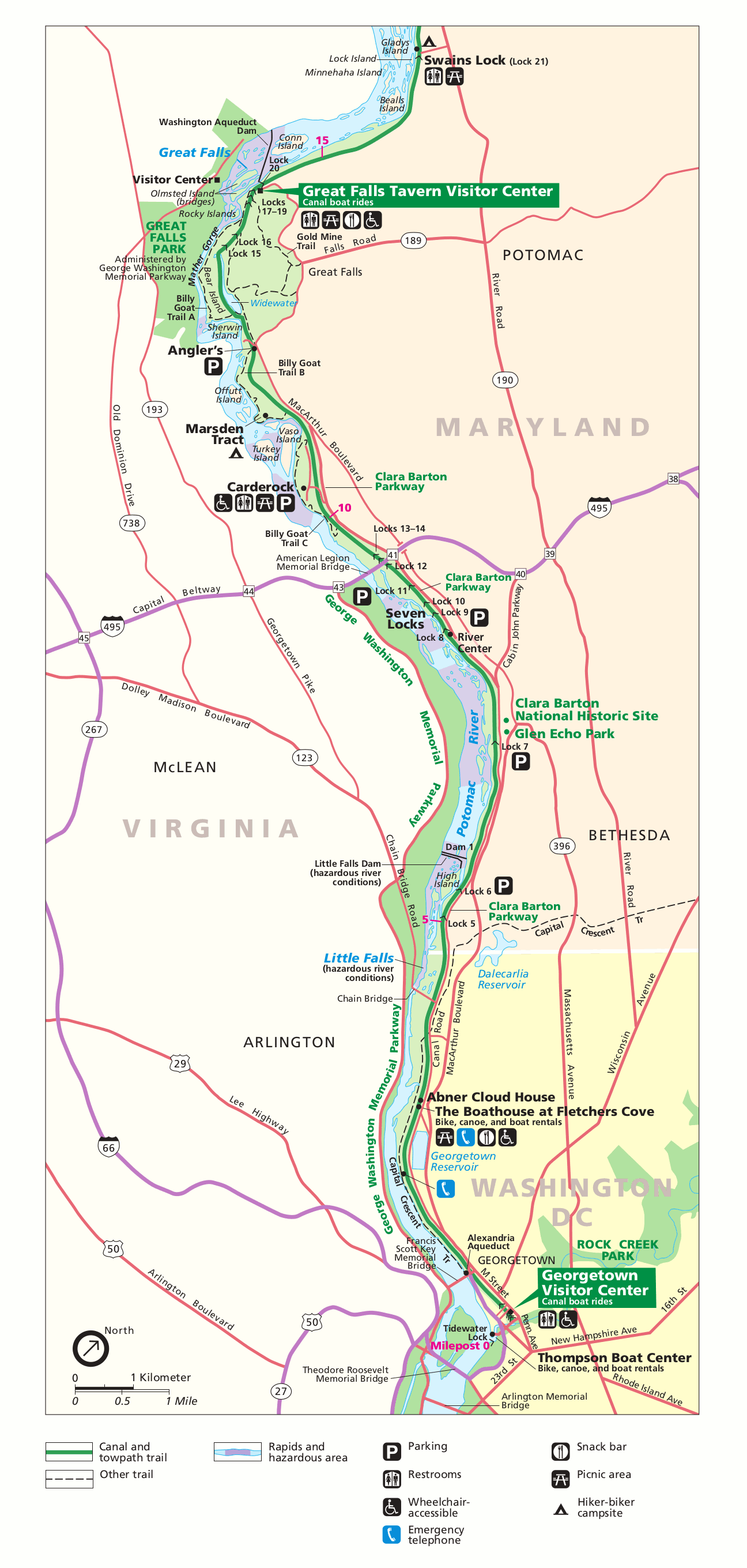 This C&O Canal detail map zooms in on the lower Potomac River from Great Falls to the Georgetown Visitor Center in Washington, D.C. Click the image to view a full size GIF (300 kb) or download the PDF (200 kb).
Simple C&O Canal maps
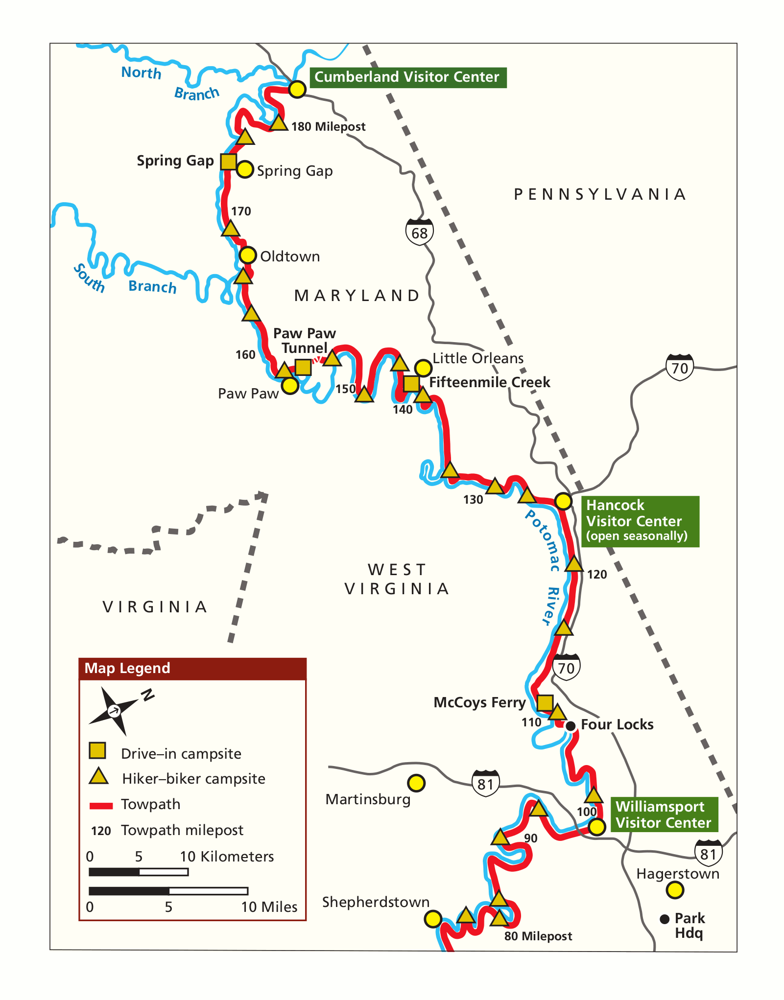 This is a C&O Canal simple map (north), focusing on the northern (and western) segment of the park in less detail than the one above. Click the image to view a full size GIF (150 kb) or download the PDF (150 kb).
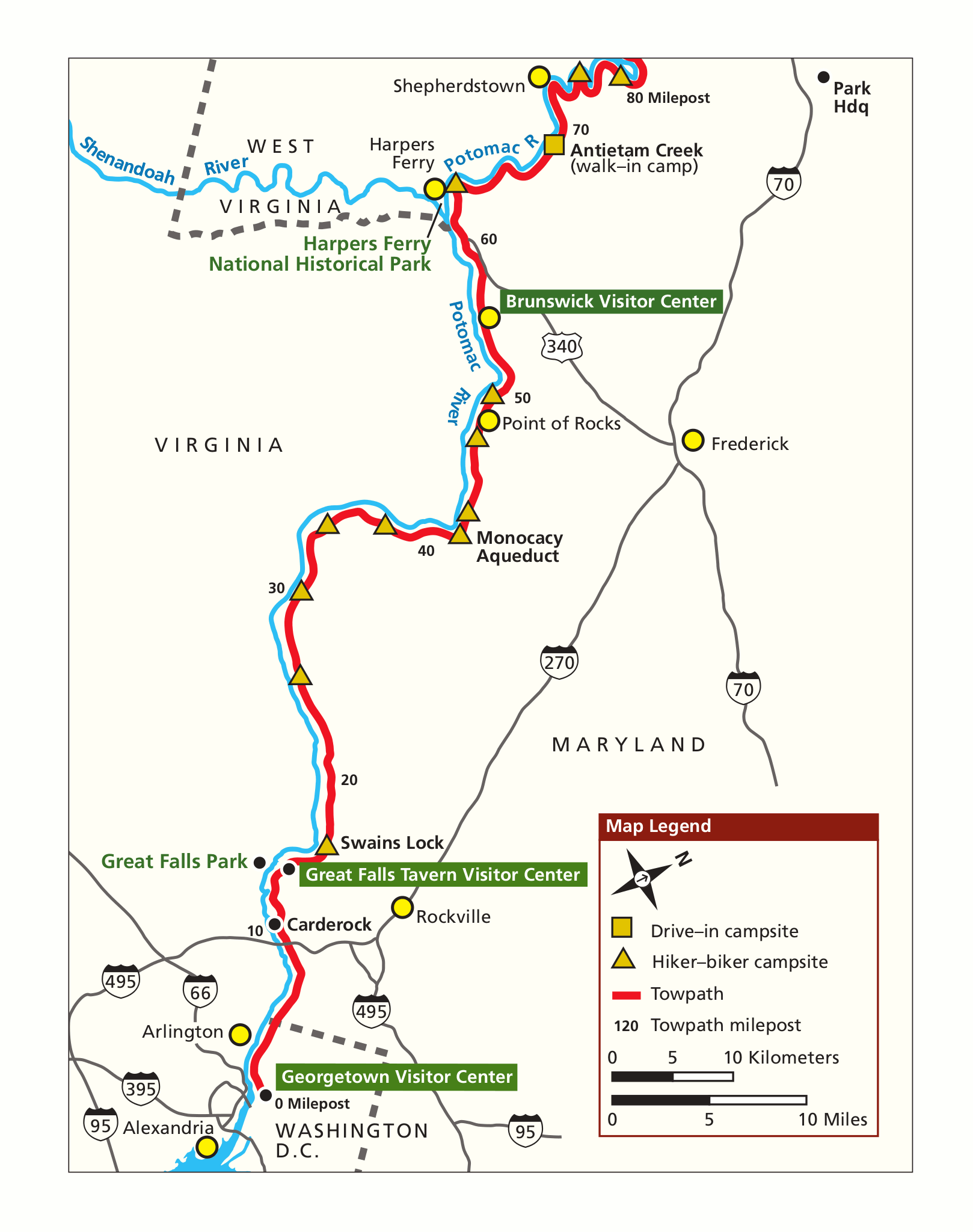 The C&O Canal simple map (south) focuses on the southern (and eastern) segment closest to Washington, D.C. Click the image to view a full size GIF (150 kb) download the PDF (150 kb).
Great Falls area maps
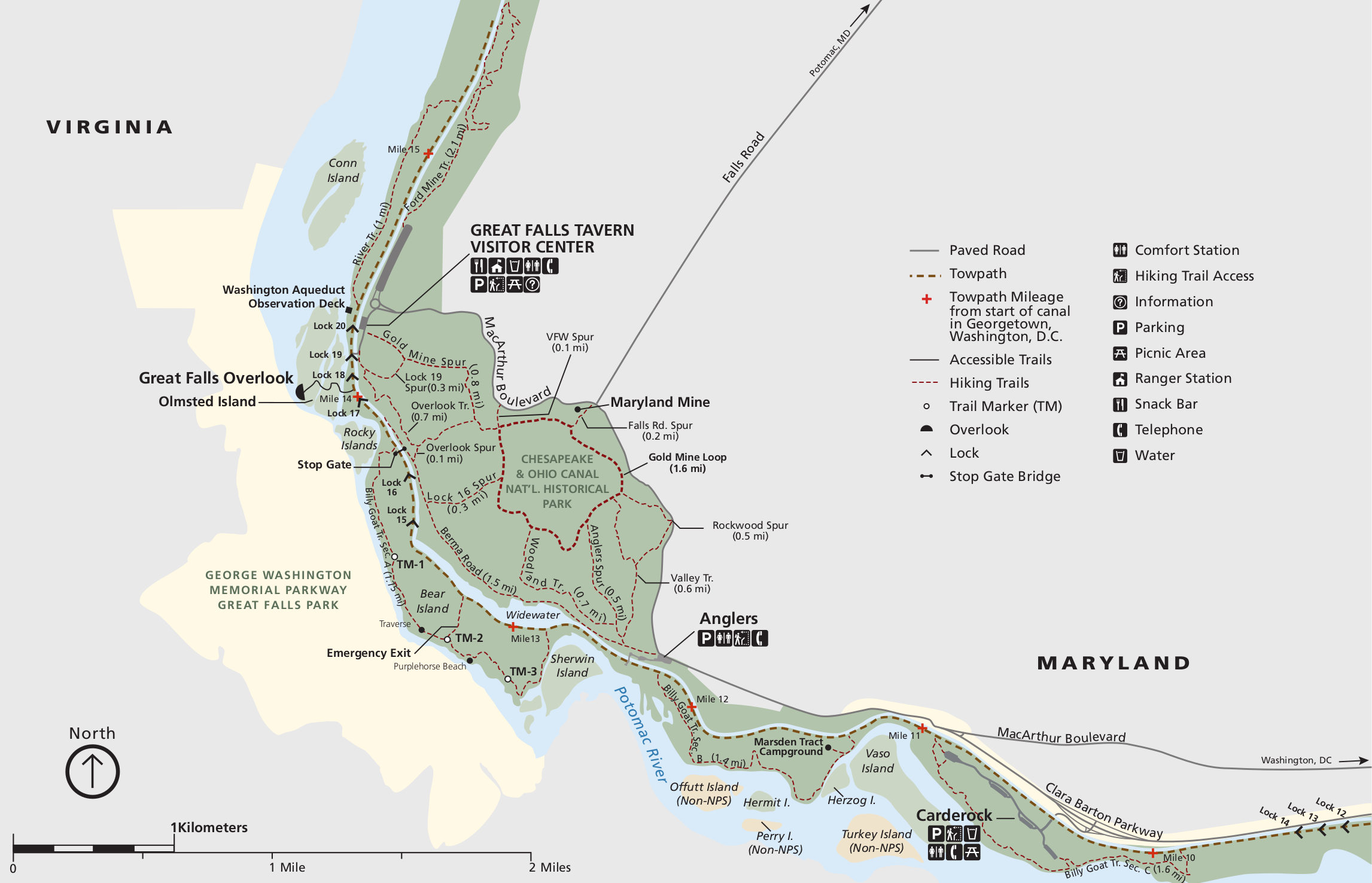 This C&O Canal trail map (300 kb) focuses on the trails around Great Falls and the Great Falls Tavern Visitor Center, including the Billy Goat Trail. It includes trail mileages between junctions and points of interest.
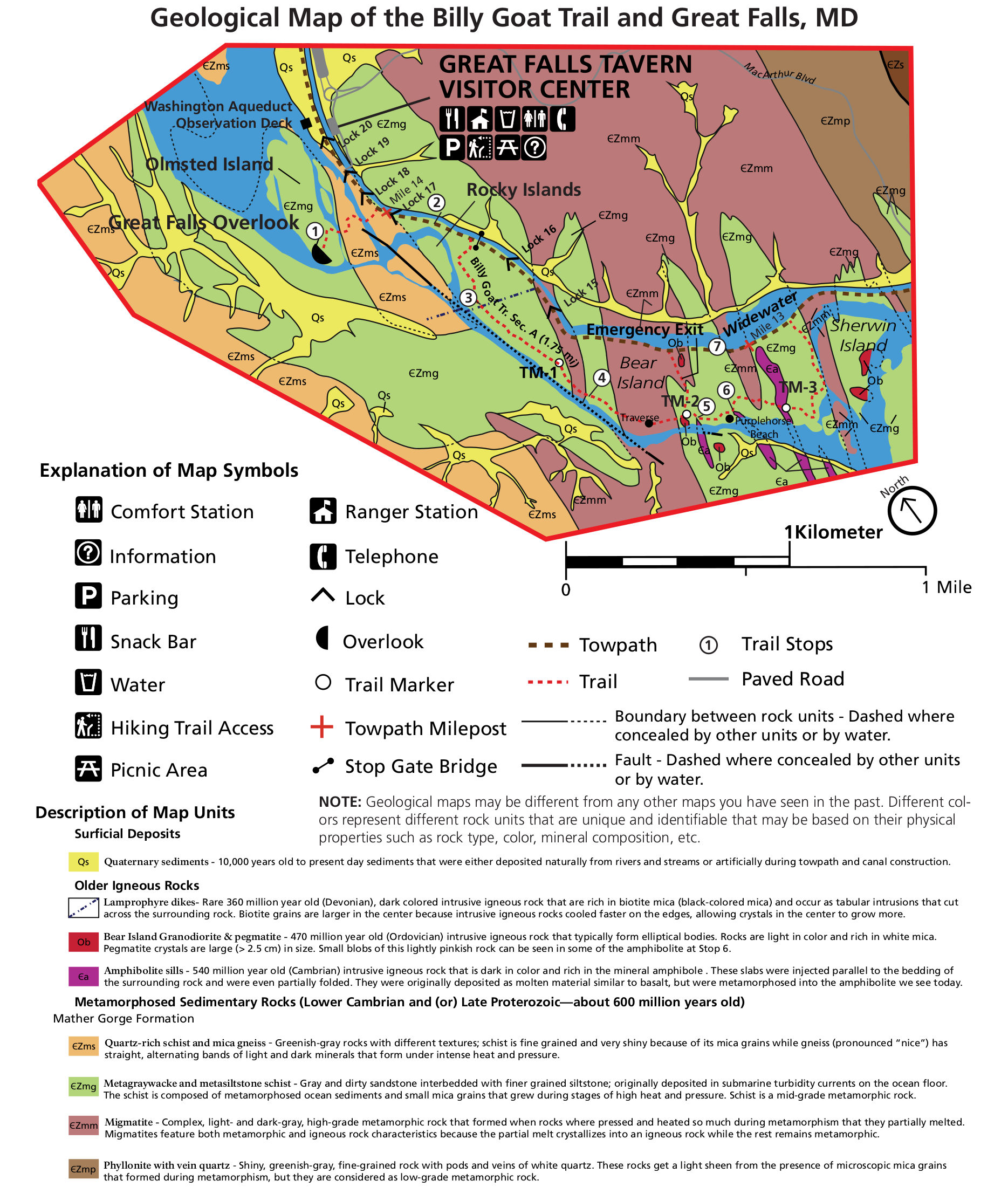 Here’s a geologic map of the Great Falls area (700 kb), focusing on the park lands in and around Great Falls, MD. This area has the most interesting geology of the Potomac; these are some very old rocks!
Other C&O Canal maps
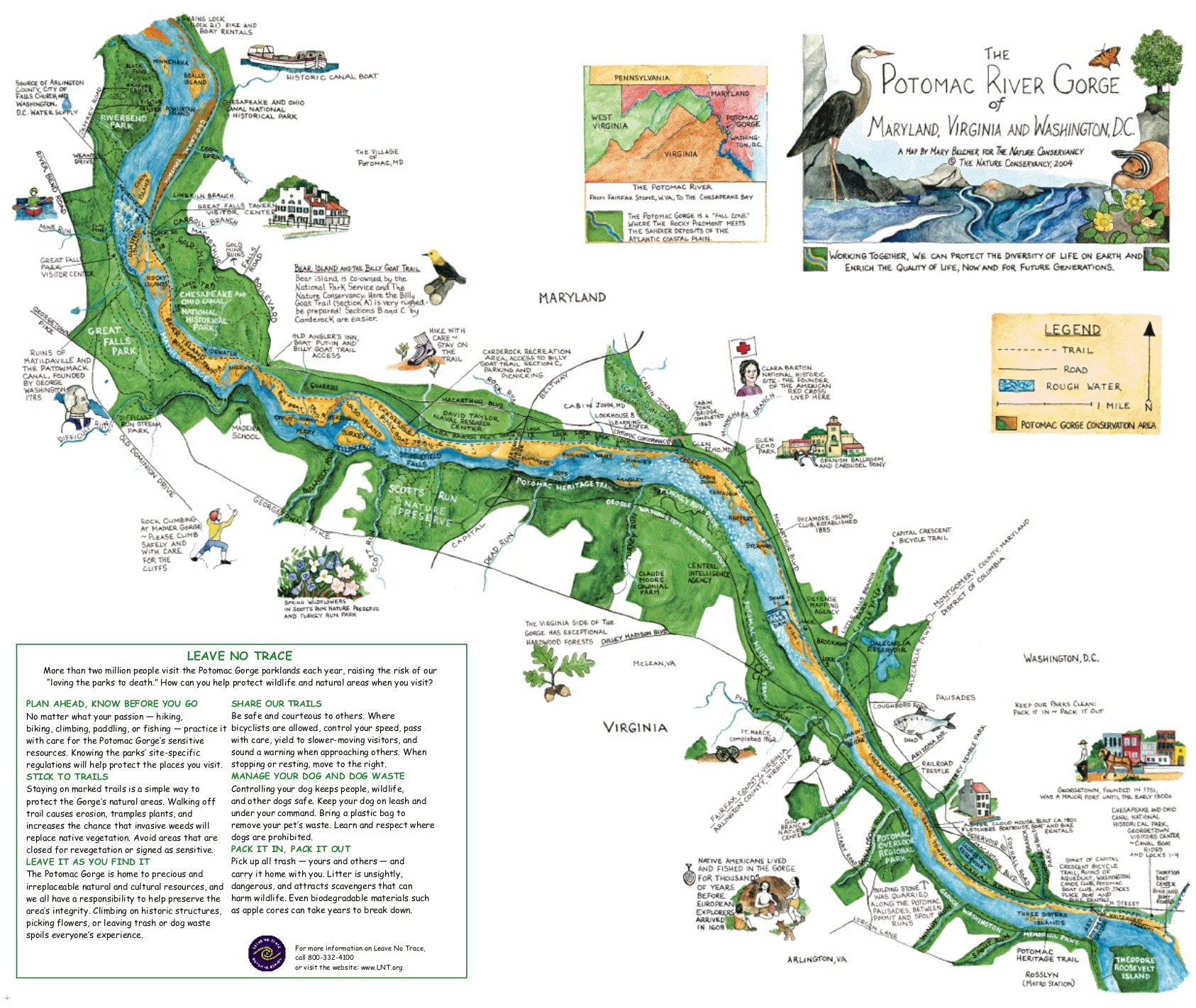 Here’s an illustrated Potomac River Gorge map (500 kb) from the Nature Conservancy, focusing on the eastern portion of the C&O Canal and Potomac River between Great Falls and Georgetown.
…and more!
< Return to National Park Maps home
< Return to Park List
< Return to List by State
Need more planning help? Browse Amazon’s best-selling C&O Canal maps and guidebooks.