If you’re looking for a Cape Cod map, you’ve come to the right place; currently I’ve collected 24 free Cape Cod National Seashore maps to view and download. (PDF files and external links will open in a new window.) Here you’ll find maps showing the full park, as well as Cape Cod maps that focus on very specific areas of the park, including trails and bike routes. You can also browse the best-selling Cape Cod maps and guidebooks on Amazon.
Cape Cod map from the official brochures
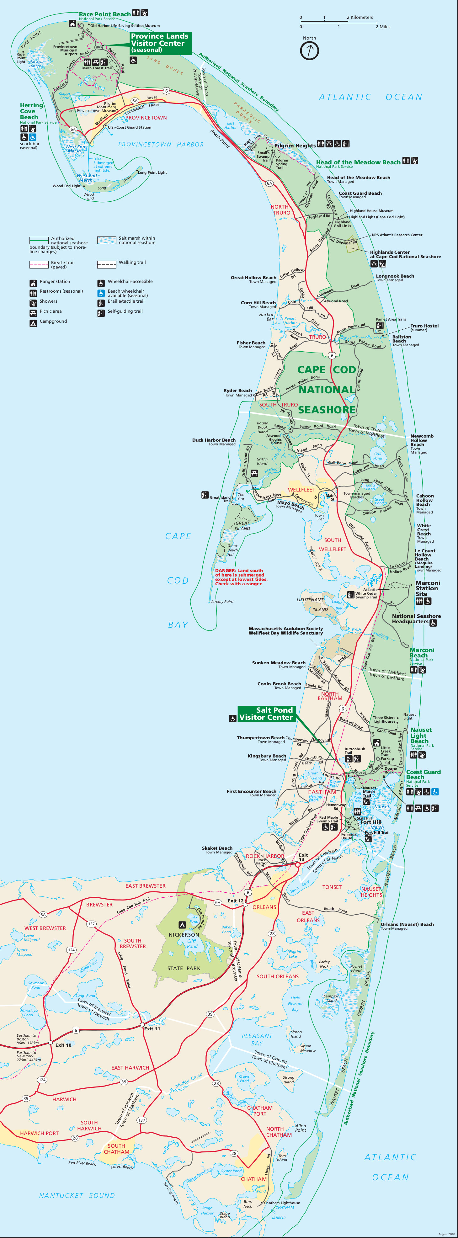 Here is the Cape Cod National Seashore map which shows the parklands on Cape Cod from Provincetown all the way down the Cape. Click the image to view a full size JPG (1.2 mb) or download the PDF (1.6 mb).
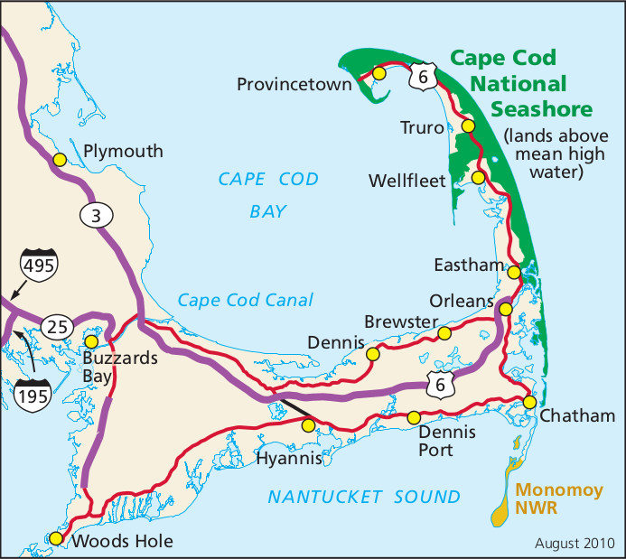 This is a regional Cape Cod map, showing the park’s location on Cape Code compared to the nearby towns and highways. Click the image to view a full size JPG (150 kb) or download the PDF (500 kb).
Cape Cod trail maps
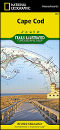
 The maps below show a few different areas of the park, but if you want one map to cover all of Cape Cod and include general topography, beaches, trails, bike trails, boating navigation aids, and tons more, you’ll want to go with the National Geographic Trails Illustrated map. With this, all the other maps on this page are pretty much redundant, as this one map covers it all.
 The Fort Hill trail map (35 kb) shows the several trails in the Fort Hill area near Nauset Marsh in the southern part of Cape Cod, including the Red Maple Swamp Trail and Fort Hill Trail.
 Here’s a White Cedar Swamp trail map (15 kb), showing this short loop trail that departs from the Marconi Station site into the swamp on a boardwalk for a round trip of a bit over one mile.
 The Great Island trail map (60 kb) focuses on the series of trails over Great Island toward Great Beach Hill, southwest of Wellfleet. This is on the Cape Cod Bay side of the peninsula, rather than the Atlantic.
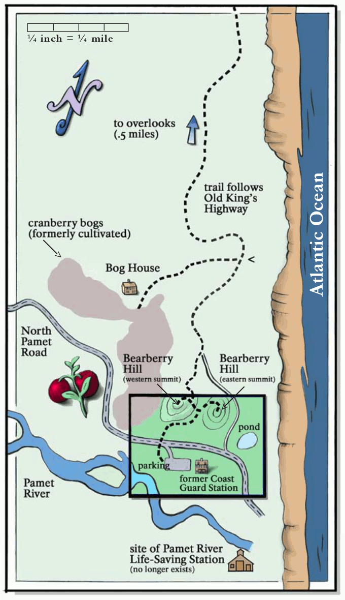 This is a Pamet area trail map (250 kb), showing the trail heading north from the former coast guard station toward a number of sights and overlooks along the Atlantic Ocean.
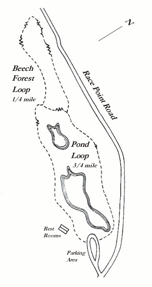 This Beech Forest trail map (75 kb) shows this series of loop trails near the end of the Cape near the Province Lands Visitor Center. You might as well do both loops – it’s only a mile or so walk.
Cape Cod bike trail maps
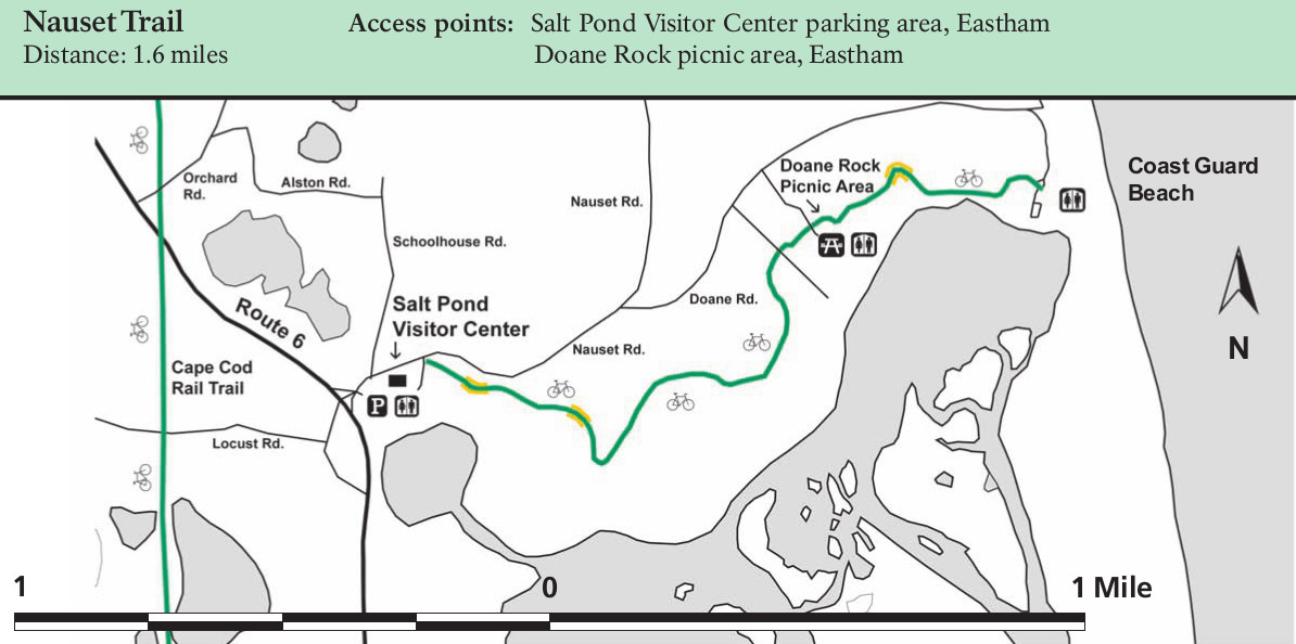 Here’s a Nauset bike trail map (100 kb) that shows the bike trail departing from the Salt Pond Visitor Center toward Coast Guard Beach in the southeastern part of the national seashore.
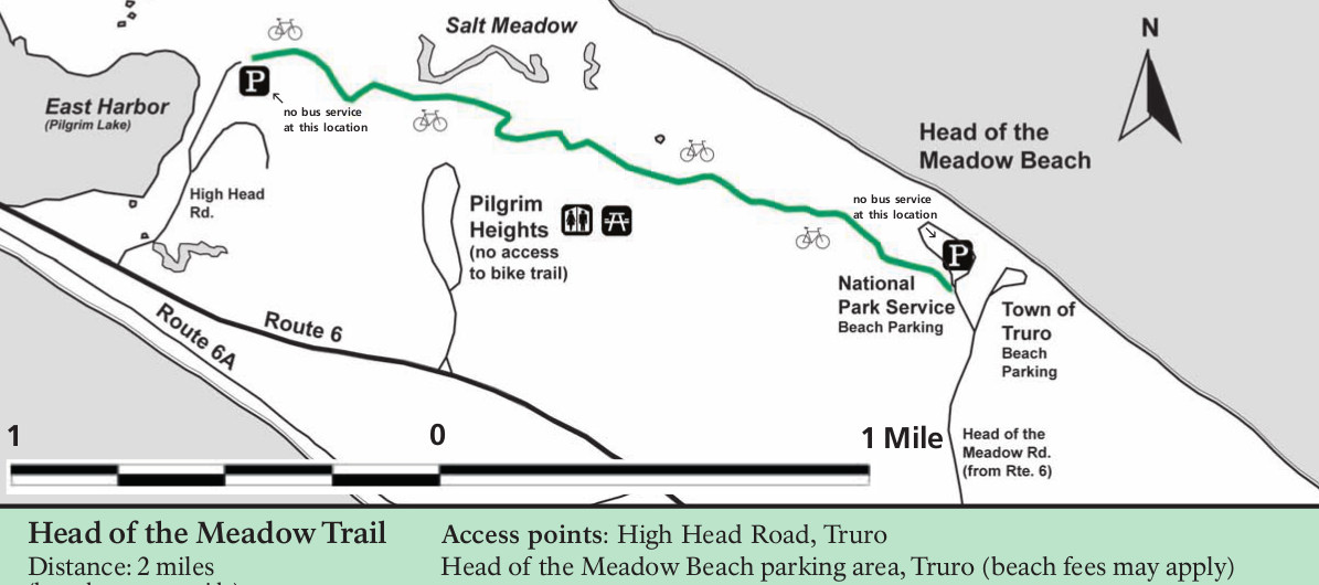 This is a Head of the Meadow bike trail map (100 kb) showing the bike trail that connects East Harbor with Head of the Meadow beach, in the northern part of the cape where it begins narrowing.
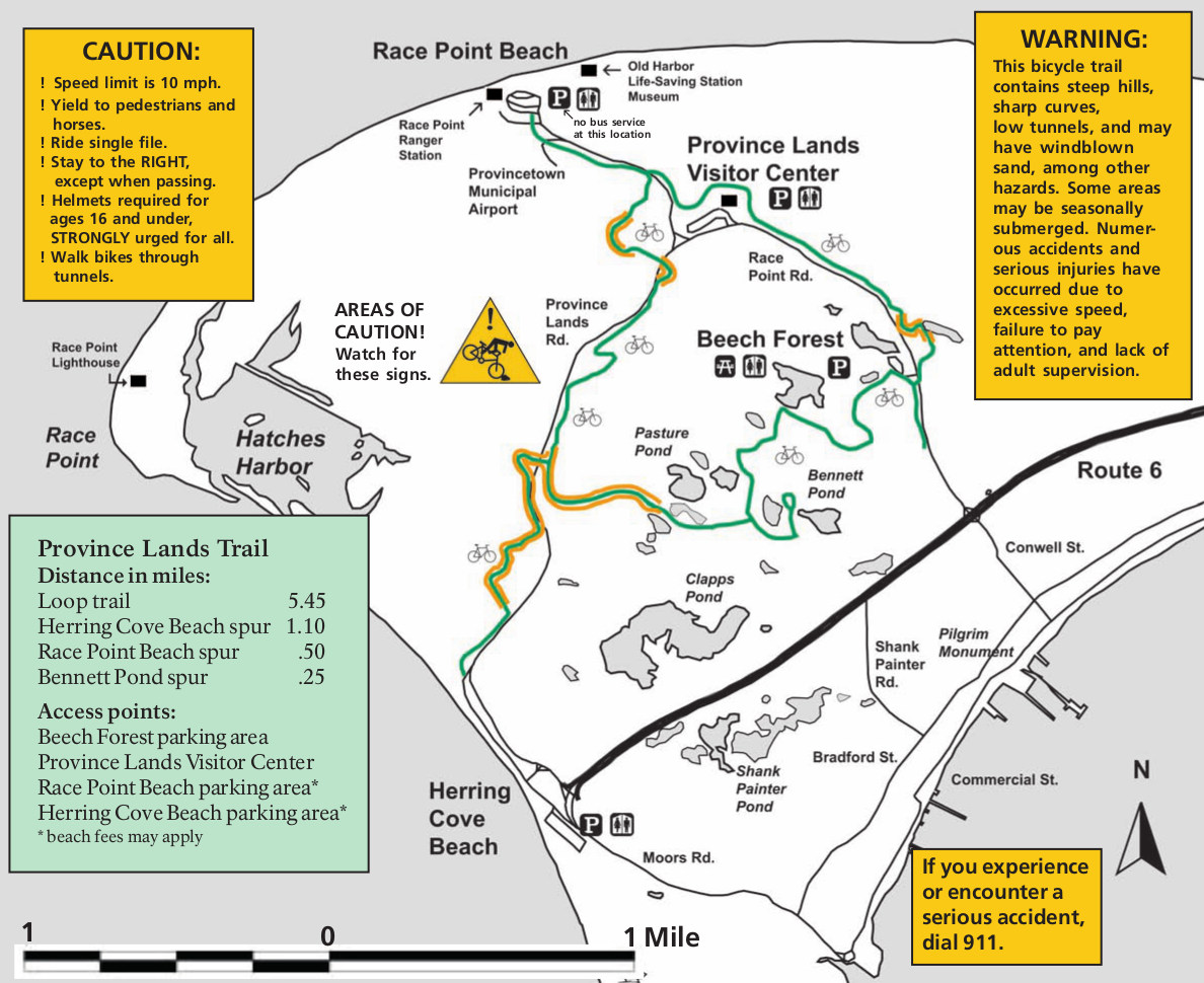 The Province Lands bike trail map (300 kb) shows several trails at the very end of Cape Cod, connecting several of the beaches and access points such as Race Point Beach and Province Lands Visitor Center.
Hand-drawn Cape Cod maps
The following maps all come from the National Park Service’s Guide’s Guide to Cape Cod National Seashore. You can download the entire guides in PDF form on the NPS website. Here the maps are arranged from south to north.
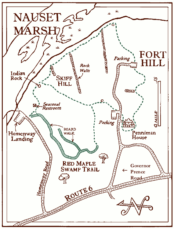
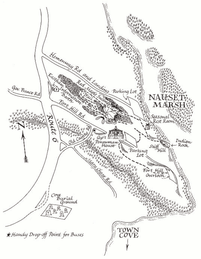 The Fort Hill map (200 kb) shows this southern portion of the national seashore located along Nauset Marsh, a bit south of the Salt Pond Visitor Center, including restrooms, overlooks, trails, and parking.
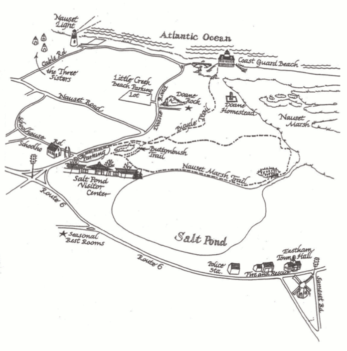 This is a Salt Pond and Nauset Marsh map (150 kb) focuses on the features right around Salt Pond Visitor Center and Nauset Marsh: trails, parking, roads, Nauset Light, Doane Rock, and more.
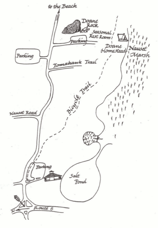 Here’s a Doane Rock map (100 kb), zooming in on region near Nauset Marsh located between Salt Pond and Coast Guard Beach. In particular, this map focuses on Doane Rock and homestead.
 This is a Coast Guard Beach map (120 kb) showing the parking area, restrooms, bike trail, and beach itself located south of Nauset Light. Maps above show this area in more context but less detail.
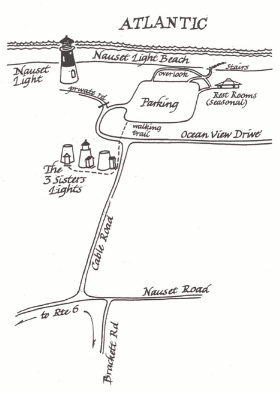 Here’s a Nauset Light map (100 kb), which shows Nauset Light as well as the Three Sisters lighthouses along with the associated roads, parking areas, restrooms, trails, and stairs to the Nauset Light Beach.
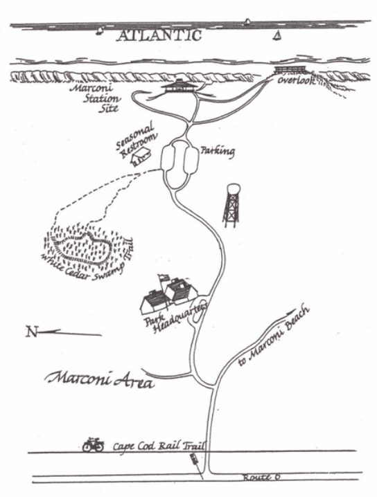 The Marconi Station map (100 kb) moves north along the coast aways to show the Park Headquarters, Marconi Station site, and some restrooms, trails, and overlook located east of Route 6.
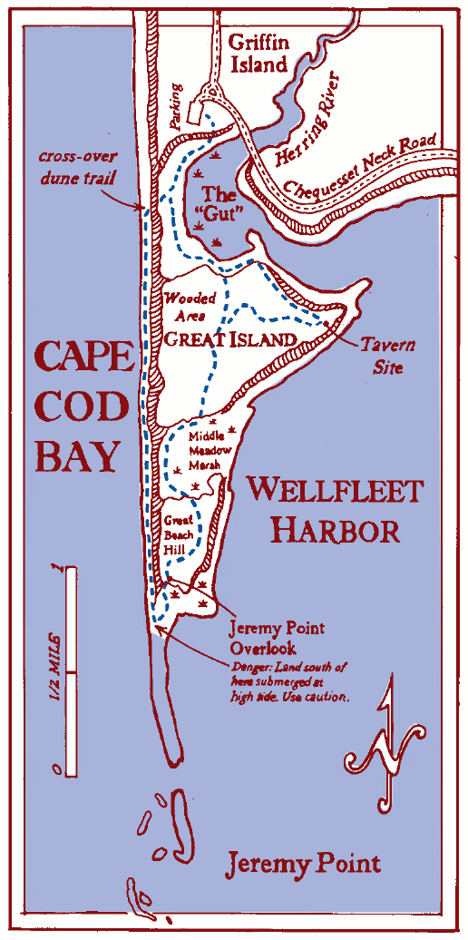
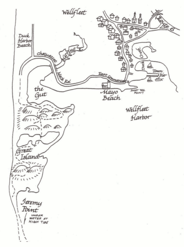 This Great Island map (120 kb) jumps across the cape to show part of the west side of the park, west of Wellfleet and Wellfleet Bay. You’ll see the trail to Jeremy Point from the Duck Harbor Beach area.
 The Bound Brook map (150 kb) shows the area a bit north of Great Island, featuring the Cape Cod House in between Wellfleet and Truro. This is one of the view maps not focused on the coastline.
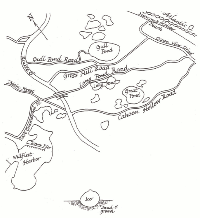 Here’s a Kettle Ponds map (120 kb), moving a bit east to focus on the area near Gull Pond, Long Pond, and Great Pond, showing the roads leading to Ocean View Drive.
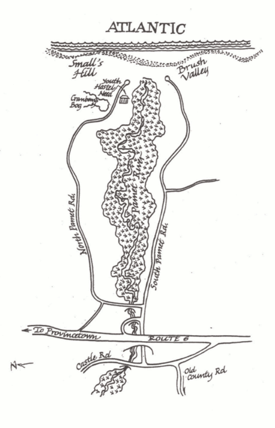 This Pamet Valley map (130 kb) shows the access roads toward Ballston Beach, with the Pamet River dividing the two roads ending near Brush Valley, Small’s Hill, and the hostel.
 The Highlands map (80 kb) jumps north to show Highland Light (previously known as Cape Cod Light) as well as the Coast Guard Beach, accessed from Highland Road and South Highland Road.
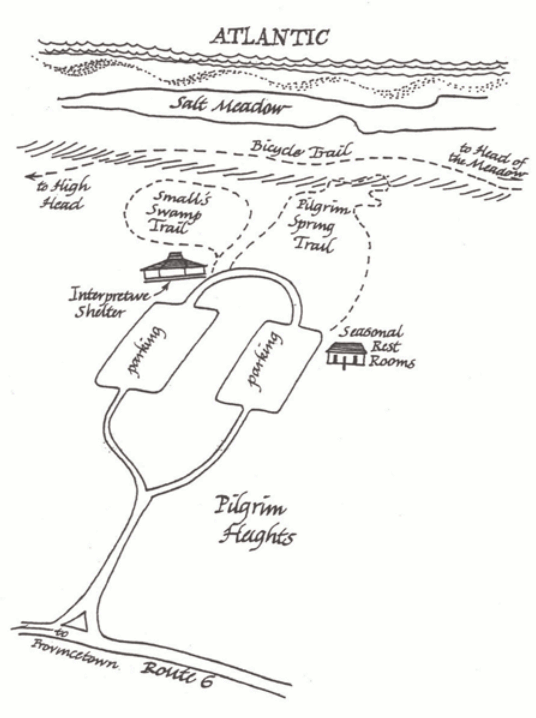 This is a Pilgrim Heights and Head of the Meadow map (100 kb), focusing on the restrooms, interpretive shelter, and trails departing from the Pilgrim Heights parking area toward Salt Meadow.
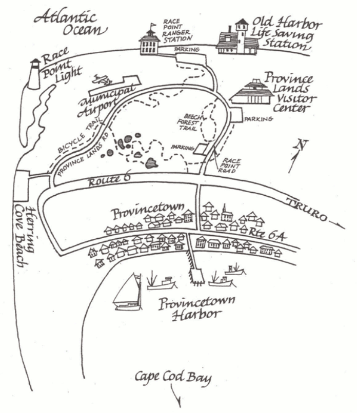 Finally, we reach the Province Lands map (150 kb), located at the end of Cape Cod and showing the visitor center, trails, lighthouse, ranger station, and more in the area near Provincetown.
…and more!
< Return to National Park Maps home
< Return to Park List
< Return to List by State
Need more planning help? Browse Amazon’s best-selling Cape Cod maps and guidebooks.