If you’re looking for a Blue Ridge Parkway map, you’ve come to the right place; currently I’ve collected 26 free Blue Ridge Parkway maps to view and download. (PDF files and external links will open in a new window.) Most of these maps focus on specific hiking areas and campgrounds, but there’s also a full-park map here too. You can also browse the best-selling Blue Ridge Parkway maps and guidebooks on Amazon.
Blue Ridge Parkway map from the park brochure
 Here’s the newly revised complete Blue Ridge Parkway map (4.2 mb) from the National Park Service brochure, showing the entire length of the parkway throughout North Carolina and Virginia.
 This is the older Blue Ridge Parkway map, from the previous edition of the national park brochure. Click the image to view a full size JPG (1.8 mb) or download the PDF (15.4 mb).
Blue Ridge Parkway trail maps
 The trail maps below are arranged in order along the parkway from north to south. If you are just doing mostly driving and light hiking, these will be sufficient, although they don’t cover every visitor area. If you want one resource to cover all locations along the entire parkway with detailed hiking descriptions and maps, you’ll want Hiking and Traveling the Blue Ridge Parkway – the best comprehensive resource for exploring the parkway.
 Here is a Humpback Rocks trail map (100 kb), showing the Appalachian Trail and other routes on the northern edge of the Blue Ridge Parkway where it approaches Shenandoah National Park.
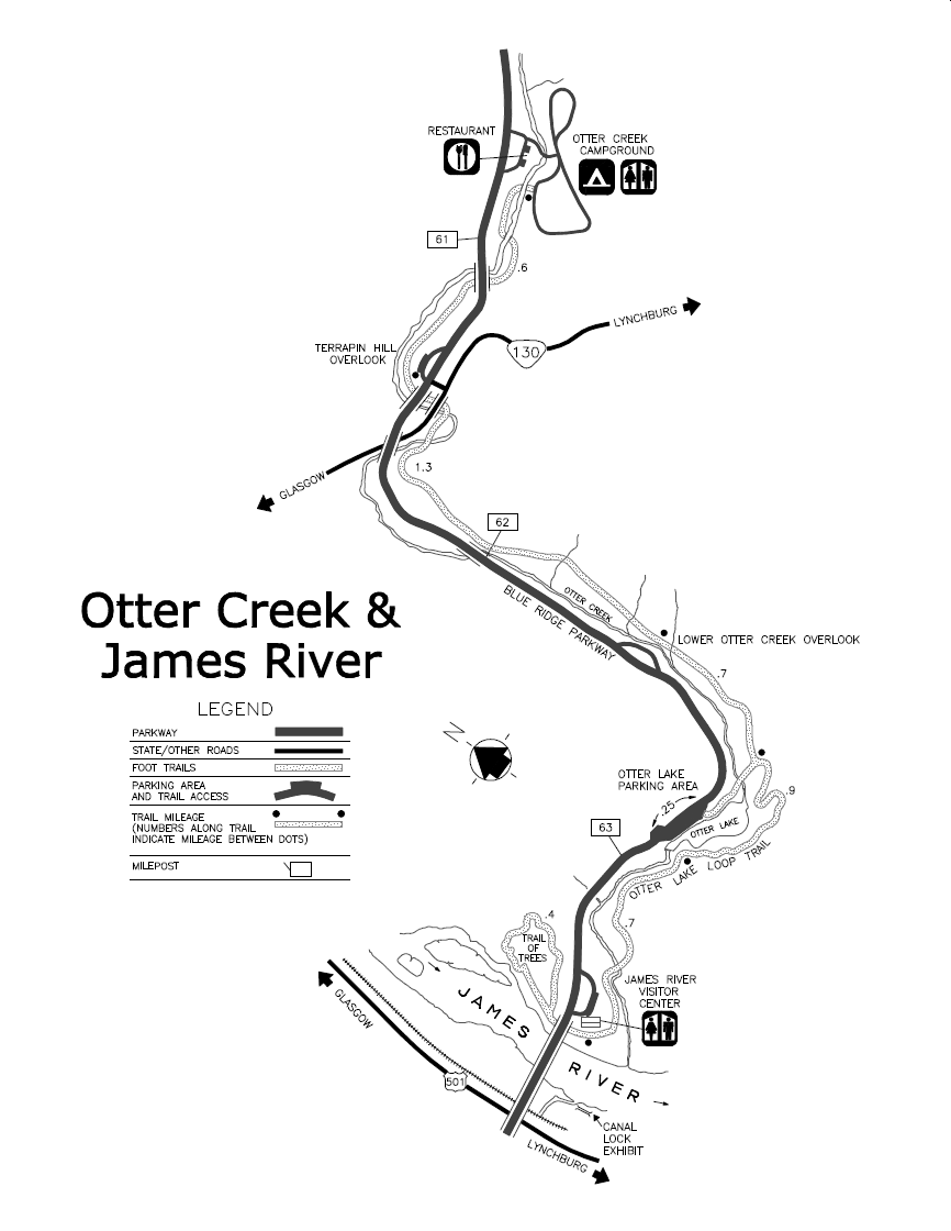 This Otter Creek and James River trail map (100 kb) shows trails on the northern end the parkway (near the Otter Creek Campground and James River Visitor Center), including the Trail of Trees and Otter Lake Loop Trail.
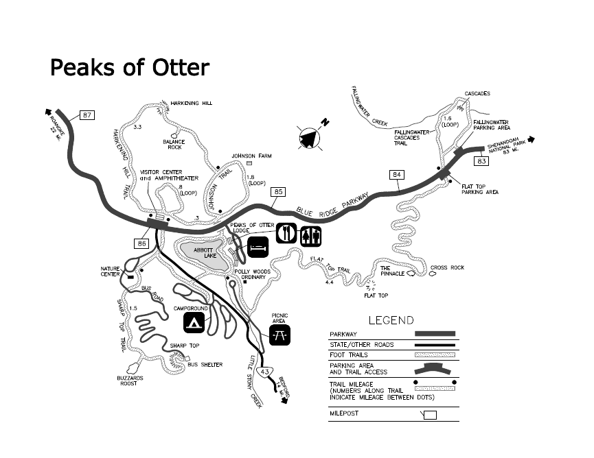 Here’s a Peaks of Otter trail map (80 kb), featuring the Flat Top Trail, Harkening Hill Trail, Fallingwater Cascades Trail, and others near the Peaks of Otter Lodge, visitor center, and campground.
 This is a Roanoke Valley trail map (70 kb), showing trails near the Roanoke Mountain Campground, Roanoke River, and Explore Park Visitor Center. You’ll find several parking areas and overlooks here.
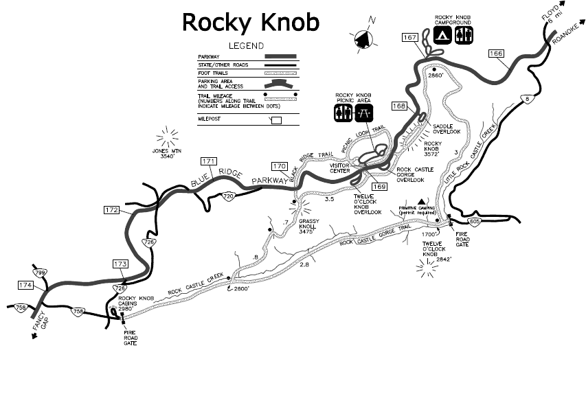 Here is a Rocky Knob trail map (70 kb), showing the Rocky Knob Campground, visitor center, and picnic area near Rock Castle Gorge a bit north of Mabry Mill (near the town of Floyd, VA).
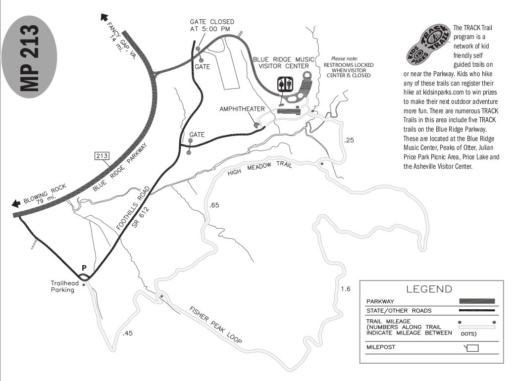 The Blue Ridge Music Center trail map (100 kb) zooms in on the music center itself, showing the amphitheater, parking area, and a couple trails (High Meadow Trail and Fisher Peak Loop), that make some nice loops.
 Here is a Cumberland Knob trail map (60 kb), showing the Gully Creek and Cumberland Knob trails starting from the picnic area south of the Blue Ridge Music Center. Gully Creek has nice cascades and a waterfall.
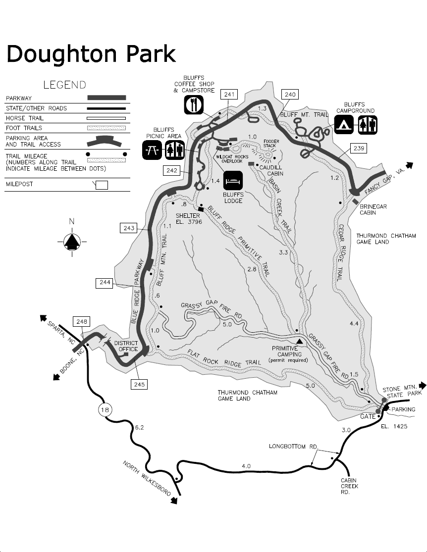 This is a Doughton Park trail map (150 kb), showing sights around Bluffs Lodge, Bluffs Campground, Bluffs Picnic Area, and Wildcat Rocks. You’ll see trails that can be accessed from the Parkway and from outside roads.
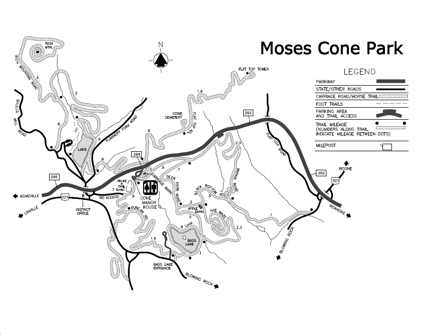 Here is a Moses Cone trail map (100 kb), featuring trails near the Cone Manor House and up to Flat Top Tower, just outside Blowing Rock, NC. This area contains a whole maze of trails!
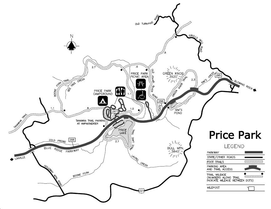 Here is a Julian Price Park trail map (100 kb), featuring the Green Knob Trail, Boone Fork Trail, Tanawah Trail, and others near Julian Price Memorial Park near Blowing Rock, NC.
 This is a Tanawah and Grandfather Mountain trail map (80 kb), featuring many trails in the Grandfather Mountain area near Linville, NC. This area has a number of parking areas and scenic overlooks.
 Here is a Linville Falls trail map (50 kb), showing distances various Linville Falls viewpoints from the visitor center and Linville Falls Campground. Also shown is the picnic area.
 The Crabtree Falls trail map (70 kb) shows the loop trail along Crabtree Creek to Crabtree Falls, departing from the Crabtree Falls Campground. This map also shows the campground layout and gift shop location.
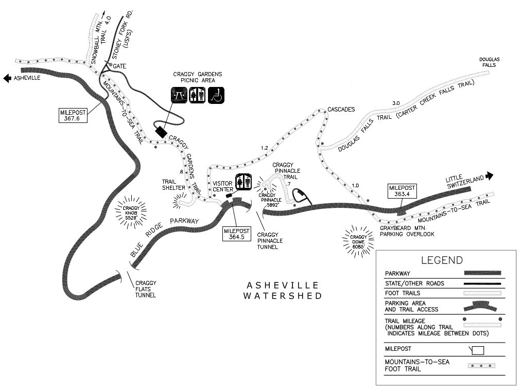 This is a Craggy Gardens trail map (80 kb), featuring the trail up Craggy Pinnacle and others from the Craggy Gardens Visitor Center and picnic area. It also shows the Mountains-to-Sea Trail and Douglas Falls Trail.
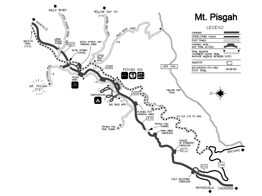 Here is a Mt. Pisgah trail map (80 kb), showing the trails near the Pisgah Inn and Mt. Pisgah Campground at the southern end of the Blue Ridge Parkway, nearest to Great Smoky Mountains National Park.
Blue Ridge Parkway campground maps
The Blue Ridge Parkway campground maps are arranged here north to south in order along the parkway:
 This is an Otter Creek Campground map (150 kb), located near the James River Visitor Center and Canal on the northern end of the Blue Ridge Parkway nearest Shenandoah National Park.
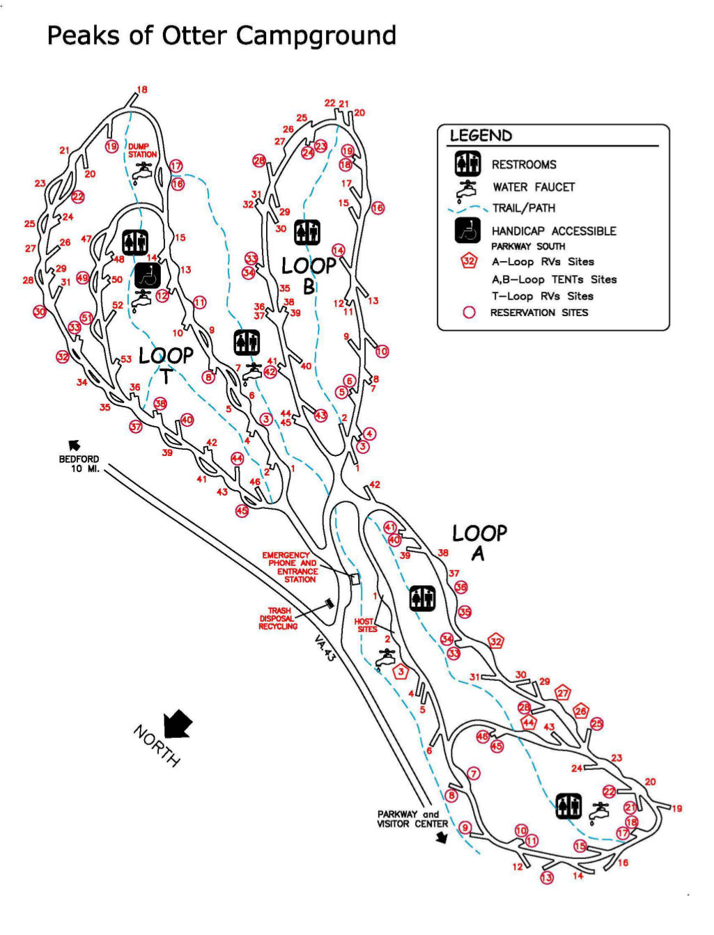 This is a Peaks of Otter Campground map (170 kb), located about 85 miles south along the Blue Ridge Parkway (and 25 miles south of Otter Creek). This campground has both tent-only and RV-only loops.
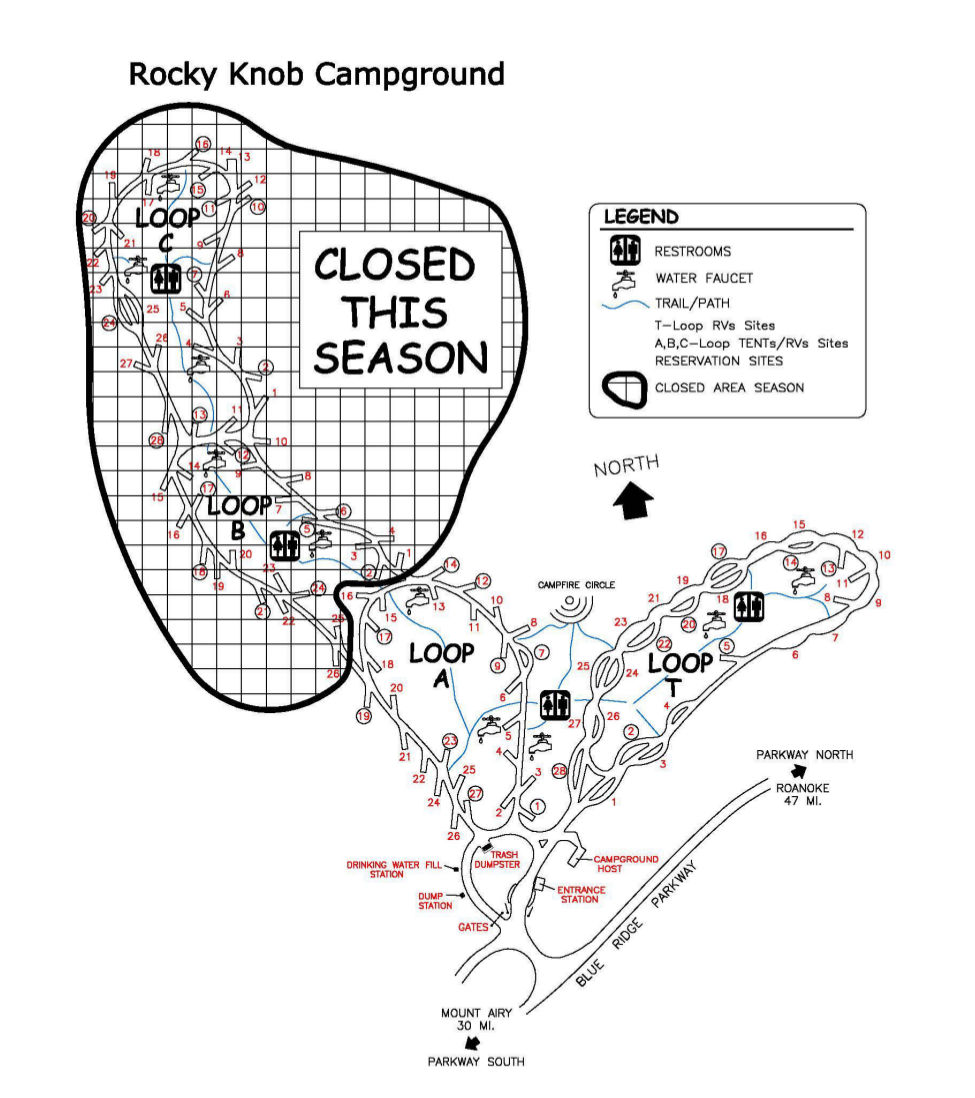 This is a Rocky Knob Campground map (150 kb), located near Mabry Mill and The Saddle in Virginia. Two loops of this campground may be closed depending on the year’s funding levels.
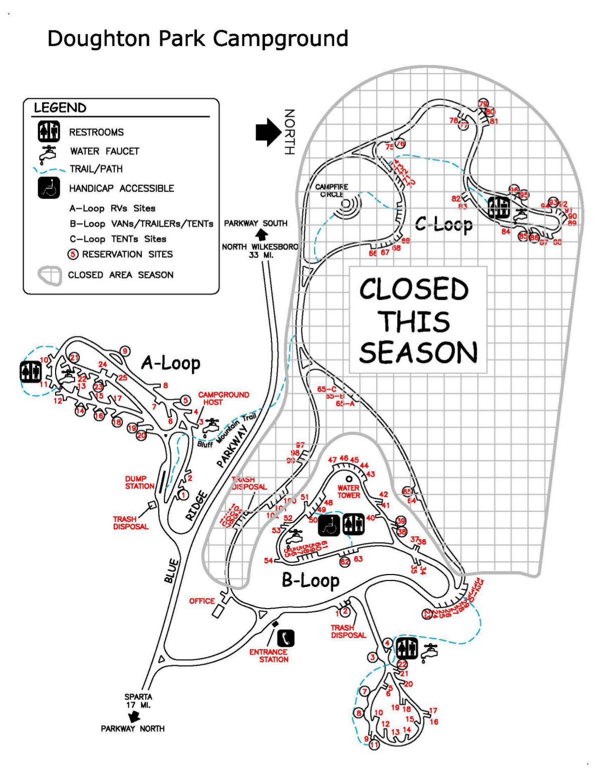 This is a Doughton Park Campground map (250 kb), located near Stone Mountain State Park. Parts of this campground may be closed depending on funding levels – inquire directly with the park before your visit.
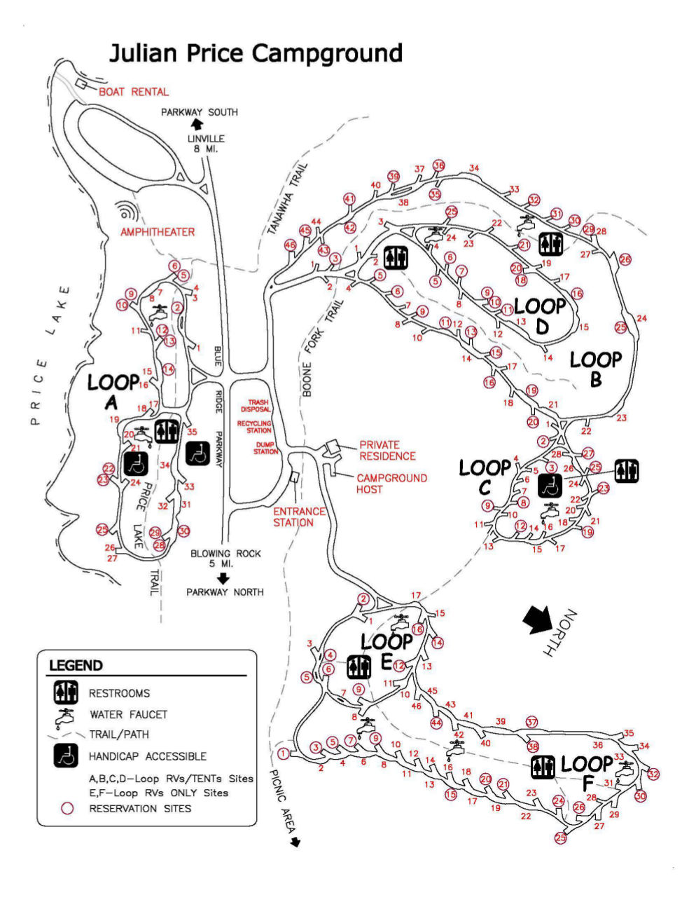 This is a Julian Price Campground map (180 kb), located near Boone, Blowing Rock, and Linville, NC, as well as Grandfather Mountain. This large campground features six different loops, two of each are RV-only.
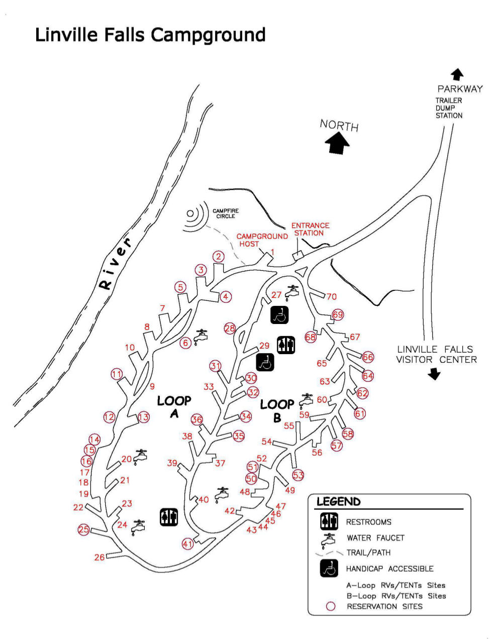 This is a Linville Falls Campground map (140 kb), showing the campground located along the side road to the Linville Falls Visitor Center. Adjacent to the campground is the Linville River.
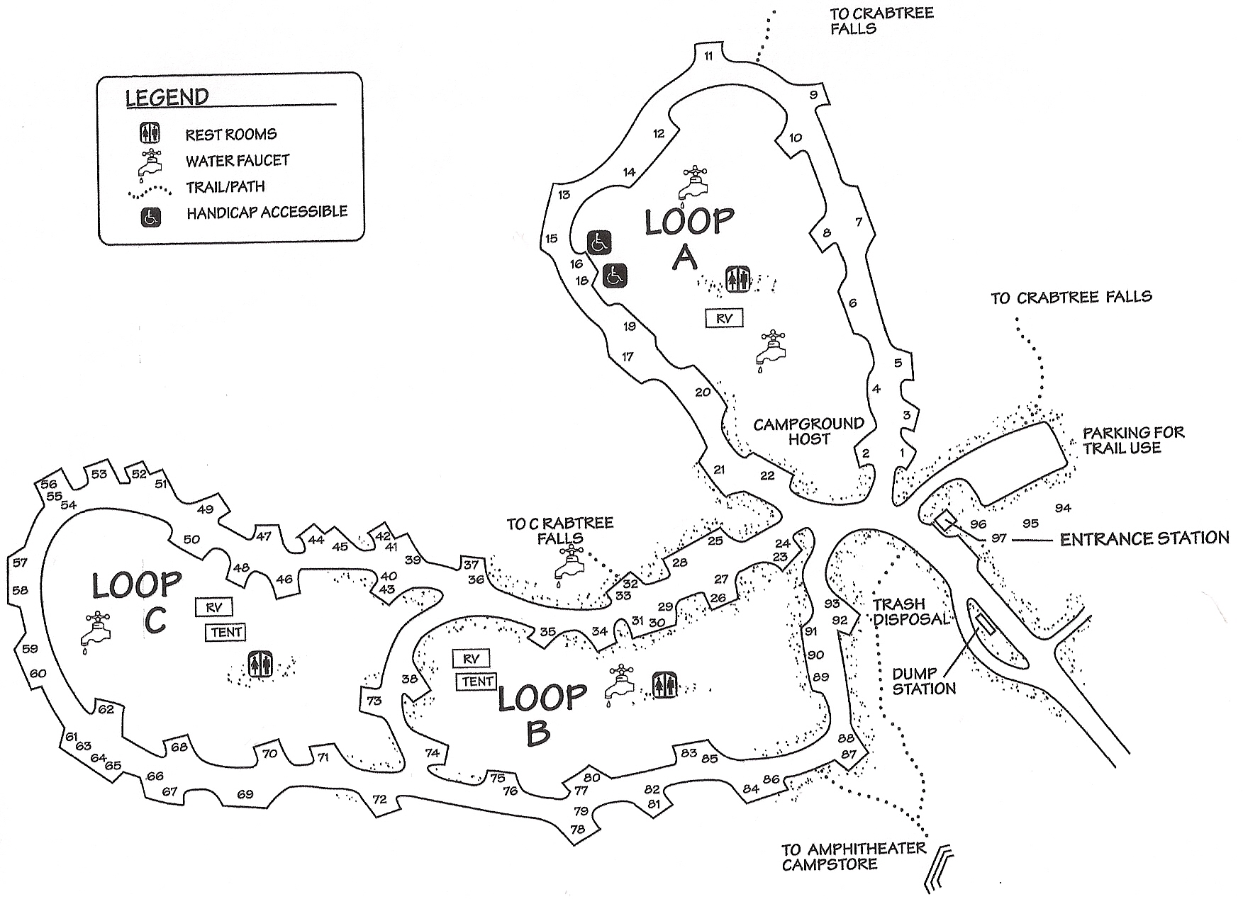 This is a Crabtree Falls Campground map (500 kb), located near mile 340 of the Blue Ridge Parkway and is nearest Mount Mitchell State Park. You can hike from your campsite directly to Crabtree Falls.
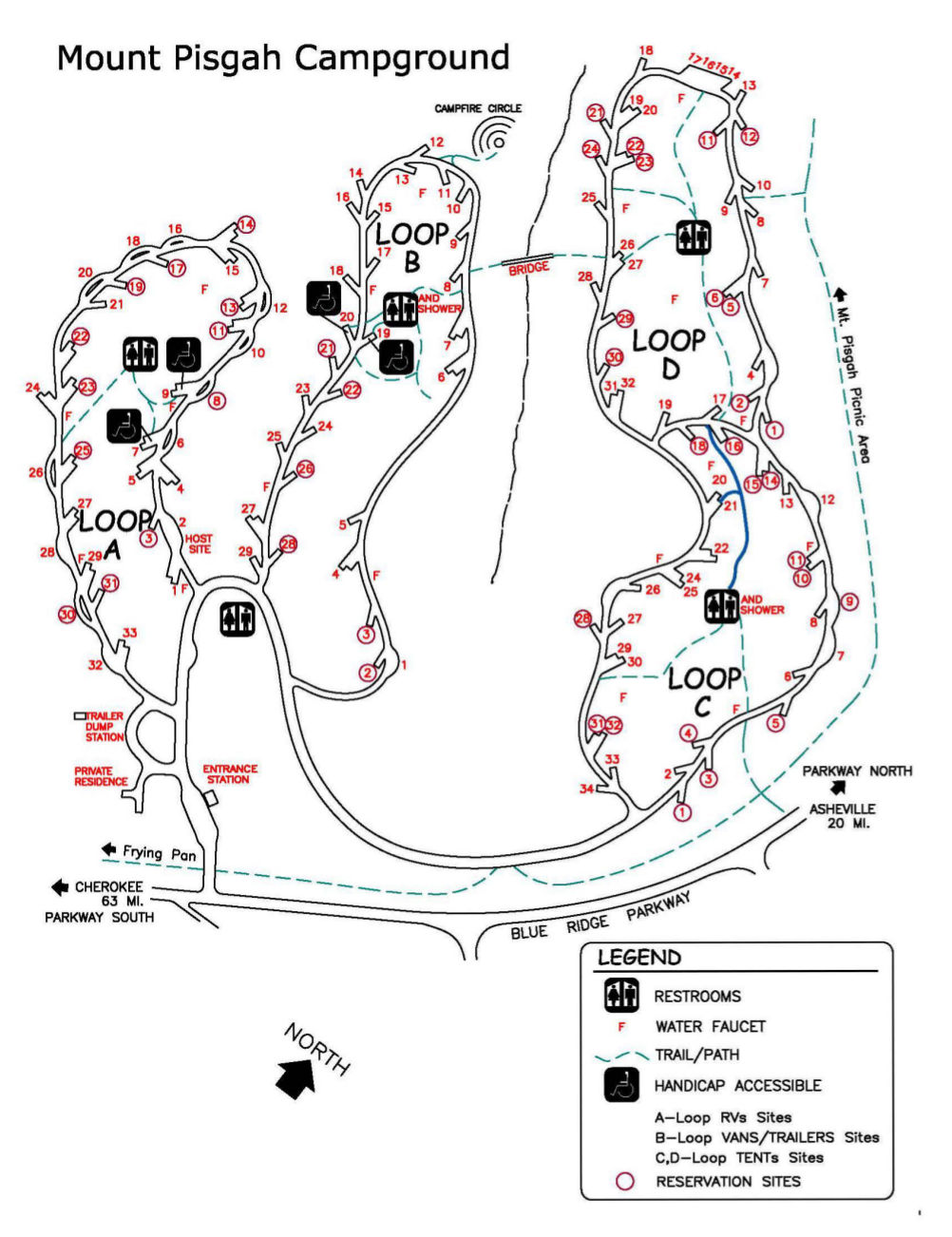 This is a Mt. Pisgah Campground map (170 kb), the furthest south campground on the parkway and nearest to Great Smoky Mountains. The four campsite loops separate out the RVs/trailers from tent campers.
…and more!
< Return to National Park Maps home
< Return to Park List
< Return to List by State
Need more help? Browse Amazon’s best-selling Blue Ridge Parkway maps and guidebooks.