If you’re looking for a Big Bend map, you’ve come to the right place; currently I’ve collected 16 free Big Bend National Park maps to view and download. (PDF files and external links will open in a new window.) The maps on this page include campgrounds, trails, vegetation, fire history, full park, and detail maps. You can also browse the best-selling Big Bend maps and guidebooks on Amazon.
Big Bend map from the park brochures
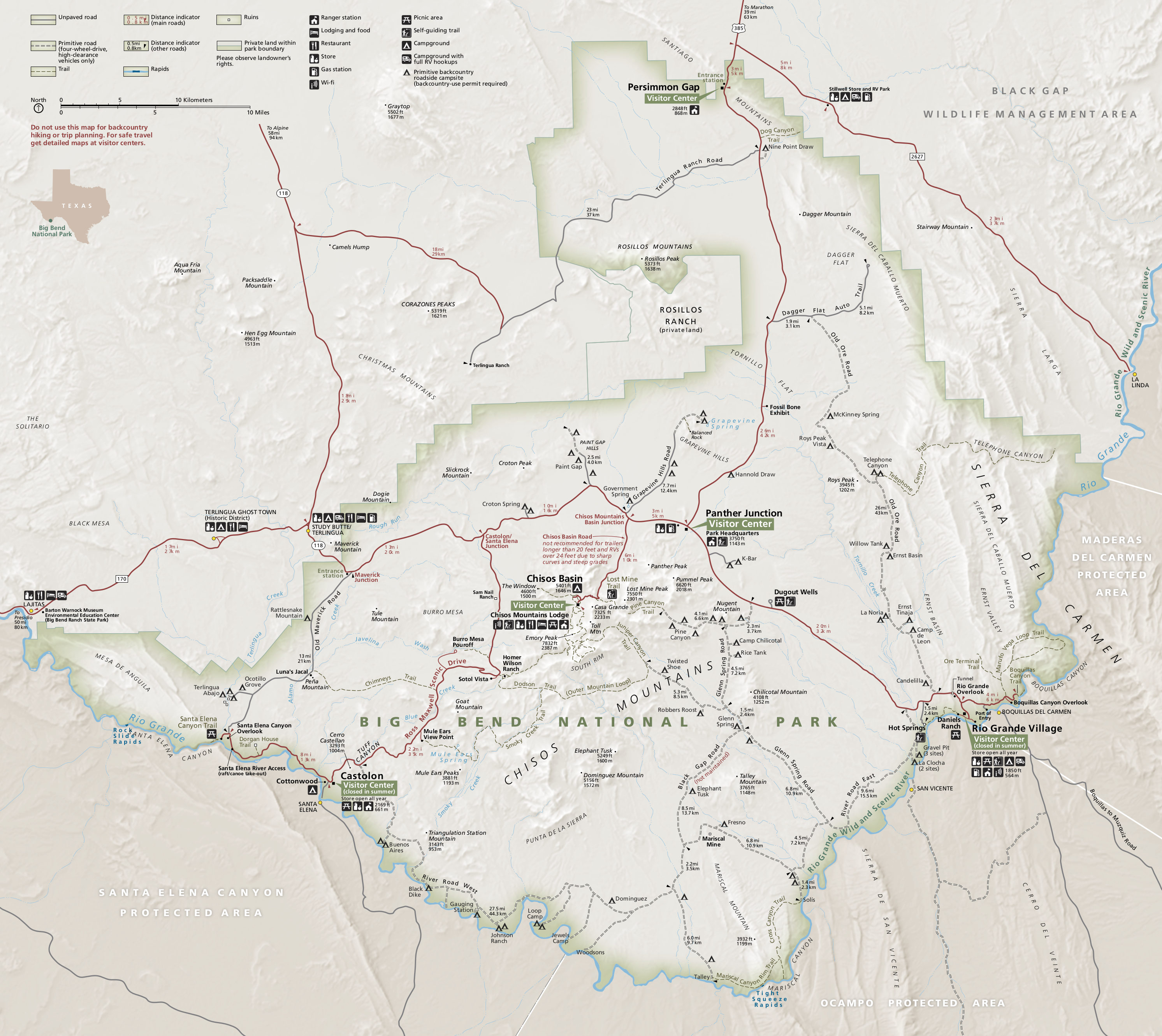 Here is the new, revised official Big Bend National Park map from the 2015 national park brochure. Click the image to view a full size JPG (1.0 mb) or download the PDF (7.0 mb).
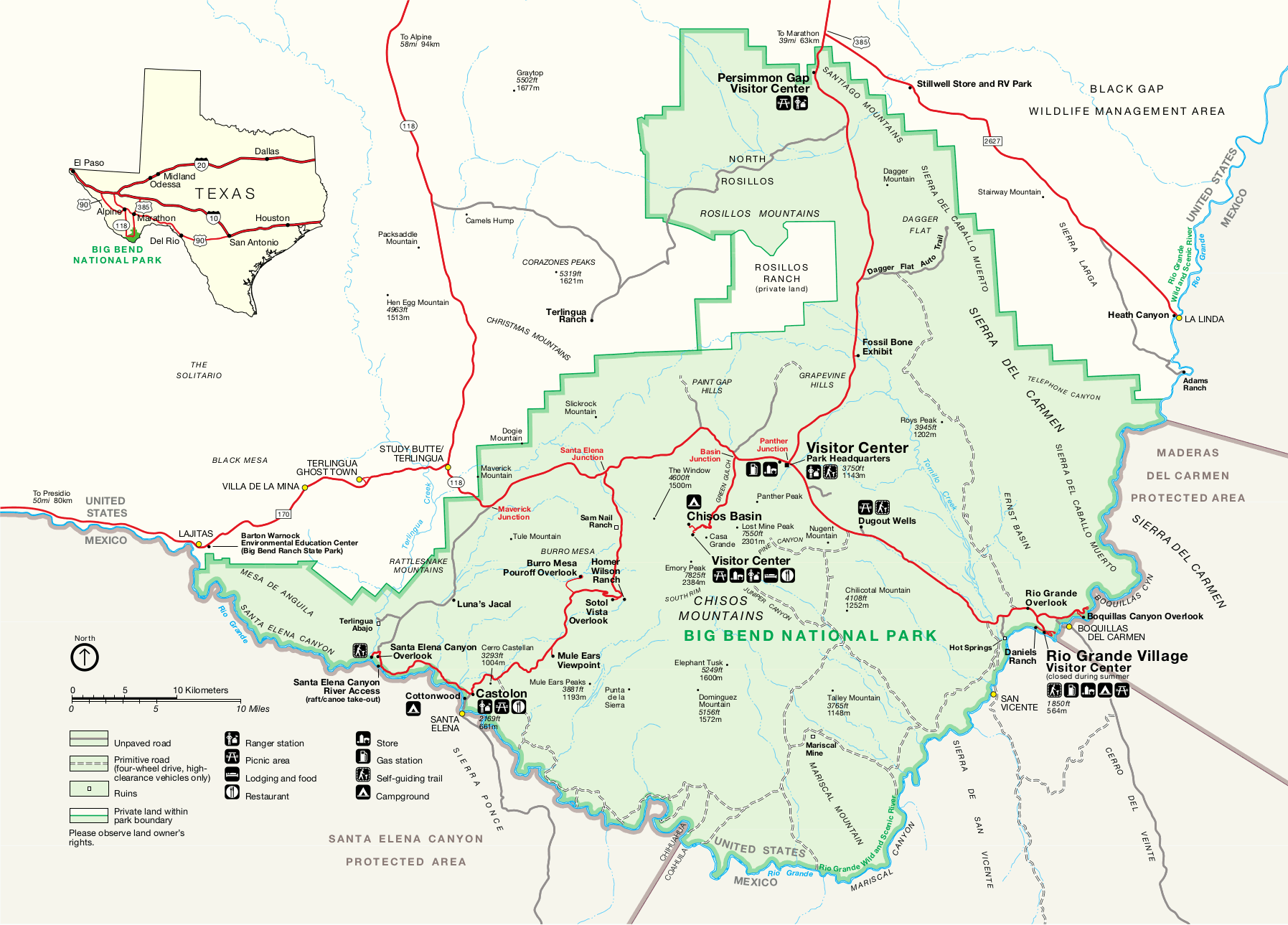
 This is a regional map of Big Bend, showing driving directions and routes to Big Bend from the north. Click the image to view a full size JPG (100 kb) or download the PDF (200 kb).
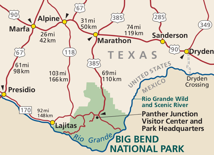
 This is the previous Big Bend map from the official brochure, showing roads, trails, and campsites, and points of interest. Click the image to view full size JPG (1.4 mb) or download the PDF (7.6 mb).
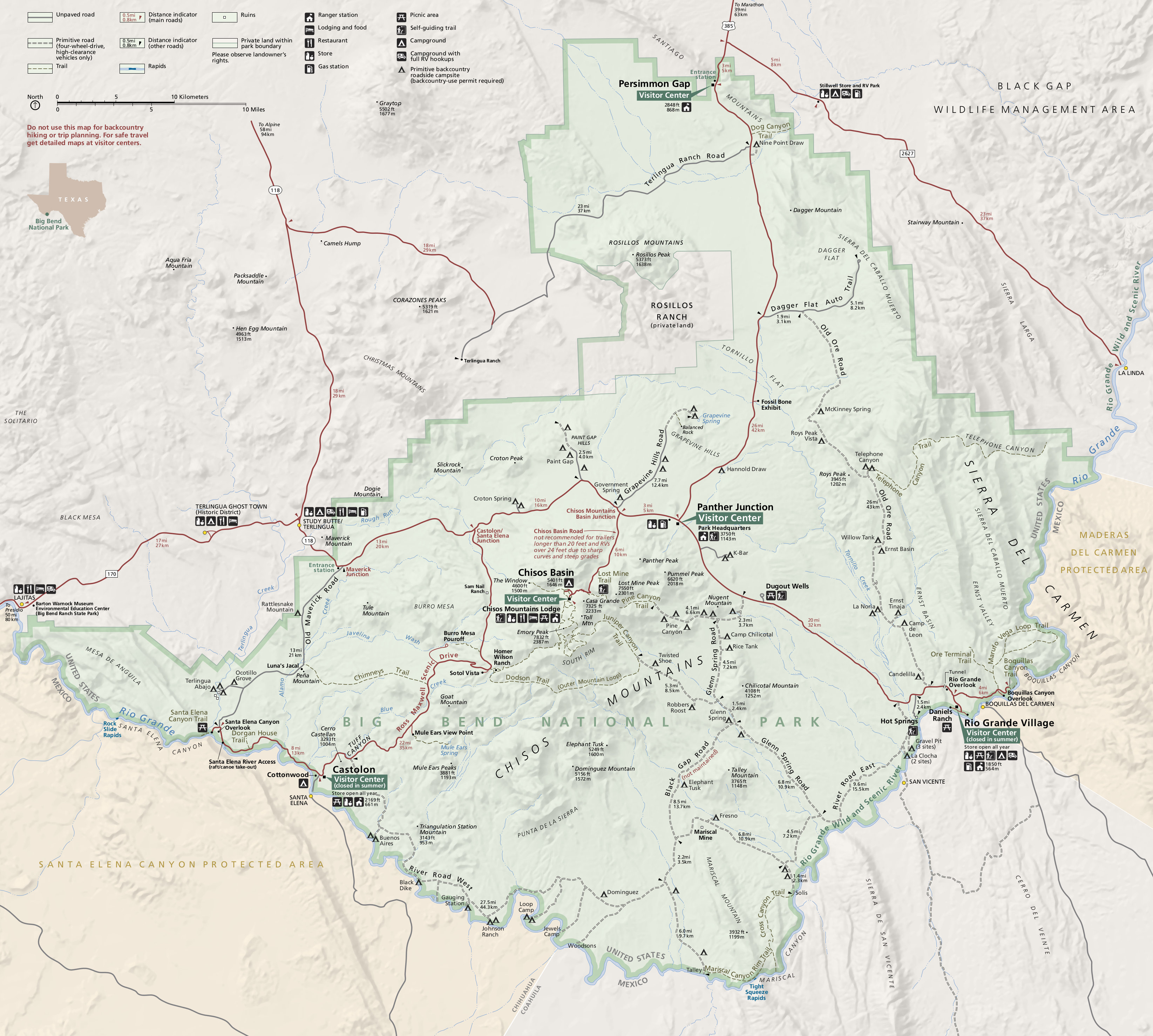
 This is a simple map of Big Bend from the park newspaper. It’s easier to read and print than the official map above. Click the image to view a full size GIF (300 kb) or download the PDF (500 kb).
Big Bend detail maps
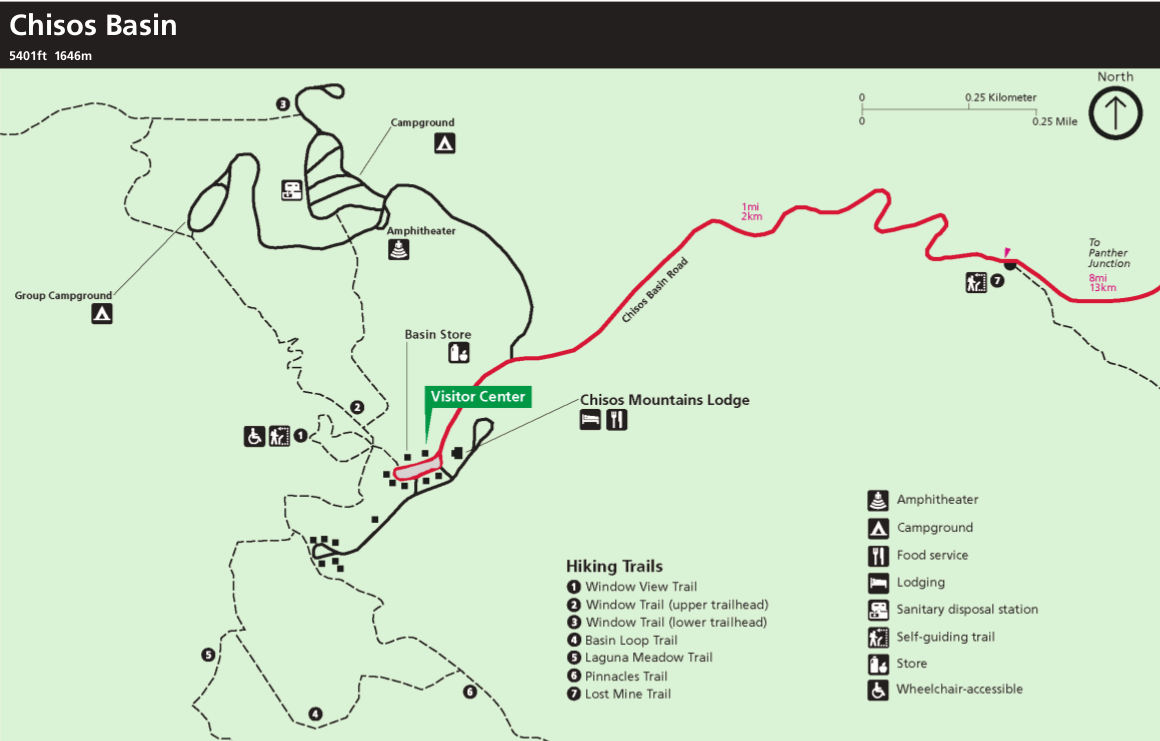 This is a detail map of Chisos Basin in Big Bend, showing the lodge, visitor center, and many Chisos Mountains trails. Click the image to view a full size GIF (75 kb) or download the PDF (600 kb).
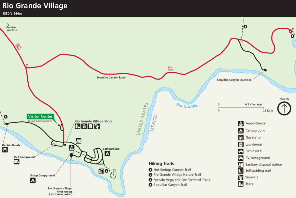 This is a detail map of Rio Grande Village, showing river access, camping, and the visitor center. Click the image to view a full size GIF (100 kb) or download the PDF (600 kb).
Big Bend trails and backcountry map
 The free map below shows many of the backcountry campsites and trails in Big Bend’s Chisos Mountains. However, it doesn’t include mileage between points or show any other areas of the park. For that, you’ll want a detailed topographic map like the National Geographic Trails Illustrated map of Big Bend; this is the best single map showing every trail in all of Big Bend National Park.
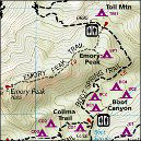
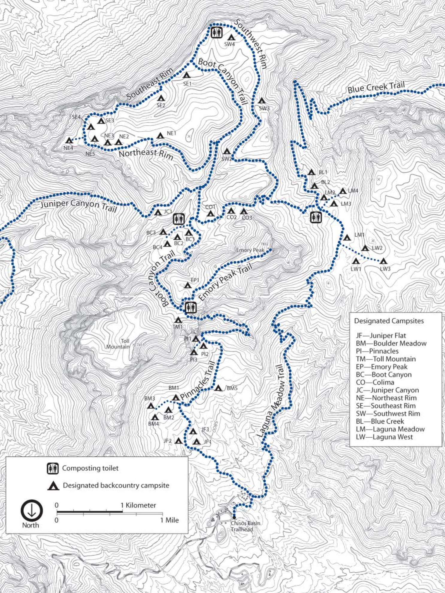 This is a trails map of the Chisos Mountains (800 kb), showing Big Bend’s popular hiking trails and backcountry campsites around Emory Peak. The map includes topo lines to show elevation changes.
Big Bend campground maps
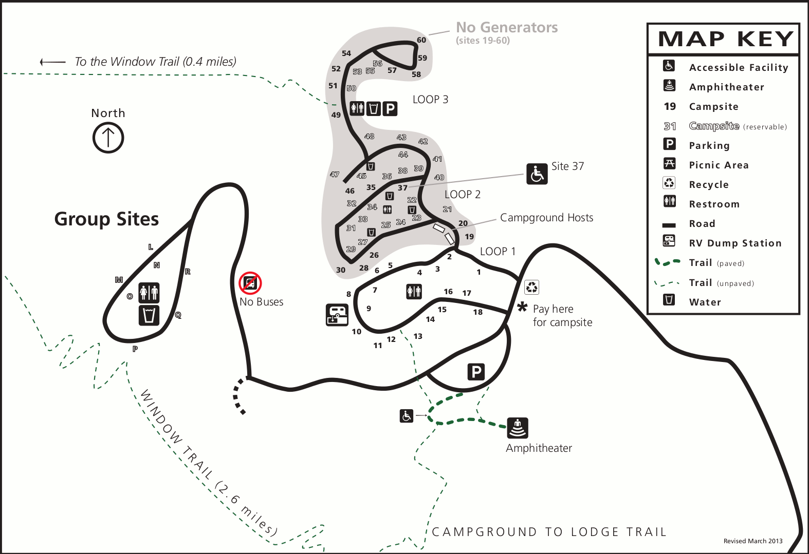 This is a Chisos Basin Campground map (100 kb), showing the three campsite loops and visitor facilities in this high elevation campground located in the Chisos Mountains in Big Bend.
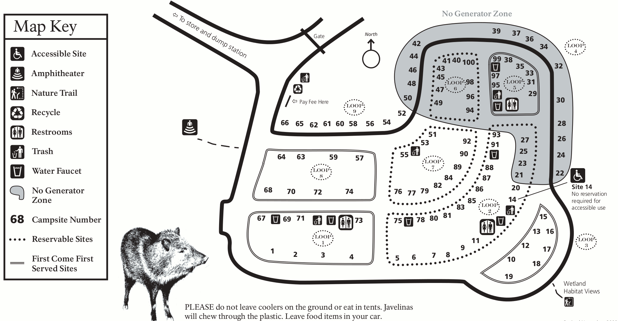 Here’s a Rio Grande Village Campground map (200 kb). This is Big Bend’s low-elevation campground located along the Rio Grande River and includes loops of reservation campsites as well as first-come first-served.
Big Bend lodging map
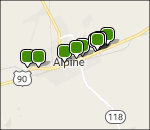 To the right, you can open a Hotels.com interactive Big Bend lodging map focused on Alpine, TX – one of the few towns anywhere in the area near Big Bend. If you zoom out and scroll, you’ll see there’s just not much of anything in the area; Big Bend is a wild place! So your options sadly are quite few. Here you can browse Hotels.com’s top-rated Big bend lodging to compare photos, reviews, location, prices, and more.
Various Big Bend maps
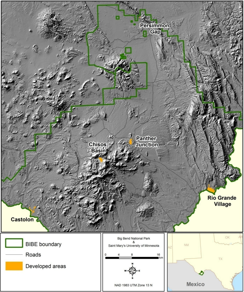 The Big Bend relief map (350 kb) shows a three-dimensional view of Big Bend National Park, making it easy to see the varied elevation at a quick glance in relation to the developed visitor destinations.
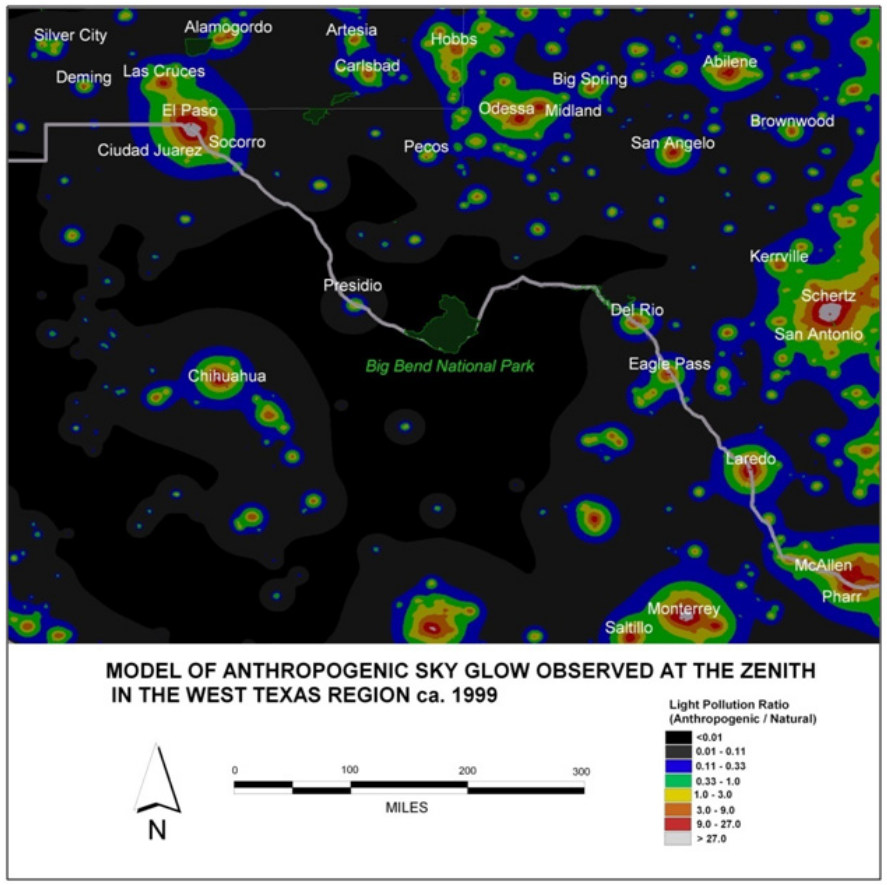 This Big Bend night sky map (150 kb) shows how incredibly dark the night skies are at Big Bend compared to nearby areas in Texas and Mexico. This also explains why it seems like such a long drive from everywhere!
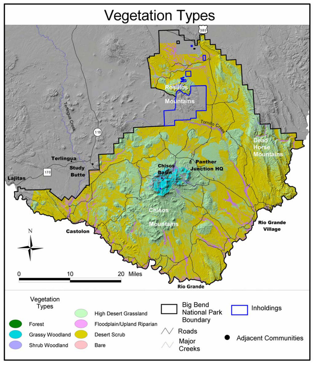 Here is a vegetation map of Big Bend (300 kb), showing desert scrub, woodlands, and grasslands mostly, with only a tiny little bit of forest. (The next map below has some more interesting vegetation!)
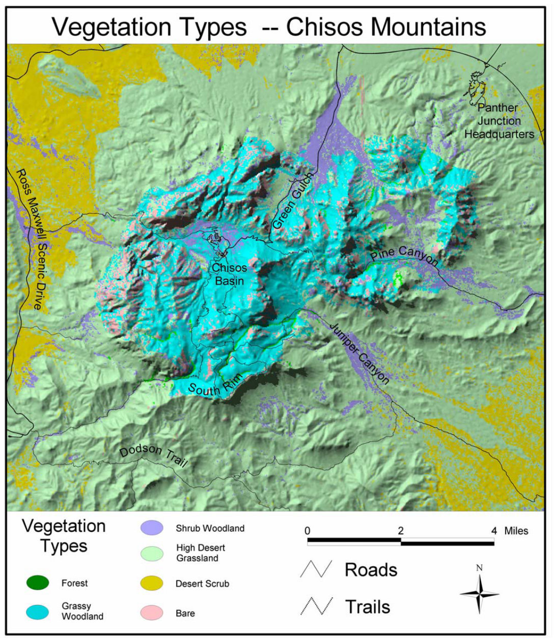 This is a vegetation map of the Chisos Mountains (380 kb), showing the complex combination of vegetation types, including forests, woodlands, and grasslands. You’ll find more trees here than elsewhere in Big Bend.
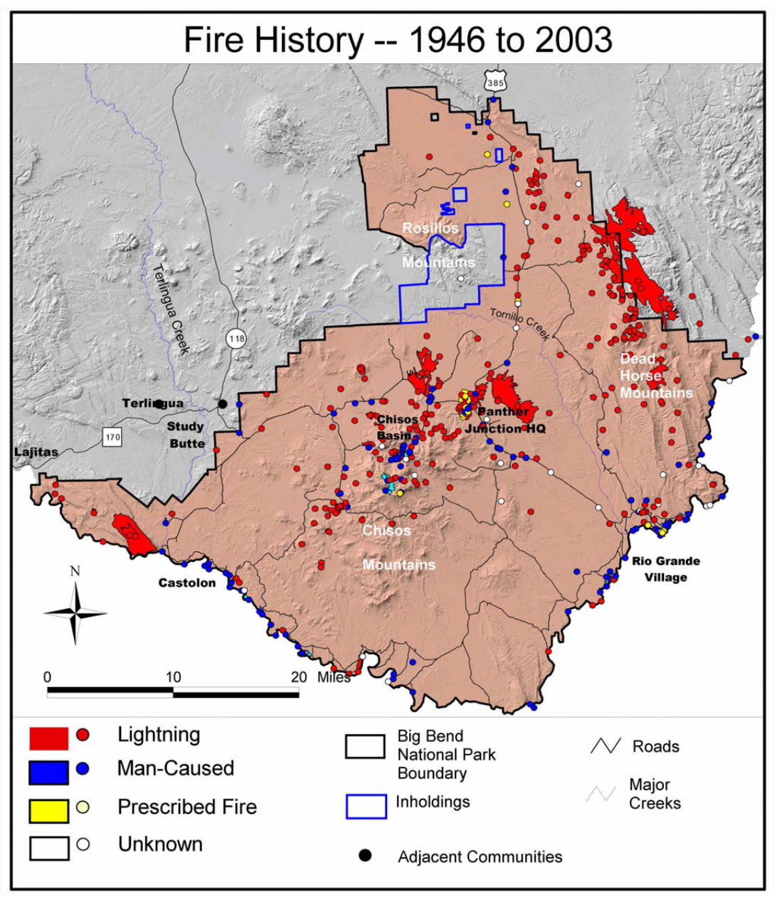 This is a Big Bend fire history map (250 kb), displaying all the fires that have taken place in the park from 1946 to 2003, including lightning, human-caused, and prescribed fires.
Big Bend historical map
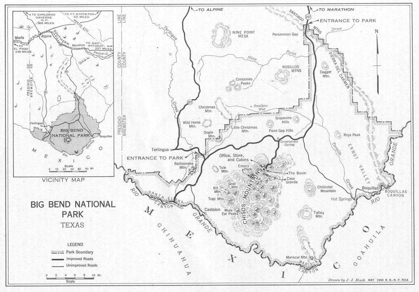 Here’s a 1944 historical map of Big Bend (220 kb). While it’s probably not useful for current trip planning, it’s fun to see how the park development has changed today compared to then.
…and more!
< Return to National Park Maps home
< Return to Park List
< Return to List by State
Still need planning help? Browse Amazon’s best-selling Big Bend maps and guidebooks.